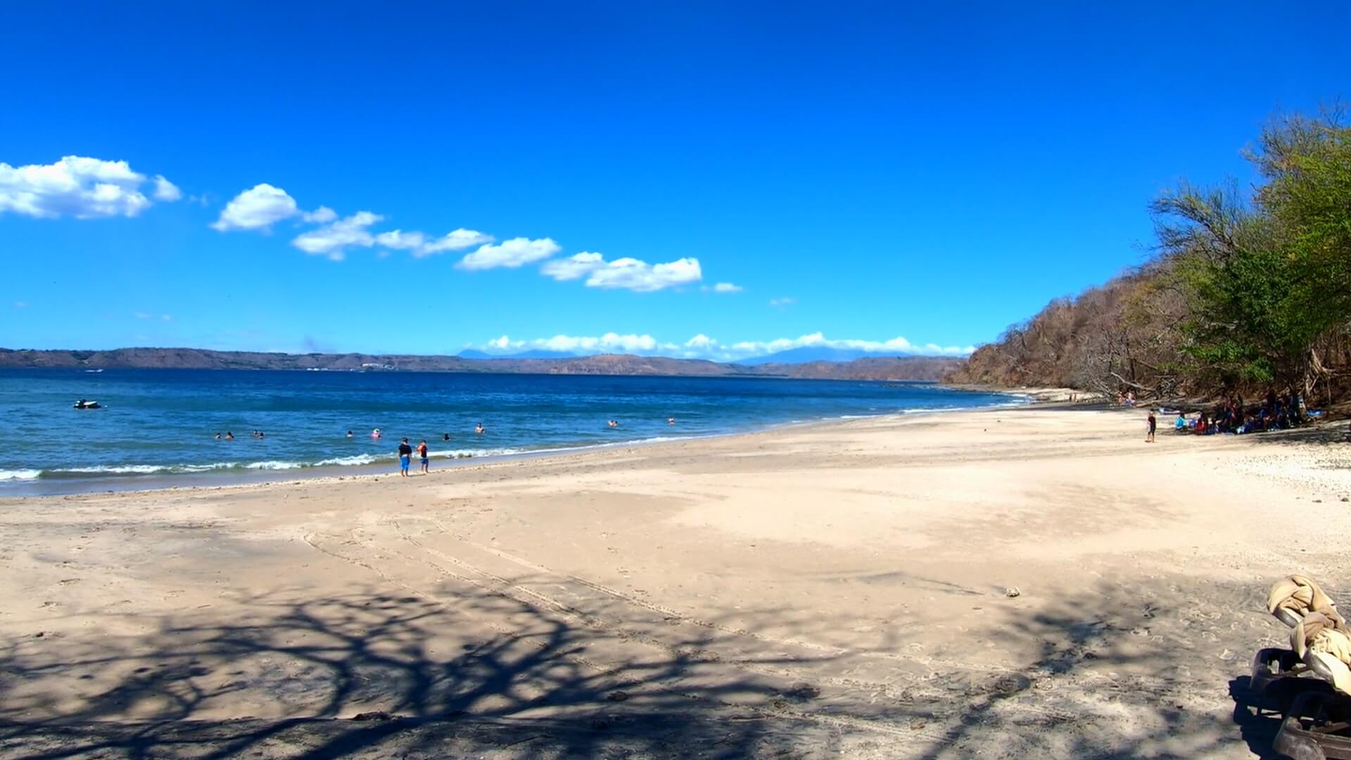
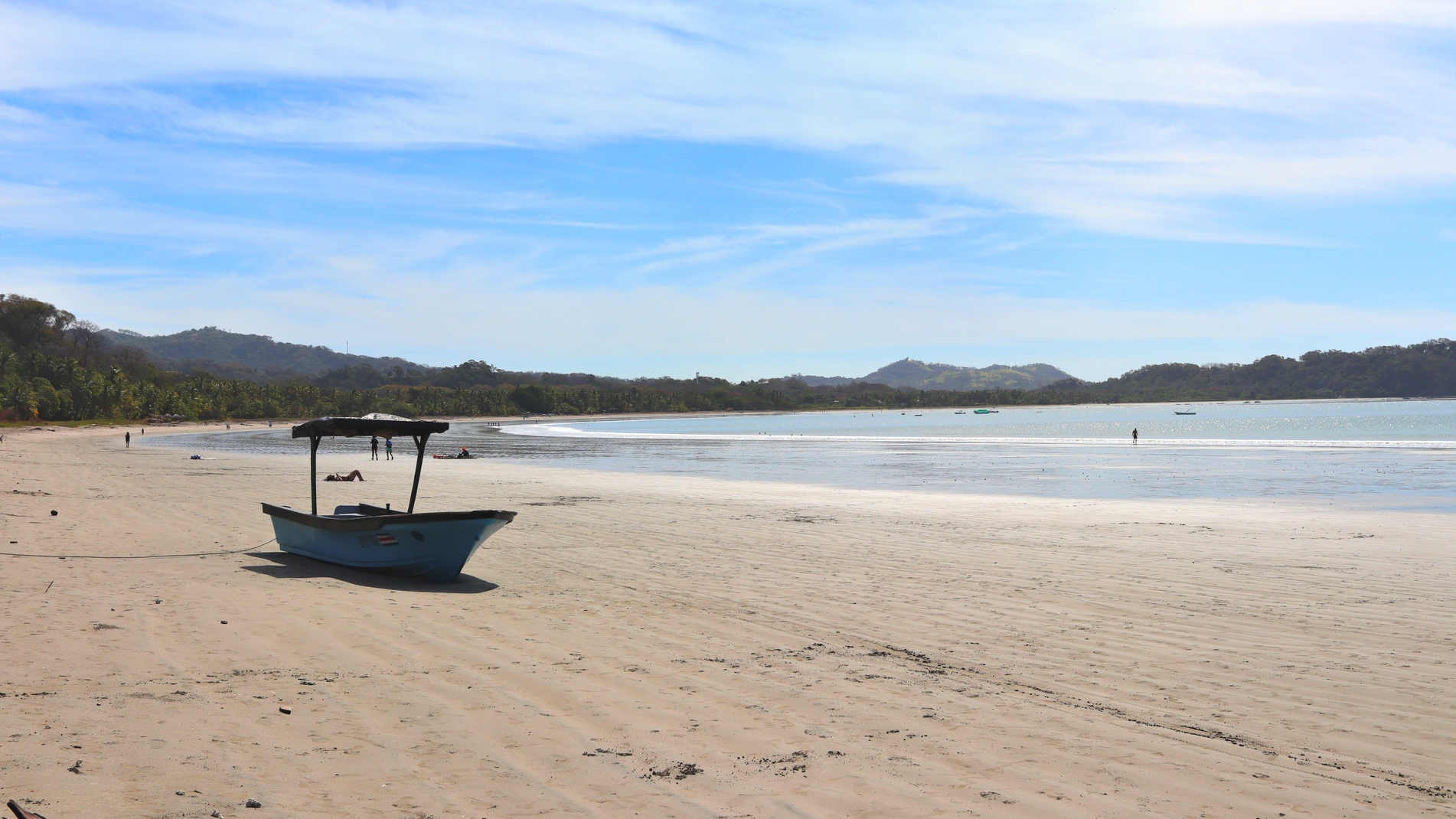
Playa Buena sits tucked into Culebra Bay near the Occidental Papagayo resort. This protected cove offers clear swimming waters with views across the bay to the Four Seasons Peninsula and Marina Papagayo.
A paved access road leads to parking, followed by a short walking path down to the beach. The cove setting provides shelter from ocean swells, making it suitable for swimming and relaxing in the calm waters. Natural forest surrounds the beach area, creating a secluded atmosphere.
Morning hours bring glassy conditions to the bay, perfect for swimming or watching boats cross between the marina and resorts. The beach remains less visited than neighboring Playa Panama, offering a quieter alternative for those seeking a peaceful cove setting.
Easy Drive
Playa Buena is between the well known beach towns of Playa Hermosa and Playa Panama. If you’re driving from the south, you’ll be on Route 159, which is the main corridor along the coast in this area.
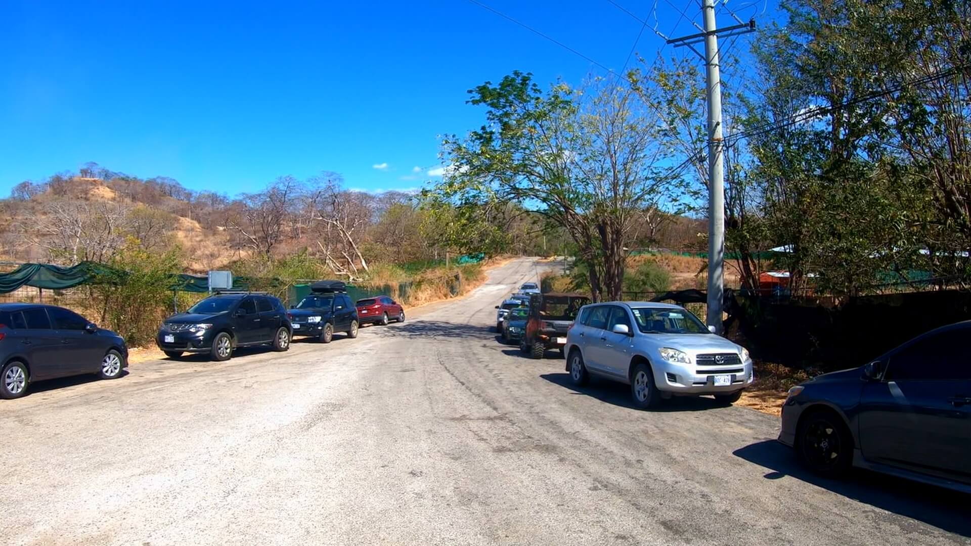
Once you pass Condovac in Playa Hermosa, you’ll look for a well maintained road which turns to the ocean(left). There are several resorts at the end of this road including Occidental Papagayo Adults Only, and Sol Papagayo.
Once you’re at the entrance of Occidental, there is a Y junction in the road that has ample street parking. You may also find a local parking attended, so be sure to have a couple thousand Colon for him to watch your vehicle.
Pick up a pair of these awesome water shoes. I’ve been using them all over Costa Rica during my travels. They have vented soles so water drains right out the bottom!
Walking The Path
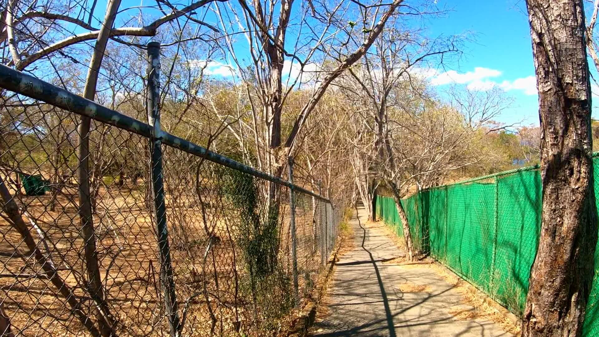
Some beaches in Costa Rica are rather adventurous to access. Playa Buena is no such beach. The path is laid brick which is easy to traverse. It’s also wide so you can carry some wider equipment if you have it.
A great option for any beach adventure is always aBackpack Cooler, which allows you to free up your hands to carry other beach essentials.
The walk to the beach from the parking area is very short, so it’s a great location if you have young kids.
White Sand, Great View
This beach is fantastic for the whole family. There’s a massive beach area at low tide, and the water was breaking very easy.
Off in the distance you’ll be able to see the volcano range that lies behind Liberia. You’re also going to be able to see the resorts around the bay like Planet Hollywood and The Four Seasons.
On the occasion of filming, it was particularly windy out. This caused some dirt to be kicked up in the water around the shore. Snorkeling in these conditions wasn’t great, but on a calmer day there’s lots of tide pools and rocks which will make for clear views of all the sea life.
You’ll also be able to rent Jetski’s on this beach, we were quoted at $50 USD for half an hour. There was also a couple getting a massage on the beach during our time there. Surely the increase in tourist traffic from the nearby resorts increases the services offered on the beach.
Follow Us!
Be sure to Subscribe to our Youtube Channel, and leave a comment with your thoughts about this location or request a video in other cool destinations around Costa Rica.
Playa Buena FAQ: Hidden Cove Guide
Q: Where is Playa Buena located? A: Near Occidental Papagayo Resort. Overlooks Culebra Bay. Views to Four Seasons Peninsula. Close to Playa Panama. Part of Papagayo bay system.
Q: What’s the beach like? A: Protected cove setting. Grey sand beach. Clear swimming waters. Bay views across water. Natural forest backdrop. Calm waters most mornings.
Q: How’s the access? A: Paved road to parking area. Short walking path to beach. Public access available. Well-maintained trail. Parking near path entrance.
Q: What facilities exist? A: Basic parking area. Paved access path. Resort facilities nearby. Bring water and supplies if not resort guest. Some natural shade available.
Q: What activities are possible? A: Swimming in protected waters. Beach walking. Photography opportunities. Sunset viewing across bay. Watch boats pass to marina.
Q: What’s nearby? A: Occidental Papagayo Resort overlooks beach. Marina Papagayo visible across bay. Four Seasons Peninsula views. Close to Playa Panama.
Q: When to visit? A: Morning hours calmest waters. Good year-round swimming. Dry season most reliable weather. Sunset views across bay. Weekdays typically quieter.
West of Playa Conchal, a rutted dirt road leads to one of Guanacaste’s less visited white sand beaches. Playa Zapotillal sits between rocky headlands, offering clear water swimming and hiking trails with incredible coastal views.
The beach combines a wide sandy area perfect for relaxing with natural features to explore. At low tide, you can check out caves in the rock formations, while a short trail leads to viewpoints overlooking neighboring beaches and the blue Pacific waters below.
Unlike busy Playa Conchal nearby, Zapotillal’s harder access keeps visitor numbers lower. The 4×4 road naturally limits traffic, though determined drivers in regular cars sometimes make the journey slowly. A parking attendant watches vehicles, and basic facilities exist for day visits.
Map of Costa Rica, showing the location of Playa Zapotillal near Playa Flamingo.
How To Get There
From Matapalo Town
Matapalo serves as your last stop for supplies before heading to the beach. This small town sits between Tamarindo and Playas del Coco, making it a good reference point. Several small stores and sodas offer chances to grab water and snacks.
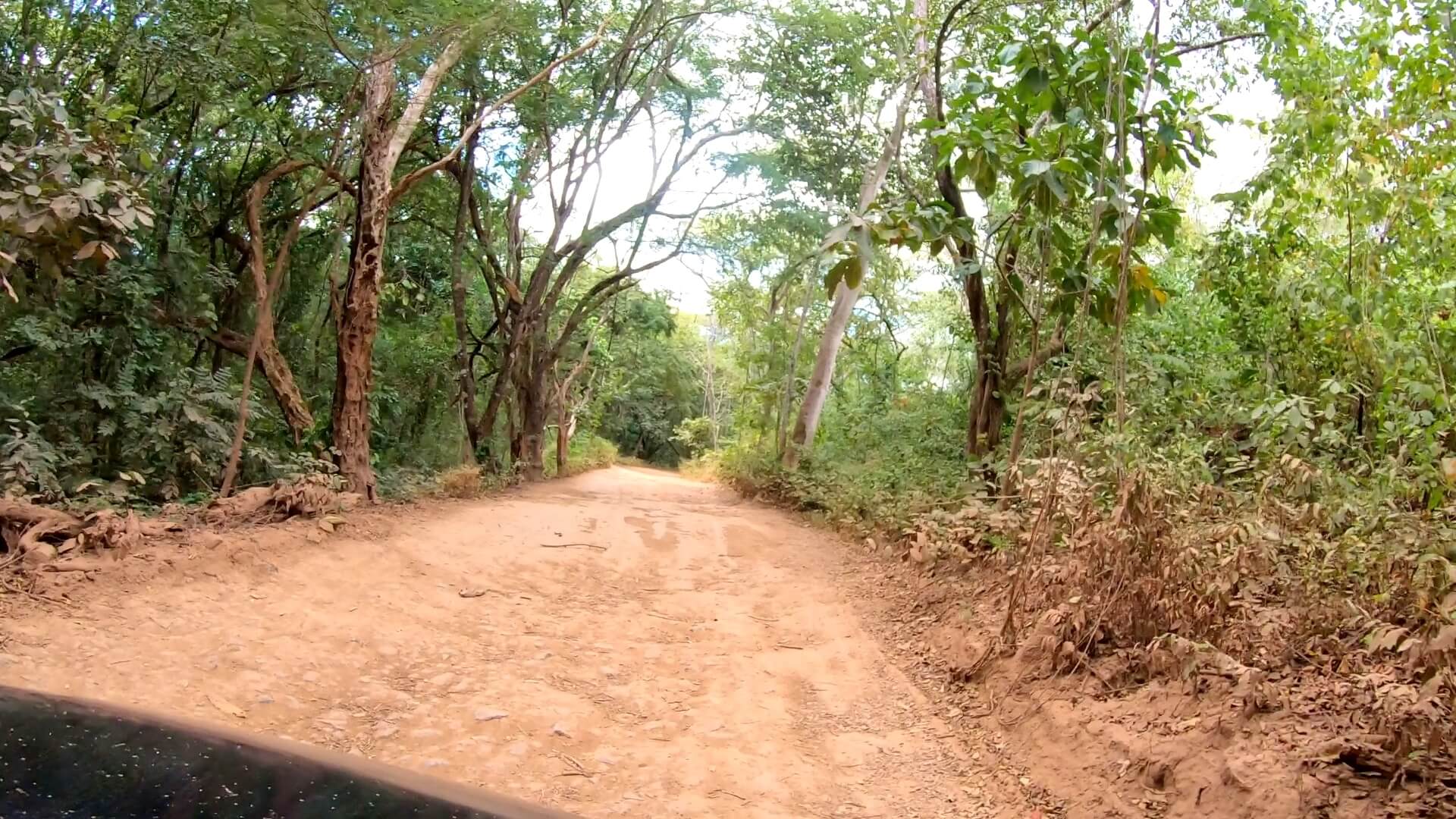
The drive from town starts on maintained gravel roads. During dry season (December-April), dust kicks up easily, so keep distance between vehicles. Green season might need more careful driving, but the main road stays passable.
Key Junction Points
After several minutes on the main gravel road, you’ll reach an important junction marked by Hotel Condor Lodge and Villas La Paz. These properties offer views over Playa Conchal and help mark your turn. If heading to Conchal, you’d continue right, but for Zapotillal, turn left.
This intersection serves as the decision point – the easier road to Conchal or the adventurous route to Zapotillal. Several flags and hotel signs mark the spot, making it easier to find.
Final Approach
About 1 kilometer after the junction, look for a gap in a gate – this marks the turn toward Zapotillal. The road condition changes significantly here, with deep ruts and rough sections requiring careful driving.
While some regular cars attempt this section, high clearance and 4×4 make the journey much easier. Take your time on this stretch, watching for oncoming vehicles as the road narrows in sections. The rough drive helps keep the beach quieter than nearby spots.
The road to this beach can be a little rough.
Pick up a pair of these awesome water shoes. I’ve been using them all over Costa Rica during my travels. They have vented soles so water drains right out the bottom!
The Beach
Swimming & Sand
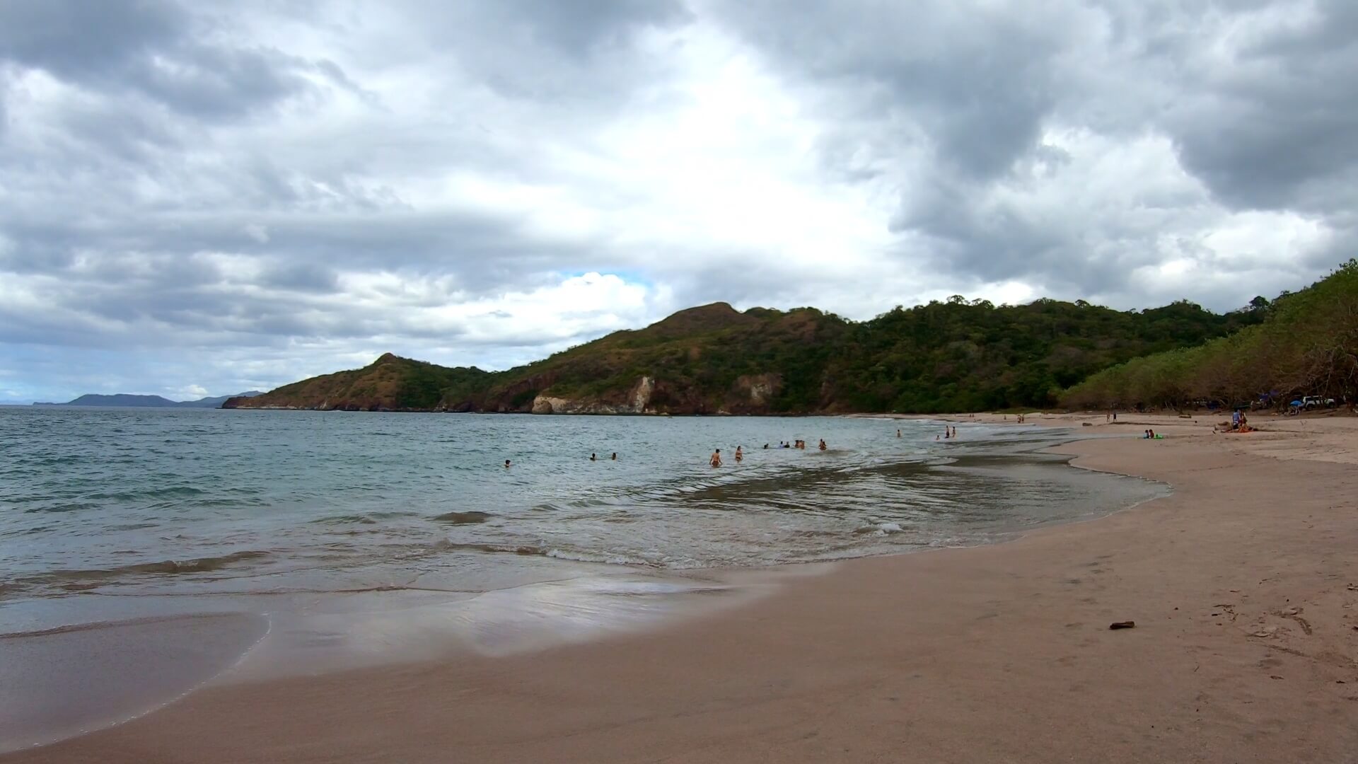
The white sand beach curves between rocky points, creating a protected swimming area. Unlike some nearby beaches, Zapotillal’s waters stay relatively calm near shore, making it good for families. The wide beach offers plenty of space for setting up, even during high tide.
Several shady spots along the beach edge provide relief from the sun. The clear waters make it perfect for spotting marine life – sea turtles sometimes appear offshore, and the rocky points attract fish.
Hidden Caves & Tide Pools
At low tide, you can explore caves in the western rocky point. These natural formations create interesting photo opportunities and exploring spots. Always check tide charts before venturing to the caves, as high tide cuts off access.
Small tide pools form among the rocks during low tide. These protected spots offer glimpses of small fish and marine life. The beach’s natural features give kids plenty to discover.
Beach Activities
Pack a cooler and plan to spend the day, as the journey here is worth taking time to enjoy. The beach’s position facing west makes it perfect for sunset viewing. During low tide, you can walk far along the beach, exploring different swimming spots.
The small river mouth creates a peaceful spot to cool off, especially for kids. You’ll often see small fish in the clear water here. The beach’s natural curves create different areas to find your own space.
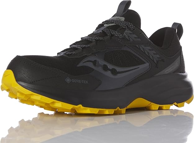
I use these versatile trail runners on my hikes in Costa Rica. The aggressive grip tackles steep terrain while maintaining comfort for long days on mountain paths.
The Viewpoint Hike
Getting Started
The hiking trail begins at the western end of the beach, marked by a natural path heading up the headland. A wire rope helps with the initial climb, making it manageable for most visitors. The first section takes about 10 minutes, leading to an impressive overlook of Zapotillal beach below.
Watch your footing on the initial climb as the path can be dusty in dry season. Early morning or late afternoon provides better hiking conditions, avoiding the strongest sun. Bring water and wear good shoes, as flip-flops aren’t ideal for the terrain.
Upper Trail Section
After the first viewpoint, the trail continues along a wider path sometimes used by ATV tours. This section offers easier walking, with several natural platforms for taking in the views. You’ll find spots where you can see both north and south along the coastline.
The path winds around the headland, revealing different angles of the coastline. Each turn brings new perspectives of the rocky shore below and neighboring beaches in the distance. On clear days, you can spot multiple beach coves stretching toward Playa Conchal.
Summit Views
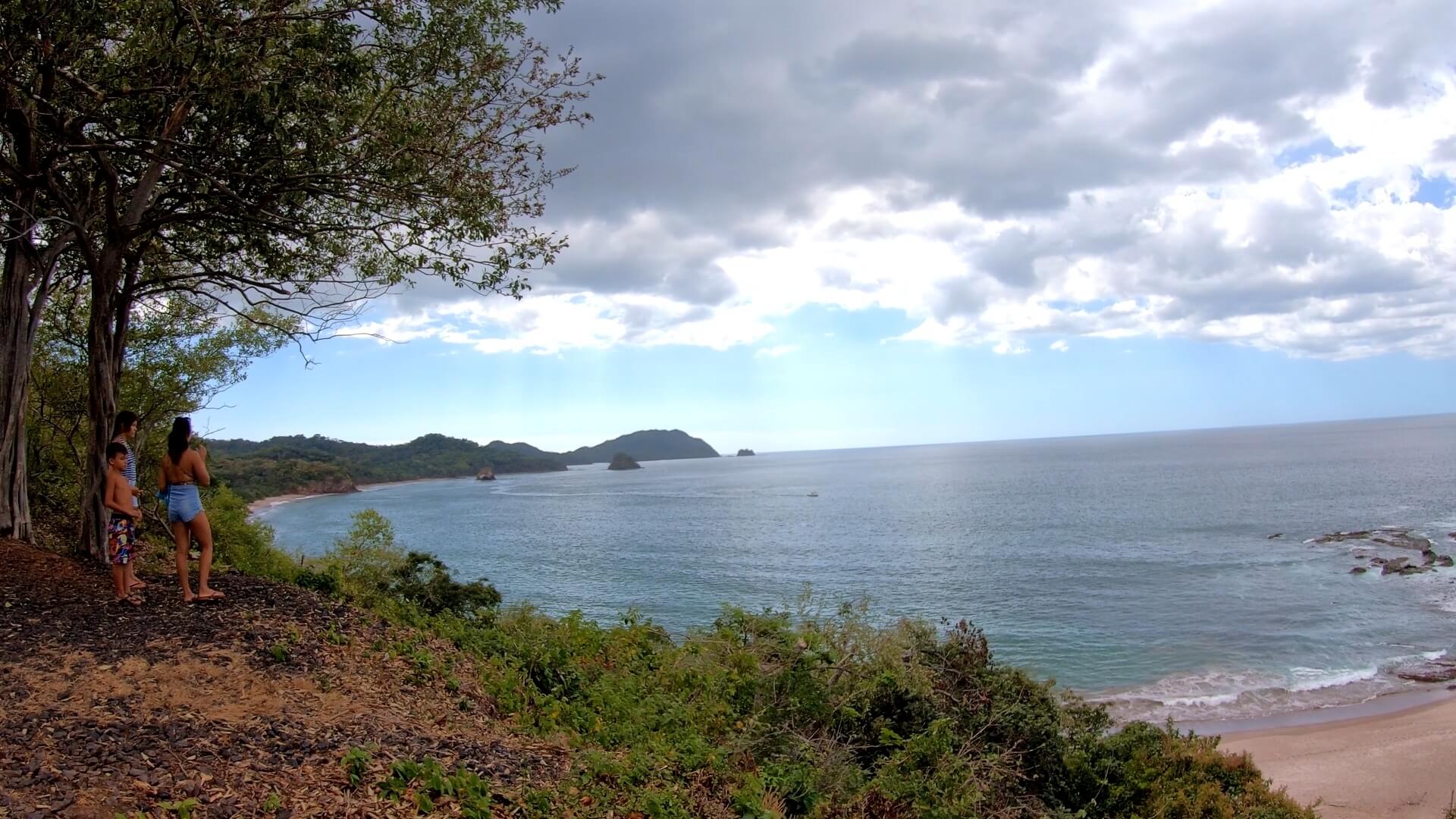
The final lookout point rewards hikers with panoramic ocean views. From here, you can see the entire sweep of Zapotillal beach and several hidden coves to the south. The dramatic rocky coastline below shows why this area remains less developed than nearby beaches.
This vantage point provides perfect photo opportunities, especially in morning light when visibility is best. The whole hike takes about 30 minutes round trip, not counting time spent enjoying the views. Some visitors bring snacks to enjoy at the top while watching for marine life in the clear waters below.
The views at the top of the mountains is incredible, you can see surrounding beaches.
Nearby City: Liberia
Getting There
Liberia sits about 90 minutes from Playa Zapotillal. Daniel Oduber International Airport serves the region, making Liberia your likely arrival point. The city offers last-chance shopping and services before heading to beach areas.
City Services
Liberia provides all major amenities: Large supermarkets (Walmart, MaxiPali), Medical facilities including private hospitals, Banks with ATMs, Car rentals, and Hardware stores. Stock up here before heading to beach towns, as prices typically run lower than coastal areas.
Shopping & Supplies Several shopping centers offer everything needed for beach trips:
Plaza Santa Rosa (major stores and restaurants)
Plaza Commercial Liberia (banks and shops)
Central market for fresh produce
Multiple gas stations along main highway
Transportation Hub
Liberia serves as a major transport connection:
International airport with regular flights
Bus terminal linking to beach towns
Major highways in all directions
Rental car offices near airport
Multiple taxi services
Follow Us!
Be sure to Subscribe to our Youtube Channel, and leave a comment with your thoughts about this location or request a video in other cool destinations around Costa Rica.
Playa Zapotillal FAQ: Hidden Beach Guide
Q: How do you get to Playa Zapotillal? A: Access through Matapalo town. Take gravel road to junction near Hotel Condor Lodge, then rougher road southwest. Look for gap in gate. 4×4 recommended for final section. Parking attendant at beach.
Q: What makes this beach special? A: White sand beach with fewer visitors than nearby Conchal. Clear water swimming. Cave exploring at low tide. Hiking trail to viewpoints. Natural shade spots available.
Q: Is 4×4 really needed? A: Highly recommended for final approach. Regular cars can make it slowly in dry season but risk bottoming out. Last section very rutted. Better access with higher clearance.
Q: What facilities exist? A: Basic parking area with attendant. No restaurants or bathrooms. Bring supplies from Matapalo town. Some shade along beach. Bring everything needed for the day.
Q: What activities are possible? A: Swimming in protected bay. Cave exploring at low tide. Hiking to viewpoints. Beach walking. Tide pool exploring. Sunset viewing. Marine life spotting.
Q: When’s best time to visit? A: Early morning or late afternoon best light. Check tide charts for cave access. Less busy weekdays. Dry season (December-April) easiest driving.
Q: What should you bring? A: Water and food for the day. Beach gear and sun protection. Good shoes if hiking. Cash for parking. Camera for views. Basic supplies as no services at beach.
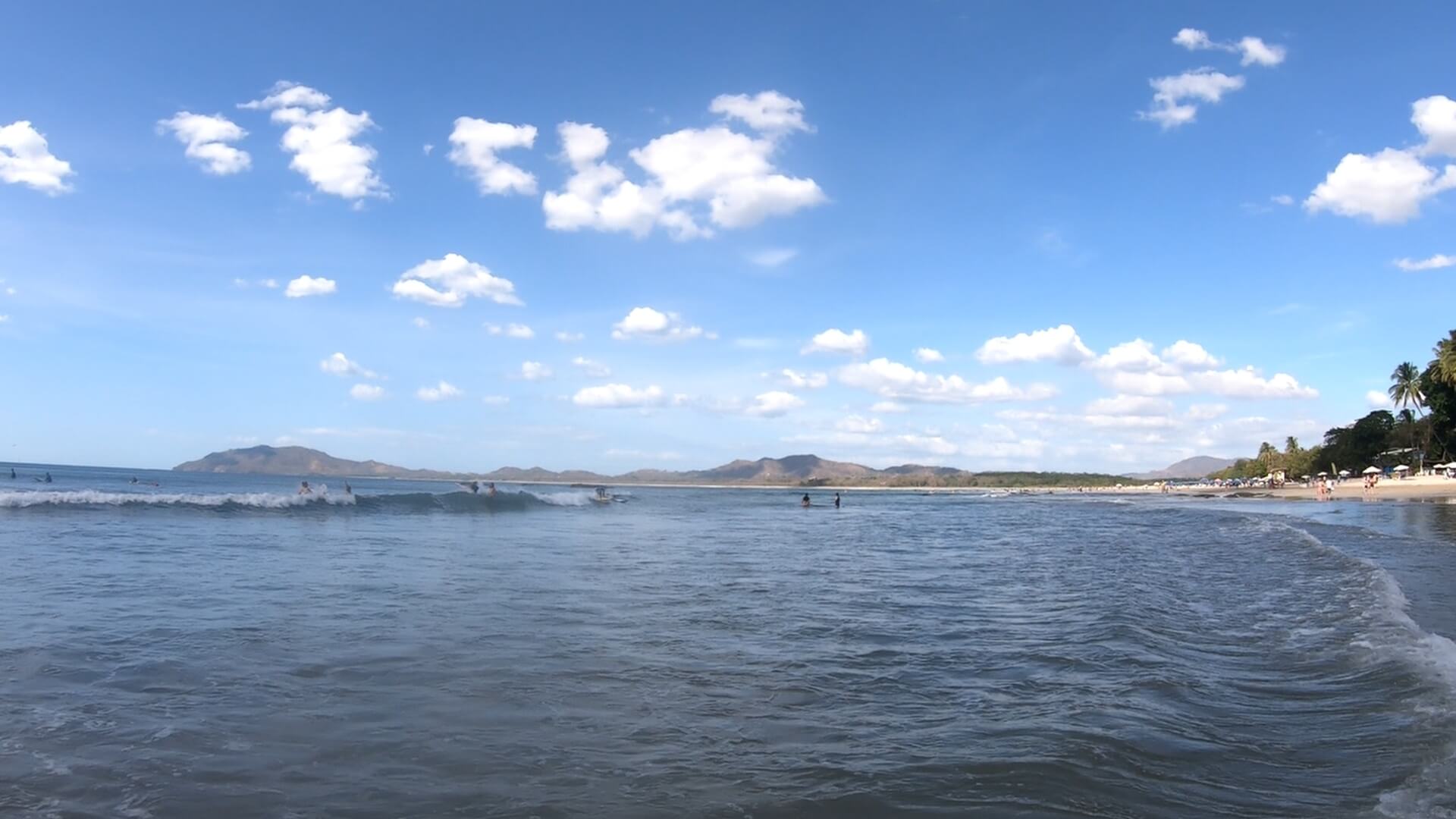
Tamarindo stretches along Guanacaste’s northern Pacific coast, where surfable waves meet walkable beach town life. The curved bay extends 3.5 kilometers, with surf breaks suiting every skill level and quiet swimming spots marking the spaces between waves.
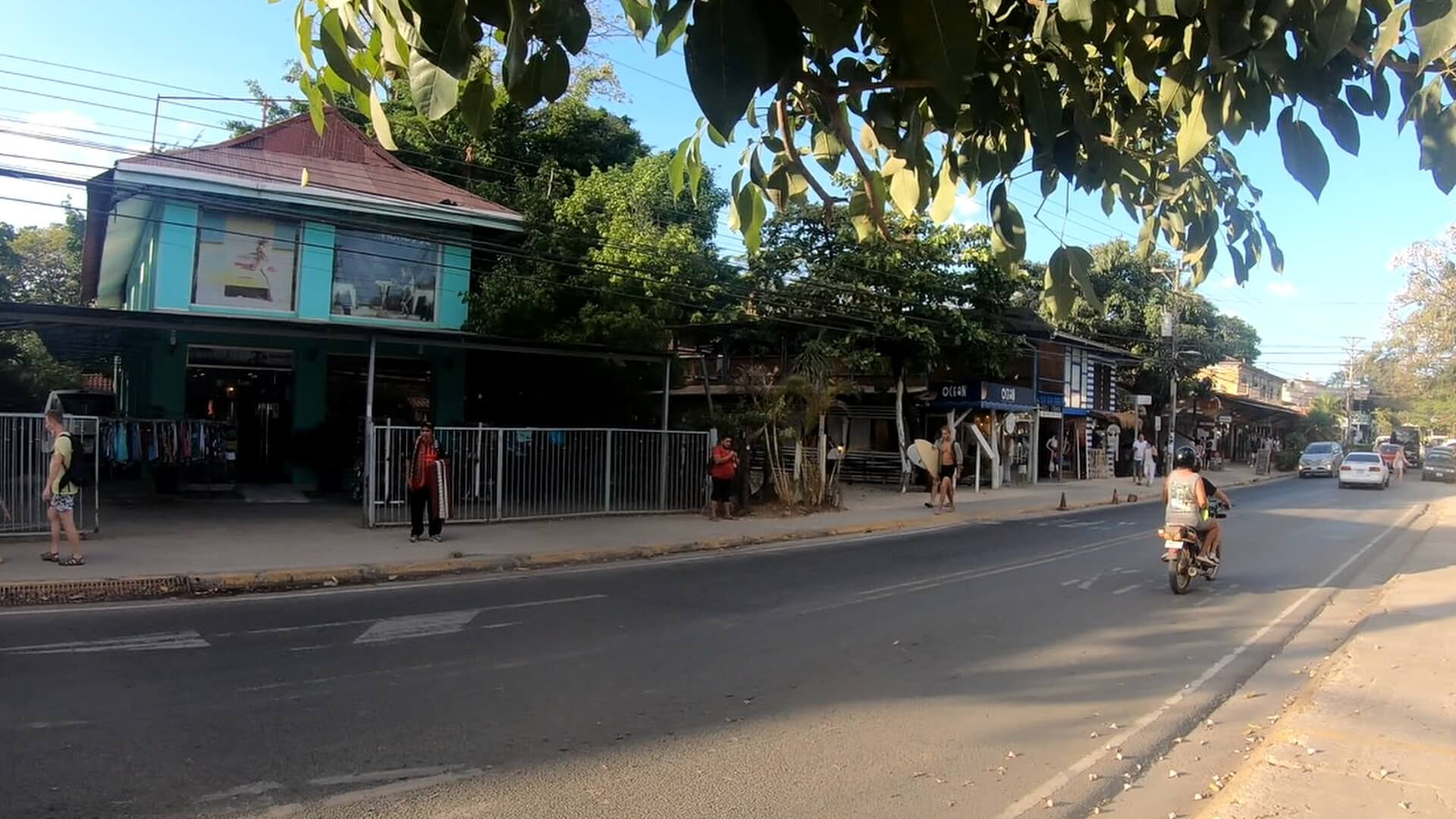
The main street parallels the beach, lined with surf shops, local restaurants, and modern services. This mix of international influence and Costa Rican culture creates a unique coastal atmosphere where different languages blend at sunset gatherings. The Tamarindo Diria hotel marks the town center, with most amenities within walking distance along the beach road.
Morning surf sessions start each day as offshore winds groom the waves. By afternoon, the beach fills with a mix of surfers, swimmers, and people walking toward Playa Langosta. Las Baulas National Park borders the northern end of town, where the estuary provides home to wildlife and marks the natural boundary of the beach zone.
Check Out The Beach
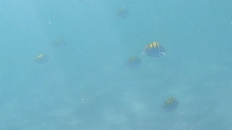
Tamarindo is well known for its amazing beach. Although it fully faces the Pacific, it has easy breaking waves and depth which is great for novice surfers. There’s ample surfing instructors on the beach, and on the main drag, who can take you out for some lessons. If you’re comfortable you can also rent a surf board.
Most of the beach is also great for swimming and relaxing. Kids really enjoy searching for seashells in the tide pools that form during lower tides.
If you’re a most advanced surfer, beaches to the north like Playa Grande will likely be more challenging.
Pick up a pair of these awesome water shoes. I’ve been using them all over Costa Rica during my travels. They have vented soles so water drains right out the bottom!
Walk Around In Town
Tamarindo can be fairly congested when driving in. Once you find parking it’s best to leave the car for the day and check out the town by walking.
On the main drag, you’ll find lots of restaurants that have an ocean view. There’s many unique shops that offer clothing, souvenirs, excursions.
Stuff can be more expensive on the drag, so remember to bring your own sunscreen and similar items. Otherwise you’ll pay top dollar for it in the shops.
There is aSuper Comprowhich is close enough to the beach, where you’ll find big water bottles and other goods for much cheaper than shops directly on the beach.
Finish The Day With Great Food
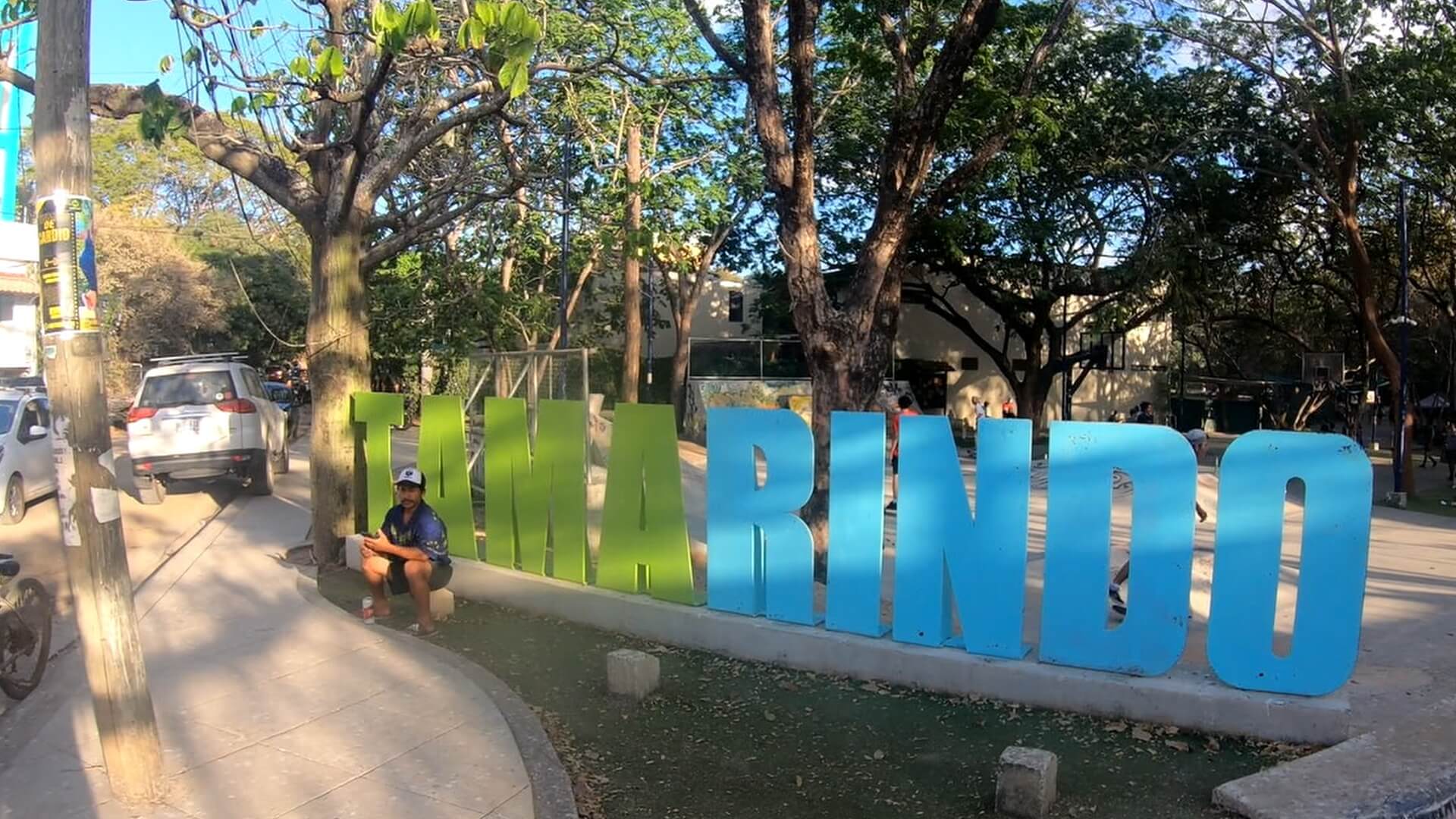
If you head towards the Super Compro, you’ll actually stumble upon a really great kids park. The park has a skate park, jungle gym and basketball court.
Directly across from this park we ate at a restaurant called “The Roof”. They offered delicious pizza and an amazing view to enjoy.
Check Google MapsHerefor directions to The Roof and reviews
Follow Us!
Be sure to Subscribe to our Youtube Channel, and leave a comment with your thoughts about this location or request a video in other cool destinations around Costa Rica.
Tamarindo FAQ: Beach Town & Surf Guide
Q: Where is Tamarindo located? A: Northern Pacific coast in Guanacaste. One hour from Liberia Airport. Main beach road spans 2 km through town. Tamarindo Diria hotel marks center.
Q: What’s the beach like? A: 3.5 km curved beach. Multiple surf breaks for all levels. Swimming areas marked. Watch afternoon currents. Beach width varies with tide. Natural shade limited.
Q: What facilities exist? A: Full services: Large supermarkets, Medical clinics, Banks with ATMs, Surf shops, International restaurants. Regular airport shuttles. Modern infrastructure.
Q: What surf spots exist? A: Rivermouth break advanced. Main beach break good for learning. Multiple peaks along beach. Morning offshore winds common. Best surf November-April.
Q: What’s nearby? A: Playa Langosta walking distance south. Estuary and Las Baulas Park north. Boat trips to hidden beaches. Day trips to national parks possible.
Q: How’s getting around? A: Walking covers most needs. Local taxis available. Public buses connect towns. Boat taxis to nearby beaches. Car rentals in town.
Q: When to visit? A: Dry season (December-April) busiest. Green season has morning sun. Good surf year-round. Less crowded September-November.
Just off the beaches of Hermosa and Penca, clear Pacific waters offer some of Guanacaste’s best snorkeling spots. Both beaches provide protected coves where calm waters and rocky points create natural fish habitats.
Playa Hermosa’s long curved bay has snorkeling areas at both ends, where morning waters stay calm and clear. The beach’s Blue Flag status helps maintain water quality, while natural rock formations attract various fish species near the shore.
Less than 20 minutes away, Playa Penca’s small hidden cove offers excellent visibility in its protected waters. This smaller beach tucked between headlands provides ideal conditions for seeing tropical fish, especially during morning hours when waters are calmest and crowds are thin.
Here’s a map of Costa Rica showing the location of Playa Hermosa. It’s near to the Liberia International Airport.
Playa Hermosa
Playa Hermosa is a well known tourism destination in Guanacaste Province. It’s under an hour drive to the Liberia Airport, and has an amazing beach. It’s a very quiet small town, as it’s about 10 minutes from the much busier Playas del Coco. Still, Hermosa has lots to do including snorkeling on the beach.
We’re snorkeling on the north end of the beach, as there’s lots of rocks where the fish will hang out during high tide. To get to the north end of the beach, you’ll turn right at the main intersection of the beach and continue along until you reach the end of the road. This is where you’ll find the entrance to the Condovac community. There’s on-street parking and some private lots.
Simply walk down to the beach with your gear and head out into the water. We’re using aCressi Snorkeling Kit(Amazon), which is a very cost effective way to start in the water. The mask is very effective and provides great clarity, and the snorkel has a purge valve in the event water gets in the snorkel (which it always does). The fins are also long and provide great propulsion.
Pick up a pair of these awesome water shoes. I’ve been using them all over Costa Rica during my travels. They have vented soles so water drains right out the bottom!
In The Water
On the north end, there’s a roped off area for easy swimming, which has no rocks. There’s generally a life guard on duty, however always be sure to have your own safety plan.
The water in Hermosa is calm compared to many beaches on the Pacific Coast, however rip currents can form. Be sure to watch the water before entering and stay aware of your distance from the beach and other rocks.
Weaker swimmers should consider using a pool noddle while they glide over the water, which are available to buy at the Luperon store in town.
Playa Penca
Playa Penca is another great beach, but it’s off the main roads and generally requires a vehicle with high ground clearance to get to. Penca is on a ridgeline that separates Playas del Coco and Playa Hermosa, so although it’s not very far, it it less busy.
In addition to driving to Playa Penca, you can always find a small charter boat/water taxi to bring you to this beach. The captains for these boats are always hanging out on Coco beach, just ask around and you’ll get introduced to one.
Fish, Snakes, Eels
This video was taken in mid December, which is well into the summer in Costa Rica. The water is very clear, but the water does get affected by the increased winds. It was still an easeful swim and well worth the crystal clear water.
We found an array of different creatures, starting with a Sea Snake which has washed itself up on the beach. These snakes are poisonous so if you see them, keep a good distance so you don’t get bit. Generally when these snakes wash up on shore they’re sick or dying, but can still bite.
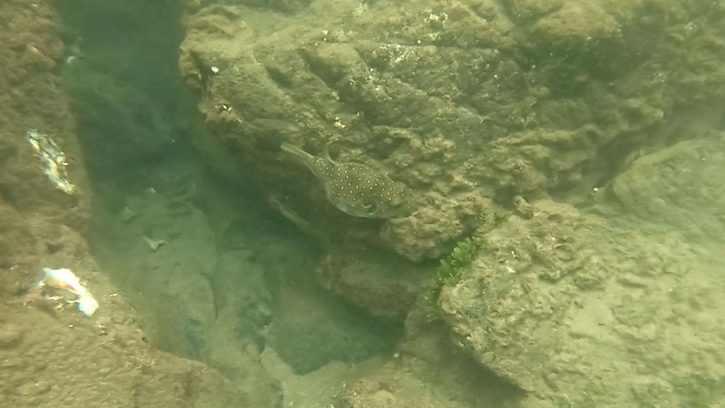
In the water, there was all kinds of different coral fish, puffer fish and an eel as well. The eel in this video is a Tiger Snake Eel, which are not dangerous. This eel was just off the shoreline in some small rocks, so you don’t have to go very far to find some incredible creatures.
Another unique thing was caught on video was a long, translucent worm like creature. I believe this was a “Salp”, which are a chain of organisms that attach to each other. I almost didn’t see it, until I saw the GoPro bump into a chain of small dots in the water. I had initially thought it was a string of plastic, until it started moving on its own and clearly had a clear biotic capsule on each segment.
All these great creatures we’re found within 50 meters of the shore, which makes Playa Penca well worth the trip for snorkeling.
Follow Us!
Be sure to Subscribe to our Youtube Channel, and leave a comment with your thoughts about this location or request a video in other cool destinations around Costa Rica.
Snorkeling Hermosa & Penca FAQ: Clear Water Guide
Q: Where are these beaches? A: Playa Hermosa 7 km north of Coco. Playa Penca 20 minutes from Hermosa by car or boat. Both in Guanacaste’s northern Pacific coast. Clear water locations.
Q: What’s best for snorkeling? A: Hermosa: Rocky points at the north end of beach. Clear morning waters. Penca: Entire cove good for snorkeling. Protected from waves. Better visibility than larger beaches.
Q: When’s best time to go? A: Early morning calmest waters. High tide covers more reef area. Dry season clearest visibility. Check tide charts. Arrive before 9 AM for best conditions.
Q: What marine life appears? A: Common sightings: Angel fish, Parrot fish, Rays, Starfish, Eels near rocks. Occasional sea turtles. More active morning hours.
Q: What facilities exist? A: Hermosa: Beach town services, restaurants, parking Penca: Basic parking only, no facilities, bring supplies
Q: How’s the access? A: Hermosa: Easy paved road access Penca: Short trail to beach from parking Both have clear water entry points
Q: What should you bring? A: Snorkel gear, Water shoes recommended, Sun protection, Water bottle, Dry bag for valuables. Basic gear rentals in Hermosa.
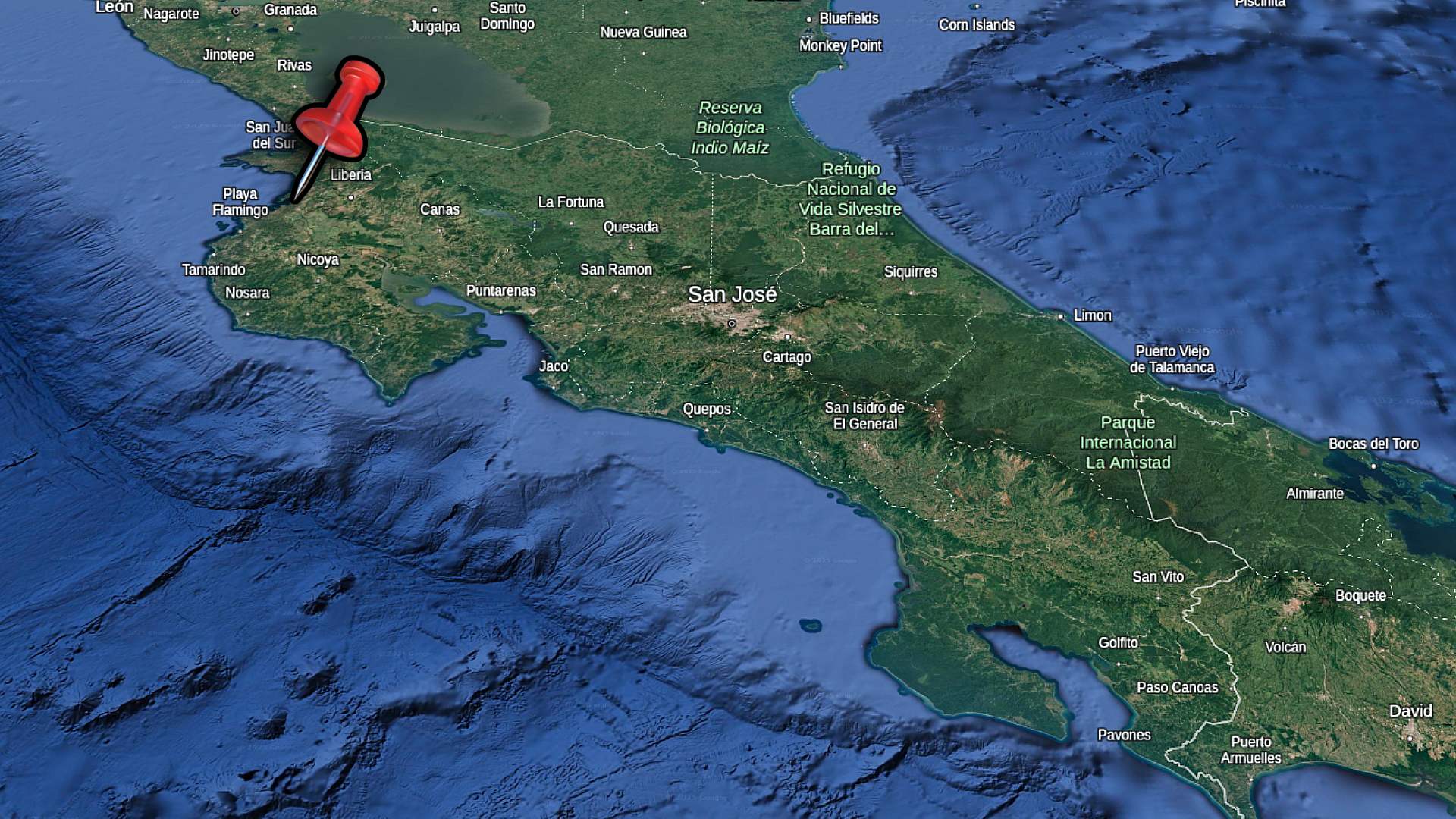
Playa Ocotal’s protected cove creates some of Guanacaste’s clearest waters for snorkeling, just minutes south of Playas del Coco. The black sand beach curves between rocky points where tropical fish gather in the calm, clear water.
The best snorkeling spots lie at both ends of the beach where natural rock formations extend into the bay. Here, angelfish, parrotfish, and even rays glide through the waters near the rocks. Early mornings typically offer the calmest conditions and best visibility.
Unlike many beaches in the area, Ocotal’s protected location and rocky points create ideal conditions for viewing marine life year-round. The gentle slope of the beach provides easy entry points for snorkelers of all levels, while deeper areas near the rocks attract more varied sea life.
Ocotal Beach
Today we’ll be checking out Ocotal for some snorkeling. When we arrived at the beach, it started raining lightly. Fortunately this didn’t result in lots of wind which would have caused waves. We always prefer to snorkel in water that’s calmer, as most of the fish are near rocks and features which you don’t want to get tossed into!
Be sure to assess the water conditions before deciding to head out. The water in Costa Rica is generally very calm, but rip currents can develop. We always have floatation devices in the water for the kids, and someone on shore monitoring.
With the safety covered, let’s snorkel!
Pick up a pair of these awesome water shoes. I’ve been using them all over Costa Rica during my travels. They have vented soles so water drains right out the bottom!
Get There
Ocotal Beach is easily accessible along a well maintained road. You’ll likely be heading there from the area of Playas del Coco. You can program Google Maps or Waze to give you directions to the beach. It’s a rather winding road with several branches off, but just stay on the pavement and you’ll end up in Ocotal.
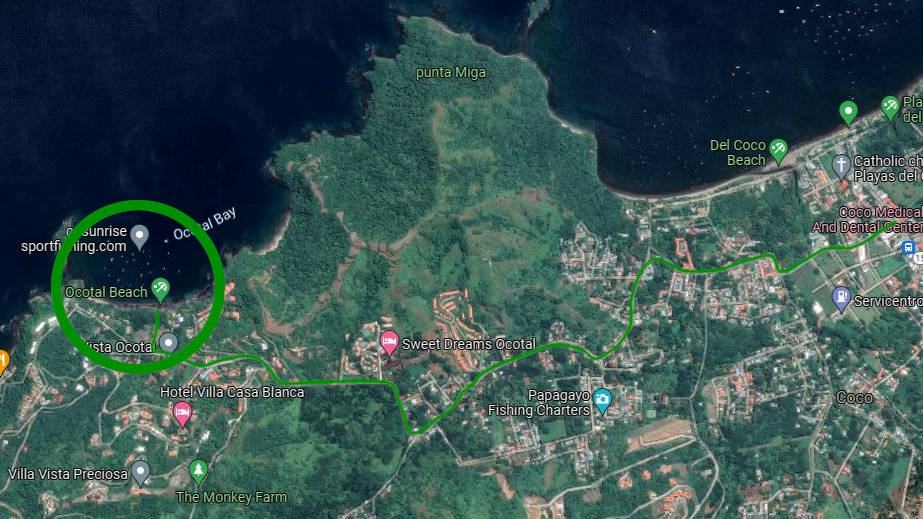
When you arrive at Ocotal Beach, you’ll have a choice of two parking locations. As you come over the hill which descends down to the beach, you can stay right and head to the parking at the east end of the beach. There’s a small public lot which usually has an attendant.
If you stay to the left, you’ll see signage for Father Roosters. You’re going to drive through a gate and then take a quick right. This will take you towards the restaurant Father Roosters, where there’s on street parking. This location is closer to the west end of the beach where this snorkeling video takes place.
In The Water
The beach in Ocotal is well known for its black sand and clear water. You’ll find lots of people relaxing on the beach, playing in the water and snorkeling. There’s boats out in the bay, which has passengers coming and going throughout the day.
We chose the west end of the beach for this snorkeling day, as there’s lots of rocks and features which fish love to cruise around looking for food.
We’re using aCressi Snorkeling Kit(Amazon), which is a very cost effective way to start in the water. The mask is very effective and provides great clarity, and the snorkel has a purge valve in the event water gets in the snorkel (which it always does). The fins are also long and provide great propulsion.
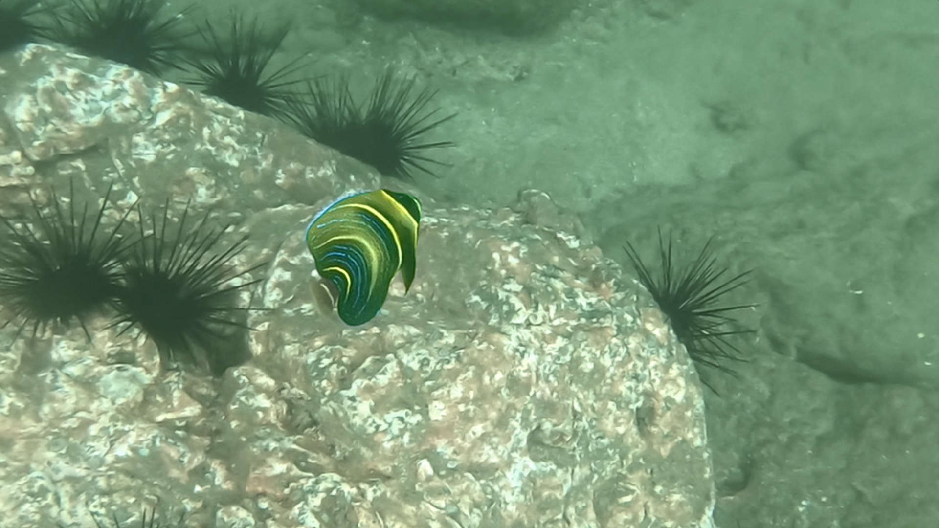
All Sorts Of Fish
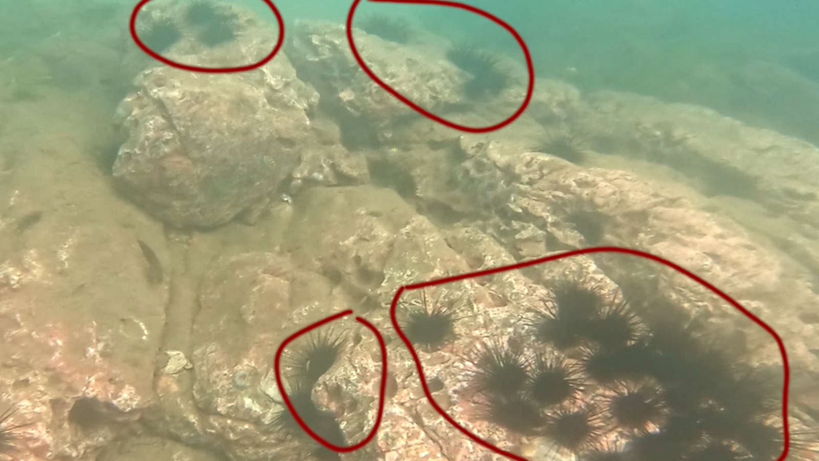
This video was taken at around high tide, so the rocks which house the variety of fish are able to be traversed over. I prefer this time as it opens up the rocks to cruising over to look at all the great fish, but you’ll still have to watch out for Sea Urchins.
To get the best sights of fish, I had to float over top of the Urchins. It’s very important to be cautious and aware of where any rocks are, along with Urchins attached to them. If the waves are ebbing and flowing heavily, don’t swim near them as the water can push you in unwanted directions.
There’s lots of colorful fish in the rocks, which I don’t the names of. They’re often referred to simply as ‘reef fish’. You’ll also see rays if you’re lucky but they’re elusive and sneaky.
Pufferfish
The star of these snorkeling trips is often the Pufferfish. You can find these out in the open water cruising along the bottom. They blend in fairly well and will sit still, so you’ll have to have a keen eye.
In the tide rocks, Pufferfish are even harder to spot. They’re very aware of your presence and will dart into crevasses in rocks to hide. There was even a few Pufferfish close to the camera that I hadn’t seen until I watch the videos after the day.
These are really cool fish and the kids love seeing them as well.
Follow Us!
Be sure to Subscribe to our Youtube Channel, and leave a comment with your thoughts about this location or request a video in other cool destinations around Costa Rica.
Playa Ocotal Snorkeling FAQ: Clear Water Guide
Q: Where’s the best snorkeling? A: Rocky points at both ends of beach. North end has more fish life. South point offers deeper water. Central bay has some coral patches. Clear water throughout cove.
Q: What marine life appears? A: Common sightings: Angel fish, Parrot fish, Rays, Sea turtles (seasonal), Octopus near rocks, Starfish, Puffer fish. Best viewing early morning.
Q: When’s best time to snorkel? A: Early morning calmest water. Best visibility before wind picks up. Dry season clearest water. High tide covers more reef area. Check tide charts.
Q: What facilities exist? A: Basic beach facilities. Some beachfront restaurants. Small convenience store. Parking area near beach. Father Rooster restaurant marks north end.
Q: How’s water access? A: Easy beach entry points. Some rocky areas – water shoes help. Gentle slope into water. Protected cove location. Calmer than surrounding beaches.
Q: What should you bring? A: Snorkel gear (some rentals available), Water shoes recommended, Sun protection, Water bottle, Dry bag for valuables. Basic gear available nearby.
Q: How’s transportation? A: 10 minutes south of Playas del Coco. Public parking available. Local buses run limited schedule. Taxis readily available. Walking possible from Coco.
Costa Rica’s diverse landscapes stretch from Caribbean mangroves to Pacific surf breaks, with cloud forests and volcanic peaks filling the spaces between. Each region offers distinct experiences, from hidden waterfalls in mountain valleys to protected beaches where turtles nest beneath palm trees.
The country’s beach areas range from developed surf towns to secluded coves accessible only by boat or trail. Mountain communities preserve traditional life while providing access to waterfalls and hiking trails. Wildlife appears throughout, from howler monkeys in beach almond trees to quetzals feeding in highland forests.
These natural zones connect through a network of towns and cities, each with its own character. Colonial architecture in Central Valley cities contrasts with laid-back beach towns, while mountain villages maintain agricultural traditions. Protected areas make up nearly a quarter of the country, creating corridors where wildlife moves freely between different ecosystems.
In this guide to Costa Rica, we’ll go over some great examples of all the natural wonders you can see during your vacation. Before you book your flights, be sure to visit ourShop Pagefor a packing list of stuff I use when travelling around Costa Rica.
Beaches
Costa Rica is well known for its amazing beaches. The best part is that depending on which type of beach you enjoy, you’ll be able to find it.
Along the Pacific Coast, there’s a spectrum of style of beaches you can check out. If you’re into surfing, places like Jaco are perfect. All along the Puntarenas Pacific coast, you’ll find tons of beaches for different surfing skill levels. This part of Costa Rica has full force from the Pacific Ocean, so you’ll often find beaches that have great waves.
Check the video below for what the water looks like in Jaco. If Jaco’s beach is too easy, you can drive 10 minutes south to find some bigger waves at Playa Hermosa. If you head even farther down the Pacific Coast you’ll find even more advanced beaches.
Dominical is about 1.5 hours south of Playa Hermosa. It’s a relaxed small town with a surfing vibe. There’s lots of beach front accommodations for those looking to wake up and get right out into the water.
If you’re taking your vacation further north in Guancaste, be sure to check out Tamarindo for its surfing. It has various skill levels, from beginner and up. Kids can practice surfing for the first time on this beach. For more advanced surfing opportunities, there’s a beach called Playa Grande which tends to have bigger waves.
Another well known surfers town is Nosara. This town is harder to get to by driving, but once there you’ll find the beach packed with people on the waves. Nosara is a bit further drive from the Liberia Airport, so some people prefer to take a small charter plane to its local airport.
Pick up a pair of these awesome water shoes. I’ve been using them all over Costa Rica during my travels. They have vented soles so water drains right out the bottom!
Waterfalls
Costa Rica isn’t just coastline and beaches, it also has huge differences in terrain and climate. These differences produce really great river features which connect the mountains to the ocean. You’ll find countless water features all throughout the hills, with some very impressive and notable waterfalls.
For example, Cataratas Llanos de Cortes is a massive waterfall which is located in Guanacaste, just south of Liberia. If you’re visiting Costa Rica, you may be flying directly into Liberia International Airport (LIR). This waterfall is about half an hour south.
The video linked below was taken during rainy season, so the flow of water is much heavier. Due to the rain falling on fields, the water is also murkier than you can expect during the dry season (December-April). Either way, the water is incredibly refreshing and the location is pristine.
You can also find lots of rivers that converge to create amazing caverns. For example, the river atPoza Los Coyoteshas areas for swimming and diving, but then chiseled out a cave as it descends the mountain. You can swim in floatation tubes at the bottom, right into the cave system to check it out.
There are rivers to visit all throughout Costa Rica, especially in the central valley. Near Cartago, you’ll find hot springs and rivers. Further south in Pérez Zeledón you’ll find rivers coming off the mountain range called Chirripó. The water there is incredibly cold and refreshing.
Tour Of Towns
When you visit Costa Rica, there’s a wide variety of towns to visit. If you start in San Jose, you’ll find a built up urban center which is very busy and may not be much of an escape from your home towns.
As you head further out towards the coasts, you’ll find different sizes of towns. In Guanacaste, you’ll find lots of shopping options in Nicoya and Liberia. In Puntarenas Province, towns like Jaco are more built up with big box stores, car repair and specialty shops.
On the coasts, there’s an array of towns ranging from those with just a few hotels and some houses, to more built up areas with shops.
For example, Playas del Coco is a well known tourist destination. It’s not very busy and built up, but it has an assortment of restaurants and shops. You’ll be able to spend an entire vacation just in Coco. If you drive 10 minutes away from Coco you’ll reach much quieter and less built up beaches which are very enjoyable.
Check out a tour of Playas del Coco in the video below to give you an idea of what you can expect when visiting.
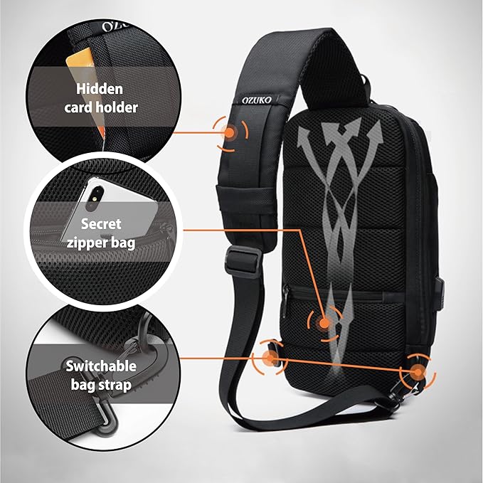
I use this sling backpack when I’m travelling in Costa Rica. It has a zipper lock to secure your stuff. I like the sling as I can flip the bag to the front for easy access.
Wildlife
Costa Rica has three main types of monkeys you’ll often see. Howler monkeys make loud calls early in the morning and late afternoon. White-faced monkeys usually travel in groups and are common near beaches. Spider monkeys stay high in the trees and are less common to spot.
Many different birds live throughout Costa Rica. Scarlet macaws fly over Pacific beaches, while toucans appear in mountain areas. You can see different types depending on where you are – beach areas have shore birds while mountain zones have forest species.
Sloths move slowly through the trees looking for leaves to eat. Costa Rica has both two-toed and three-toed sloths. They’re often seen in trees near beaches and forest trails. These slow-moving animals are easy to spot when they hang in trees near walking paths. Here’s a video of a sloth I spotted at the beach in Dominical.
Follow Us
We hope you enjoyed this post about some activities and things to consider on your trip to Costa Rica.
Be sure to Subscribe to our Youtube Channel, and leave a comment with your thoughts about this location or request a video in other cool destinations around Costa Rica.
FAQ: Vacationing in Costa Rica
1. What is the best time of year to visit Costa Rica? The best time to visit Costa Rica is during the dry season, which runs from December to April. This period offers sunny weather and is ideal for outdoor activities like beach trips, hiking, and wildlife tours. The rainy season (May to November) is also a good option if you prefer fewer crowds and lush green landscapes, but be prepared for daily showers, especially in the afternoons.
2. Do I need a visa to travel to Costa Rica? Visitors from many countries, including the United States, Canada, and most European nations, do not need a visa for stays of up to 180 days. You’ll need a valid passport that doesn’t expire for at least six months after your arrival date. It’s also recommended to have proof of onward travel when entering the country.
3. Is Costa Rica safe for tourists? Costa Rica is considered one of the safest countries in Central America for tourists. However, like any destination, it’s important to take basic precautions. Keep your belongings secure, avoid walking alone at night in unfamiliar areas, and stay informed about local conditions. Most visits are trouble-free, but it’s always good to be cautious.
4. What currency is used in Costa Rica, and can I use US dollars? The official currency of Costa Rica is the Costa Rican colón (CRC). However, US dollars are widely accepted in most tourist areas, hotels, and restaurants. It’s still a good idea to carry some local currency for smaller purchases or in more remote areas. ATMs are common in cities and towns, and many accept international cards.
5. What are the must-see destinations in Costa Rica? Costa Rica offers a variety of must-see destinations, including the Arenal Volcano, Manuel Antonio National Park, Monteverde Cloud Forest, and the beaches of Guanacaste. Each region has its own unique attractions, from wildlife and rainforests to surfing and snorkeling spots.
6. Is it easy to get around Costa Rica? Getting around Costa Rica can be straightforward, especially with the country’s well-maintained road network. Renting a car is a popular option for travelers who want flexibility, but there are also reliable bus services and shuttle options between major tourist destinations. Domestic flights from Sansa are available for quicker travel between distant areas.
7. What kind of activities can I do in Costa Rica? Costa Rica is known for its outdoor activities, including zip-lining, surfing, hiking, wildlife tours, and visiting hot springs. The country’s diverse ecosystems offer something for everyone, whether you’re into adventure sports or relaxing in nature. Don’t forget to explore the local farmers markets as well.
8. How expensive is a vacation in Costa Rica? Costa Rica can range from budget-friendly to more expensive, depending on your travel style. Accommodations vary from hostels to luxury resorts, and dining options include affordable local sodas (small eateries) as well as high-end restaurants. Entrance fees to national parks and activities can add up, so it’s good to plan your budget accordingly.
9. What should I pack for a trip to Costa Rica? Packing for Costa Rica depends on the regions you’ll visit. Lightweight clothing is ideal for the warm coastal areas, while the higher altitudes like Monteverde can get chilly, so bring a jacket. Don’t forget essentials like sunscreen, insect repellent, a rain jacket (especially in the rainy season), and sturdy shoes for hiking. Swimsuits and flip-flops are a must for beach days. Visit our Packing Listfor items I use when travelling around Costa Rica
A hidden stretch of white sand beach curves along Guanacaste’s Pacific coast, offering clear waters and natural shade areas. Playa Blanca connects with Matapalo Beach to the north, while the RIU Guanacaste resort marks its southern end.
Access starts through the small town of Nuevo Colon, following rural roads that wind toward the coast. The route keeps visitor numbers lower than nearby beach areas, especially during green season when the dirt roads need more careful navigation.
This section of coastline provides excellent swimming conditions most mornings, with views stretching across the entire bay. Beach almond trees create natural shade along the shore, while the white sand and clear water make it perfect for long walks or relaxing away from more developed beaches.
The journey to Playa Blanca takes you through quiet back roads of Guanacaste. Most visitors access the beach through the small town of Nuevo Colon, about 30 minutes from Liberia airport.
Unlike popular tourist beaches nearby, reaching Playa Blanca requires some local knowledge and careful navigation. The route changes from paved roads to dirt tracks, but the extra effort rewards you with a less crowded beach experience.
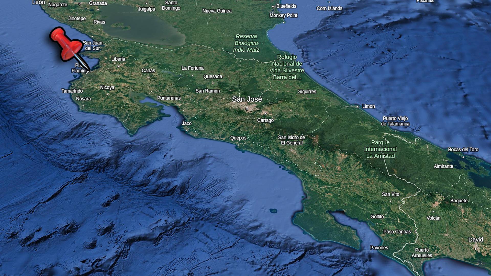
Map of Costa Rica showing the location of Playa Blanca in Guanacaste Province.
Starting from the Highway
From the Liberia International Airport you’ll drive towards the coast. Before reaching Playas del Coco, you’ll turn south towards the Riu Guanacaste Hotel. After about 10 minutes you’ll reach a small town called Nuevo Colon. This is where you’ll either head straight, or turn onto the Monkey Trail(which goes to Potrero & Tamarindo). The small town of Nuevo Colon has a few local shops where you can grab water and snacks. Continue on towards the Riu Hotels.
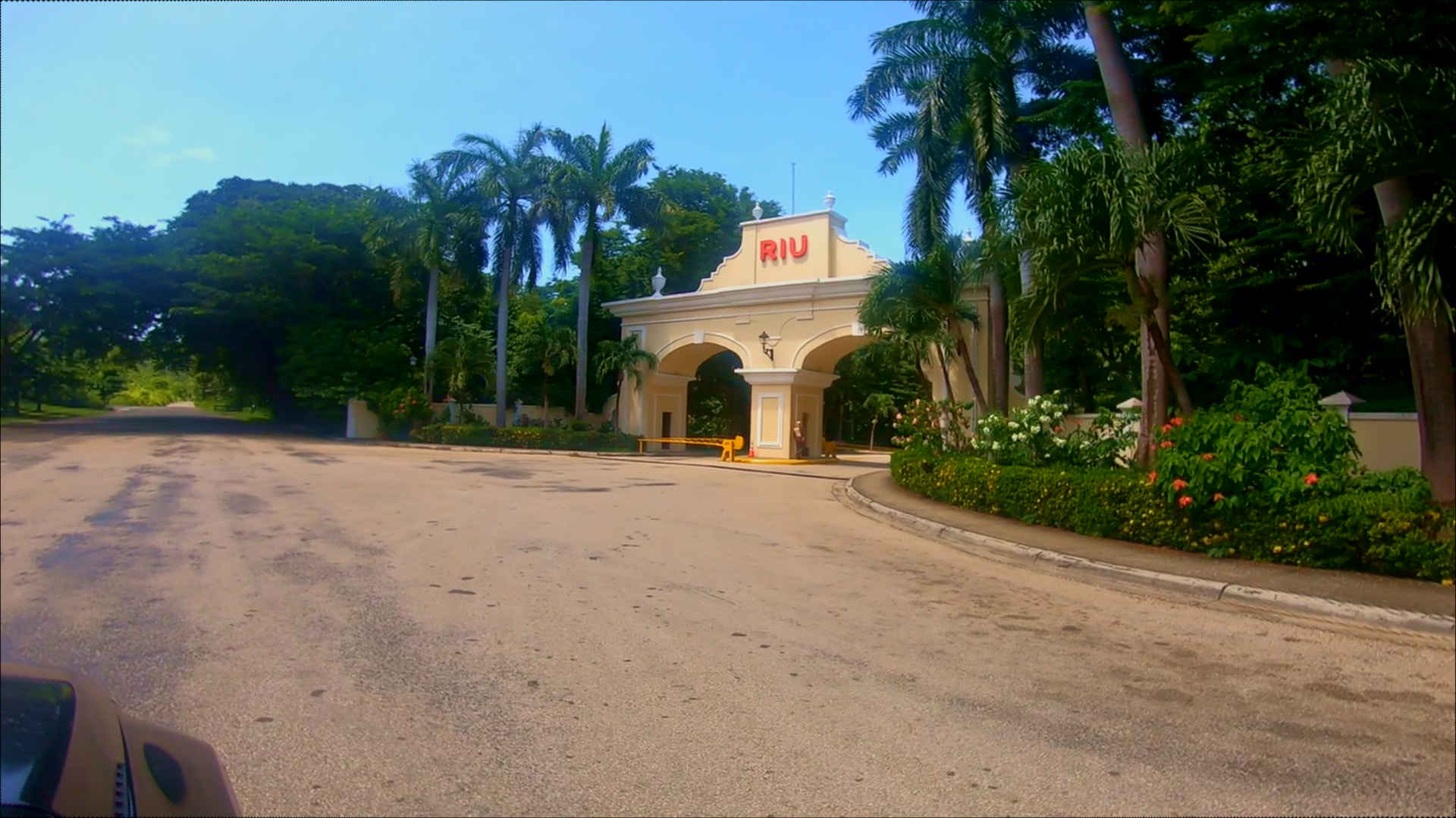
The paved road winds past local houses and farms. Several speed bumps and very large potholes are usually present on the road so drive with care. The road is paved until you reach the main sign for the Riu.
This is the entrance to the Riu Hotels, including the Guanacaste and the Palace.
The Dirt Road Section
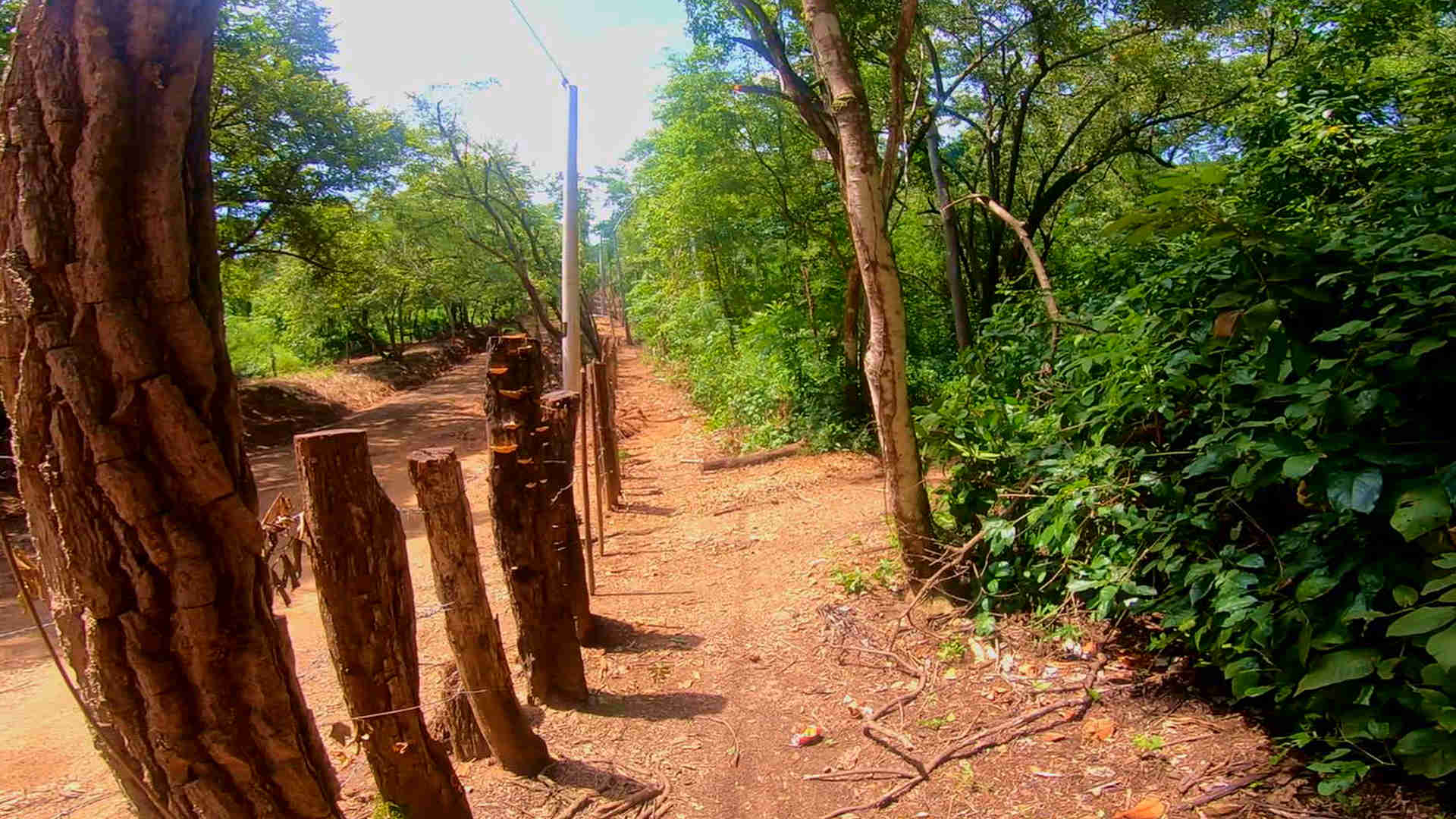
The final approach follows a dirt road that varies with seasons. Dry season makes the route dusty but passable for most vehicles, while green season can create muddy sections requiring higher clearance. Several side tracks branch off the main road – stick to the most traveled path. You’ll actually find the entrance through a gap in the fence. If you’re lucky, there’ll already be a couple cars parked there to point it out.
This is what you’ll be looking for when you park and enter through the fence.
Pick up a pair of these awesome water shoes. I’ve been using them all over Costa Rica during my travels. They have vented soles so water drains right out the bottom!
Beach Experience
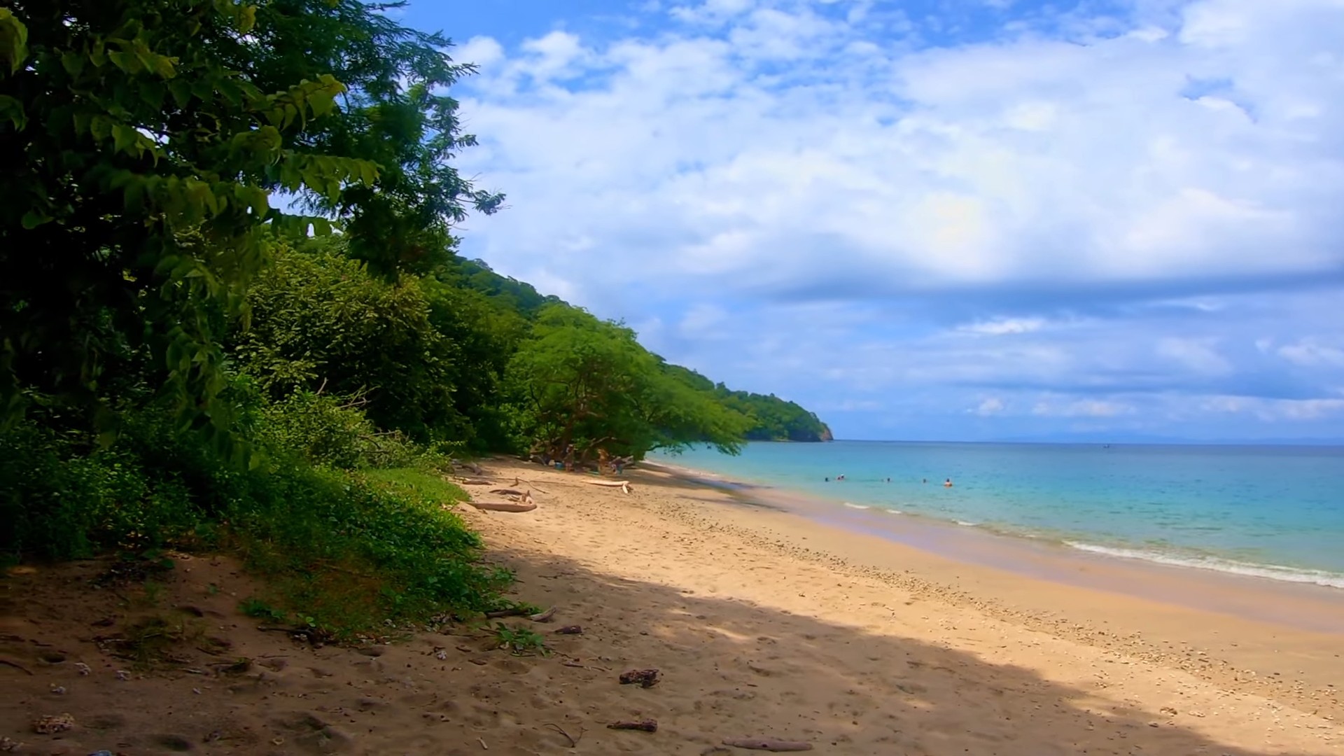
A long curve of white sand stretches until the rocks to the north, offering different spots to set up for the day. The beach’s position in the bay provides good swimming conditions most mornings, and there’s lots of natural shade from beach trees along the shore.
Unlike the RIU resort section to the south, this area maintains a natural, undeveloped feel. The beach width varies with tides but always leaves plenty of space for walking or finding quiet spots away from other visitors.
Swimming and Water Conditions
Morning hours bring the calmest waters, perfect for swimming and floating in the clear bay. The beach slopes gently into the water, making it good for families. Watch for afternoon winds that can bring stronger waves.
Most visitors swim near the center of the beach where the sandy bottom stays consistent. Rocky points at each end attract fish but require water shoes for comfortable exploration.
Playa Blanca, from about the middle of the beach facing north.
Shade and Facilities
Beach trees provide natural shade along most of the beach. Early arrival helps secure these coveted shady spots, especially important during hot dry season months.
No permanent facilities exist at the beach, so bring everything needed for your visit. This includes water, snacks, and beach gear. Some vendors occasionally walk the beach selling coconuts and drinks, but don’t count on regular service.
Best Times to Visit
Early morning brings best conditions for swimming and usually fewer people. The beach faces east, so sunset may fall behind the tree line for some of the year.
Weekdays see fewer visitors than weekends when local families often visit. Green season (May-November) brings even quieter beach days, though access requires more planning around weather.
Near The Riu Resort
The southern end of the beach connects with the RIU Guanacaste resort area. While the resort occupies its own section of beach, all Costa Rica beaches remain public by law, letting you walk the entire stretch from Playa Blanca to the resort area.
This connection makes Playa Blanca popular with resort guests looking to explore beyond the hotel beach. The walk between areas takes about 15 minutes along the shore, passing interesting rock formations and offering good photo opportunities.
Resort Area Access
Resort guests often walk north along the beach to reach the quieter Playa Blanca section. The route stays accessible even at high tide, though some rocky sections might need careful footing.
Local vendors are usually set up near the resort end of the beach, who sell food and souvenirs. The beach at the Riu is also open to the public, should you want to explore Playa Matapalo as well.
Beach Differences
The resort section has more amenities but is way more busy. Moving north toward Playa Blanca, the crowd thin out and the beach is more natural and secluded.
The water stays equally clear in both areas, but Playa Blanca often has better swimming conditions due to less boat traffic. The natural shade and wider beach also provide more options for setting up away from crowds.
Follow Us
Keep up with our latest Costa Rica travel videos and guides bysubscribing to our YouTube channel. We regularly post new content showing real conditions across different regions and seasons. Leave a comment with your Costa Rica travel questions – we’re happy to help plan your perfect time to visit.
Playa Blanca FAQ: Local Beach Guide
Q: How do you get to Playa Blanca?
A: Access through Nuevo Colon town. Follow dirt road to beach parking. Watch for the break in the fence to get to the walking path to the beach.
Q: What facilities exist?
A: Very basic setup. No permanent facilities at beach. Parking area with attendants. Bring water and supplies needed. Natural shade from beach almond trees.
Q: Is 4×4 needed?
A: Helpful in green season (May-November). Regular cars manage in dry season but drive carefully. Dirt road sections require attention. Higher clearance makes access easier.
Q: How’s swimming here?
A: Morning brings calmest waters. Clear bay good for swimming. Gentle slope into water. Watch afternoon winds. Rocky points good for snorkeling with proper footwear.
Q: What’s nearby?
A: RIU resort short walk south. Matapalo Beach connects north. Small shops in Nuevo Colon for basic supplies. Beach walking possible in both directions.
Q: When’s best time to visit?
A: Early morning best for swimming and parking. Weekdays quieter than weekends. Dry season (December-April) easiest access. Sunset views worth late visits.
Q: Can you walk to the RIU?
A: Yes, about 15-minute beach walk south. Public beach access guaranteed by law. Some rocky sections need careful footing. Resort facilities private but beach public.
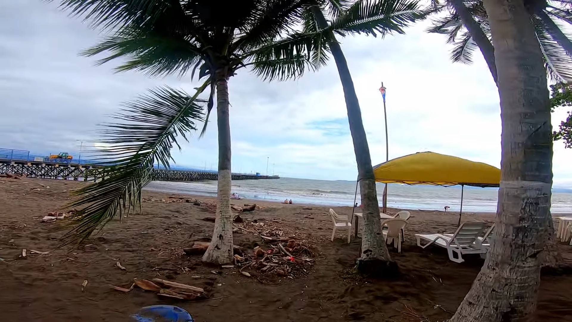
Puntarenas stretches along a narrow peninsula into the Pacific, where cruise ships dock and fishing boats bring in daily catches. The city serves as both a working port and gateway to Nicoya Peninsula, with regular ferries crossing the gulf to Paquera and Naranjo.
The long beach road called the Paseo de los Turistas runs the length of the peninsula, lined with seafood restaurants and local shops. This walkway fills with families and visitors enjoying sunset views across the gulf waters. Food vendors set up along the beach selling Churchill, the city’s famous shaved ice dessert.
The port area mixes daily fishing activity with tourism services. Fresh seafood arrives at the market while ferry passengers head to peninsula beaches. The town’s location creates cooler temperatures than Guanacaste, with afternoon breezes common along the peninsula.
How To Get There
Puntarenas city sits on a narrow peninsula on Costa Rica’s central Pacific coast, about 90 minutes from San Jose International Airport. The main highway (Route 27) connects directly from San Jose to Puntarenas, making it an easy drive. The road is well maintained and clearly marked.
Regular buses leave from San Jose’s central station to Puntarenas throughout the day. The bus terminal in Puntarenas is at the base of the peninsula, walking distance to the beach area and ferry terminal. Rental cars can take advantage of several parking areas along the peninsula’s main road.
For today’s video, let’s visit the area of Parque del Muellero, which is about half way along the town, on the south side. The beach in this area faces south into the Gulf of Nicoya, which has full exposure to the Pacific Ocean.
In the area, check out the Imperial Restaurant, which is on the corner of Calle Central/Av 4. It’s on the northeast corner. We had lunch there and the food was very good and well priced.
Down the path to the west, you’ll find a long chain of interconnected restaurants and shops selling all kinds of great items.
The Main Attraction
Walk a minute farther and you’ll find the large tourist sign with Puntarenas in large and striking statue letters. There’s also a very interesting theatre with blue leaves hovering above the stage.
If you’re staying in Punta Arenas, you’ll find lower cost accommodations in the mid area of town. It’s easily within walking distance to the west end of town where you’ll find the peak of the island. It’s also where you can take a ferry across the bay to Guanacaste.
I use this sling backpack when I’m travelling in Costa Rica. It has a zipper lock to secure your stuff. I like the sling as I can flip the bag to the front for easy access.
Beautiful Town
Punta Arenas is a great town with lots to see. Even the drive to the peninsula is exception with great views of both mountains and ocean. There’s lots of small vendors along to road selling grilled meat and treats. Adding Punta Arenas to your itinerary is an obvious choice!
Be sure to Subscribe to our Youtube Channel, and leave a comment with your thoughts about this location or request a video in other cool destinations around Costa Rica.
Puntarenas FAQ: Port City Guide
Q: Where is Puntarenas located? A: Central Pacific coast, 90 minutes from San Jose. Long peninsula extends into gulf. Main port city for region. Ferry terminal to Nicoya Peninsula.
Q: How do you get there? A: Direct highway (Route 27) from San Jose. Regular buses from capital. Train service on weekends. Easy driving on well-marked roads. Parking available along peninsula.
Q: What facilities exist? A: Full port city services. Bus and ferry terminals. Fresh seafood market. Public beach facilities. Local restaurants. Shopping areas. Marine supplies.
Q: What makes it special? A: Main ferry port to Nicoya. Fresh seafood daily. Long beach walkway (Paseo). Cooler than Guanacaste. Local food specialties. Active fishing port.
Q: What activities exist? A: Beach walking along paseo. Fresh seafood dining. Sunset viewing. Ferry trips possible. Local market visits. Marine museum. Public swimming areas.
Q: When to visit? A: Early morning coolest for walking. Weekdays less crowded than weekends. Ferry schedule affects crowds. Morning fish market active. Local festivals vary by season.
Q: How’s transportation? A: Easy bus connections. Regular ferry service. Train weekends only. Local taxis available. Walking good on peninsula. Parking near main areas.
Costa Rica celebrates its Independence Day on September 15th, marking the day in 1821 when the Act of Independence was signed in Guatemala City, freeing Central America from Spanish colonial rule. The news of independence took nearly a month to reach Costa Rica by foot, arriving in Cartago on October 13th, 1821. This delayed arrival is now commemorated in the traditional torch run from Guatemala to Costa Rica, carried out by students each year.
The celebrations today combine historical traditions with modern festivities, centered around parades called desfiles where students showcase traditional dances, music, and costumes. Schools across Costa Rica spend months preparing choreographed performances, while communities organize civic events featuring marching bands, flag ceremonies, and traditional food sales. Each town adds its own local customs to the national celebration, from small mountain village gatherings to large city festivals.
Unlike many independence movements, Costa Rica’s separation from Spain happened without armed conflict, shaping how the holiday is celebrated. Instead of military parades, the focus falls on cultural displays, educational events, and family gatherings. The evening before Independence Day, Costa Ricans participate in the “Desfile de Faroles” (Lantern Parade), where children carry handmade lanterns representing the original torch runs that spread news of independence.
About Playas del Coco
Playas del Coco is in Costa Rica’s northwestern province of Guanacaste along the Pacific coastline. The Gulf of Papagayo stretches between the Nicaraguan border and the Nicoya Peninsula with El Coco positioned right in the middle.
This part of Costa Rica has direct access from Liberia International Airport with just a 30-minute drive to the beach. The area follows the typical Guanacaste weather patterns of clear dry season days from December to April and afternoon rains from May to November.
Location and Getting There
You can reach Playas del Coco by taking the paved highway from Liberia through the town of Comunidad. The drive is straightforward with clear signs pointing to the beach. Many small communities line the route as you head toward the coast.
The public bus runs several times each day from stops near Liberia Airport. Most visitors either take the bus or arrange a rental car for their stay. Shuttle services also run this route if you book in advance.
Beach Town Overview
El Coco started out as a quiet fishing village before growing into the busy beach town you see today. The main street runs right to the beach with plenty of restaurants and small shops along the way. You’ll find everything you need in town from grocery stores to pharmacies and banks.
Local fishing boats head out daily and sell freshly caught fish at local markets. The beach curves along the bay for about 2 kilometers with calm waters most days. Early mornings bring the fishing boats while evenings draw people to watch the sunset from the beach or the restaurants along the shore.
Follow Us
Be sure to Subscribe to our Youtube Channel, and leave a comment with your thoughts about this location or request a video in other cool destinations around Costa Rica.
FAQ About Playas del Coco Costa Rica
Q: Where exactly is Playas del Coco? A: Playas del Coco is in Guanacaste Province, about 30 minutes from Liberia International Airport (LIR). It’s one of the closest beach towns to the airport.
Q: What’s the beach like at Playas del Coco? A: The beach has dark gray sand and calm waters. The swimming area is protected by a bay, making it safer than many Pacific beaches. The water gets deep gradually, good for families with kids.
Q: When is the best time to visit Playas del Coco? A: The dry season (December to April) has sunny days and no rain. But the town is good year-round – even in green season (May to November), mornings are usually clear and it only rains for a few hours in the afternoon.
Q: What is there to do in Playas del Coco? A: Popular activities include fishing trips, snorkeling tours to nearby beaches, diving, and sunset sailing. The town has a long beachfront strip with restaurants, bars, and small shops. You can also take day trips to nearby beaches like Playa Hermosa or Ocotal.
Q: Is Playas del Coco expensive? A: It’s mid-range for Costa Rica. You can find hotels from $50-200 per night. Local restaurants serve meals for $8-15, while beachfront dining runs $15-30 per plate. Grocery stores have reasonable prices if you’re cooking your own meals.
Q: How do I get around Playas del Coco? A: The main beach strip is walkable. For trips to other beaches or Liberia, you can use local taxis or rent a car. Many visitors rent golf carts to explore the area – they cost about $50-70 per day.
Q: What’s the nightlife like? A: Playas del Coco has the most active nightlife in the Papagayo area. The beach strip has several bars and a casino. It gets busy in high season but stays quieter than party towns like Tamarindo.
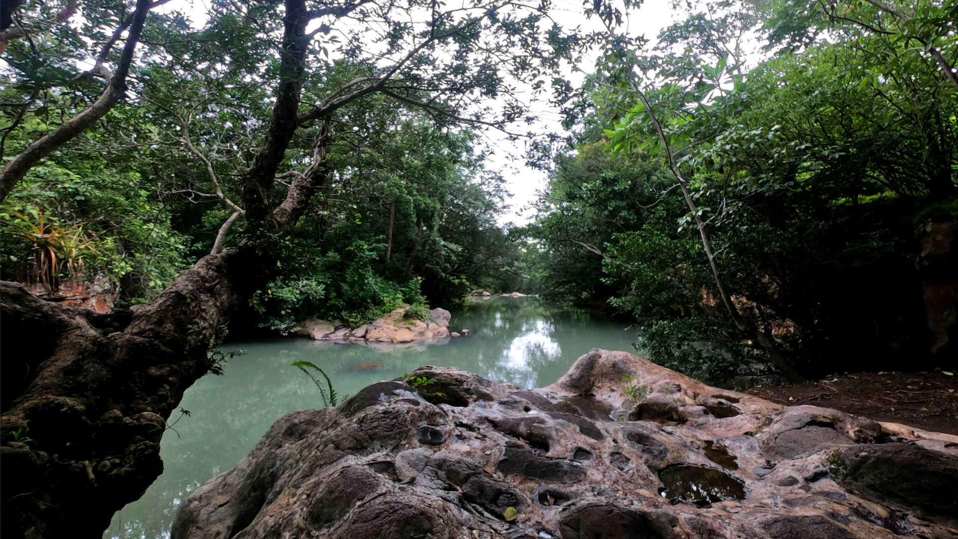
Just outside of the large city of Liberia in Guanacaste, you’ll find an amazing river system. It’s called Poza Los Coyotes, and it’s one of my favorite places in all of Costa Rica. In this blog post we’ll detail how to get there and what you can expect at this tourism hotspot.
Poza translates to pool in English. You’ll find this word describing locations that are on rivers and have a naturally formed area where you can swim. Keep an eye out on Google Maps for other Pozas in Costa Rica, or check out our Youtube channel for more videos with locations like this one.
Visit ourShop Pagefor a packing list of items I find useful when travelling. Don’t forget to pick up some sunscreen before spending a day at a location like Poza Los Coyotes.
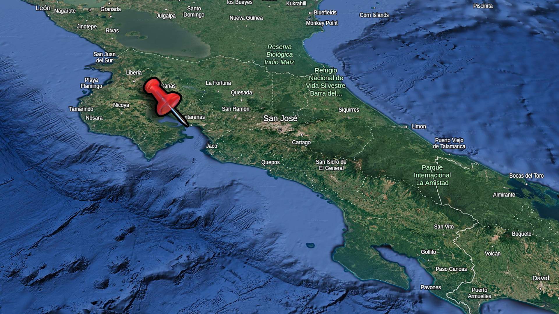
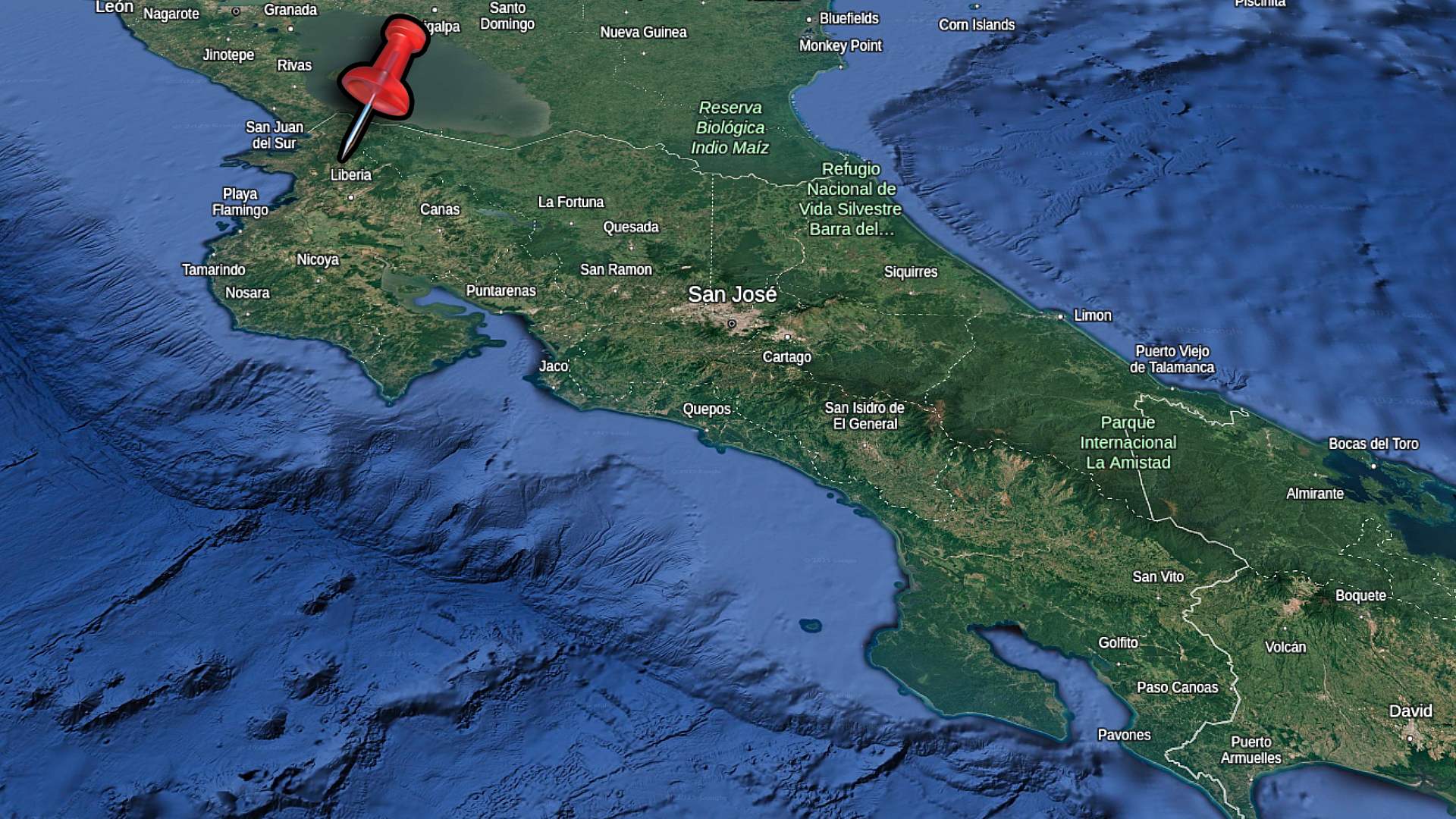
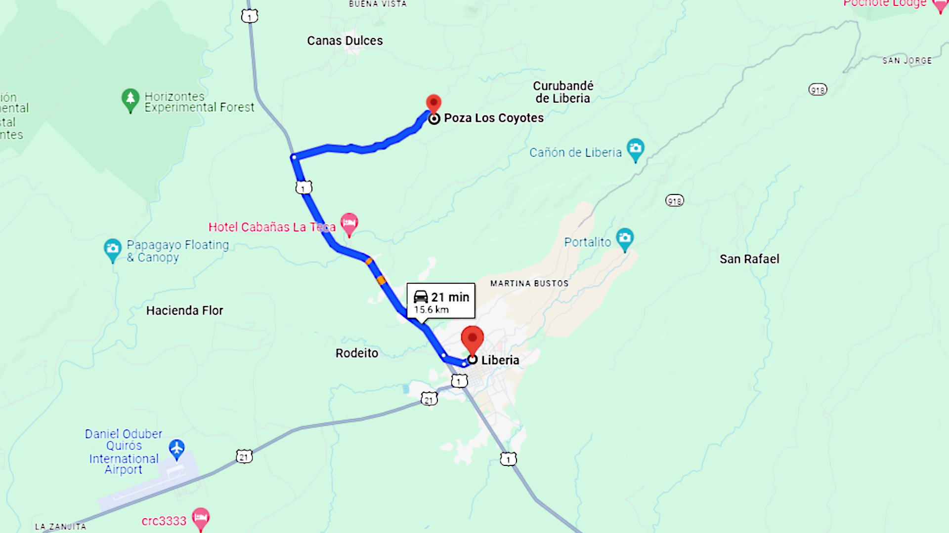
Here’s a map of Costa Rica showing the location of Poza Los Coyotes. It’s in the northern part of the country, just north of Liberia.
Close To Liberia
Poza Los Coyotes is very close to Liberia and the International Airport. It’s a great destination to visit if your vacation is being spent in any of the surrounding locations. Places like Tamarindo, Playas del Coco and La Fortuna are within a day trip driving distance.
To find Poza Los Coyotes from Liberia, you’ll start by driving north on Route 1. This is the main highway which runs north/south through the province of Guanacaste. Drive about 10 kilometers, and you’ll see a clearly marked sign for Poza Los Coyotes. To ensure you don’t miss the sign, you can program the location into both Waze and Google Maps.
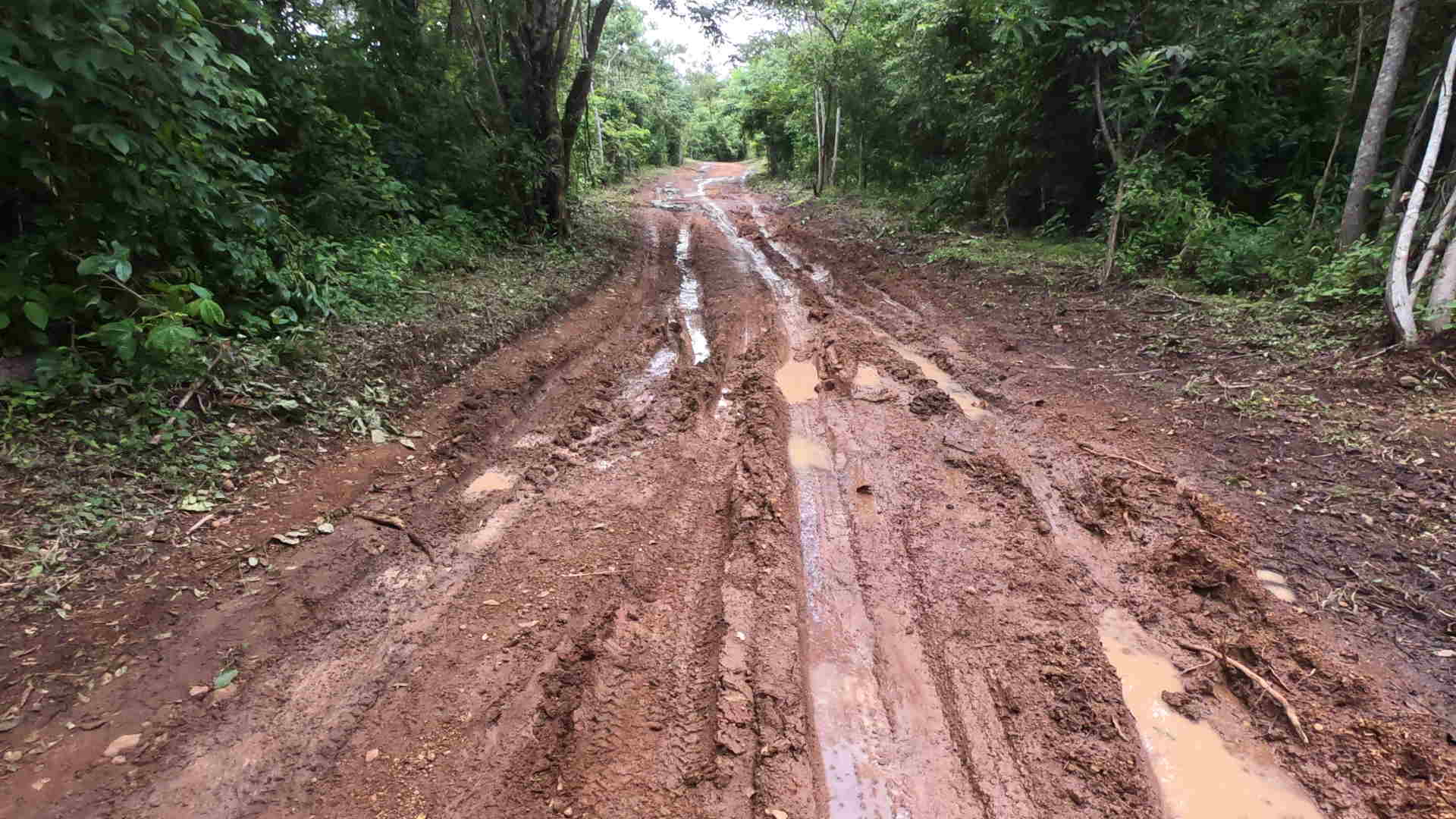
Once you turn on right, you’ll find a long gravel road. This road is very well maintained. Aside from a couple slightly rutted locations, it’s a very easeful drive. Just about any vehicle can make the trip to the final location.
You’ll be driving about 5 kilometers along this gravel road, be sure to watch for wildlife in the trees as your driving. You never know what you’ll see in Costa Rica. You’ll eventually reach an intersection where you’ll stay straight for just a short distance further.
Pick up a pair of these awesome water shoes. I’ve been using them all over Costa Rica during my travels. They have vented soles so water drains right out the bottom!
Arrival At Coyotes
When you arrive at Poza Los Coyotes, there’s a clearly marked gate with attendant. The cost to enter at this location is 1000 colones/person. This is about $2USD. On our arrival, we were advised to park immediately at the gate and walk the remainder of the way down to the river. This was due to it being rainy season and the road being rough. On days I’ve visited in the dry season, we are able to drive right down to the river for parking.
About 200 meters down this road, there’s a station renting out life jackets and inflatable tubes for 1000 colones. At the location where the equipment rentals are, the paths split in 3 main ways. Depending on what you’d like to see first, you can take your gear for a short hike.
Three Distinct Locations
The first area, which is north along the river, will take you to a really nice area where you can jump in the water. We tried some higher jumps from about 20 feet after testing the depth ourselves. You can float around this area with an inner tube. If you venture further upriver there’s a cool little waterfall with a shallow area to relax. When we visiting the Pozas it had rained, so the water was a bit deeper in this part.
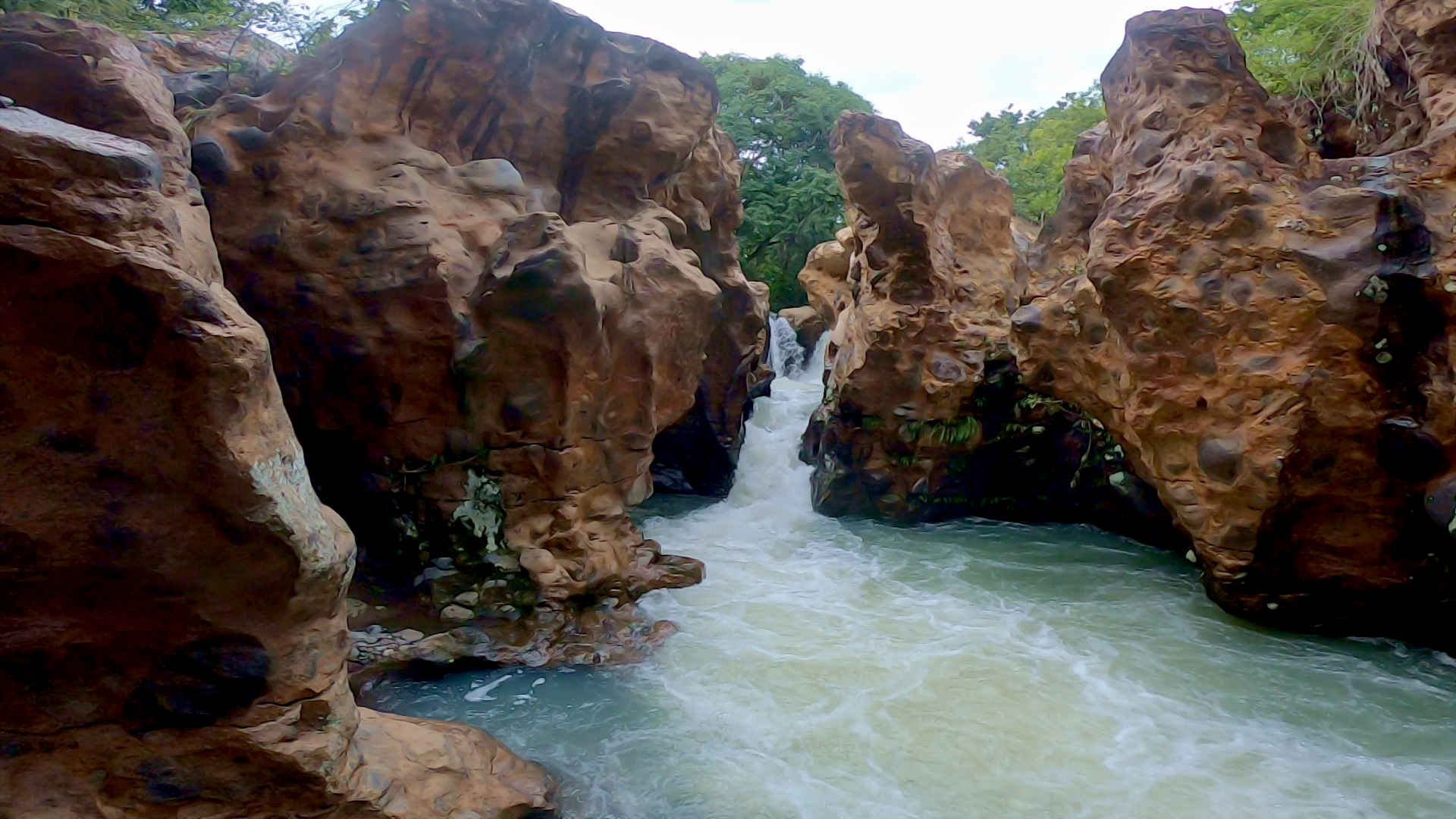
The second branch of path will take you do a picturesque part of the river, where water has cut through the rocks over time. The result is a strong current with small waterfalls and little pools of water which leads further into this chasm. The gentleman from the tube rental assisted us with locating the path to go directly down to the water where it’s power is clearly on display. It was a very memorable experience.
The third path, which is south from the rentals, will take you about 400 meters along the water. You can’t see the river from most of the path. Eventually you’ll find a slight hill which will take you to the bottom of the cascading waterfalls. This is where the inflatable tubes would be handy, as you will be able to float into the canyon with the rocks towering above you on either side.
Add It To Your Itinerary!
On the day we came, closing time at 6pm was soon, and the water appeared to be very powerful. For young kids it, the outflow from the canyons may have been too powerful to accomplish. Of course, in dry season with less daily rain and less powerful current, I anticipate that the canyon would be a very easeful and enjoyable swim.
Consider the cost and the proximity to Liberia, I highly recommend visiting Poza Los Coyotes. The water is blue as can be, and the flora is incredible.
Be sure to Subscribe to our Youtube Channel, and leave a comment with your thoughts about this location or request a video in other cool destinations around Costa Rica.
FAQ: Poza Los Coyotes in Guanacaste, Costa Rica
How do I get to Poza Los Coyotes? Poza Los Coyotes is located in Guanacaste, Costa Rica, near Liberia. You can reach it by driving along Route 1 (Interamericana Norte) and taking a sideroad which heads inland towards the volcanos.
Is there an entrance fee for Poza Los Coyotes? Yes, there is usually a small entrance fee to access the Poza Los Coyotes swimming area. It’s advisable to bring cash, as card payments may not be accepted.
What should I bring to Poza Los Coyotes? Bring swimwear, water shoes (the area can be rocky), a towel, sunscreen, and plenty of water. A waterproof bag for your belongings is also recommended.
Are the waters of Poza Los Coyotes safe for swimming? Yes, the waters in the natural pools are generally safe for swimming. However, be mindful of natural elements like slippery rocks and the strong waters in the caves.
Is Poza Los Coyotes family-friendly? Yes, Poza Los Coyotes is family-friendly, with shallow natural pools suitable for children. However, supervision is important due to the natural environment.
What is the best time of year to visit Poza Los Coyotes? The best time to visit is during the dry season, from December to April, as roads are easier to navigate and the weather is more predictable. The water is also more likely to be clear blue.
Are there any facilities at Poza Los Coyotes? Facilities are very limited. Plan to bring your own food and drinks. The staff have been building up more and more facilities as the destination becomes more popular.
Can I visit Poza Los Coyotes on a day trip? Yes, Poza Los Coyotes can be visited as a day trip from nearby towns like Liberia or Playas del Coco. Many visitors also combine it with other nearby attractions like Llanos de Cortés waterfall.
Is Poza Los Coyotes accessible by public transportation? Public transportation options are limited. It’s best to visit by renting a car or joining a tour, as the area can be remote and the roads may be rough. You can also reach the site by bicycle.
Are there guided tours available for Poza Los Coyotes? Yes, some local tour operators offer guided tours that include transportation to and from Poza Los Coyotes. These tours often combine visits to other local natural attractions as well.