Tag: Puntarenas Province

Stretching along the Pacific, from Manuel Antonio to the Osa Peninsula. Home to world-class surfing, whale watching, and rainforest adventures. Includes popular beach towns and marine parks.

  • Explore Dominical: From Forest Pools to Secret Beaches

    Explore Dominical: From Forest Pools to Secret Beaches

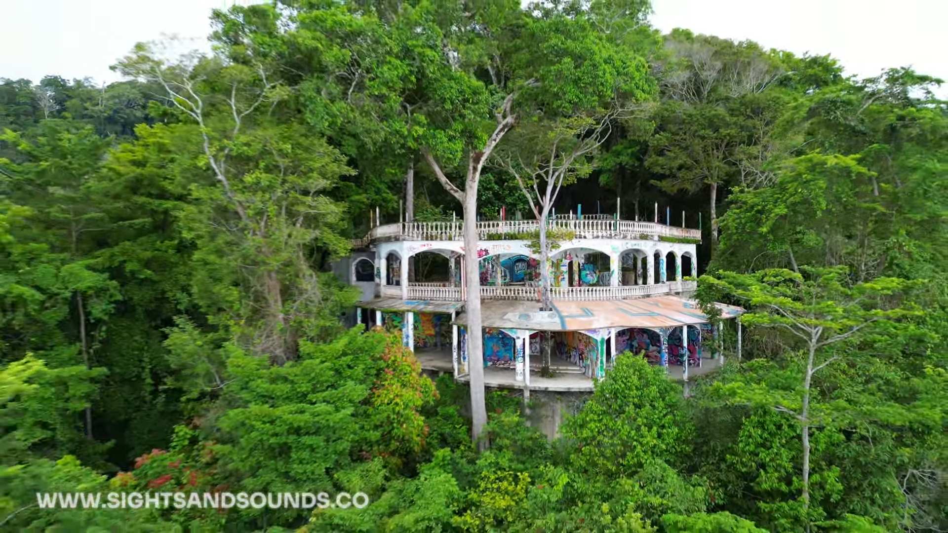
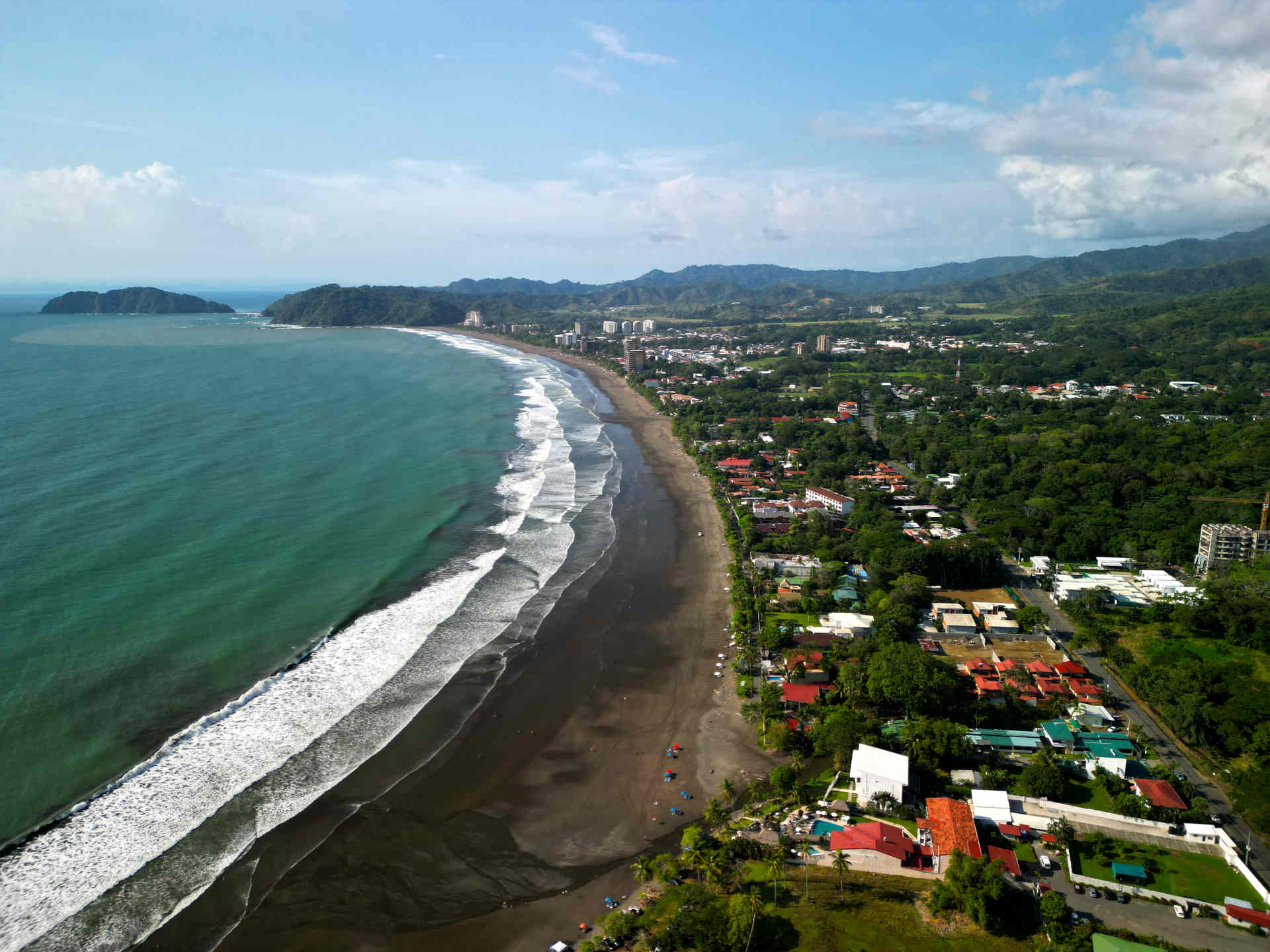
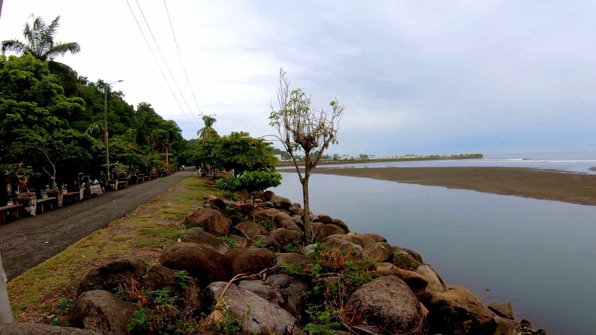
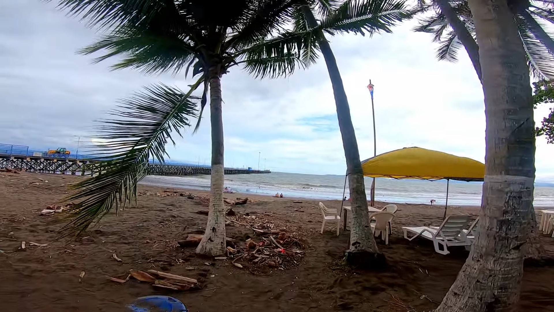
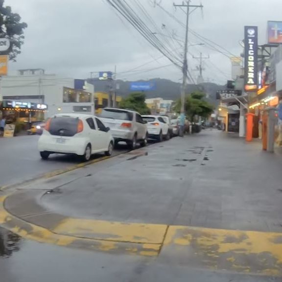
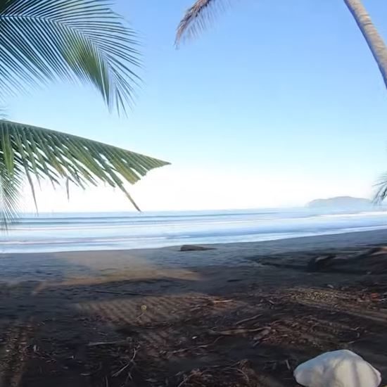
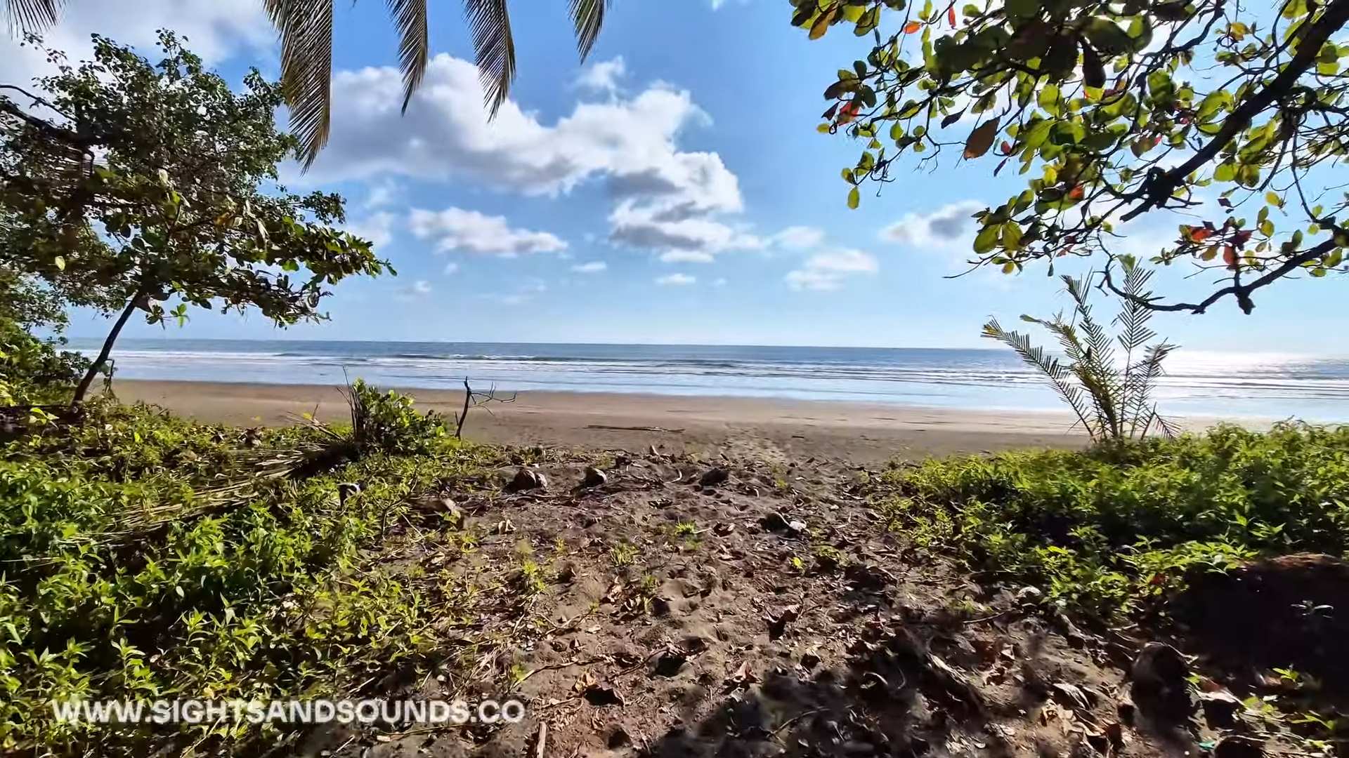
    Dominical blends surf culture with jungle living where the rainforest meets the Pacific. The small beach town centers around its main dirt road, where local restaurants and surf shops create a laid-back atmosphere away from larger tourist destinations.

    Beyond the waves, Dominical offers several natural attractions within minutes of town. Hidden swimming holes like Poza Azul provide fresh water retreats, while less visited beaches like Playa Mozambique stretch north along the coast. Wildlife appears throughout town, from sloths in beach almond trees to toucans flying overhead.

    The weekend eco-market showcases local organic products and crafts, highlighting the area’s focus on sustainable living. This mix of surf, nature, and community creates a distinct southern Pacific vibe different from Guanacaste’s beach towns.

    dominical drone

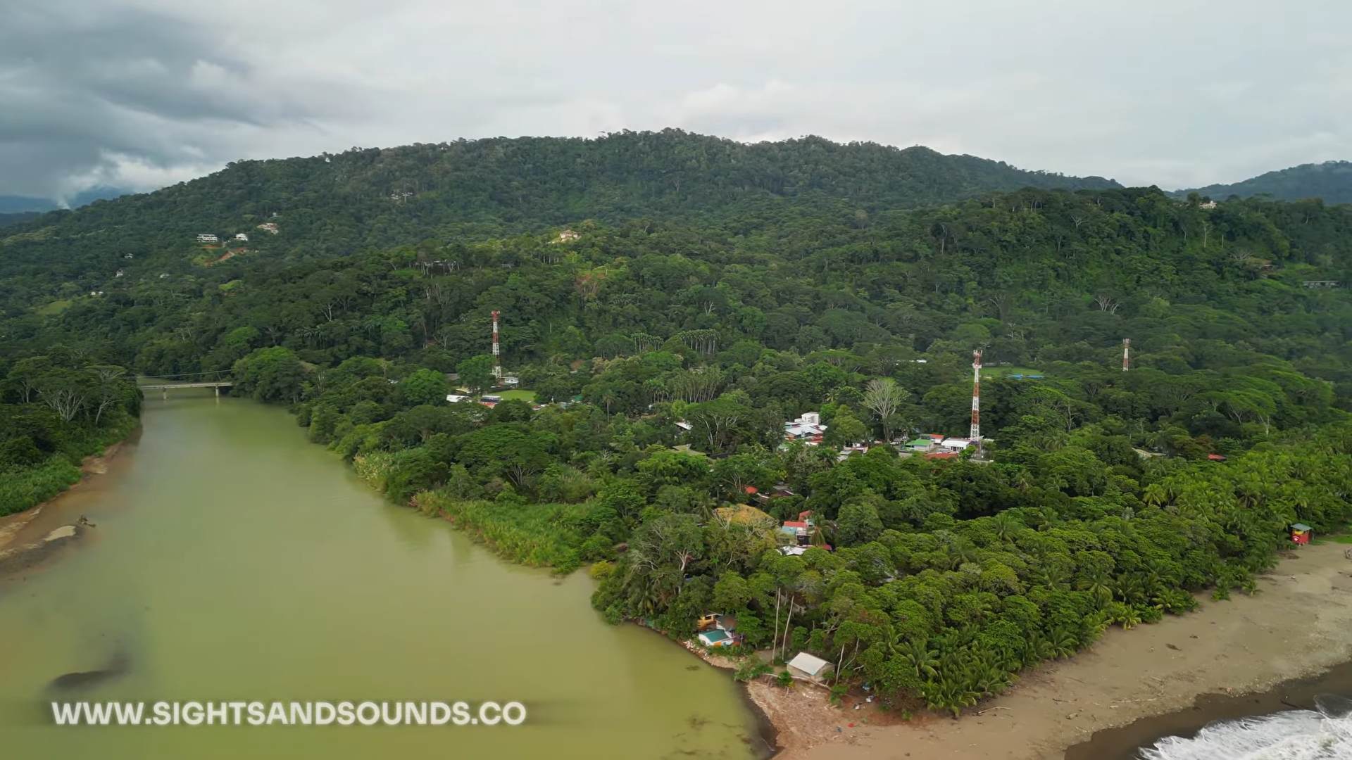
    Drone photo of Dominical, showing the river to the left and center of town in the middle.

    Dominical

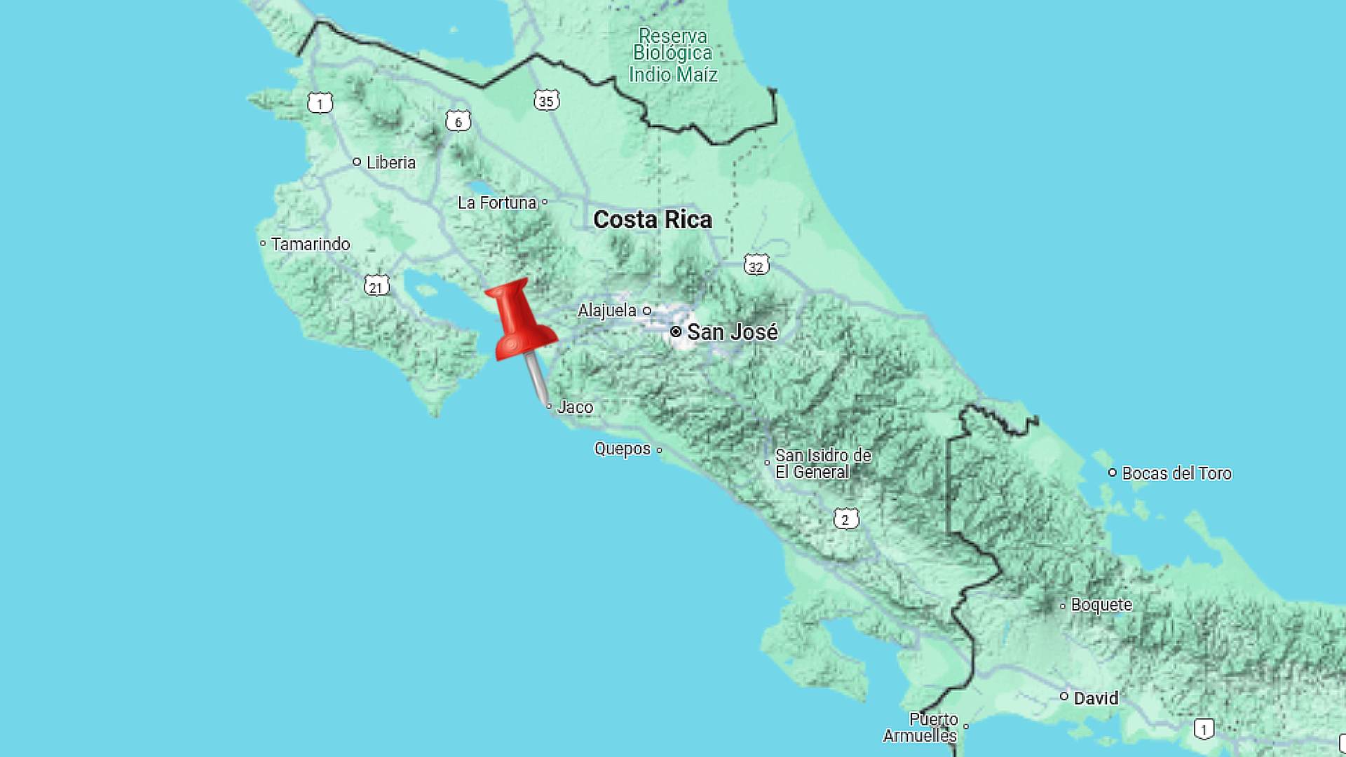
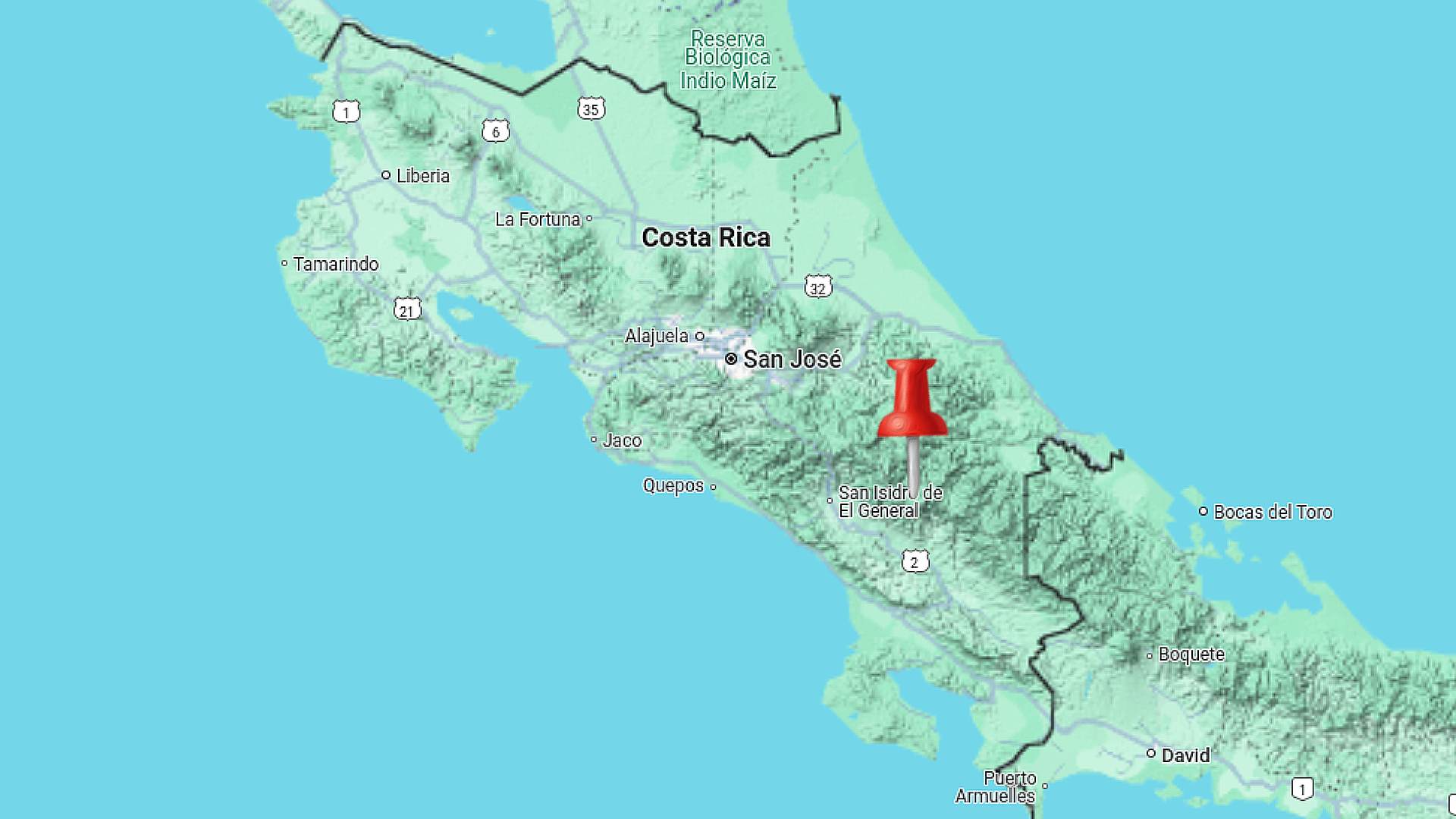
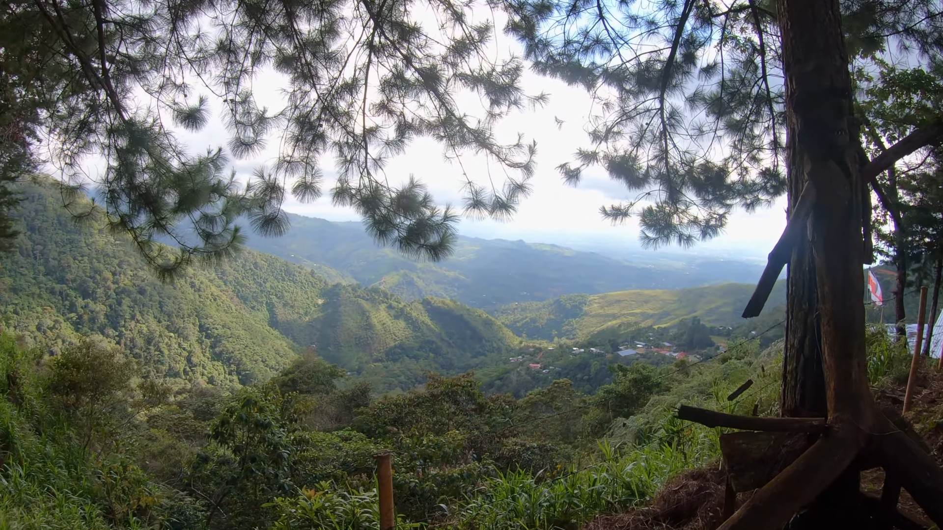
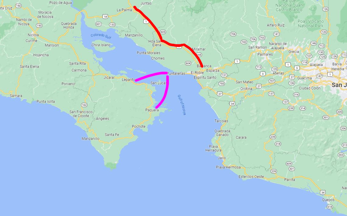
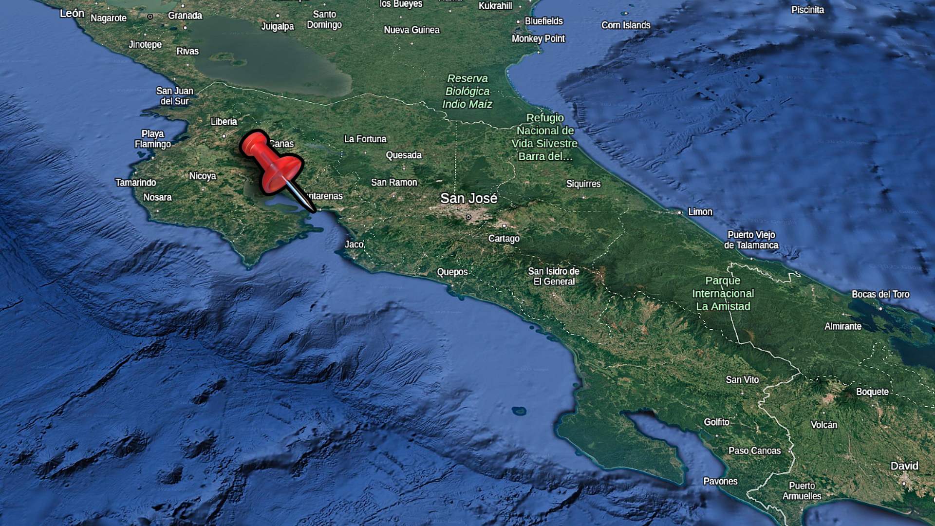
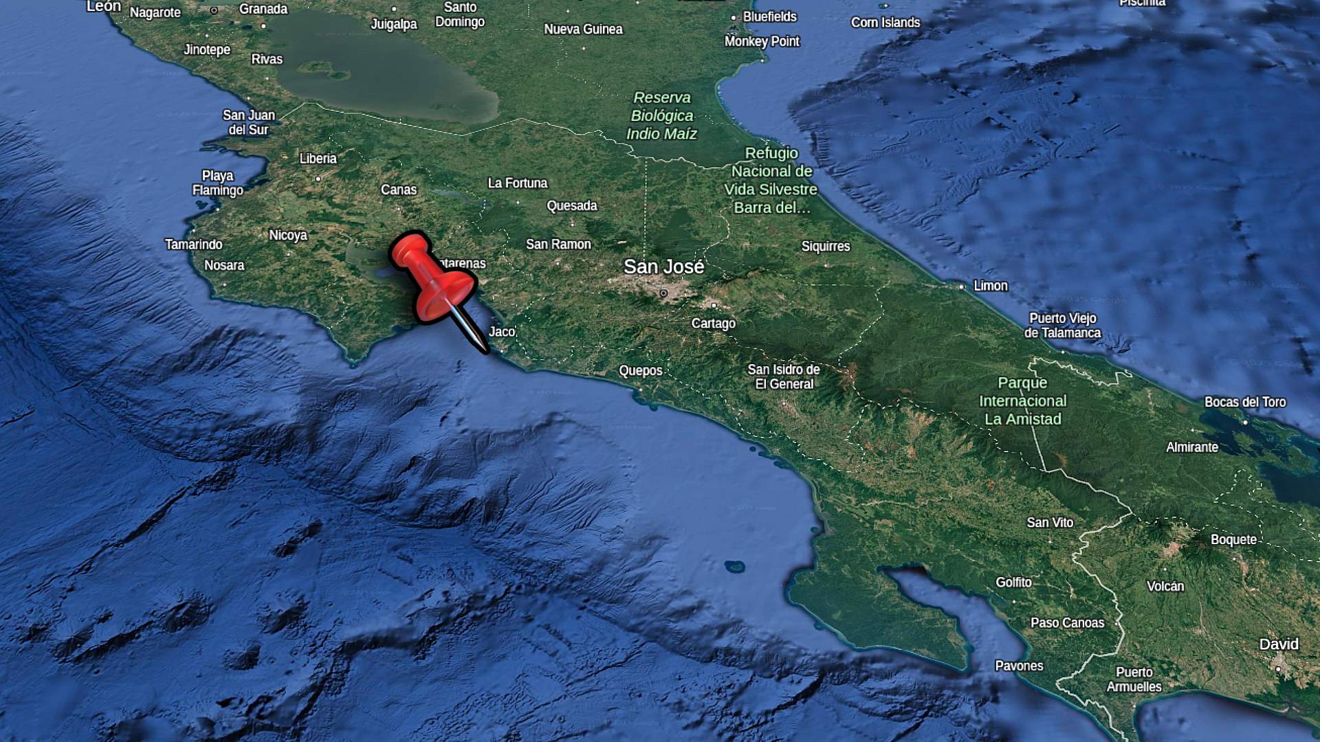
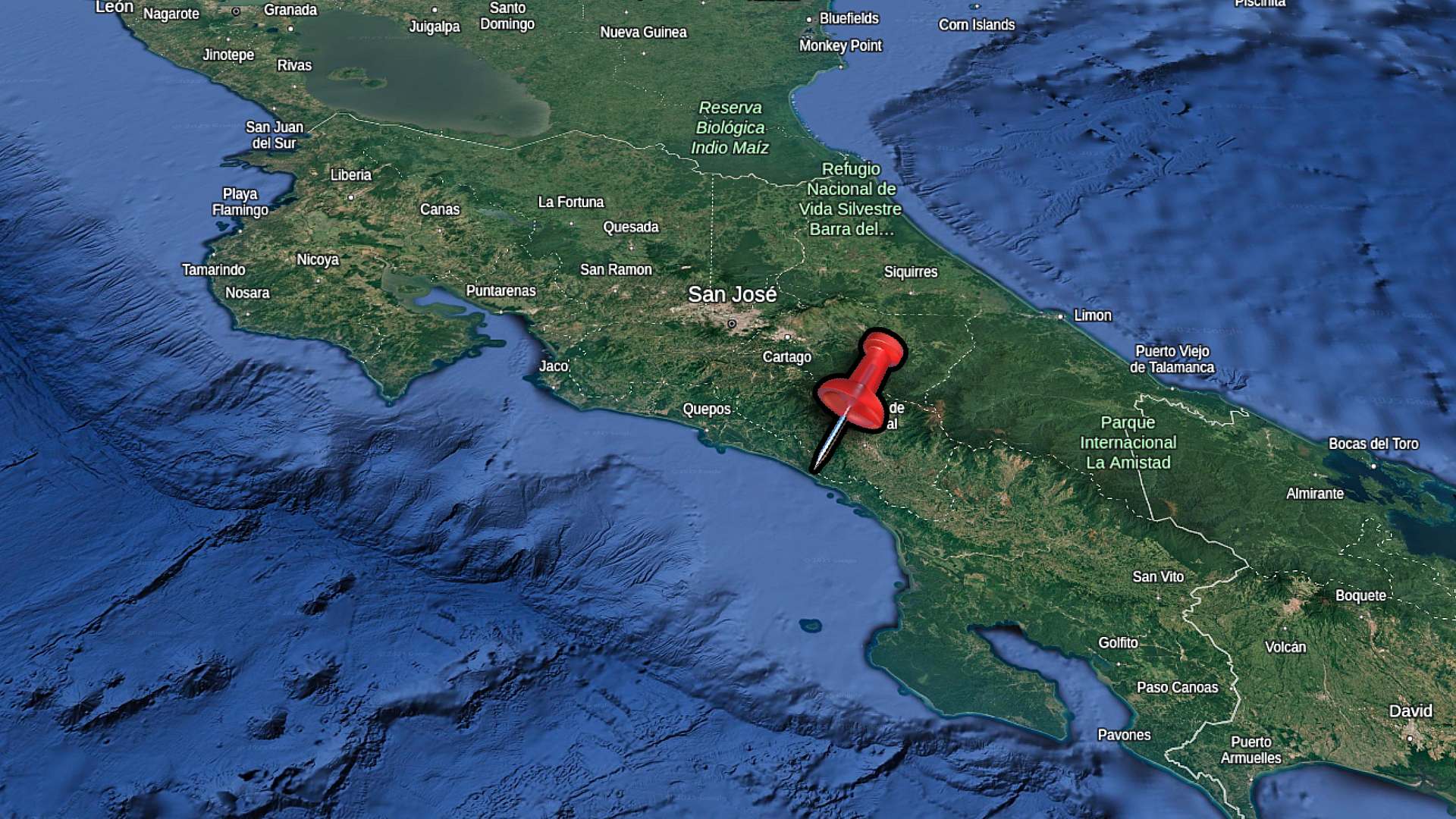
    Dominical is on Costa Rica’s Pacific Coastal Highway, roughly halfway between Quepos and the Osa Peninsula. This section of coast marks where the mountains begin meeting the ocean more dramatically, creating steep jungle backdrops behind the beach. The town serves as a natural stop between Manuel Antonio National Park to the north and the southern Pacific regions of Costa Rica.

    dominical location map of costa rica

    Getting to Dominical

    The journey to Dominical takes you along Costa Rica’s Pacific coast, with mostly good condition highways from San Jose International Airport. A convenient option is to drive rental cars, taking Highway 27 west before connecting to the Coastal Highway south. The 3.5-hour route passes through Jaco and Quepos, with plenty of ocean views along the way.

    If you prefer not to drive, private shuttle services offer direct transport from the airport. These typically need advance booking are a more comfortable way to travel. Public buses also connect through Quepos, though the journey takes longer with connections.

    Where to Stay

    Dominical has distinct areas for different experiences. The town center puts you walking distance to surf breaks and restaurants, with accommodations ranging from backpacker hostels to boutique hotels. Whatever option you decide, you’ll find easy access to the beach from in town.

    South of town, properties can be found in the jungle. These offer more privacy while staying close to town services. You will be able to expect to see more wildlife close to your door from these areas.

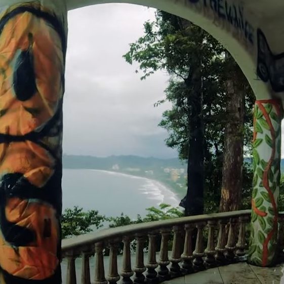
    The hillside above town has several hotels and rental homes with incredible ocean views. While these need transport to reach the beach, they provide peaceful settings and a cool breeze. Pools and larger grounds are common at these elevation properties.

    Local Food Scene

    Dominical’s restaurants center along the main beach road. You’ll find lots of smoothie shops and places to grab a coffee. Keep an eye out for small sodas that provide traditional Costa Rican meals at local prices.

    Some international dining options include wood-fired pizza, fusion cafes, and beach bars. Local bakeries and fruit stands add quick options for beach days. There’s enough restaurant options in Dominical that you won’t have to repeat once over a few weeks vacation.

    travel-backpack-costa-rica

    I use this sling backpack when I’m travelling in Costa Rica. It has a zipper lock to secure your stuff. I like the sling as I can flip the bag to the front for easy access.

    WEEKLY ECO MARKET

    Dominical’s Friday market brings together mountain farmers, local artisans, and food vendors in a vibrant open-air setting. You’ll find it easily by the VW bug van marking the entrance, just off the main road through town.

    dominical eco market

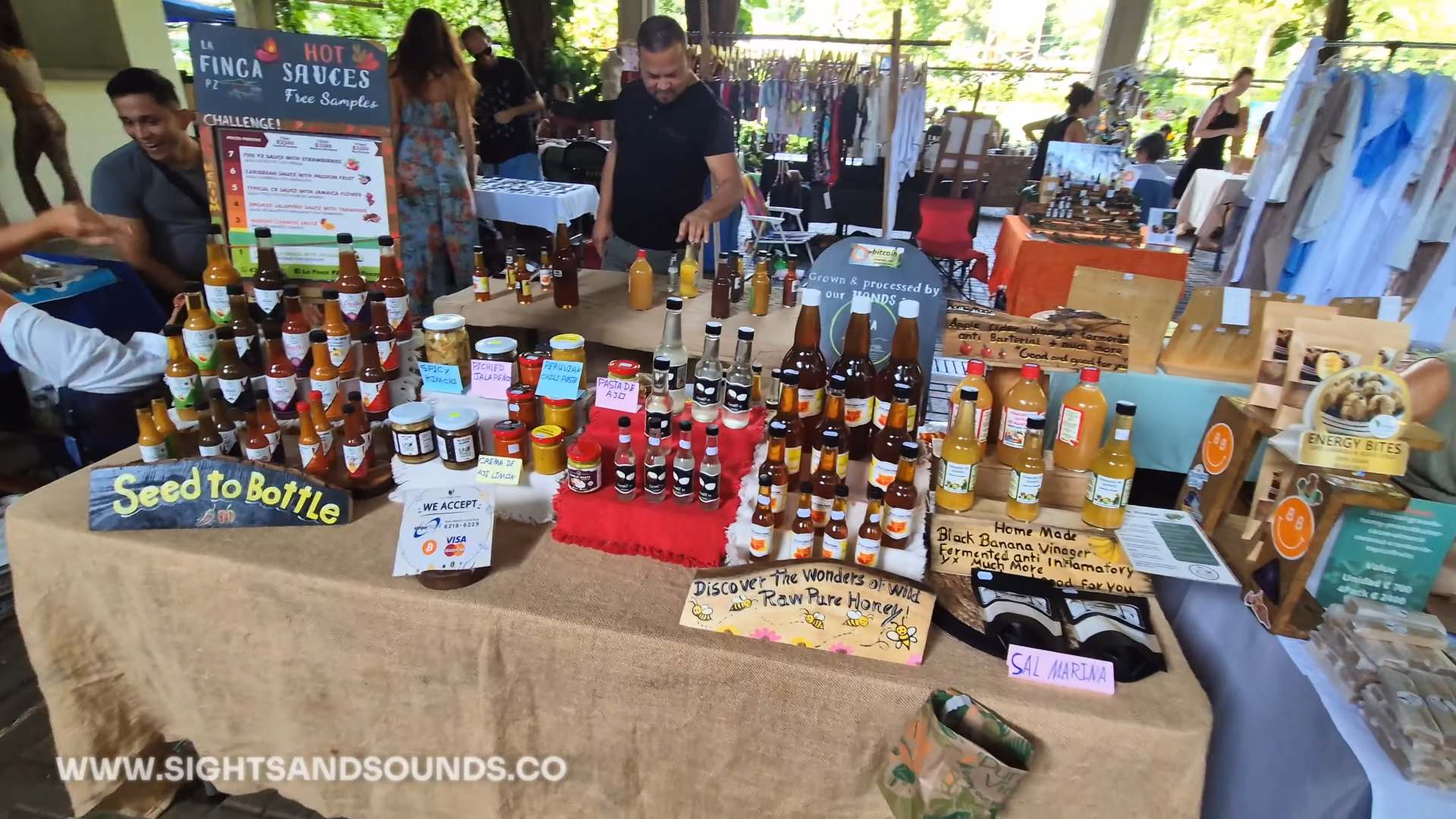
    Some of the options available at the Dominical Eco Market, including honey and oils.

    Fresh Local Food

    Fresh produce from mountain farms fills the covered walkways, with everything from traditional fruits to organic vegetables. Local farmers bring their food, often freshly picked. You’ll find mangoes, pineapples, and unique mountain-grown items you might not see in regular stores.

    Many vendors sell homemade products like honey, coconut oil, and fresh bread. The prices here are local, and the quality is usually better than what you’ll find in supermarkets. Some stands specialize in organic products, while others focus on traditional Costa Rican ingredients.

    Artisan Crafts & Natural Products

    Local artists are selling handmade jewelry, paintings, and crafts at the market. You’ll find unique pieces that reflect the area’s beach and jungle surroundings. Several vendors offer natural beauty products, essential oils, and handmade soaps.

    The market has grown to include more artisans over time, with many creating their goods right in the Dominical area. Look for original artwork, carved items, and textile crafts for great souvenirs you can take home.

    Food Court & Refreshments

    The food court area has traditional Costa Rican dishes, including casados priced around $8. Fresh smoothies and local coffee are available for a quick refreshment while you browse. Several bakers bring fresh bread and pastries each week.

    Most food vendors offer both breakfast and lunch options. You can try traditional dishes or grab something quick like empanadas or fresh fruit. The covered eating area provides a good spot to rest. Nearby the market, there’s a host of dining options available as well.

    water shoes for exploring costa rica

    Pick up a pair of these awesome water shoes. I’ve been using them all over Costa Rica during my travels. They have vented soles so water drains right out the bottom! 

    WILDLIFE SPOTTING IN DOMINICAL

    Along Dominical’s beach, wildlife regularly appears between the beach almond trees and forest edges. The mix of ocean, river mouth, and jungle creates unique spots where you might catch animals during their daily routines.

    sloth in dominical

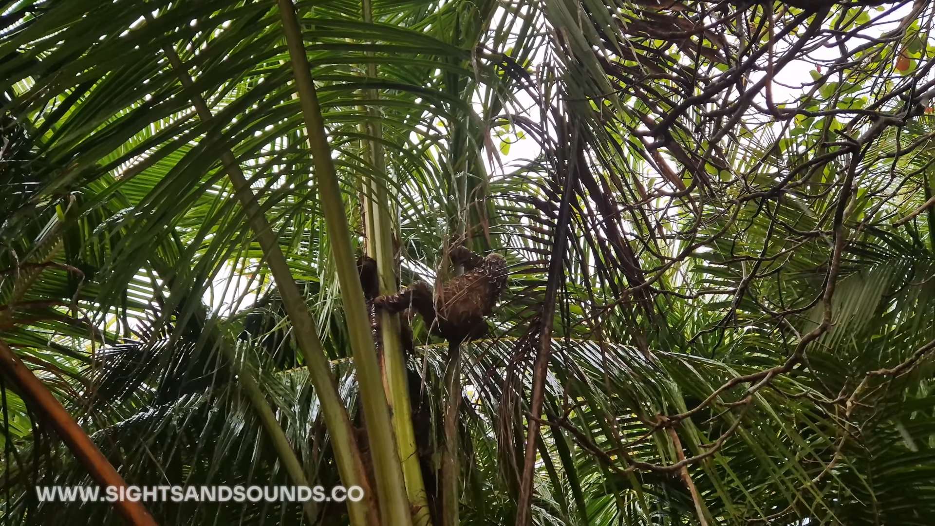
    A sloth spotted navigating the trees at the beach in Dominical.

    ​Sloth Encounters

    Two-toed sloths sometimes surprise visitors by appearing right on the beach, moving between the almond trees. While most people expect to find them deep in the jungle, these peaceful animals follow the connected tree line along the shore, looking for fresh leaves.

    These beach sightings often happen when sloths need to move between feeding areas. They’ll use several trees in sequence, showing surprising speed as they navigate from branch to branch, always with a clear destination in mind.

    Scarlet Macaw Sightings

    Pairs of scarlet macaws patrol the coastline daily, their loud calls alerting beachgoers to look up. They follow regular routes between nesting and feeding areas, making them one of Dominical’s most reliable wildlife sightings.

    The beach almond trees provide perfect food sources, bringing these colorful birds right to the shoreline. Morning and late afternoon flights offer the best viewing chances.

    Common Beach Wildlife

    Howler monkeys often wake visitors with their morning calls, moving through the same trees where sloths feed. White-faced capuchins visit in groups, while iguanas sun themselves on fallen logs near the water.

    The river mouth attracts fishing birds and basilisk lizards. Early mornings bring the most activity, when animals feel comfortable moving closer to the beach area.

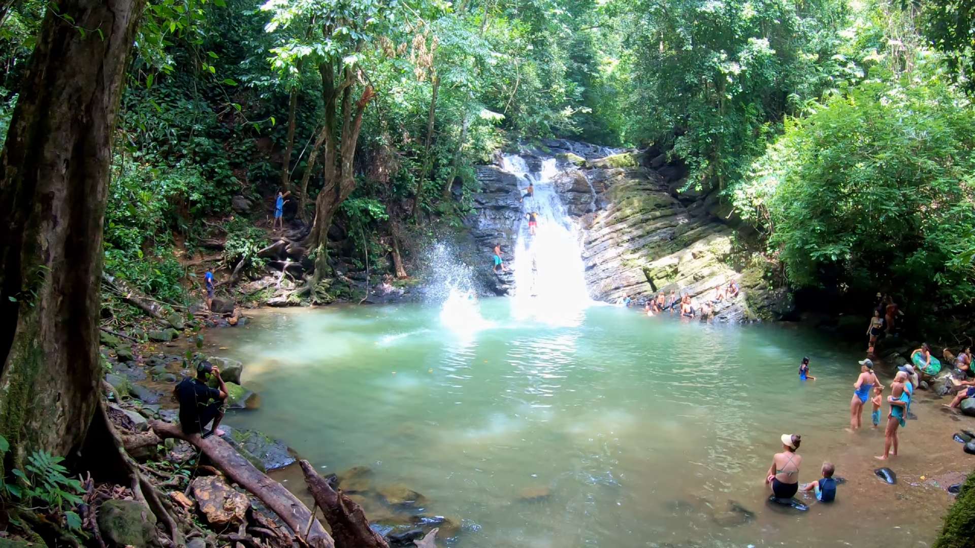
    POZA AZUL SWIMMING HOLE

    Just minutes from Dominical, this natural swimming hole offers a refreshing escape from the beach heat. The clear river water pools beneath a small waterfall, creating a perfect spot for cooling off. It’s called Poza Azul as the water is often clear blue, but this can change in rainy season with run off from the mountains. Either way, it’s a great place to go for a dip.

    poza azul free swimming near dominical

    Getting There

    The entrance is just off the main road going through Dominicalito, marked by a small parking area. A short but steep trail leads down to the river, with a mix of concrete steps and natural tree roots forming the path. The walk takes just a minute or two.

    Local parking attendants are usually there to watch vehicles, and there’s no entrance fee to the swimming hole itself. Small shops in the nearby neighborhood have drinks and snacks.

    At the Swimming Hole

    The main pool stretches wide enough for several groups to enjoy comfortably. A rope swing hangs from a tree branch, and braver visitors jump from the small waterfall rocks. The water stays refreshingly cool year-round.

    Deep spots near the waterfall provide swimming areas, while shallower sections offer places to sit and relax. The surrounding trees create natural shade throughout the day.

    Safety and Best Times

    Morning visits avoid the busiest times, though the spot rarely feels overcrowded. Watch children on the trail down and near deeper water areas. The concrete steps can be slippery when wet, so a walking pole can be helpful if needed.

    Bring water shoes for walking on rocks and basic supplies as there are no facilities at the swimming hole itself. Most people will stay 1-2 hours, making it a perfect morning activity before beach time.
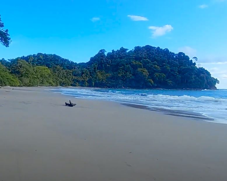
    Playa Mozambique

    A few kilometers north of Dominical, this long stretch of natural beach offers a quiet alternative to the main surf spots. The area connects to a protected zone, with jungle meeting the shore and various trails leading to the sand.

    quiet beach near dominical

    Getting There

    Look for the turnoff near the gas station north of Dominical. The road passes Hacienda Baru Lodge before becoming rougher – you’ll need higher clearance to reach the parking area. Several small parking spots exist along the beach access points.

    Once parked, walking trails lead through jungle sections before opening onto the wide beach. The shoreline stretches north toward the protected area, with few people even during high season.

    Nature Along the Trail

    In the video below, we’ll see some leaf cutter ants. These insects create highways across the beach paths, carrying pieces of leaves back to their nests. These fascinating ants maintain clear trails through the forest floor, with some ants carrying leaves while others patrol the paths. Their organized columns can stretch for many meters.

    The surrounding trees fill with coconut palms, creating natural shade along the beach. Fallen coconuts scatter the ground, while local harvesters regularly climb for fresh ones. The dense jungle backdrop provides habitat for monkeys and birds.

    Beach Experience

    The beach offers long stretches for walking, with shallow waters good for swimming at low tide. Waves break further out, creating a gentle slope of sand perfect for relaxing or beach walks. Morning hours bring the calmest conditions.

    Unlike busier beaches south near Dominical, this spot rarely sees crowds. The protected area to the north means development stays minimal, preserving the natural beach environment.

    Follow Us

    I hope you enjoyed this review of the area of Dominical. It’s a great place to spend your vacation in Costa Rica if you’re looking for waves and nature.

    Be sure to Subscribe to our Youtube Channel for more great videos for your itinerary.

    Dominical Beach Town FAQ: Surf & Nature Guide

    Q: How far is Dominical from San Jose Airport?
    A: 3.5 hours driving. Take Highway 27 to Coastal Highway (34). Pass through Jaco and Quepos. Well-marked roads, several gas stations on route.

    Q: What makes Dominical unique?
    A: Mix of surf culture and jungle access. Weekly eco market. Natural swimming holes nearby. Less developed than northern beach towns. Regular wildlife sightings. Close to whale watching spots.

    Q: What day trips are possible?
    A: Nauyaca Waterfalls (30 min), Uvita Whale Tail (20 min), Poza Azul swimming hole (10 min), Hacienda Baru trails, Hidden beaches like Playa Mozambique. Mountain valley access.

    Q: What’s the best season to visit?
    A: Surf consistent year-round. December-April driest months. Whale watching August-October. Green season (May-November) less crowded. Morning sun common year-round.

    Q: What wildlife appears regularly?
    A: Sloths in beach almond trees, Howler monkeys near river mouth, Scarlet macaws flying over beach, Toucans in morning hours, Whales during migration season.

    Q: What services exist?
    A: Basic beach town amenities: Supermarkets, Medical clinic, ATMs, Surf shops, Tour offices, Variety of restaurants. Weekly farmers market. Surf schools.

    Q: What about accommodation?
    A: Mix of hostels to boutique hotels. Jungle lodges in hills. Beachfront options limited. Most places within walking distance to beach. Book ahead December-March.

  • Top Hiking Trails In Costa Rica

    Top Hiking Trails In Costa Rica

    Hiking in Costa Rica means watching the landscape change as you move through different elevations. Each altitude brings its own climate, creating pockets where specific plants and animals have made their homes. The southern Pacific region shows this off well, with trails running from beach level up into the high mountain passes.

    The microclimates here shape how you hike. Early starts help with coastal heat, while mountain trails need planning around afternoon clouds. Weather patterns change fast with elevation – you might need sunscreen and a rain jacket in the same backpack. Wildlife adapts to these changes too, with different birds and animals active at each level.

    These elevation shifts mean you’ll see something different on every hike. Beach trails have their morning monkey troops and macaw flocks. Mid-elevation paths wind through dense forest where oaks and wild avocados grow. The highest trails break through the treeline into open air where winds sweep across mountain peaks. Each trail tells its own story about how Costa Rica’s mountains meet the sea.

    trail shoes for costa rica

    I use these versatile trail runners on my hikes in Costa Rica. The aggressive grip tackles steep terrain while maintaining comfort for long days on mountain paths.

    El Miro: Jaco’s Hidden Viewpoint Trail

    jaco hike

    The El Miro trail starts at the south end of Jaco beach, climbing steeply through forest to a dramatic clifftop viewpoint. From here, the entire curve of Jaco Bay stretches north, while the coastline south towards Playa Hermosa disappears into the distance. The morning light shows surfers catching waves below, while late afternoon brings spectacular sunsets.

    Getting to the trailhead takes just minutes from central Jaco. Park near the south beach access, where a marked path leads into the trees. The climb takes 30-45 minutes, with some rope-assisted sections on the steeper parts. Early morning or late afternoon hikes avoid the midday heat.

    This short but rewarding hike offers a completely different perspective on Jaco. While most visitors stick to the beach, this elevated viewpoint reveals how the mountains meet the Pacific. Macaws often fly past at eye level, and the breeze at the top provides relief from the beach heat below.

    jaco hike location

    This hike is located at the south end of Jaco beach. You’ll cross the main highway and find the entrance across from Puddlefish.

    At a brisk pace the hike will take 20 – 30 minutes. You can take some stops to spot wildlife and enjoy the art, and spend about 1 hour on the trail.

    The trail is mostly moderate with a couple washed out areas that are rutted. Not recommended for those with mobility issues. Children can complete the hike under supervision.

    Early morning before the heat or 2-3 hours before sunset for best views. Sunrise offers clearest ocean views, while sunset provides dramatic lighting across Jaco bay.

    Water bottle, good walking shoes, camera for views. Phone for safety. Small backpack useful.

    Hike with others when possible. Tell someone your plans. Watch footing on steep sections. Bring water even for short hike. Return before dark if hiking for sunset.

    El Ascensión: Cloud Forest Peak Trail

    muerte

    The trail starts near the Pan-American Highway’s highest point, where clouds regularly sweep across the continental divide. This high-altitude hike offers rare access to Costa Rica’s páramo ecosystem, where stunted trees and unique vegetation adapt to life at 3,300 meters (11,000 feet).

    Hidden behind a small restaurant at the mountain pass, this trail climbs through cloud forest before emerging into open páramo landscape. The stark transition from dense forest to alpine-like conditions shows how elevation shapes Costa Rica’s diverse environments.

    The summit trail reveals both Caribbean and Pacific slopes on clear mornings, though clouds often roll in by mid-day. This ecosystem hosts unique highland species like the volcano junco and timberline wren, found nowhere else in Costa Rica.

    cerro de la muerte hike

    Located at KM 89 of the Pan-American Highway (Cerro de la Muerte). There’s a wide parking area at the roadside. Trailhead starts at the road with 3,300 meters of elevation.

    20 – 30 minutes to reach the summit at a steady pace. Plan for 1-2 hours total to enjoy views and return. Extra time needed for photography and bird watching.

    High altitude makes this moderate trail more challenging. Some steep/very vertical sections near top. Trail clearly marked but rocky in parts. Take time to adjust to elevation before starting.

    Early morning before clouds roll in (usually by 10 AM). Check weather as conditions change quickly. Clearest views December-April. Bring warm layers any time of year.

    Warm jacket and layers (temps can drop below 10°C), hiking shoes with good grip, water, snacks, camera. Rain gear recommended year-round. Hat and sunscreen despite cool temps.

    Watch for altitude symptoms. Start slow and stay hydrated. Tell someone your plans. Check weather before starting. Cell service available at trailhead. Return if weather turns bad.

    Los Gigantes: Valley View Trail

    gigantes

    High in the mountains above San Isidro del General, the Los Gigantes trail network winds through working coffee farms into pristine forest. The trails offer sweeping views across the Perez Zeledon valley, where on clear days you can see all the way to the Pacific Ocean.

    These paths started as coffee farm access routes but have evolved into maintained hiking trails. As you climb, the landscape shifts from sun-drenched coffee plants to cool forest shade. The elevation gain reveals how the valley’s patchwork of farms gives way to forest-covered peaks.

    Multiple viewpoints along the way showcase the region’s agricultural heritage. Morning fog often fills the valley below before burning off to reveal the expanse of San Isidro and the surrounding mountains. Local farmers still use parts of these trails, making this a unique mix of working land and natural space.

    gigantes screenshot

    Located in Perez Zeledon’s mountain region. Turn off the Inter-American Highway at San Isidro, follow signs toward Cerro Chirripo. Trail network starts near the community of Quebradas.

    Main loop takes 2-3 hours at steady pace. Multiple trail options ranging from 1-4 hours. Worth taking time at viewpoints and rest areas.

    Moderate with steady elevation gain. Well-maintained trails through farms and forest. Some steeper sections but regular rest spots available. Good for varied skill levels. You can drive to the top and walk across mostly level terrain to the giant trees.

    Early morning before heat and for best valley views. Clouds typically move in afternoon. Dry season (December-April) offers clearest visibility.

    Water, sun protection, light jacket for elevation, good walking shoes, camera for views, snacks. Cash for local stores if needed.

    Tell someone your plans. Stay on marked trails to respect farm boundaries. Watch weather as afternoon rains common. Carry enough water as sources limited.

    Subscribe For More

    These three hikes show different sides of Costa Rica’s southern Pacific region, each offering unique views and experiences. From beach town overlooks to high mountain passes, and agricultural valleys, the diversity of landscapes here creates endless hiking possibilities.

    Remember that conditions change throughout the year, so checking recent trail reports helps with planning. Each of these hikes works well as a half-day adventure, leaving time to explore the surrounding areas.

    Subscribe to the YouTube channel for more Costa Rica hiking videos, trail updates, and hidden spots across the southern Pacific region.

  • Guide To Jaco: Surfing & Nightlife

    Guide To Jaco: Surfing & Nightlife

    Welcome to Jacó, Costa Rica, a vibrant coastal town along the Pacific that’s gaining popularity for its sun, surf, and adventure. Located about 55 miles southwest of San Jose, Jacó is a popular locations for beach enthusiasts and outdoor seekers. With its easily accessible location, Jacó is a busy town. From great surfing waves to lush hikes through mountain landscapes, Jacó offers a adventure without straying too far from the beaten path.

    In this blog post, we’ll show some things to do in and around Jacó. There’s lots of places to stay, nearby beaches and hikes to enjoy. Check out our Shop Page with some necessities for your trip.

    jaco drone photo

    The Main Strip

    Jacó’s main strip is a very busy road that runs parallel along the beach. You’ll find it to be vibrant and varied, with restaurants serving both Costa Rican and international dishes. There’s plenty of quick/fast food options to fill up during your day at the beach. At night, you’ll find many sit down restaurants with varying price points.

    If you need groceries, check out Mas x Menos. This supermarket is owned by Walmart and is essential a mini one. Grab all your essentials for the beach, or to cook dinner. It’s located right downtown.

    I suggest carrying local currency while you’re vacationing in Costa Rica. Some street vendors and small shops don’t accept credit card. To pull out cash, I usually go to the national bank called ‘BN’, which is Banco Nacional. They have always been reliable and have very low fees to take cash out of a credit card. The BN in Jacó is on the main strip of the town as well.

    While I’m travelling in Costa Rica, I use a secure sling backpack. I like the confidence of being able to lock my stuff in my pack, and the convenience of being able to pull the bag to the front. Check this one out on Amazon.

    water shoes for exploring costa rica

    Pick up a pair of these awesome water shoes. I’ve been using them all over Costa Rica during my travels. They have vented soles so water drains right out the bottom! 

    Where To Stay

    Heading down to the southern stretch of Jacó Beach, you’ll discover a chill spot where the waves are more mellow, making it great for swimming and just soaking. It’s also better for young kids to jump in the ocean. There’s loads of places to stay at this end of the beach. You can find boutique hotels, family friendly developments with pools, and large houses. The south end of the beach is great for relaxing and walking into town for the excitement when you’d like.

    If you’re a beginner looking for surfing lessons, the south end of Jacó is likely where you’ll start. The easier, rolling waves are great to learn how to get your footing and positioning on the board. If you have a accommodations in the south end of the beach, you can simply rent a surf board and you can practice as much as you’d like.

    The Crocodile Bridge

    Just a short drive from Jacó, the Crocodile Bridge in Costa Rica is a fun and free place to stop and see these massive creatures. It’s on the highway from the San Jose Airport, before you arrive in Jacó. This bridge spans the Tarcoles River, which is a larger and murkier river than some others. Along the riverbanks you can spot crocodiles of lengths up to 15 feet. They bask in the sun, creating great opportunities for photos. It’s a unique opportunity to safely witness these cool creatures.

    If you decide to stop for a bit longer at the bridge, you’ll find an assortment of dining options. I’ll often grab a locally sourced coffee and the cafe. You can also find a ‘POPS’, which is a ice cream shop that is present throughout all of Costa Rica.

    Hike To El Miro

    Situated right in Jacó, the El Miro hike is great workout, and a great way to see nature. Along the trail, you will often see animals like scarlet macaws, toucans and even monkeys. Be sure to bring a camera or phone that can zoom in, as they’re often in the dense brush high in the trees.

    The trail is long, but not especially steep or difficult in terrain. Be sure to bring water along with you, enough for a couple hours of activity. Kids can easily complete to journey to the lookout at the top, it’ll just take a little longer. Grab a snack a Mas x Menos before heading out with them.

    The highlight of the El Miro hike is the chance to explore an abandoned house at the top of the hill. This structure offers a unique vantage point, providing an excellent view of Jacó Beach and the surrounding area. There’s cool graffiti painted all over this abandoned house, some of which is very incredible art. 

    When I’m doing hikes like this, I prefer to bring hiking running shoes. I find that boots would be too heavy for the simple paths, but I still like some additional grip. Try these Saucony Trail Runners, available on Amazon.

    Relax At Esterillos Oeste

    Just a short drive from Jacó to the south you’ll find the beach town of Esterillos Oeste.  It’s a laid-back coastal beach with its own unique charm. This beach town is easily accessible, making it a convenient destination for realxation away from Jacó. Esterillos Oeste known for its iconic landmark — the mermaid sculpture off shore in the tidepools. At low tide, you can walk right out to the statue for some great pictures. Tidepools are also great for little ones to swim in and try to spot tiny fish.

    If you have a rental car, Esterillos Oeste is a great option to rent a place. This way, you can head into Jacó, or south to Quepos whenever you feel. You’ll be able to relax on a tranquil beach for most of your trip.

    Follow Us!

    Be sure to Subscribe to our Youtube Channel, and leave a comment with your thoughts about this location or request a video in other cool destinations around Costa Rica.


    FAQ For Visiting Jaco

    1. Where is Jaco located?

    Jaco is located on the Pacific coast of Costa Rica, approximately 55 miles southwest of San Jose, in the Puntarenas province.

    2. What is there to do on Jaco’s main strip?

    Jaco’s main strip offers a variety of local and international restaurants, shops, and a vibrant atmosphere perfect for exploring Costa Rican culture and cuisine.

    3. Where should I stay in Jaco?

    Options range from cozy beachfront spots to family-friendly rentals and boutique hotels, especially around the southern stretch of Jaco Beach, which is ideal for a laid-back experience.

    4. What surfing opportunities are available in Jaco?

    The south end of Jaco Beach is perfect for beginners with its mellow waves, making it an excellent spot for taking surfing lessons and practicing.

    5. What can I see at the Crocodile Bridge?
    Just a short drive from Jaco, the Crocodile Bridge spans the Tarcoles River, where you can safely view large crocodiles sunbathing along the riverbanks.

    6. What is the El Miro hike?
    The El Miro hike in Jaco offers a well-marked trail suitable for all skill levels, featuring potential sightings of monkeys and toucans and ending at an abandoned house with panoramic views of Jaco Beach.

    7. What is special about Esterillos Oeste?
    Esterillos Oeste is a laid-back beach town near Jaco, known for its relaxed vibes and the iconic mermaid sculpture on the shoreline, making it a great spot for a peaceful escape.

  • Puntarenas Ferry: Skip The Traffic

    Puntarenas Ferry: Skip The Traffic

    Driving in Costa Rica can often take longer than expected. Simply looking at the maps to determine the distance between two towns or beaches can often be deceiving. This is especially the case on the main highway that heads north from Puntarenas. It’s currently a 1 lane road, with all truck and passenger traffic passing along daily. This is the road you’ll take to head north towards Liberia or the beaches around Tamarindo or Playas del Coco.

    One way to skip across this leg of traffic is to take the ferry ride from Puntarenas toward Naranjo or Paquera. You simple park your car on the ferry, sit back and relax!

    In this blog post, we’ll tell you what you can expect on the ferry ride and how to get there. Before your vacation, be sure to visit our Shop Page with some necessities for your trip.

    ferry in costa rica

    Getting There

    To reach Puntarenas from the Juan Santamaría International Airport in San Jose, Costa Rica, you have several transportation options. The most convenient and commonly chosen method is by renting a car and driving. The fastest route typically takes around 1.5 to 2 hours, depending on traffic conditions. Alternatively,  various shuttle services and private transportation options are available. 

    Purchasing tickets for the Puntarenas ferry is a straightforward process. At the ferry terminal, you’ll find designated ticket booths for various destinations, including Paquera and Naranjo. Rates vary depending on whether you are traveling as a pedestrian or with a vehicle, and the booth attendants will assist you in selecting the appropriate ticket. The ticketing system is efficient and well-organized.

    You can find the schedule and rates HERE.

    routes north and south in costa ricatravel-backpack-costa-rica

    I use this sling backpack when I’m travelling in Costa Rica. It has a zipper lock to secure your stuff. I like the sling as I can flip the bag to the front for easy access.

    The Trip Across

    Riding the Puntarenas ferry is a unique and leisurely experience. You’ll first pull your car aboard the ferry. Be sure to lock the doors and secure the windows. You’ll then head to the passenger decks to enjoy the journey. Upstairs, a spacious open-air area provides a great way to look out across the bay and enjoy the scenery. There’s also a bar providing drinks.

    To travel indoors, he lower deck boasts an air-conditioned area with comfortable seating. Here you’ll find a kitchen serving a selection of snacks and refreshments. There are washrooms on the ferry as well.

    Save The Driving

    Currently, Highway #1 which heads south from Liberia is an incredible 2 lane divided highway. Unfortunately, this completed highway ends at a town called Limonal. From there, its one lane in either direction and any small accident can cause serious traffic backups.

    I once sat on this route for a couple hours as a tree had fallen on the roadway. It was a time like this that it would have been nice to be sitting on the ferry instead of standstill traffic.

    If you do decide to take the ferry, I suggest carrying a securable backpack. It’s nice knowing my stuff is locked in my bag. I use this sling bag which is available on Amazon.

    Follow Us!

    Be sure to Subscribe to our Youtube Channel, and leave a comment with your thoughts about this location or request a video in other cool destinations around Costa Rica.

    FAQ for the Puntarenas Ferry

    How much does the Puntarenas Ferry cost?
    The Puntarenas Ferry costs around ₡1,800 (approximately $3.25) per passenger, and if you’re bringing a vehicle, the cost is higher, typically around ₡8,000 ($24) for a car.

    How long is the Puntarenas Ferry ride?
    The ferry ride from Puntarenas to the Nicoya Peninsula (Paquera or Naranjo) takes approximately 70 minutes. It’s a smooth trip with scenic views of the Gulf of Nicoya.

    Where do you buy tickets for the Puntarenas Ferry?
    You can purchase ferry tickets at the ticket booth located at the Puntarenas terminal or online through the ferry’s official website, which is recommended during peak seasons.

    Is there food available on the Puntarenas Ferry?
    Yes, the ferry has a small cafeteria offering snacks, drinks, and light meals. Many passengers also choose to bring their own food and enjoy a picnic-style meal during the ride.

    Can you bring pets on the Puntarenas Ferry?
    Yes, pets are allowed on the ferry, but they must remain in a designated area. It’s a good idea to keep your pet comfortable with water and shade, especially on hot days.

    How early should you arrive for the Puntarenas Ferry?
    I’d recommend to arrive at least 45 minutes to 1 hour before the scheduled departure, especially if you’re boarding with a vehicle, as spaces fill up quickly.

    Is the Puntarenas Ferry wheelchair accessible?
    Yes, the Puntarenas Ferry is wheelchair accessible, with ramps and designated seating areas for passengers with mobility issues.

    What are the peak times for the Puntarenas Ferry?
    Peak times are typically during weekends, holidays, and tourist seasons, particularly around Christmas, Easter, and summer vacations. Early mornings and late afternoons can be busier as well.

    Are there bathrooms on the Puntarenas Ferry?
    Yes, there are bathrooms on board, but they can be basic, so it’s a good idea to use them early in the trip to avoid lines or bring personal hygiene items like hand sanitizer.

  • Quepos: Fishing, Fun & Sun

    Quepos: Fishing, Fun & Sun

    Quepos is a great fishing town located in the Puntarenas Province of Costa Rica. It’s on the Pacific Coast, and a very popular location due to its proximity to Manuel Antonio National Park. In Quepos you’ll find plenty of accommodations, restaurants and shops.

    Quepos is located about 2.5 hours drive away from the San José. To reach Quepos, you’ll head west from the airport and start driving south along the Pacific Coast. Passing through the popular town of Jacó, you’ll arrive at Quepos about 1 hour later. The drive to Quepos is well paved and usually not congested. Rainy conditions or accidents can increase the trip time.

    Quepos has a small airport which services flights from San José. Check with Sansa Airlines for availability. A flight between these airport will on average cost $100 USD. The best part is the flight is only 30 minutes.

    Before you visit Costa Rica, check out our Shop Page for a great packing list. These are things that I use while I’m travelling and filming our Youtube videos.

    tour to quepos

    When To Visit Quepos

    The hottest time for tourism in Quepos and surrounding area is during the dry season. This is between December and April. There’s more travelers from the north when it’s cold, so you can expect to pay more for your vacation during this time. You’ll find that there’s lots of activities in Quepos during the dry season. The marina in Quepos has fishing charters which are very popular.

    If you decide to visit during the rainy season in Costa Rica, you’ll be paying much less for your services and accommodations. The coastal area will be more lush during this time, and there’s more likelihood of seeing animals in their habitats. Most of the time rainy season will have a few showers. Sometimes it’s unlucky and it’ll rain for most of the day.

    Whenever you decide to visit Quepos, I recommend bringing a securable backpack. I like this sling style bag as I can access my stuff without removing the pack. This bag is especially useful at the nearby Manuel Antonio National Park, where the monkeys like to steal visitors stuff.

    Nature, Wildlife And Water

    If you’re into fishing then Quepos is a great location for you vacation. You don’t even need a boat to catch some fish. As the tide comes in, the main bridge going into town will have fishing opportunities. You’ll see many people fishing right off the bridge and nearby rocky ledges.

    Only a short drive away, Manuel Antonio National Park is renowned for its wildlife and amazing beaches. For a small fee you can access the park which is a full day activity. You’ll hike through mangroves, see monkeys and be able to access a tall wooden tower that brings you to tree height. Quepos is a perfect place to stay for your vacation if you’re planning on visiting this incredible national park.

    When you arrive in Quepos you’ll see mountains more inland. In this area the trees become more dense and there’s lots of adventures to have. You can try ATVing, ziplining and rappelling down waterfalls. You’ll also spot lots of cool animals in these areas. I most often spot scarlet macaws flying around in packs. They’re large red birds that travel all over the coastal region.

    travel-backpack-costa-rica

    I use this sling backpack when I’m travelling in Costa Rica. It has a zipper lock to secure your stuff. I like the sling as I can flip the bag to the front for easy access.

    Follow Us!

    Be sure to Subscribe to our Youtube Channel, and leave a comment with your thoughts about this location or request a video in other cool destinations around Costa Rica.

    We also upload ambient videos and walking tours of the locations that we visit, check out that channel Here.

    Quepos, Puntarenas FAQ

    1. How far is Quepos from Manuel Antonio National Park?
    Quepos is only about a 10-minute drive from Manuel Antonio National Park. It’s the closest town to the park, making it a convenient base for those looking to visit.

    2. What is the best time of year to visit Quepos?
    The best time to visit Quepos is during the dry season, from December to April, when you can enjoy sunny days and clear skies. However, the rainy season from May to November still offers lush landscapes and fewer crowds.

    3. Is Quepos a good place for fishing?
    Yes, Quepos is famous for its sport fishing. The marina offers various fishing charters, and you can expect to catch species like marlin, sailfish, and tuna.

    4. Are there good places to eat in Quepos?
    Yes, Quepos has a variety of dining options, ranging from casual local sodas serving traditional Costa Rican food to more upscale restaurants offering seafood and international cuisine.

    5. Can I rent a car in Quepos?
    Yes, there are car rental agencies in Quepos. Renting a car can be a convenient option for exploring the surrounding areas, including Manuel Antonio and nearby beaches. Dominical and Uvita are a short drive south.

    6. Is there public transportation from Quepos to Manuel Antonio?
    Yes, there are regular buses that run between Quepos and Manuel Antonio, making it easy and affordable to travel between the two locations.

    7. What outdoor activities can I do in Quepos?
    In Quepos, you can enjoy a variety of outdoor activities like hiking, zip-lining, ATV tours, and horseback riding. The town is also a gateway for water activities such as kayaking, snorkeling, and surfing.

    8. Is Quepos family-friendly?
    Yes, Quepos is a family-friendly destination with plenty of activities for all ages. Families can enjoy beach days, wildlife tours, and visits to nearby Manuel Antonio National Park.

    9. What is the weather like in Quepos?
    Quepos has a tropical climate, with warm temperatures year-round. The dry season is hot and sunny, while the rainy season sees afternoon or evening showers with humid conditions.

    10. Are there ATMs and banks in Quepos?
    Yes, Quepos has several ATMs and banks where visitors can withdraw money or exchange currency.

  • Puntarenas Tourism: Ferry and Fishing Town

    Puntarenas Tourism: Ferry and Fishing Town

    Puntarenas stretches along a narrow peninsula into the Pacific, where cruise ships dock and fishing boats bring in daily catches. The city serves as both a working port and gateway to Nicoya Peninsula, with regular ferries crossing the gulf to Paquera and Naranjo.

    The long beach road called the Paseo de los Turistas runs the length of the peninsula, lined with seafood restaurants and local shops. This walkway fills with families and visitors enjoying sunset views across the gulf waters. Food vendors set up along the beach selling Churchill, the city’s famous shaved ice dessert.

    The port area mixes daily fishing activity with tourism services. Fresh seafood arrives at the market while ferry passengers head to peninsula beaches. The town’s location creates cooler temperatures than Guanacaste, with afternoon breezes common along the peninsula.

    How To Get There

    Puntarenas city sits on a narrow peninsula on Costa Rica’s central Pacific coast, about 90 minutes from San Jose International Airport. The main highway (Route 27) connects directly from San Jose to Puntarenas, making it an easy drive. The road is well maintained and clearly marked.

    Regular buses leave from San Jose’s central station to Puntarenas throughout the day. The bus terminal in Puntarenas is at the base of the peninsula, walking distance to the beach area and ferry terminal. Rental cars can take advantage of several parking areas along the peninsula’s main road.

    puntarenas costa rica map

    For today’s video, let’s visit the area of Parque del Muellero, which is about half way along the town, on the south side. The beach in this area faces south into the Gulf of Nicoya, which has full exposure to the Pacific Ocean.

    In the area, check out the Imperial Restaurant, which is on the corner of Calle Central/Av 4. It’s on the northeast corner. We had lunch there and the food was very good and well priced.

    Down the path to the west, you’ll find a long chain of interconnected restaurants and shops selling all kinds of great items.

    The Main Attraction

    Walk a minute farther and you’ll find the large tourist sign with Puntarenas in large and striking statue letters. There’s also a very interesting theatre with blue leaves hovering above the stage.

    If you’re staying in Punta Arenas, you’ll find lower cost accommodations in the mid area of town. It’s easily within walking distance to the west end of town where you’ll find the peak of the island. It’s also where you can take a ferry across the bay to Guanacaste.

    travel-backpack-costa-rica

    I use this sling backpack when I’m travelling in Costa Rica. It has a zipper lock to secure your stuff. I like the sling as I can flip the bag to the front for easy access.

    Beautiful Town

    Punta Arenas is a great town with lots to see. Even the drive to the peninsula is exception with great views of both mountains and ocean. There’s lots of small vendors along to road selling grilled meat and treats. Adding Punta Arenas to your itinerary is an obvious choice!

    Be sure to Subscribe to our Youtube Channel, and leave a comment with your thoughts about this location or request a video in other cool destinations around Costa Rica.

    Puntarenas FAQ: Port City Guide

    Q: Where is Puntarenas located?
    A: Central Pacific coast, 90 minutes from San Jose. Long peninsula extends into gulf. Main port city for region. Ferry terminal to Nicoya Peninsula.

    Q: How do you get there?
    A: Direct highway (Route 27) from San Jose. Regular buses from capital. Train service on weekends. Easy driving on well-marked roads. Parking available along peninsula.

    Q: What facilities exist?
    A: Full port city services. Bus and ferry terminals. Fresh seafood market. Public beach facilities. Local restaurants. Shopping areas. Marine supplies.

    Q: What makes it special?
    A: Main ferry port to Nicoya. Fresh seafood daily. Long beach walkway (Paseo). Cooler than Guanacaste. Local food specialties. Active fishing port.

    Q: What activities exist?
    A: Beach walking along paseo. Fresh seafood dining. Sunset viewing. Ferry trips possible. Local market visits. Marine museum. Public swimming areas.

    Q: When to visit?
    A: Early morning coolest for walking. Weekdays less crowded than weekends. Ferry schedule affects crowds. Morning fish market active. Local festivals vary by season.

    Q: How’s transportation?
    A: Easy bus connections. Regular ferry service. Train weekends only. Local taxis available. Walking good on peninsula. Parking near main areas.

  • Downtown Jaco: Popular Tourism Destination

    Downtown Jaco: Popular Tourism Destination

    Jacó is a very popular tourism town in Costa Rica. Located on the Pacific Coast, it’s a few hours drive from the San José International Airport. Jacó is well known for its downtown nightlife, along with surfing and proximity to nature.

    If you’re heading to Costa Rica for a vacation, I suggest bringing a locking backpack to carry the stuff you pick up along the way. I like this anti theft crossbody sling bag, as I don’t have to remove it in order to access the contents. Just spin it around to the front!

    Let’s Walk!

    The walk starts at the intersection of Calle Bohio and Pastor Diaz Ave. We’ll be heading south along Pastor Diaz Ave. This road is usually very busy during the day, with both pedestrian and vehicle traffic. Pastor Diaz Ave is the main strip of Jacó which runs along the beach.

    Along this walk there are lots of tourist shops with souvenirs, food and various local themed items. Restaurants are everywhere – with pizza shops, taco joints, ice cream and cafes.

    We’ll pass by Calle Lapa Verde, which is one of the roads which connects the downtown area to Highway #1(Costanera Sur). You’ll find more shops and stores in this area, as well as a few more hotels and long term rental condos. You can find bike shops on this road as well. Check out Ciclo Xscape at the corner of Calle Lapa Verda/Costanera Sur for some cheap used bikes and parts.

    Jaco Walk – Upscale Shopping

    At the south end of the main strip, you’ll find Jaco Walk. It’s a walkable shopping center that features many unique shops and restaurants. It also has an electronics store and a playground for the kids.

    A very popular spot is Moyo, which serves frozen yogurt treats. This delicious food is a great way to cool off after a day of relaxing or surfing at the beach. Other great treats include a Sushi shop and a Crepe shop.

    If you’re planning on spending a day in the sun, I highly recommend using sunscreen. Nothing ruins a trip better than a sunburn! Sunscreen can be very expensive in Costa Rica, so I suggest bringing your own with you for your vacation. Try this Sunstick, which is a roll on sunscreen. It’s great for packing in your luggage!

    More Great Options On The Main Strip

    It’s a good idea to carry a bit of local currency in Costa Rica(called “Colones”), as some street vendors don’t accept card. When I need to take out cash with my credit card, I always use the ATM’s at Banco Nacional. They’ve always been reliable and have the lowest fees. Look for the blue sign and a ‘BN’ to find it. The one in Jacó is about 100 meters north of Jacó Walk.

    In this same area, there’s a grocery store called ‘Mas x Menos’, which is spoken as “mas para menos“. It means more for less, and it’s a Walmart brand supermarket. Here you’ll find cheap prices for many of the food essentials. It’s conveniently located and likely to be the best/biggest supermarket near your accommodations.

    Bonus Video: Check Out El Miro

    If you’re wondering what there is to do in Jacó, definitely visit the hiking trail that goes to El Miro. This hike is at the south end of Jacó, and the best part is that it’s completely free. There’s often a vendor at the bottom of the hill serving fresh juice, perfect for after the hike.

    The trail is well marked, and you can often see a variety of animals along the path. I’ve completed the trek a few times, and I’ve seen monkeys, toucans, scarlet macaws, and even a turquoise lizard.

    Jaco is a fantastic town that’s definitely worth visiting during your time in Costa Rica. With great restaurants, surfing and nightlife – you’re sure to find some entertaining experiences.

    Be sure to comment on YouTube with your own experience, tips or questions. Subscribe To Our Channelto get more videos of locations and destinations!

    Jaco Downtown FAQ: Beach Town Guide

    Q: Where is downtown Jaco located?
    A: Main street runs parallel to beach, stretches 2.5 km. Central area between beach and highway. Walking distance to everything. Runs north-south along entire beach.

    Q: What facilities exist?
    A: Full services: Large supermarkets, Medical clinics, Banks with ATMs, Pharmacy chains. Bus terminal central location. Modern shopping centers. International restaurants throughout.

    Q: How’s getting around?
    A: Walking works for most needs. Local taxis readily available ($2-5 rides). Public buses to nearby beaches. Main roads well paved. Rental cars, scooters, bikes available.

    Q: What’s nearby?
    A: Beach one block west of main street. South end quieter, north end livelier. Shopping centers east side. Bus terminal north end. Medical facilities central area.

    Q: When’s best time to visit?
    A: Shops open 8 AM – 8 PM. Restaurants until 10 PM. Bars until 2 AM. Morning coolest for walking. Afternoon rain common May-November. Evening social scene active.

    Q: What about safety?
    A: Well-lit main street. Police presence central area. Use marked taxis at night. Watch belongings at beach. ATMs inside stores safer. Main areas active day and night.

    Q: Where to find local food?
    A: Local sodas off main street ($5-10 meals). Food courts in shopping centers. Beach restaurants pricier. Small markets for fresh fruit. Evening food vendors near bus terminal.

  • El Miro: Hike To Jaco Beach View

    El Miro: Hike To Jaco Beach View

    El Miro is located in the tourist town of Jaco, Costa Rica. It’s only at the top of a very long trail that will take you up the side of a mountain. The views along the way, and all the way at the top, are amazing and well worth the journey.

    Finding The Trail

    You will locate the entrance to the trail at approximately the corner of Calle Madrigal/Costenera Sur. On your map you will find PuddleFish Brewery at the corner. There is on street parking on Calle Madrigal, as well as some limited parking on the west side of the main road.

    Costanera Sur is a very busy road, which is the main corridor along the Pacific Coast. Be very careful when crossing, especially with children, as motorists and trucks will be coming off a hill from the south. 

    You’ll first find a juice stand at the bottom, which has limited hours but amazing smoothies and fresh juices. If you decide to grab a drink before your hike, there are garbage cans along the trail for disposal.

    On The Way Up

    Once you start heading up the trail, you’ll first pass by building on the left. This building is called Villa Mariposa, it’s orange and hard to miss. Continue along a little farther and there are some winding trails with great views of the trees and hill to your sides. You’ll eventually reach a wide location on the path with an opening to the trees in the valley. This is where you’ll have an easy time seeing monkeys if there around at that day and time. 

    Another hundred meters or so up the hill, and you’ll reach a lookout point. This location has some seating areas to rest, and will afford you a really great view of Jaco and the beach below.

    Continuing on, there’s amazing inscribed paintings on the retaining wall. This part of the trail becomes a bit steeper, so be sure to have water and some snacks. Depending on the amount of rain, the trail around this part may be slightly muddy or even flowing with water.

    You’ll reach a fork on the path, where if you continue you’ll be heading towards Playa Hermosa. If you decide to continue on foot to Playa Hermosa, you can expect a very long walk. The pathway runs for quite some distance, and will deliver you to a road which is very high above Playa Hermosa. If you plan on this walk – come prepared.

    If you continue a little farther up the hill you’ll reach El Miro.

    At The Top

    The path to El Miro is very distinguishable, you’ll see a fork in the path from the Hermosa branch, with another route heading steeply up volcanic rock. Head up this short run and it will level off quickly into El Miro.

    El Miro is a three story abandoned building with amazing views, cool graffiti and lots of great architecture. The rumor is that a local family was building it as a house, when one of them passed away. Thus, the project was abandoned while only beginning to take form. 

    The entire walks up the hill at a brisk pace is about 15 minutes. With kids or dogs, expect at least 30 minutes. There’s a local horse tour that also heads up the hill as well, you can find these horses on the beach at the bottom of Calle Madrigal.

    Follow Us

    Be sure to comment on YouTube with your own experience, tips or questions. Subscribe To Our Channel to get more videos of locations and destinations!

    El Miro Jaco FAQ: Viewpoint Hike Guide

    Q: Where is El Miro located?
    A: South end of Jaco beach. Look for trail entrance across from Puddlefish restaurant. Parking available near beach access point.

    Q: How long is the hike?
    A: 20-30 minutes up at steady pace. Total round trip 1-2 hours including viewing time. Steeper sections slow progress.

    Q: What’s the difficulty level?
    A: Moderate to challenging. Steep sections with ropes for assistance. Natural trail surface. Some eroded areas. Not recommended for mobility issues. Children can complete with supervision.

    Q: What will you see?
    A: Panoramic views of Jaco Bay. South coast visibility toward Playa Hermosa. North views along beach. Mountains meeting ocean. Good for wildlife spotting.

    Q: What should you bring?
    A: Water bottle essential. Good walking shoes. Camera for views. Hat recommended for sun. Phone for safety. Small backpack useful.

    Q: When’s best time to go?
    A: Early morning before heat. Two hours before sunset for best photos. Sunrise offers clear views. Avoid midday heat. Return before dark if hiking for sunset.

    Q: What about safety?
    A: Hike with others recommended. Tell someone your plans. Watch footing on steep sections. Bring enough water. Keep valuables minimal. Return before dark.

  • Jaco’s South End: Guide to the Quiet Side

    Jaco’s South End: Guide to the Quiet Side

    Let’s take a walk along the beach in Jacó, Costa Rica. This popular tourist town is located in the Province of Puntarenas on the Pacific Coast. It’s known for its nightlife, access to nature and surfing.

    The beach at Jacó is very long, with different strengths of waves throughout. In this video, we’ll be strolling around the south end of the beach. This end is often less strong, and the waves roll in over a greater distance. It’s not the best for advanced surfers, but beginners will appreciate the gentle rolling waves to learn with.

    As you venture further north on the beach, you’ll find the waves will get stronger. This part of the beach has a lot of surf camp instructors, from whom you can rent boards and get lessons from.

    Visit our Shop Page for a packing list of stuff that I find very useful in Costa Rica. You can find a link for the Saily eSIM app, which let’s you connect to wireless data right when you land in Costa Rica.

    map of costa rica jaco

    Here’s a map of Costa Rica, showing the location of Jaco. It’s about 2 hours drive from the San Jose Airport.

    About This Walking Tour

    We’re going to be walking along the southern end of Jaco for this video. There is a main road about 100 meters off the beach called Pastor Diaz Ave. This road is a main conduit for traffic to travel for Central Jaco to the beaches to the south. Along Pastor Diaz Ave, there are several side streets that bring you to the beach front.

    The roads along the beach front are slower speed and less travelled. They are great for walking and also have lots of hotels and short term stays. These locations are fantastic as you can quickly access the beach for swimming and surfing, or walk up to Central Jaco along the beach. You will have to cross several river mouths, which depending on how much rain there has been, can be quite deep and turbulent. 

    If it’s rained recently/raining and high tide, I suggest walking along Pastor Diaz Ave unless you’re rather adventurous. 

    water shoes for exploring costa rica

    Pick up a pair of these awesome water shoes. I’ve been using them all over Costa Rica during my travels. They have vented soles so water drains right out the bottom! 

    Surfs Up!

    You’re going to see surfing along the entire frontage of Jaco, usually at or around higher tide. Along the southern end, the waves break much smaller and there was less rip currents visible. If you’re heading to Jaco with young kids or you’re not a surfer, you’ll likely try surfing around this location. Even if you sign up for a daily surfing school further up the beach, you’ll be heading to this end for the lessons.

    There are surfing schools all along the beach and they’re all very nice and offer a few hours of lessons for about $50. You can also buy a high quality body board for about that price at the surf shops in town.

    Either way, if you’re not familiar with the water just ensure that when and where you enter, there are others out in the surf. It’s a good way to gauge the safety of the water – both for depth and possible turbulence.

    For stronger swimmers, further north towards Central Jaco is where you’ll see bigger waves and much stronger currents. The run out is much smaller, you can be in water up to you knees one moment and the next up to your neck. Again, watch the water for a bit to determine whose swimming/surfing it and if it’s calm enough for you to enter.

    Enjoy Your Stay

    If you’re visiting Jaco, the southern end of the beach is great for a lot of reasons. It’s less busy than Central Jaco, the beaches are calmer and you can still surf the water. There’s lots if short term rentals and hotels to choose from, try even looking on social media for posts about rentals for a month or so. 

    Be sure to comment on YouTube with your own experience, tips or questions. Subscribe To Our Channel to get more videos of locations and destinations!

    FAQ: South End of Jaco, Costa Rica

    What is the South End of Jaco like?
    The South End of Jaco is quieter compared to the busier north, offering more relaxed vibes and fewer crowds. It’s great for surfing and enjoying nature.

    2. Is the South End of Jaco good for beginner surfers?
    Yes, this area has consistent waves that are ideal for beginner and intermediate surfers. Many surf schools operate in the area.

    3. Are there restaurants near the South End of Jaco?
    Yes, there are several local eateries and beachside restaurants where you can enjoy fresh food during your time at the beach.

    4. Can you swim at the South End of Jaco?
    The South End is more swimmable, but still be aware of strong currents. Always check the conditions before getting into the water.

    5. Is there wildlife at the South End of Jaco?
    Yes, you may see scarlet macaws, iguanas, and fish jumping in the water.

    6. What’s the best way to get to the South End of Jaco?
    You can easily drive or bike from central Jaco. Walking is also an option since it’s not too far from the main town.

    7. Are there hiking trails near the South End of Jaco?
    Yes, there are nearby trails that offer beautiful views of the Pacific Ocean and the surrounding forests. One is called ‘El Miro’.

    8. Is the South End of Jaco family-friendly?
    Yes, it’s a calmer spot that’s great for families looking to relax, enjoy the beach, and explore nature without the busy crowds.

    9. What’s the best time of day to visit the South End of Jaco?
    Morning and late afternoon are the best times to visit for surfing, swimming, and catching a beautiful sunset.

    10. Can I find accommodation near the South End of Jaco?
    Yes, there are hotels, hostels, and vacation rentals that cater to a range of budgets, all within walking distance of the beach.

  • Manuel Antonio National Park: A Day In Paradise

    Manuel Antonio National Park: A Day In Paradise

    This is Parque Nacional Manuel Antonio, one of the treasures of Costa Rica. This incredible beach and park is located just outside of Quepos in Puntarenas Province. This park receives a large number of international tourists every year.

    There is a fee of about $20 to enter the Parque, but it is absolutely worth the expense. This Parque is well known for it’s beautiful beaches and wildlife. In this blog post, we’ll go over how to get to Manuel Antonio and what you can expect inside.

    Check out our Shop Page with a packing list for your trip. We have great options for photography and lounging on the beach at Manuel Antonio.

    21 05 27 MANUEL ANTONIO WB

    Getting There

    If you’re heading towards Quepos from the north, you’ll simply take Route 34 south. This is the main highway, it’s well paved and in good condition. I rarely encounter traffic on the leg between Jacó and Quepos.

    From the south towards Dominical and Uvita, it’s the same highway road but you’ll drive northwards. Like the leg to the north, it’s well paved and usually not very busy.

    Once you’re in Quepos, getting to Manuel Antonio is very easy. There are ride sharing apps, cabs, and buses. Bus may be the easiest and cheapest way. The bus that heads to Manuel Antonio can be caught along the 618 road, which starts at the intersection of Calle 5 / Av.2. It will have a placard saying “Manuel Antonio”, and the fare is about 335 Colones(less than $1 USD).

    Along this route, there are lots of unique restaurants and scenic views as the road goes over the mountains. The restaurant “El Avion” is highly reviewed and very unique as it has a decommissioned airplane within the restaurant.

    When you arrive at Espadilla Beach, continue down to the end of the road. From there, you can walk up the Beach Trail to arrive at the entrance to Parque Nacional Manuel Antonio. There’s a turnstile at the entrance, and a fee of about 500 Colones.

    travel-backpack-costa-rica

    I use this sling backpack when I’m travelling in Costa Rica. It has a zipper lock to secure your stuff. I like the sling as I can flip the bag to the front for easy access.

    Navigating The Park

    You’ll have to choose which direction to take at this point. If you go to the left, you’ll have the opportunity to walk along the Sloth Path. Sloths are more out in the morning so if you’re here early it’s probably better to choose left then. If you head right, you’ll walk through an elevated bridge path which goes through Mangroves. Along this path there are monkeys which will try to steal your items. Be sure to move your backpack to the front, and take off any glasses/jewelry your don’t want to lose.

    I suggest bringing a securable backpack on your trip to Costa Rica. I like this one from Amazon, as I can lock it and it’s a sling. This allows me to quickly access the contents without removing the bag.

    There are two beaches on opposite sides of the peninsula. This video starts at Espadilla South Beach, with some segments on the Park Trail. It’s very scenic and quiet as well. As you come to the end of this beach, you’ll come to a junction, where you’ll be able to walk around the path at Cathedral Point. This path is less maintained but affords outstanding views of the ocean from elevated pathways.

    There’s a massive wooden lookout at this junction, which allows you to head up to tree level and look around. If you go past the wooden structure, you’ll find Manuel Antonio Beach, which is fantastic. There’s more people on this beach as it’s a crescent bay, which provides a bit more protection from the waves of the Pacific.

    You can then head back to the main gate by the alternative path to get the most out of your time in the park. This is an amazing location and certainly worth visiting if you’re staying on the South Pacific Coast.

    FOLLOW US

    Be sure to comment on YouTube with your own experience, tips or questions. Subscribe To Our Channel to get more videos of locations and destinations!

    When you visit Costa Rica, skip the headache of buying a SIM card for your cellphone. Download the Saily eSIM app and you can have a data connection when you land in either Liberia or San José.

    FAQ About Manuel Antonio National Park, Costa Rica

    What is the best time to visit Manuel Antonio National Park?
    The best time to visit Manuel Antonio National Park is during the dry season, from December to April, when you’re more likely to have clear skies and easier hiking conditions.

    How much does it cost to enter Manuel Antonio National Park?
    The entrance fee for Manuel Antonio National Park is $18 for foreign visitors. It’s recommended to book tickets online in advance, as there is a daily limit on visitors.

    Can I see wildlife in Manuel Antonio National Park?
    Yes, Manuel Antonio National Park is famous for its wildlife. You can expect to see sloths, monkeys, iguanas, and a variety of birds and reptiles while walking through the park.

    Are there beaches inside Manuel Antonio National Park?
    Yes, the park has two beautiful beaches, Playa Manuel Antonio and Playa Espadilla Sur, both of which are known for their clear waters and stunning views.

    Do I need a guide to explore Manuel Antonio National Park?
    While you can explore the park on your own, many visitors recommend hiring a guide. Guides are knowledgeable about the park’s wildlife and can help you spot animals that you might miss on your own.

    Is Manuel Antonio National Park good for families with kids?
    Yes, the park is family-friendly with easy hiking trails and calm beaches perfect for kids to swim and explore. Just be sure to bring plenty of water and sunscreen.

    How long does it take to hike through Manuel Antonio National Park?
    Depending on the trails you choose, hiking through the park can take anywhere from two to four hours. The main trail to the beaches is relatively short and manageable for most visitors.

    Is there parking available at Manuel Antonio National Park?
    Yes, there are several parking lots near the entrance of the park, but they can fill up quickly, especially during peak season. Some parking areas are privately owned and charge a small fee.

    What should I wear when visiting Manuel Antonio National Park?
    Wear comfortable clothing, sturdy walking shoes, and bring a hat, sunscreen, and insect repellent. Swimwear is recommended if you plan to enjoy the beaches, and a lightweight rain jacket can be useful during the wet season.