Tag: Transportation

Ground transportation and travel options throughout Costa Rica. Covers rental cars, shuttle services, public buses, and domestic flights. Includes practical advice for navigating between provinces, airport transfers, and getting to popular destinations. Features tips on road conditions, GPS navigation, and local transportation options.

  • Costa Rica Entry Requirements: Visa, Return Ticket & Immigration Guide (2026)

    Costa Rica Entry Requirements: Visa, Return Ticket & Immigration Guide (2026)

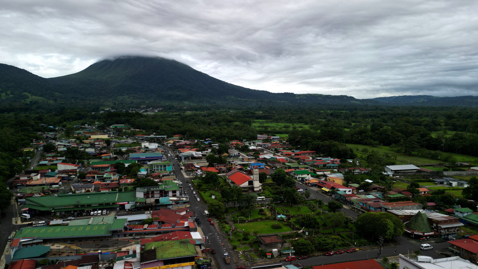
    When you arrive in Costa Rica, immigration will ask you three things: your passport, proof of where you’re staying, and proof that you’re leaving the country. Most travelers focus on booking their accommodation and forget about that third requirement until they’re standing at the immigration counter. Whether you’re flying into Liberia or San José, or crossing the border by bus from Nicaragua or Panama, you need to show a return ticket or onward travel reservation before they’ll stamp you in.

    Costa Rica requires proof of onward travel to ensure tourists don’t overstay their visa-free period. You can enter Costa Rica without a visa for up to 180 days if you’re from the US, Canada, EU countries, or most other Western nations. But that entry stamp comes with a condition – you need to prove you have plans to leave. Immigration officers check for this at airports and land borders, and they will turn people away without it.

    I’ve seen this requirement stop travelers at the border firsthand. On a bus trip back from Managua, a guy from China nearly got denied entry because he didn’t have a booked departure. He was traveling through Central America on a loose timeline and told the officer “maybe in a month I’ll continue to Colombia.” I helped him book an Onward Ticket reservation right there at the border within minutes. Immigration accepted it and he continued on the bus. This guide covers Costa Rica’s visa requirements, what documents you need, and how to handle the return ticket requirement without locking yourself into rigid travel plans.

    Table Of Contents

    Estimated Reading Time: 20 Minutes

    Do You Need a Visa for Costa Rica?

    Good news – if you’re reading this from the US, Canada, or most of Europe, you don’t need to apply for a visa before your trip. You just show up at the airport or border with your passport and immigration stamps you in for 180 days. This changed in 2024 from the old 90-day limit, which is great for anyone planning a longer stay or multiple trips throughout the year.

    Visa-Free Countries (180-Day Tourist Entry)

    I’ve entered Costa Rica dozens of times and never had to apply for a visa in advance. The visa-free entry works for citizens from about 70 countries including the US, Canada, UK, all EU countries, Australia, New Zealand, and most of South America. You land, they stamp your passport, and you’re good for six months. The clock starts the day you arrive.

    When I’m at immigration, the whole process takes maybe two minutes. They check my passport, ask where I’m staying, verify I have a return ticket, and stamp me through. No fees, no paperwork, no visa application stress.

    Countries Requiring Visas

    Some countries do need a visa before arrival – mainly visitors from China, India, Russia, and parts of Africa and the Middle East. If that’s you, you’ll need to apply through a Costa Rican embassy in your home country before you book your flights. Processing times vary but plan for at least a few weeks.

    There’s a workaround though. If you have a valid US, Canadian, or Schengen visa in your passport, Costa Rica might let you in visa-free even if your country normally requires one. The visa needs at least six months validity left on it. Check with your nearest Costa Rican embassy to confirm.

    How Long Can You Stay

    The 180-day stamp gives you six months in Costa Rica without any extensions or extra paperwork. You can stay the full six months or leave earlier – it’s up to you. I usually bounce between Costa Rica and neighboring countries, so I rarely use the full 180 days in one stretch.

    Your passport needs to be valid for at least six months past when you plan to leave. Immigration checks this at the counter. I’ve seen people get turned away because their passport was expiring in four months even though their trip was only two weeks. Don’t let that be you.

    Costa Rica Return Ticket Requirement

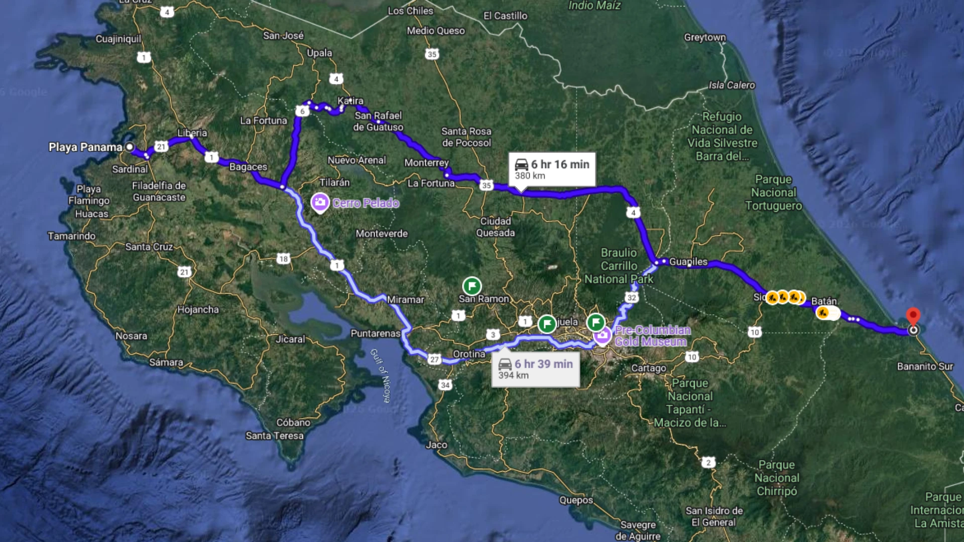
    Here’s the part that catches people off guard – Costa Rica requires proof that you’re leaving the country before they let you in. This isn’t optional or something they only check sometimes. Every single time I’ve entered Costa Rica, whether flying into Liberia or crossing the border by bus, immigration asks to see my return ticket or onward travel reservation.

    Why Immigration Requires Proof of Onward Travel

    Costa Rica wants to make sure you’re not planning to overstay your 180-day tourist visa. The return ticket requirement forces you to demonstrate you have plans to leave within that timeframe. It’s their way of preventing people from entering as tourists and then staying indefinitely without proper residency status.

    I get why this frustrates travelers with open-ended plans. Maybe you’re not sure if you’ll head to Panama next or fly back home. Maybe you want to see how much you like Costa Rica before committing to a departure date. Doesn’t matter – immigration needs to see something showing you’re leaving.

    porter airlines review costa rica to toronto

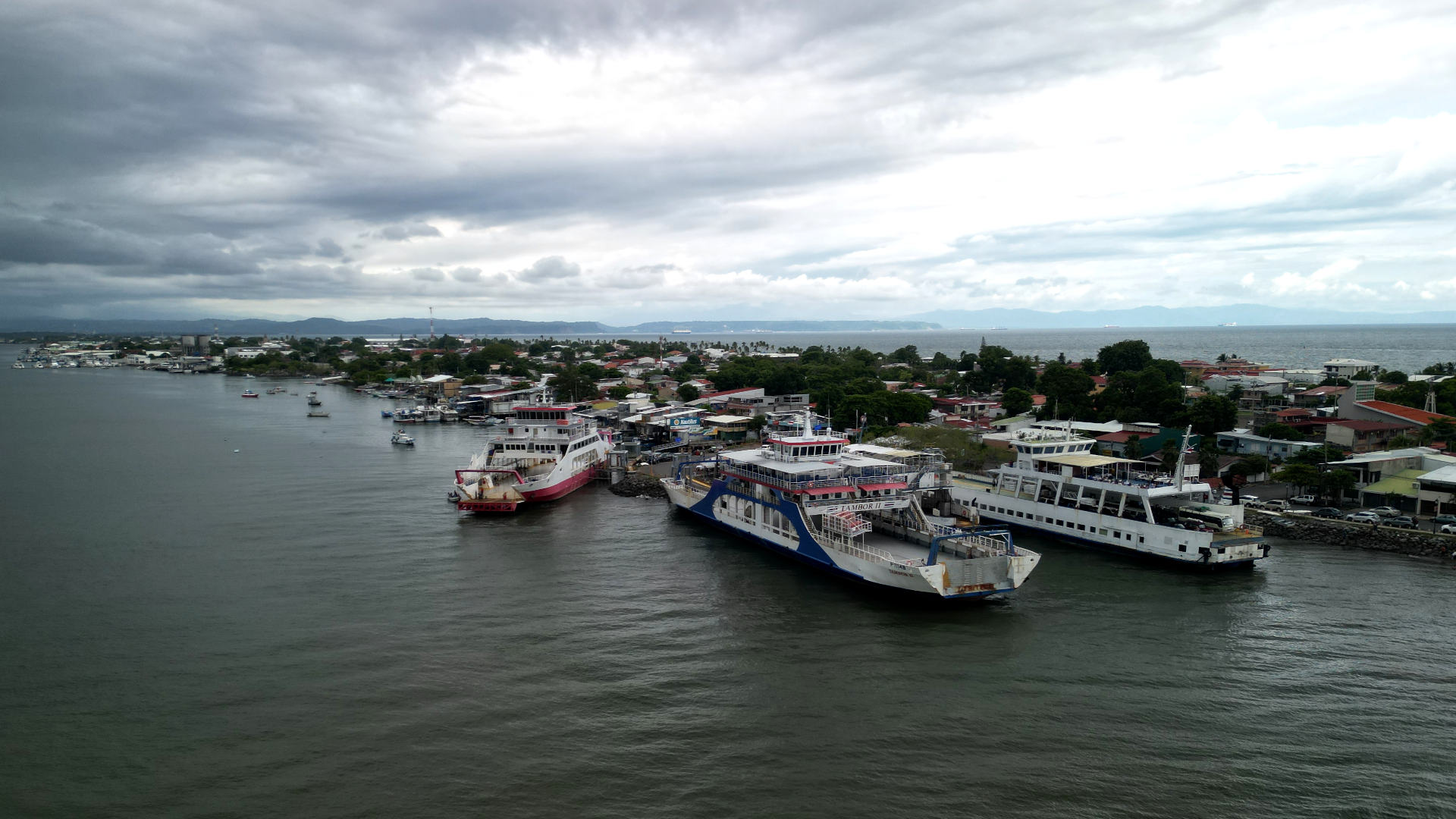
    When arriving by airplane in Costa Rica, you’ll have to show your departure ticket at the airport of departure. Here’s a plane arriving at LIR(Guanacaste).

    What Counts as Proof

    Immigration accepts several types of onward travel proof. A flight reservation leaving Costa Rica works – it can be a return flight to your home country or a one-way ticket to anywhere else. Bus tickets out of the country count too, which is what most people use when traveling overland to Panama or Nicaragua. Ferry tickets to other countries also qualify, though that’s less common.

    The ticket doesn’t have to be fully paid and confirmed. A reservation or booking confirmation is enough. This is where services like Onward Ticket come in handy – you can book a real flight reservation for $16 that’s valid for 48 hours, show it to immigration, and then let it expire if your plans change. I use this every time I travel through Central America with flexible plans.

    When You’ll Be Asked

    Airlines check for onward tickets before you even board your flight to Costa Rica. I’ve watched airline staff at the gate turn people away who couldn’t show proof of return travel. They’re strict about this because if Costa Rica denies you entry, the airline has to fly you back at their expense.

    Immigration officers at Liberia and San José airports verify your return ticket when you go through the entry line. At land borders like Peñas Blancas from Nicaragua or Paso Canoas from Panama, border officials check before stamping you in. There’s no way around this requirement – you need proof of onward travel to enter Costa Rica.

    onward ticket banner

    My Experience: Helping a Traveler at the Nicaragua Border

    On a bus trip back from Managua last year, I saw exactly what happens when you don’t have proof of onward travel. We pulled up to the Peñas Blancas border crossing on the Costa Rica side and everyone filed off to go through immigration. Most people breezed through in a few minutes, but one guy got stopped at the counter.

    He was from China, spoke some English but no Spanish, and the immigration officer was asking him questions he clearly didn’t understand. I could hear the officer asking “¿Cuándo sale de Costa Rica?” – when are you leaving Costa Rica. The guy kept saying he wasn’t sure, maybe in a month he’d continue to Colombia. That’s not what immigration wanted to hear.

    I walked over and translated between them. The officer explained he needed to see a booked departure from Costa Rica – a flight, a bus ticket, something showing he had plans to leave. The traveler had nothing. He was backpacking through Central America on a loose timeline and hadn’t thought about booking an exit before arriving at the border.

    The guy was getting stressed. The officer wasn’t being mean about it, but he was clear – no proof of onward travel, no entry stamp. I showed the traveler Onward Ticket on my phone and explained how it works. He pulled out his phone, went to the site, and booked a flight reservation to Colombia for about $16. The whole process took maybe five minutes.

    He showed the reservation to immigration. The officer looked it over, nodded, and stamped his passport. The guy got back on the bus and we continued into Costa Rica. If he hadn’t been able to book that reservation right there, he would have been stuck at the border and had to turn back to Nicaragua.

    That’s why I always tell people about Onward Ticket when they’re planning trips to Costa Rica or anywhere in Central America. Having that backup option means you don’t get caught at immigration without proof of departure.

    Onward Ticket: The Solution for Open-Ended Travel

    I’ve used Onward Ticket for years and it solves the biggest problem with the return ticket requirement – you don’t have to lock yourself into firm travel plans just to satisfy immigration. You book a real flight reservation that shows up in the airline system, immigration accepts it, and then the reservation expires after 48 hours if you don’t use it.

    How Onward Ticket Works

    You go to their website, pick a flight leaving Costa Rica within your visa period, and pay $16 for the reservation. They book it through the airline’s actual system, so it’s a legitimate reservation with a confirmation code. You get the booking details instantly via email. Show that to immigration and you’re good.

    The reservation stays active for 48 hours. If your plans firm up and you want to keep that flight, you can pay the full ticket price and convert it to a real ticket. If not, just let it expire. No refund hassles, no cancellation fees, no calling the airline to explain why you’re not using the ticket.

    26 01 30 nicaragua costa rica border immigration building with tica bus

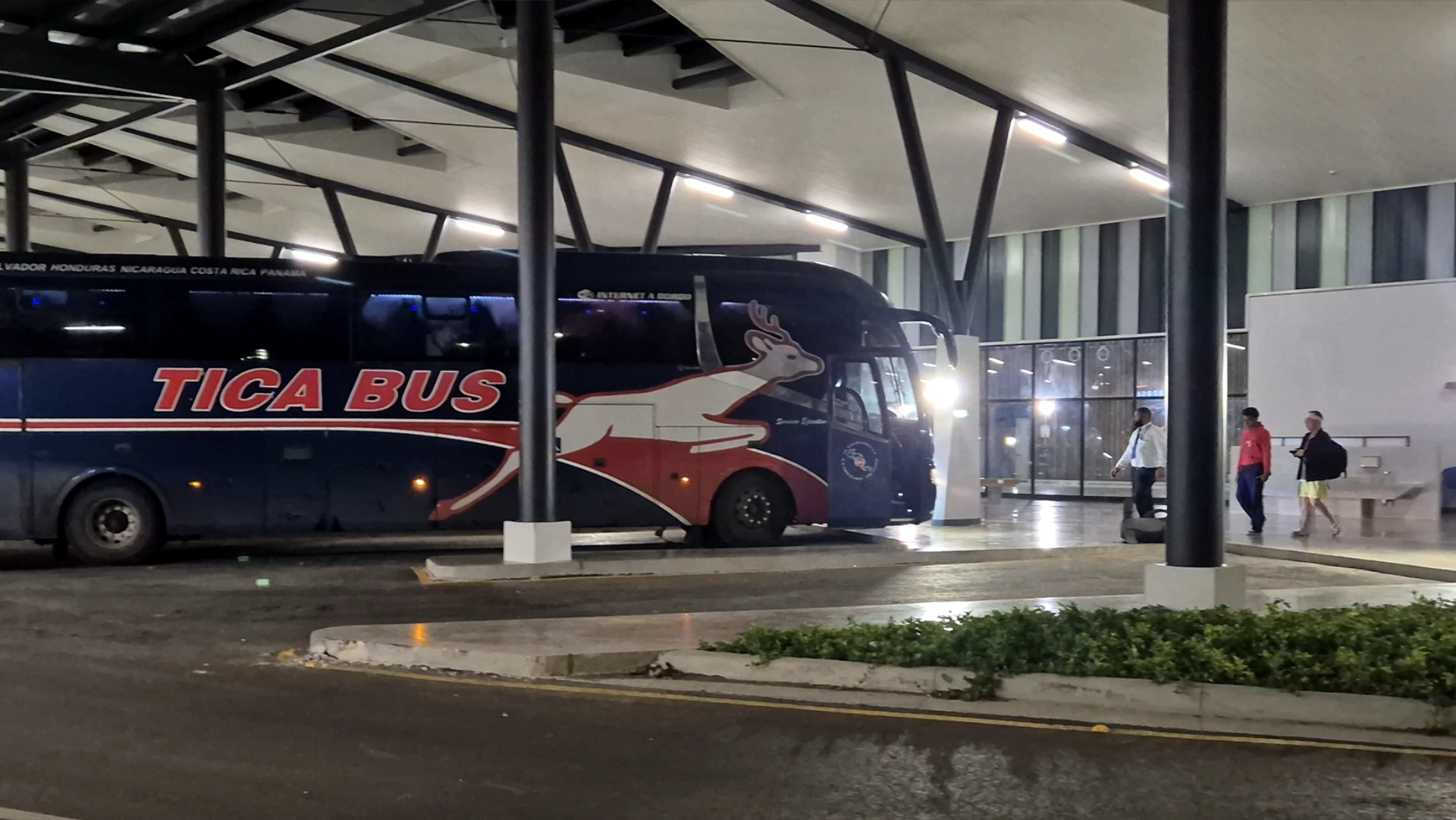
    This is the immigration building for Costa Rica at the Nicaragua Border. Tica Bus is one of the transnational bus lines that make this journey daily.

    Why I Use It for My Costa Rica Trips

    I travel to Costa Rica multiple times a year and I never know exactly when I’m leaving. Sometimes I extend my stay, sometimes I head to Nicaragua or Panama, sometimes I fly home early. Booking actual return flights and then changing them costs way more than $16 in change fees and fare differences.

    Onward Ticket gives me flexibility while keeping immigration happy. I book the reservation before I fly to Costa Rica, show it at check-in and at immigration, and then make my actual departure plans once I’m in the country. It’s worked every single time.

    Cost vs Full Ticket Refund Process

    A refundable ticket to the US from Costa Rica runs $400-600 minimum. Even if you get your money back, most airlines take 7-10 business days to process the refund. Some charge restocking fees. Some only give you airline credit instead of cash back.

    For $16, Onward Ticket eliminates all that hassle. You’re not tying up hundreds of dollars waiting for a refund. You’re not dealing with airline customer service. You’re not gambling on whether your “refundable” ticket actually gives you cash back or just a voucher. You pay $16, get your proof of onward travel, and move on with your trip.

    If these blog posts and videos help plan your Costa Rica vacation, please support our channel.

    Follow Us

    Keep up with our latest Costa Rica travel videos and guides by subscribing to our YouTube channel. We regularly post new content showing real conditions across different regions and seasons.

    Planning a trip to Costa Rica? Contact us — we help with itineraries, logistics, and finding the spots most tourists miss.

    Frequently Asked Questions

    Do I need a visa to enter Costa Rica?

    Most visitors don’t need a visa for Costa Rica. Citizens from the US, Canada, UK, EU countries, Australia, and about 70 other countries get visa-free entry for up to 180 days. You just show up with your passport and get stamped in at the airport or border. Some countries including China, India, and Russia do require applying for a visa in advance through a Costa Rican embassy.

    Does Costa Rica require a return ticket?

    Yes, Costa Rica requires proof of onward travel before they let you enter the country. This can be a return flight, a bus ticket to Panama or Nicaragua, or a flight reservation to another country. Immigration checks for this at airports and land borders every time. Airlines also verify you have a return ticket before letting you board flights to Costa Rica.

    Can I extend my 180-day stay in Costa Rica?

    You can’t extend the 180-day tourist visa from inside Costa Rica. If you want to stay longer, you need to leave the country and re-enter to get a new 180-day stamp. Many travelers do a quick trip to Nicaragua or Panama for a few days and then come back. Alternatively, you can apply for residency if you’re planning to live in Costa Rica long-term.

    What happens if I don’t have proof of onward travel?

    Immigration will deny you entry to Costa Rica without proof of onward travel. I’ve seen this happen at the Peñas Blancas border where a traveler had to turn back to Nicaragua because he couldn’t show a departure ticket. Airlines also won’t let you board your flight to Costa Rica without proof of a return or onward ticket. You need this documentation before you start your trip.

    How much does Onward Ticket cost?

    Onward Ticket costs $16 for a 48-hour flight reservation. This gives you a real booking confirmation that shows up in the airline system and satisfies immigration requirements. The reservation expires after 48 hours unless you convert it to a full ticket. This is much cheaper than buying a refundable ticket for $400-600 and waiting for the refund to process.

    Does immigration accept Onward Ticket reservations?

    Yes, Costa Rica immigration accepts Onward Ticket reservations. I’ve used them multiple times entering Costa Rica and immigration has never questioned it. The reservation is a real booking in the airline system with a valid confirmation code, which is what immigration is looking for. I also helped a traveler at the Nicaragua border use Onward Ticket and the officer accepted it immediately.

    Can I enter Costa Rica by bus from Nicaragua or Panama?

    Yes, you can enter Costa Rica by bus from Nicaragua at Peñas Blancas border or from Panama at Paso Canoas border. The immigration process is the same as arriving by air – you need your passport, proof of onward travel, and your passport must be valid for at least six months. Border officials check these documents before stamping you into Costa Rica. The bus stops at the border and everyone goes through immigration on foot.

  • Driving Guanacaste to Caribbean Coast: Complete Road Trip Guide

    Driving Guanacaste to Caribbean Coast: Complete Road Trip Guide

    In this post we’ll talk about the trip from Guanacaste’s Pacific beaches to the Caribbean coast. The drive takes about 7 hours on well-maintained highways. This route avoids San José traffic completely by using Highway 4 north of the capital. You’ll pass through mountain scenery, coffee towns, and flat agricultural plains before reaching Limón.

    I recommend spliting this drive up with an overnight stop. I chose to stop in La Fortuna, but there are many other small towns along the way. This creates two manageable 2-3 hour driving days instead of one long haul. La Fortuna has hotels, restaurants, and hot springs for breaking up the journey. You can leave Playa Panama or other Guanacaste beaches in the morning and arrive in La Fortuna by early afternoon.

    The entire route uses paved highways accessible with any rental car. Highway 4 runs north of San José with minimal traffic and scenic mountain views. Highway 32 is a divided two-lane highway connecting to the Caribbean coast. Watch for occasional potholes and ditches near towns, especially when entering Limón.

    Travel Tip: If you’re visiting Costa Rica for a road trip you’ll need a data connection for routes and road conditions. Check out Saily eSim, you won’t need a physical SIM card when you land.

    Table Of Contents

    Estimated Reading Time: 20 Minutes

    Route Overview and Timing

    This cross-country route connects the Pacific and Caribbean coasts while avoiding San José’s notorious traffic. The highways stay in excellent condition with minimal congestion outside major towns.

    Best Route to Avoid San José Traffic

    Highway 4 runs north of San José and eliminates the capital’s traffic completely. From Liberia or Guanacaste beaches, drive east to connect with Highway 4. The highway passes through Upala region with mountain scenery and small towns. You’ll never touch San José traffic or deal with city navigation.

    Puerto Viejo de Sarapiquí marks where Highway 4 meets Highway 32. This intersection connects the northern route with the main highway to Limón. Highway 32 is a divided two-lane highway in excellent condition. The road stays flat through agricultural areas until reaching the Caribbean coast.

    drive from liberia airport to limon in costa rica

    Here is the route we took from Playa Panama to Limon in Costa Rica. This route avoids the often high amounts of traffic in San Jose.

    Total Drive Time and Distances

    Playa Panama to La Fortuna takes 2-3 hours depending on stops. The drive covers about 150 km on Highway 4 with good pavement throughout. Bijagua de Upala is halfway and makes a good coffee stop near Río Celeste.

    La Fortuna to Limón takes 4-5 hours covering approximately 200 km. Puerto Viejo de Sarapiquí is 1 hour 15 minutes from La Fortuna. Guápiles is another hour past that with gas stations and supermarkets. The final hour from Guápiles reaches Limón on the coast. Total trip time is 6-8 hours of driving depending on stops and traffic in towns.

    Liberia to La Fortuna (First Leg)

    The first leg from Guanacaste beaches to La Fortuna takes 2-3 hours on Highway 4. This well-paved route passes through mountain scenery with minimal traffic. Plan to leave in the morning to arrive in La Fortuna with time to explore.

    Starting from Guanacaste Beaches

    Playa Panama is 15-20 minutes from Liberia International Airport in good traffic. Other popular Guanacaste beaches like Playa Hermosa, Playas del Coco, and Tamarindo range from 30-90 minutes from the airport. All connect to Highway 4 via well-maintained roads through Liberia.

    From any Guanacaste beach, drive to Liberia head south on Highway 1. You’ll then turn towards the east into the mountains. Traffic stays light once you leave the Liberia area. The scenic route provides mountain views and passes through small agricultural towns.

    Top Destination: La Fortuna is one of my favorite destinations in Costa Rica. Check out our blog post for more information.

    Highway 1 & 4 Conditions

    Highway 4 maintains excellent pavement throughout the entire route to La Fortuna. The two-lane highway has good sight lines and minimal curves. This highway has scenic views of the mountains around, and you might catch a view of the Arenal Volcano as you get close to La Fortuna.

    Expect occasional construction zones but nothing that significantly slows travel. The road climbs through mountains with scenic views of valleys and farmland. Small towns are every 20-30 minutes with sodas and gas stations. Any rental car handles this route easily without needing 4×4.

    Bijagua Stop and Río Celeste Access

    Bijagua de Upala is about 2 hours from Playa Panama and is about the halfway point to La Fortuna. This small town has a Mega Super grocery store, Super Económico, sodas, and coffee shops. Coffee costs around $1.50 at local cafes. The town makes a perfect stretch break.

    Río Celeste National Park entrance is 5 minutes north of Bijagua. The famous blue river and waterfall are Costa Rica’s most photogenic natural attraction. If you drive 5 minutes past the park entrance, you’ll find a free swimming spot in the blue river. A new restaurant plaza opened near this swimming area for post-hike refreshments.

    La Fortuna Overnight Stop

    I like stopping in La Fortuna for my cross Costa Rica trips. The town has everything you need within walking distance – hotels, restaurants, tour operators, and supermarkets. Arrive by early afternoon and you’ll have time to walk around before heading to the Caribbean the next morning.

    Where to Stay

    Airbnb units just outside downtown cost around $40 per night. These typically include secure parking, kitchenettes, and hot water. I booked mine the night I arrived and had no trouble finding availability. High season fills up faster so book ahead if traveling December through April.

    Hostels with private rooms work if you want to stay downtown. La Fortuna has several within 5 minutes of the central park. Maxi Palí supermarket is on the main road for stocking up on water and snacks before tomorrow’s drive. Gas stations are plentiful if you need to fuel up.

    Downtown at Night

    The central park gets decorated with Christmas lights during December. Security guards patrol the area so families walk around safely. I visited on a Tuesday night around 10 PM and restaurants were still busy with outdoor seating.

    Restaurants line the streets around the park – steakhouses, pizza places, sushi spots, and local sodas. A two-story gym operates above Kris Market if you need a workout. Everything stays walkable. The church dominates the central square with well kept grounds. You can see Arenal Volcano straight down the main street on clear days, though clouds often cover the peak.

    La Fortuna to Limón (Second Leg)

    The second day covers 4-5 hours from La Fortuna to the Caribbean coast. I left around 8 AM and reached Limón by early afternoon. Highway 4 continues east with smooth pavement before connecting to Highway 32. The landscape transitions from mountains to flat agricultural areas as you approach the coast.

    Highway 32 Conditions

    Highway 32 is a divided two-lane highway in both directions. The road quality here beats most Costa Rican highways – smooth surfaces with hardly any potholes to dodge. I passed maybe 10 cars the entire stretch. Construction zones appear occasionally but didn’t slow me down much.

    Puerto Viejo de Sarapiquí is 1 hour 15 minutes from La Fortuna where Highway 4 meets Highway 32. This bigger town has gas stations and fast food for quick stops. The landscape flattens completely after this junction. You’re entering agricultural lowlands with endless pineapple plantations on both sides.

    Guápiles Pit Stop

    Guápiles is about 2 hours from La Fortuna and was the perfect pit stop. I pulled into the Mega Super right off the highway some cold drinks. McDonald’s, KFC, and Taco Bell are near the highway overpass if you want familiar food. 

    The town extends beyond the highway but I just stuck to the commercial zone. Gas stations are plentiful here – fill up if you’re running low. From Guápiles, it’s about a 1 hour drive to Limón. The road stays flat and straight through argicultural areas. The air gets noticeably more humid as you descend toward the Caribbean coast.

    Arriving in Limón

    Limón is Costa Rica’s main Caribbean port city with a different vibe than Pacific beach towns. The town has a large central park, waterfront area, and cruise ship port. I drove about 10 minutes through town to reach the beach area where I set up for exploring.

    What to Expect

    Limón feels more like a working port city than a tourist destination. The central commercial area has shops, restaurants, and a municipal market selling produce and local goods. A large park near the waterfront gets decorated with Christmas lights in December.

    The town has older colonial style buildings mixed with modern commercial development. There’s a small regional airport just outside of town which allows for faster travel from the Capitol. Puerto Viejo beach town is about 1 hour south if you want more tourist infrastructure and beach vibes. Most travelers use Limón as a jumping off point rather than a final destination.

    Road Hazards to Watch

    Watch carefully for ditches and potholes when entering Limón. The roads deteriorate compared to Highway 32’s excellent condition. I hit a ditch on the side of the road and damaged my car’s undercarriage. These ditches often have asphalt covering them making them hard to spot.

    Park carefully and look for attended parking lots charging around $3 per hour. The beachfront road can be confusing – it looks one-way but operates as two-way traffic. Take it slow, watch for oncoming cars, and don’t rush through the beach area. The Caribbean coast rewards careful driving.

    If these blog posts and videos help plan your Costa Rica vacation, please support our channel.

    Follow Us

    Keep up with our latest Costa Rica travel videos and guides by subscribing to our YouTube channel. We regularly post new content showing real conditions across different regions and seasons.

    Planning a trip to Costa Rica? Contact us — we help with itineraries, logistics, and finding the spots most tourists miss.

    Frequently Asked Questions

    How long does it take to drive from Guanacaste to the Caribbean coast?

    The drive takes 6-8 hours total depending on stops. Most travelers split this into two days with an overnight stop in La Fortuna. Day one is 2-3 hours from Guanacaste beaches to La Fortuna. Day two is 4-5 hours from La Fortuna to Limón.

    Can you avoid San José traffic driving to the Caribbean?

    Yes, Highway 4 runs north of San José and completely avoids the capital’s traffic. From Liberia or Guanacaste beaches, take Highway 4 east through the mountains. This route connects to Highway 32 near Puerto Viejo de Sarapiquí without touching San José at all.

    Do you need 4×4 for this route?

    No, any rental car works for this route. Highway 4 and Highway 32 are fully paved and well-maintained. However, watch carefully for ditches and potholes when entering Limón. The roads deteriorate near town compared to the highways.

    Where should you stop for gas on this route?

    Gas stations appear in Bijagua de Upala, La Fortuna, Puerto Viejo de Sarapiquí, and Guápiles. Guápiles is the best stop with multiple stations right off Highway 32. Fill up in Guápiles if you’re low – it’s the last major town before Limón.

    Is La Fortuna worth stopping overnight?

    Yes, La Fortuna makes the perfect overnight stop. The town has hotels starting around $40 per night, restaurants, and hot springs. Splitting the drive into two days eliminates the exhaustion of 7 hours straight. You can explore downtown at night and leave refreshed the next morning.

    Can you visit Río Celeste on this route?

    Yes, Río Celeste is just 5 minutes north of Bijagua de Upala on Highway 4. The national park entrance has the famous blue waterfall. Drive 5 minutes past the park entrance to find a free swimming spot in the blue river. This adds minimal time to your drive.

    What are the road conditions on Highway 32?

    Highway 32 is a divided two-lane highway in excellent condition with smooth pavement and minimal potholes. The road quality beats most Costa Rican highways. Traffic stays very light except near major towns. Construction zones appear occasionally but don’t significantly slow travel.

    Is Limón a good final destination or should you continue to Puerto Viejo?

    Most travelers use Limón as a jumping-off point rather than final destination. Puerto Viejo beach town is 1 hour south with more tourist infrastructure and beach vibes. Limón works better as a lunch stop or quick exploration of the working port city before continuing south to beach towns.

  • Monkey Trail Costa Rica: Short Route From Coco To Potrero

    Monkey Trail Costa Rica: Short Route From Coco To Potrero

    The Monkey Trail, also known as Route 911, stretches between Playas del Coco and Potrero along Costa Rica’s Pacific Coast. This rugged shortcut offers a direct connection for travelers heading between Liberia Airport and popular destinations like RIU Guanacaste, Las Catalinas, and the beaches of Potrero. While the conventional route follows the paved highway around the mountains, the Monkey Trail cuts through them, potentially saving 30-40 minutes of driving time.

    What makes the Monkey Trail distinctive is its river crossing, particularly during green season when water levels rise. The main crossing near Nuevo Colón becomes a decision point for many drivers, who must judge whether their vehicle can handle the current conditions. During dry season (December through April), almost any vehicle can navigate the crossing, but rainy season transforms this simple stream into a challenging obstacle that may require 4×4 capability.

    The route offers more than just a shortcut – it provides a glimpse into rural Costa Rica away from tourist centers. Small towns like Nuevo Colón and Artola are landmarks along the journey, with local stores where you can stop for refreshments or directions. For guests staying at or planning to visit Las Catalinas, understanding this alternative route can add flexibility to your transportation options and potentially save valuable vacation time. This route also connects to the primary roads connecting to the Riu Guanacaste and Palace.

    Travel Tip: You don’t need to buy a SIM card when you land in Costa Rica to get data connection. With an eSIM, you’ll be able to configure your data connection before you depart for your vacation. I use the Saily eSIM in Costa Rica.


    Table Of Contents

    Estimated Reading Time: 20 Minutes

    About Route 911 and the Monkey Trail

    Route 911 runs through the mountainous interior of Guanacaste, passing through the towns of Artola and Nuevo Colón before continuing south. While the entire road is designated as Route 911, only the southern portion from Nuevo Colón to Potrero is known as the “Monkey Trail.” This distinction is important for travelers, as the northern section of Route 911 is generally better maintained than the more challenging Monkey Trail section.

    The Monkey Trail earned its nickname from the wildlife often spotted along this rugged stretch, particularly howler monkeys in the trees overhead. This 8-kilometer section connects Nuevo Colón with Potrero and the southern beaches, creating a shortcut that bypasses the longer coastal route. The trail is mostly paved, with sections that range from well-graded gravel to challenging rocky patches and notable river crossings.

    river crossing costa rica

    Location and Connections

    Route 911 begins near Sardinal and connects to the main road leading to Playas del Coco. From Liberia International Airport, you’ll drive approximately 25 minutes toward Sardinal before finding the turnoff for Route 911. There’s a prominent corner store right at the corner, where you can grab some essentials for the trip. The road passes through Artola before reaching Nuevo Colón, where the Monkey Trail portion begins. This rugged section then continues south until emerging near Potrero, providing access to beaches like Flamingo, Las Catalinas, and Playa Danta.

    The small town of Nuevo Colón serves as the primary landmark and transition point where the regular Route 911 becomes the Monkey Trail. This town marks where the road becomes more challenging and sits near the main river crossing. For travelers staying at RIU Guanacaste, a separate access road branches off from Route 911. You’ll basically stay straight on the paved road in Nuevo Colón, rather than turning left towards the river crossing.

    If the river is too deep you can try The Congo Trail, a paid alternative route that bypasses the main river crossing on the Monkey Trail, offers an emergency option during extremely high water conditions. Most navigation apps recognize Route 911, though they often don’t account for seasonal conditions or distinguish between the northern section and the more challenging Monkey Trail portion.

    Why Take This Route

    The primary reason travelers choose the Monkey Trail portion of Route 911 is to save time when traveling between Playas del Coco and the southern beaches near Potrero or Las Catalinas. The conventional route would require following the coastal highway all the way around, adding an extra 30-40 minutes of driving. During peak tourist season when coastal traffic increases, the time savings can be even greater.

    Route 911 also provides essential access to several popular destinations. The northern section connects to RIU Guanacaste and Diamante Adventure Park, while the southern Monkey Trail section creates a direct link to Las Catalinas and Potrero. This interior route allows visitors to easily explore a wider range of beaches and activities without lengthy detours around the peninsula.

    For adventure seekers, traversing the Monkey Trail portion of Route 911 offers a more rugged Costa Rican experience than the main highways. You’ll see local life unfolding in small towns, pass cattle ranches and family farms, and potentially spot wildlife including monkeys, coatimundis, and tropical birds. In the video of this destination linked below, I saw a cowboy riding casually through Nuevo Colón – pretty cool!. The elevated sections will provide stunning viewpoints over the Pacific coastline, making the journey itself part of your adventure in Costa Rica.

    Driving the Monkey Trail

    Navigating the Monkey Trail requires different approaches depending on when you visit. The road conditions change dramatically between seasons, and river crossings that barely wet your tires in March might require serious consideration in September. I’ve driven this route dozens of times in different vehicles, and the experience is never quite the same twice.

    Most of the northern section of Route 911 stays in decent condition year-round, with some mostly paved sections with some patchy asphalt stretches. Once you reach Nuevo Colón and turn onto the Monkey Trail proper, things get more interesting. The route becomes narrower, bumpier, and includes two river crossings that serve as the main decision points for many drivers.

    map route 911

    Map of Guanacaste area, showing the route between Playas del Coco & Potrero. The Liberia Airport is shown for reference.

    River Crossings & Conditions

    The main river crossing sits just past Nuevo Colón at the start of the Monkey Trail. During dry season, this crossing typically has just a few inches of water flowing over a solid rock bottom. Most days, you’ll see all types of vehicles crossing without difficulty – from motorcycles and sedans to buses and delivery trucks. The river bed has been reinforced and leveled at the crossing point, making it more manageable than it appears.

    During my visits, I’ve noticed drivers often take clever routes through the crossing. They’ll stick to the shallowest parts or follow tire tracks from previous vehicles. If you’re unsure, simply pull over and watch a few vehicles cross first – you’ll quickly learn the best path.

    The second crossing is smaller and rarely poses problems except after heavy storms. Both crossings have bypass routes that locals use when water levels rise too high. If the water looks deeper than about 12 inches, and you’re not in a high-clearance 4×4, consider taking the alternative Congo Trail route or the longer coastal highway.

    Dry vs Rainy Season

    Dry season (December through April) transforms the Monkey Trail into a dusty but relatively easy drive. The river crossings typically shrink to minor water features, and even small cars can manage the journey with careful driving. The main complaint during this period is the dust – vehicles ahead of you will kick up clouds that can reduce visibility, so keep your distance and consider closing your windows.

    Rainy season changes everything. From May through November, particularly in September and October, afternoon downpours can temporarily raise river levels by several feet. The road develops washouts and ruts that require more careful navigation. After heavy rain, the crossing points can become impassable for several hours before receding to manageable levels.

    I’ve seen the main river crossing at waist height during particularly wet periods. What’s interesting is how quickly conditions can change – a river that’s too deep to cross in the evening might be perfectly manageable by the following morning. If you’re staying nearby and the crossing looks too challenging, simply wait a few hours and check again.

    cars crossing monkey trail costa rica

    Two vehicles crossing the primary river area of the Monkey Trail. It’s dry season, so there’s not much water.

    Vehicle Requirements

    During dry season, almost any vehicle can handle the Monkey Trail. There’s no rental car in the fleet that won’t be able to manage the small crossing. The key is careful driving – take it slow over rocky patches and approach river crossings with caution.

    Rainy season raises the bar significantly. During this season I strongly recommend a vehicle with higher clearance and ideally 4×4 capability. SUVs and pickup trucks handle the conditions much better than standard cars. If you’ve rented a small vehicle and find yourself needing to use the Monkey Trail during rainy season, consider taking the longer coastal route instead.

    Motorcycle riders face special considerations. The trail is popular with dirt bikes and dual-sports, but street bikes need to be careful with the rocky sections and water crossings. As shown in the video, I’ve crossed on a street bike by carefully picking my line through the river, but sometimes it’s safer to turn off the engine and walk the bike through to prevent water damage to your exhaust system.

    Destinations Along Route 911

    Route 911 and the Monkey Trail serve as key connectors to some of Guanacaste’s most popular beach destinations. Rather than isolated points, this route links several distinct coastal areas, each with its own character. Understanding how these spots connect can help you maximize your time exploring the region, whether you’re on a day trip or moving between hotels.

    The area surrounding Route 911 has seen significant development in recent years, with new resorts, residential communities, and attractions appearing along its length. There’s a new development called Zapotal, which has a golf course and very high end development. Despite this growth, the road itself has maintained much of its rural character, creating an interesting contrast between luxury destinations and an authentic country landscape.

    RIU Guanacaste Access

    RIU Guanacaste resort is at the beach of Playa Matapalo, a beautiful but often overlooked beach on the Papagayo peninsula. To reach the resort from Liberia Airport, most transportation services will take Route 911 through Sardinal and Artola before turning onto the resort access road near Nuevo Colón.

    The turnoff to RIU is well-marked and located before you reach the main river crossing of the Monkey Trail. This means that resort guests rarely encounter the more challenging sections of road, as the resort access remains on the better maintained portion of Route 911. The resort road itself is paved and winds through dry tropical forest before reaching the property gates.

    For guests staying at RIU who want to explore nearby beaches like Playas del Coco (about 15 minutes north) or Las Catalinas (about 25 minutes south), Route 911 provides convenient access to both. This central location makes RIU Guanacaste a good base for exploring multiple beaches while enjoying the all-inclusive resort.

    Las Catalinas & Potrero

    The southern end of the Monkey Trail emerges into Potrero, a small beach town with a growing expat community. From here, it’s just a short drive to Las Catalinas, an upscale planned community known for its Mediterranean inspired architecture, car free downtown, and excellent mountain biking trails. Taking the Monkey Trail from Playas del Coco to Las Catalinas cuts driving time nearly in half compared to the coastal route.

    Las Catalinas sits on a hillside overlooking Playa Danta and Playa Dantita, two of the area’s most incredible beaches. These beaches have excellent swimming conditions and tend to be less crowded than more accessible beaches in the region. The controlled development around these beaches has preserved much of their natural beauty, making them worth the journey via the Monkey Trail.

    Potrero itself offers a more laid-back beach experience with several small hotels, restaurants, and a long stretch of gray sand beach with calm waters. The area has fewer tourists than Playas del Coco but still provides essential services for travelers. I’ve found some great local restaurants in Potrero where the seafood is fresh and prices are reasonable compared to more developed beach towns.

    Travel Tip: Bring a good set of water shoes to explore the beaches at Potrero or Las Catalinas. You can walk through town and the water!

    Connection to Playas del Coco

    Playas del Coco, one of Guanacaste’s most developed beach towns, is near the northern end of Route 911. This busy town has the widest range of amenities in the area, including supermarkets, banks, medical services, and a variety of restaurants and nightlife options. For travelers exploring the more remote beaches to the south, Coco serves as the main supply point and service center.

    The drive from Coco to Potrero via the Monkey Trail takes about 35-40 minutes in dry season, compared to 60-75 minutes if you follow the coastal highway. This makes it practical to base yourself in either location while making day trips to explore the other. Many visitors to RIU Guanacaste also make evening trips to Coco for dinner or entertainment, using Route 911 as their access road.

    For divers and snorkelers, Playas del Coco is a great departure point for trips to the best underwater sites in the region. Using the Monkey Trail connection, visitors staying in southern areas like Las Catalinas or Potrero can easily reach morning boat departures without having to change accommodations. Similarly, visitors based in Coco can easily explore the beaches to the south without a lengthy drive around the peninsula.

    Check our blog post about Playas del Coco for more info about this popular town.

    Follow Us

    Keep up with our latest Costa Rica travel videos and guides by subscribing to our YouTube channel. We regularly post new content showing real conditions across different regions and seasons.

    Planning a trip to Costa Rica? Contact us — we help with itineraries, logistics, and finding the spots most tourists miss.

    If these blog posts and videos help plan your Costa Rica vacation, please support our channel.

    Frequently Asked Questions

    Is the Monkey Trail safe to drive?

    The Monkey Trail is generally safe to drive, though road conditions vary by season. During dry season (December-April), most vehicles can handle it without issue. In rainy season, it becomes more challenging and potentially hazardous after heavy rainfall. The biggest safety concerns are the river crossings when water levels are high and occasional blind corners where you might encounter oncoming traffic.

    How long does it take to drive the Monkey Trail?

    The complete drive from Playas del Coco to Potrero via the Monkey Trail typically takes 35-40 minutes in dry season with good conditions. During rainy season or after storms, allow 45-60 minutes as you’ll need to navigate more carefully. The specific Route 911 section from Sardinal to Nuevo Colón takes about 15 minutes, while the Monkey Trail portion from Nuevo Colón to Potrero takes approximately 20-25 minutes.

    Will I see monkeys on the Monkey Trail?

    While the trail is named for the monkeys that inhabit the surrounding forest, sightings aren’t guaranteed. Your best chance of spotting howler monkeys is in the early morning or late afternoon when they’re most active. Listen for their distinctive calls, which can sound like roaring and often reveal their location in the trees along the route. Coatimundis, tropical birds, and occasionally sloths can also be seen along the trail.

    Can I take a rental car on the Monkey Trail?

    Most rental cars can handle the Monkey Trail during dry season without problems. However, many rental agreements in Costa Rica have restrictions about driving on unpaved roads or through water. Check your rental agreement carefully, as damage occurring on unpaved roads might not be covered by insurance. If renting during rainy season, consider requesting an SUV or 4×4 vehicle if you plan to use this route.

    What should I do if the river is too high to cross?

    If you arrive at the river crossing and the water appears too deep (generally over 12 inches for standard cars), don’t attempt to cross. You have several options: take the paid Congo Trail bypass route, backtrack and use the longer coastal highway, or simply wait a few hours for the water level to recede. After heavy rain, water levels typically drop significantly within 4-6 hours as long as the rain has stopped.

    Is there cellular service along the Monkey Trail?

    Cellular coverage along Route 911 and the Monkey Trail is spotty but improving. The northern section near Sardinal and Artola typically has good coverage, while the Monkey Trail section through the hills has several dead zones. Don’t count on having consistent signal for navigation – download offline maps before your journey if you’re relying on your phone for directions.

  • Trip Through Costa Rica: From The Beaches To The Mountains

    A Journey Through Costa Rica:
    Beaches, Markets, and Mountain Adventures

    Costa Rica is an incredible country with a wide array of destinations and attractions to visit on your vacation. I recently embarked on a road trip across Costa Rica, where I explored some of the country’s most stunning and diverse spots. From a quiet beach with soft sands to a vibrant city full of history. I came across a crystal clear blue water swimming spot and wandered through a misty forest filled with butterflies. Afterwards I visited a bustling local market in San José. As you come along this journey, I’ll include the routes I took between each destination, so you can decide if it’s worth adding to your vacation itinerary.

    Before you book your tickets, check out our Shop Page with some necessities for your trip. We have a packing list for some items that I find useful when I’m travelling in Costa Rica.

    playa calzon de pobre

    STOP #1: Exploring Playa Calzón de Pobre:
    A Serene Spot Near Playas del Coco

    Playa Calzón de Pobre in Guanacaste is a small & beautiful beach that attracts many visitors for its clear waters and tranquility. It’s located between Playa Hermosa and Playas del Coco. It’s also right next to Playa Penca and the new Waldorf Astoria development. The road has recently been paved, so it’s easily accessible. The beach is surrounded by lush greenery and the sand is perfectly clean. Due to it’s position, it has calmer water than many of the nearby beaches, and it’s often crystal clear.

    Tourists often head to Calzón de Pobre for its excellent snorkeling opportunities. The clear water allows for great visibility, and you can often see a variety of fish and other marine life close to the shore. Check out this snorkel set which is perfect to bring to Costa Rica. The beach’s peaceful environment also makes it a great spot to hang out for the day, with plenty of shade provided by the surrounding trees.

    Parking at Calzón de Pobre is convenient, with a small parking area just before your hike. The hike is about 10 minutes and is over a wide, gravel pathway. The beach is less crowded than some of the more popular beaches in the region. You’ll often find it to be more laid back and relaxing. Whether you’re looking to snorkel, swim, or simply relax, Playa Calzón de Pobre is a great option for a beach day in Guanacaste.

    If you’re vacation itinerary brings you to the area of Calzón de Pobre, there’s lots of other great beaches in the area to check out. Of course, Playa Penca is just up the road. At the time of writing this blog, there’s a great deal of construction, but the beach itself is still accessible.

    To the north one beach, you’ll find Playa Hermosa. This beach has incredible sand and water, along with great views. You’ll find Hermosa to be pretty laid back and relaxed, but still has many options for accommodations and restaurants. 

    To the south is Playas del Coco, which is a bustling town. The north end of the beach is great for swimming, and features a (small) waterfall when the rains picks up. You’ll find El Coco to be plentiful in dining, accommodations and nightlife. 

    Continue to the south from El Coco, and you’ll be at Playa Ocotal. This black sand beach is renowned for calm water and scenery. I’ve seen monkeys on many occasions at this beach. I’ve also had the opportunity to snorkel both ends of the beach and saw incredible sea life. Try the hiking trails above Ocotal for a great view of the beach and Pacific.

    water shoes for exploring costa rica

    Pick up a pair of these awesome water shoes. I’ve been using them all over Costa Rica during my travels. They have vented soles so water drains right out the bottom! 

    driving to Liberia, Guanacaste

    STOP #2: Discovering Liberia:
    The Gateway to Guanacaste’s Best Adventures

    Liberia, known as the “White City” of Costa Rica, is the capital of Guanacaste Province and a step off to the northwest region. With its colonial architecture and busy streets, Liberia has a blend of history and amenities. The city is a convenient starting point for exploring nearby attractions such as the Rincon de la Vieja National Park and the beaches of the Pacific coast. Many tourists will land at the nearby international airport to begin their vacation at towns like Playas del Coco, Samara and Tamarindo.

    The Museo de Guanacaste in Liberia is a popular attraction that provides a look into the region’s history and culture. Located in an old prison/barracks, the museum will occasionally feature exhibits on pre-Columbian artifacts, colonial history, and local art. The Museo is a great place to check out if you’re staying in Liberia or just passing through.

    You’ll also find many restaurant options around the central park. My favorite is ‘Casero Express’, which is a small buffet style Soda with great food and friendly staff. Before you head to the beaches you can also stock up on essentials at bigger stores like Walmart, Pequeno Mundo and El Rey.

    Heading to the next destination, we’ll be riding north on Ruta 918 from Liberia. This route is an exciting and scenic journey through Guanacaste which is enjoyed by cyclists. There’s mostly smooth roads and incredible landscapes. There’s many locations to stop and take some photos with the rolling hills behind. Some parts of the route are bumpy and pitted, so taking a small car is not advised.

    One of the great reasons to ride along Ruta 918 is the proximity to several natural reserves and parks. You’ll pass by Santuario Santa Rosa de Lima. The park offers a great place to take a break, stretch your legs, and enjoy the scenery. Additionally, the ride provides opportunities to spot local wildlife.

    directions for this route along 918

    STOP #3: Río Celeste Free Pool:
    Alajuela’s Relaxing Natural Oasis

    The next stop is on the way towards La Fortuna. Río Celeste is one of the top tourist attractions in Costa Rica. It’s known for having incredible blue water and a super photogenic waterfall. When you visit, don’t miss the free swimming location just outside the main park area. Although swimming isn’t allowed in the national park(where the waterfall is), this spot allows you to jump in the refreshing water. There’s also no entrance fee or lineups to enter. This natural pool is surrounded by lush rainforest, making it a perfect spot to unwind and soak in the natural beauty of Costa Rica.

    I just so happened to see a Coatimundi crossing the main bridge when I arrived. These creatures are referred to as ‘Pizotes’ in Costa Rica, and they’re very often seen in the area around Lake Arenal. I’ve often spotted them in packs near the roads, so be sure to drive cautiously in these areas.

    coatimundi

    The trail to this swimming spot is easy to navigate, making it accessible for all ages. Just park on either side of the bridge along the road. On the side closest to Río Celeste, there’s often vendors set up with food and souvenirs. This is the side of the bridge where you can walk down to the swimming spot. On the other side of the bridge, there’s another more rugged trail, but it’s still only about 20 meters.

    If you have the time to stop in nearby Bijagua de Upala, pick up some extra food and drinks at the supermarket to enjoy the river for a bit longer. The cool, clear water is ideal for swimming, you’ll surely feel refreshed after a hike. This location provides a more laid-back alternative to the more regulated parts of the Río Celeste area. Check it out to swim, relax, or explore.

    This part of Costa Rica can have quickly changing weather. It’s very important to bring sunscreen if you’re going to spend some time outside, like at this river. Try this sunscreen bar with roll on application. I find it’s great to not overuse, like cream. It’s also solid so much easier to bring at the airport

    driving costa rica alajuela

    STOP #4: Exploring La Fortuna:
    Volcano Views, Hot Springs, and More

    Visitors who are stopping by or staying in La Fortuna will often head towards Rio Celeste on their vacation. This is the route I took to travel between the two destinations. These roads are all paved and in very good condition. You won’t need a 4×4 to go along.

    If you’re driving in Costa Rica, both Waze and Google Maps work pretty well for driving between well established destinations like these. Sometimes off the beaten path, either app could land you on a difficult back road. Costa Rica has done a fantastic job of ensuring that travelling to the popular locations is easy and smooth.

    volcano from la fortuna

    La Fortuna is a popular destination known for its stunning natural beauty and outdoor activities. It’s located inland within the Province of Alajuela. One of the main attractions is the Arenal Volcano, which towers over the town and provides a breathtaking backdrop from most locations in the area. Tourists can enjoy a variety of activities such as hiking, zip-lining, and horseback riding. The nearby Arenal Volcano National Park is highly recommended sight to see. The area offers a chance to explore diverse wildlife and lush rainforest.

    Another major draw to La Fortuna is its hot springs. The geothermal activity from the Arenal Volcano heats the waters, creating natural hot springs that are perfect for relaxing for the day. Places like Tabacón Hot Springs and Baldi Hot Springs are highly recommended for their beautiful settings and therapeutic waters. Hot spring water is soothing and there’s often a variety of pool temperatures available. Check out our visit to a local hot spring pool on Youtube.

    La Fortuna is also known for its busy town center, which is full of great shops, restaurants, and markets. The town is very walkable, with many accommodations options being a short distance to the center. I stayed at a hostel/hotel called Selina, which has shared and private rooms. There is a kitchen, pool and co-working space, all a great value for the price.

    drive from la fortuna towards san jose

    STOP #5: A Day at Bosque Nuboso El Cocora:
    Butterflies, Hummingbirds, and Coffee

    I departed La Fortuna heading towards San José in the morning, and decided to take the less travel route. This route is mountainous and winding about half way through, which was exciting. I enjoy these roads through the mountains as you’ll never know what you’ll see. It can also get quite chilly!

    Which is exactly what happened. Driving through the clouds and fog on a moto makes for cold hands, so I started looking for a place to grab a hot coffee. It just so happens I caught a glimpse of a coffee sign at Bosque Nuboso El Cocora. I stopped here after driving about 1.5 hours from La Fortuna.

    24-08-12-BUTTER

    Bosque Nuboso El Coroca is in Alajuela Province. It’s is a popular spot for exploring the cloud forest. The trails here are relatively easy to navigate, and you can enjoy the scenic views of the forest and its wildlife. You’ll be able to spot birds, frogs, and the occasional coati along the paths. Since the area is a cloud forest, expect cooler, misty conditions, which many find refreshing compared to the warmer lowlands of Costa Rica. One of the highlights of the visit is butterfly garden. There’s a variety of different butterflies roaming the shrubs and plants. You’ll see them flying around you and some of the species will stop for a good period. This makes for some great photos.

    In this video and for these photos I’m using the Samsung S24+. I like the lenses on this camera and the ability to do slow motion videos. Kids will love seeing and taking photos of the butterflies. The onsite café and gift shop provide a convenient stop for those wanting a break after their hike. The café serves locally sourced coffee, which many is incredible. The small gift shop has souvenirs like handmade crafts. I highly recommend checking out this location when you visit Costa Rica.

    trail shoes for costa rica

    I use these versatile trail runners on my hikes in Costa Rica. The aggressive grip tackles steep terrain while maintaining comfort for long days on mountain paths.

    route from the butterfly dome to san jose

    STOP #6: To The Market In San José:
    Great Food And Cool Vendors

    I continued my journey south through the mountains. Eventually I arrived at a fairly busy town called San Ramon. Once there, I only made a quick stop there for some lunch before continuing on south towards San José.

    I decided to stop at a hostel/hotel that I frequently stay at. It’s called Hotel Finca Escalate. You can find a previous video profiling this cool place Here On Youtube. Escalante is a neighborhood which is within walking distance east of downtown San José. It’s a great place to stay for a day if you’re planning on exploring the Costa Rican Capital City.

    The next morning I simply searched Google Maps for a cool spot to film in the area. Luckily it was Sunday, and there was a small market being held just a 5 minute drive away. 

    The market is at the John F. Kennedy Park in San Josés. The market usually starts early in the morning, and you can find a variety of items ranging from fresh produce to homemade crafts. It’s a popular place to pick up fruits and vegetables, especially if you’re looking for local options. You can also visit for the atmosphere, there’s always something happening, whether it’s people socializing or street vendors setting up.

    In addition to the vendors, there’s food and refreshments being served to enjoy while you browse. You’ll find affordable prices for the selection available. Given that the market has a casual, laid-back vibe, it’s great to relax and browse for an hour or two.

    Parking around the park on street so it’s better to arrive early. There are a few spots around the park, but there’s many people parking for the nearby church as well. You can also take a bus or walk if you’re nearby. The market tends to get more crowded as the morning goes on, so earlier is better if you prefer activity.

    san jose to south

    STOP #7: Eco Market Kapi Kapi: In The Shadow Of The Massive Chirripó Mountain

    The next leg of this journey will take us further south in Costa Rica. Leaving San José, you’ll shortly pass through the large town of Cartago. Here you’ll find lots of amenities like grocery stores, historical sites and a large shopping mall. Cartago is a great place to stay for a vacation and visit the nearby towns like Orosi.

    I’ll only stop in Cartago for a snack and continue on south. Between the towns of Cartago and San Isidro de El General, you’ll cross a mountain range that is incredible. There’s scenic views of the surrounding hills and plant life which is unlike any other in Costa Rica. Towards the top there’s abundant pine trees and moss that I’m used to seeing in northern Canada.

    Along the way there’s stopping locations with restaurants and coffee shops. There is a portion of the highway which runs through a national park called Tapantí. For about 30 minutes you’ll be passing through this area that has no stops or amenities. Due to the high altitude and often low temperatures/fog, the route is called “Cerro de La Muerte”. This translates to The Hill Of Death, but don’t worry. The name came about when the road first opened, and would require a multiday journey on horseback or foot. Travelers could succumb to the elements during the trip. Now, it’s a well paved and marked roadway that I regard as very safe.

    Once I arrived at the bottom of the mountain range in San Isidro de El General, I drove back towards the mountains in the east. I passed through many small villages like Rivas, which is a great place to stop and grab some food. Keep an eye out on these routes for farmers markets which will be open on various days.

    My final destination in this trip is an eco market called Kapi Kapi. This is a great store which I frequently visit. They have all kinds of hard to find health foods, custom tea blends and great coffee. They have a very cool sitting area which is on the side of a giant boulder, overlooking the river below. 

    Kapi Kapi is just a short drive from the entrance to the hike to Chirripó, the largest mountain in Costa Rica. It’s a very popular place for adventures to ascend, as on a clear day you’ll be able to see both the Pacific and Caribbean coasts.

    Follow Us!

    I hope you enjoyed this vlog about this journey through Costa Rica. There will be more to come!

    Be sure to Subscribe to our Youtube Channel, and leave a comment with your thoughts about this location or request a video in other cool destinations around Costa Rica.


    FAQ For Traveling In Costa Rica

    • How easy is it to travel around Costa Rica?
      Traveling across Costa Rica is pretty straightforward, but road conditions can vary. Main highways are paved, while rural areas might have dirt roads. Most people either rent a car or take buses, which are affordable and widely available.
    • Is it safe to drive in Costa Rica?
      Driving in Costa Rica is generally safe, though some roads are narrow or have potholes, especially in rural areas. Watch out for weather conditions like rain, which can make driving trickier. It’s common to rent a 4×4 for better control on rough roads.
    • Can you travel Costa Rica without a car?
      Yes, many travelers get around using public buses, shuttles, or private taxis. Buses are cheap and cover most of the country, though routes may take longer. Some people also choose to fly between major cities to save time.
    • How long does it take to drive across Costa Rica?
      It typically takes 8 to 10 hours to drive from one side of the country to the other, depending on traffic and road conditions. The distance between San José (the capital) and popular beaches like Tamarindo or Puerto Viejo can range from 4 to 6 hours.
    • Are there toll roads in Costa Rica?
      Yes, some highways around San José and other major routes have tolls. Keep small change handy, as most toll booths only accept cash in Costa Rican colones.
    • Do you need GPS or maps for driving?
      Using a GPS or map app like Google Maps is highly recommended. Some road signs may be unclear, especially in rural areas, so having navigation can help prevent getting lost.
    • Is public transportation reliable in Costa Rica?
      Public buses are reliable but can be slow due to frequent stops and indirect routes. Long-distance buses are more comfortable and a good option for budget travelers. If you’re in a rush, private shuttles are faster but more expensive.
    • What’s the best time to travel across Costa Rica?
      The dry season, from December to April, is the easiest time to travel as roads are in better condition. During the rainy season, some areas may flood or become muddy, making travel more difficult, especially in rural regions.
    • Can you travel between Costa Rica’s major cities by air?
      Yes, domestic flights are available between cities like San José, Liberia, and Quepos. These small flights can save time, especially if you’re traveling from one end of the country to the other.
    • Do you need to speak Spanish to get around Costa Rica?
      While knowing some basic Spanish is helpful, especially in rural areas, most people in tourist spots speak enough English to help. Having a translation app or learning simple phrases can make things easier.
  • Puntarenas Ferry: Skip The Traffic

    Puntarenas Ferry: Skip The Traffic

    Driving in Costa Rica can often take longer than expected. Simply looking at the maps to determine the distance between two towns or beaches can often be deceiving. This is especially the case on the main highway that heads north from Puntarenas. It’s currently a 1 lane road, with all truck and passenger traffic passing along daily. This is the road you’ll take to head north towards Liberia or the beaches around Tamarindo or Playas del Coco.

    One way to skip across this leg of traffic is to take the ferry ride from Puntarenas toward Naranjo or Paquera. You simple park your car on the ferry, sit back and relax!

    In this blog post, we’ll tell you what you can expect on the ferry ride and how to get there. Before your vacation, be sure to visit our Shop Page with some necessities for your trip.

    ferry in costa rica

    Getting There

    To reach Puntarenas from the Juan Santamaría International Airport in San Jose, Costa Rica, you have several transportation options. The most convenient and commonly chosen method is by renting a car and driving. The fastest route typically takes around 1.5 to 2 hours, depending on traffic conditions. Alternatively,  various shuttle services and private transportation options are available. 

    Purchasing tickets for the Puntarenas ferry is a straightforward process. At the ferry terminal, you’ll find designated ticket booths for various destinations, including Paquera and Naranjo. Rates vary depending on whether you are traveling as a pedestrian or with a vehicle, and the booth attendants will assist you in selecting the appropriate ticket. The ticketing system is efficient and well-organized.

    You can find the schedule and rates HERE.

    routes north and south in costa ricatravel-backpack-costa-rica

    I use this sling backpack when I’m travelling in Costa Rica. It has a zipper lock to secure your stuff. I like the sling as I can flip the bag to the front for easy access.

    The Trip Across

    Riding the Puntarenas ferry is a unique and leisurely experience. You’ll first pull your car aboard the ferry. Be sure to lock the doors and secure the windows. You’ll then head to the passenger decks to enjoy the journey. Upstairs, a spacious open-air area provides a great way to look out across the bay and enjoy the scenery. There’s also a bar providing drinks.

    To travel indoors, he lower deck boasts an air-conditioned area with comfortable seating. Here you’ll find a kitchen serving a selection of snacks and refreshments. There are washrooms on the ferry as well.

    Save The Driving

    Currently, Highway #1 which heads south from Liberia is an incredible 2 lane divided highway. Unfortunately, this completed highway ends at a town called Limonal. From there, its one lane in either direction and any small accident can cause serious traffic backups.

    I once sat on this route for a couple hours as a tree had fallen on the roadway. It was a time like this that it would have been nice to be sitting on the ferry instead of standstill traffic.

    If you do decide to take the ferry, I suggest carrying a securable backpack. It’s nice knowing my stuff is locked in my bag. I use this sling bag which is available on Amazon.

    Follow Us!

    Be sure to Subscribe to our Youtube Channel, and leave a comment with your thoughts about this location or request a video in other cool destinations around Costa Rica.

    FAQ for the Puntarenas Ferry

    How much does the Puntarenas Ferry cost?
    The Puntarenas Ferry costs around ₡1,800 (approximately $3.25) per passenger, and if you’re bringing a vehicle, the cost is higher, typically around ₡8,000 ($24) for a car.

    How long is the Puntarenas Ferry ride?
    The ferry ride from Puntarenas to the Nicoya Peninsula (Paquera or Naranjo) takes approximately 70 minutes. It’s a smooth trip with scenic views of the Gulf of Nicoya.

    Where do you buy tickets for the Puntarenas Ferry?
    You can purchase ferry tickets at the ticket booth located at the Puntarenas terminal or online through the ferry’s official website, which is recommended during peak seasons.

    Is there food available on the Puntarenas Ferry?
    Yes, the ferry has a small cafeteria offering snacks, drinks, and light meals. Many passengers also choose to bring their own food and enjoy a picnic-style meal during the ride.

    Can you bring pets on the Puntarenas Ferry?
    Yes, pets are allowed on the ferry, but they must remain in a designated area. It’s a good idea to keep your pet comfortable with water and shade, especially on hot days.

    How early should you arrive for the Puntarenas Ferry?
    I’d recommend to arrive at least 45 minutes to 1 hour before the scheduled departure, especially if you’re boarding with a vehicle, as spaces fill up quickly.

    Is the Puntarenas Ferry wheelchair accessible?
    Yes, the Puntarenas Ferry is wheelchair accessible, with ramps and designated seating areas for passengers with mobility issues.

    What are the peak times for the Puntarenas Ferry?
    Peak times are typically during weekends, holidays, and tourist seasons, particularly around Christmas, Easter, and summer vacations. Early mornings and late afternoons can be busier as well.

    Are there bathrooms on the Puntarenas Ferry?
    Yes, there are bathrooms on board, but they can be basic, so it’s a good idea to use them early in the trip to avoid lines or bring personal hygiene items like hand sanitizer.

  • The Monkey Trail: Adventure Driving

    The Monkey Trail: Adventure Driving

    Most of the roads in Costa Rica are paved and well maintained. You can reasonably expect to visit many beach towns and other locations with ease during your vacation.

    There are some roads that are a little rougher, and require a versatile vehicle. The Monkey Trail is one of those roads.

    This route is situation in the coastal area of Guanacaste. It passes through the mountains between Potrero and Playas del Coco. The Monkey Trail is a fun way to go between these two beaches.

    A Shortcut, Sort Of

    The Monkey Trail can save you a bit of time if you’re heading down the coast in Guanacaste, but only a little bit. If you’re staying in Playas del Coco, or at the Riu Hotel at Playa Matapalo, and going to Potrero or Flamingo, The Monkey Trail will be shorter.

    If you’re heading to Tamarindo or farther, then the primary routes will be faster. This includes trips from the Liberia International Airport. You’ll take Route 21, which will take you through several small towns like Belen.

    If you just landed in the Liberia Airport and you’re looking to get to your resort quickly to relax – Route 21 is probably the better option. Some resorts you may see are The Westin or Margaritaville in Playa Flamingo.

    water shoes for exploring costa rica

    Pick up a pair of these awesome water shoes. I’ve been using them all over Costa Rica during my travels. They have vented soles so water drains right out the bottom! 

    Water Levels May Vary

    The Monkey Trail does cross through a river at one point. This river can have fluctuations in the depth of the water. Not only that, but even if the water appears to be a similar level, the river bed depth can change and move. Drivers may cross the water along a certain path only to get stuck the next time as the high points have changed.

    You’ll see lots of vehicles in Costa Rica with snorkels coming off the engine compartment – this allow the engine to continue pulling in air while the vehicle goes through water above the hood. We’ve only see a couple occasions where this would be necessary going across The Monkey Trail.

    Most of the time, passenger cars can pass through the trickle of water. If you’re unsure about the depth, wait until some other seasoned drivers go through.

    Scenic Views And Quick Driving

    With the river out of the way, the remainder of The Monkey Trail is an amazing drive. You’ll be heading up and down the terrain, which will afford you some amazing valley views.

    If you’re looking to take this route from Playas del Coco, click Here. You can also check out the very active Facebook Group which posts daily updates on the status of the river and other cautions for the route Here.monkey trail route

    Check Out Playas del Coco

    One of my favorite beach towns in Costa Rica is Playas del Coco. It’s always growing and home to lots of amenities and activities. It’s a very short 30 minute drive from the Liberia International Airport. You’ll find lots of options for accommodations at every budget, and many different styles of restaurants to enjoy.

    While the beach in Playas del Coco is nice, there’s many renowned beaches very close. For example, a short drive south and you’ll find the black sand, calm water beach called Ocotal. This beach is great for relaxing and snorkeling.

    Just to the north, you’ll find beaches like Playa Hermosa, Playa Penca and Playa Calzón de Pobre. These beaches are incredible, with Hermosa being the most busy. They are all a short distance from El Coco and a great place to stop during your tour of Costa Rica & Guanacaste.

    Follow Us!

    Be sure to Subscribe to our Youtube Channel, and leave a comment with your thoughts about this location or request a video in other cool destinations around Costa Rica.

    Visit www.elcoco-properties.com for real estate opportunities in Playas del Coco and the surrounding area.

    FAQ About The Monkey Trail Costa Rica

    Q: What is the Monkey Trail?
    A: It’s a backroad connecting Playas del Coco to Potrero and surrounding beaches. The route includes a river crossing and mountain roads with ocean views. It can save about 30 minutes compared to the main highway.

    Q: Is the Monkey Trail safe to drive?
    A: In dry season (December-April), most vehicles can manage it with caution at the river crossing. During rainy season (May-November), it can be dangerous or impassable. The mountain section is always steep and narrow.

    Q: Do I need a 4×4 for the Monkey Trail?
    A: In dry season, most vehicles can cross with careful driving. In rainy season, you need a lifted 4×4 with a snorkel, and even then it might not be passable if the river is high.

    Q: Is there an alternative route?
    A: Yes, the Congo Trail bypasses the river crossing but requires about a $10 purchase at the local store as a passing fee. The paved highway route takes about 30 minutes longer.

    Q: What are the driving conditions like?
    A: The trail has three main sections: a short dirt road, a river crossing, and steep mountain roads. The mountain section has tight turns and narrow points where only one vehicle can pass. Best to drive during daylight hours.

    Q: When is the best time to use the Monkey Trail?
    A: Early morning in dry season is ideal. The river is lowest, visibility is good for the mountain section, and you’ll encounter less traffic. Avoid during or after heavy rains.

    Q: Is it worth taking the Monkey Trail?
    A: If you’re comfortable with rough roads and want to save time between Coco and Potrero/Flamingo/Tamarindo, yes. The ocean views are great. If you’re unsure about driving rough roads, take the highway.