Tag: Hiking

Hiking trails and trekking experiences across Costa Rica. From easy nature walks to challenging mountain trails. Features difficulty levels and trail conditions

  • Llanos del Cortes Waterfall: A Perfect Stop Near Liberia

    Llanos del Cortes Waterfall: A Perfect Stop Near Liberia

    Just 30 minutes south of Liberia Airport, Llanos del Cortes stands out among Costa Rica’s waterfalls for its easy access and visitor facilities. The wide cascade drops over a rock face, creating a natural swimming pool below where a sandy beach area provides perfect spots for relaxing.

    Unlike many waterfalls that require long hikes or rough roads, this one combines natural beauty with modern amenities. The maintained pathways, changing rooms, and organized parking make it suitable for visitors of all ages, while keeping its natural charm.

    The site offers more than just the main cascade. Hidden trails lead to a secret pool upstream, and adventurous visitors can hike to viewpoints above the falls. Local vendors near the entrance sell snacks and crafts, making it easy to spend several hours enjoying the area.

    maps of guanacaste with llanos del cortes waterfall

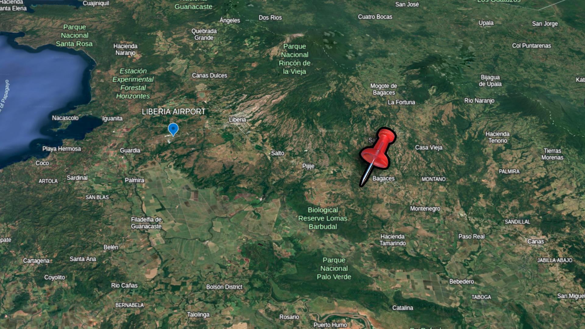
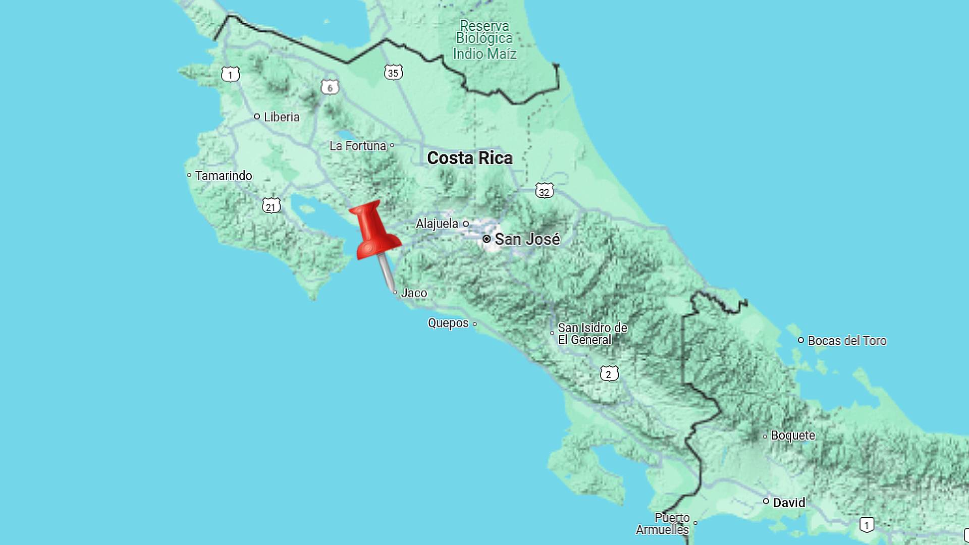
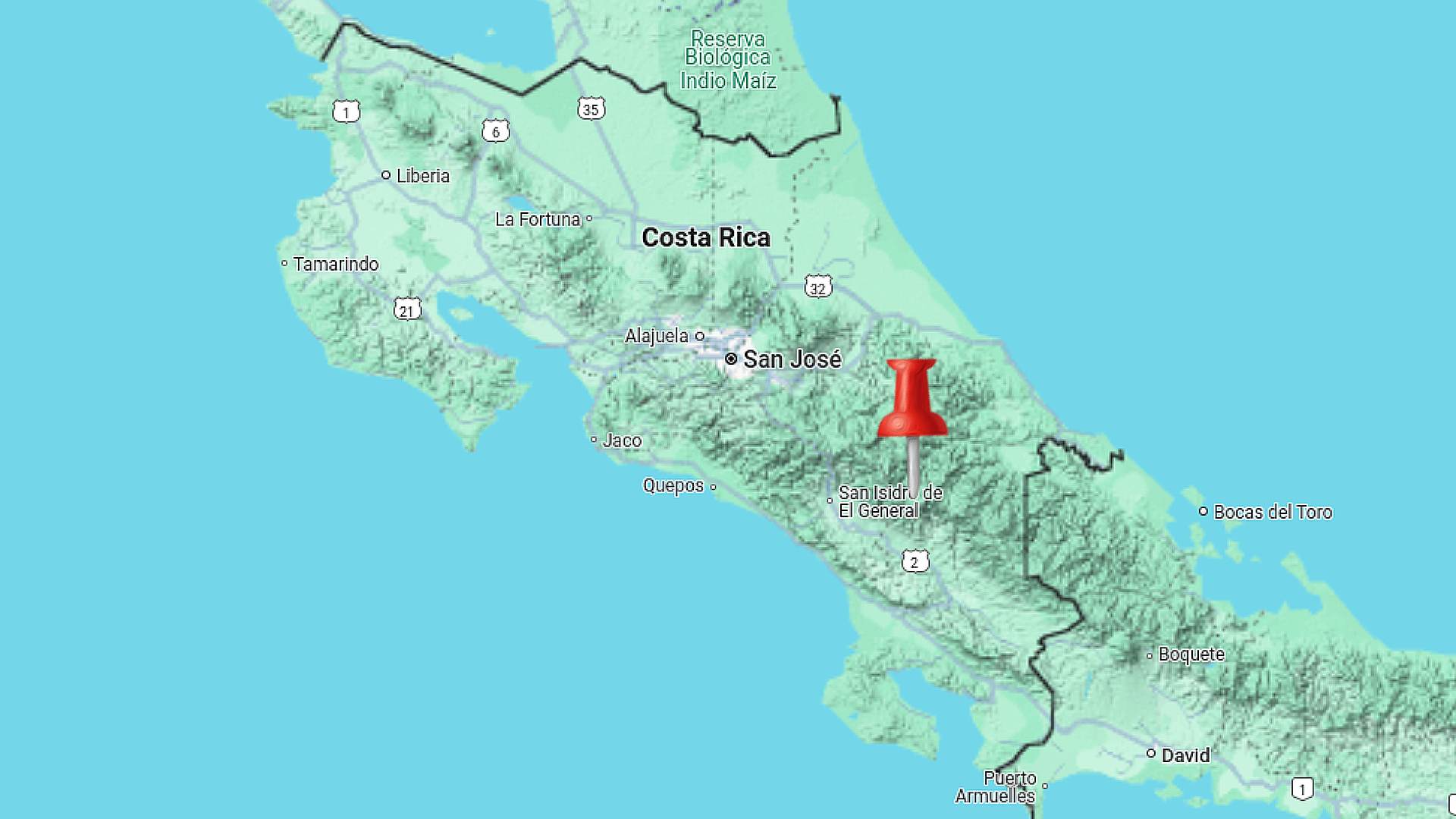
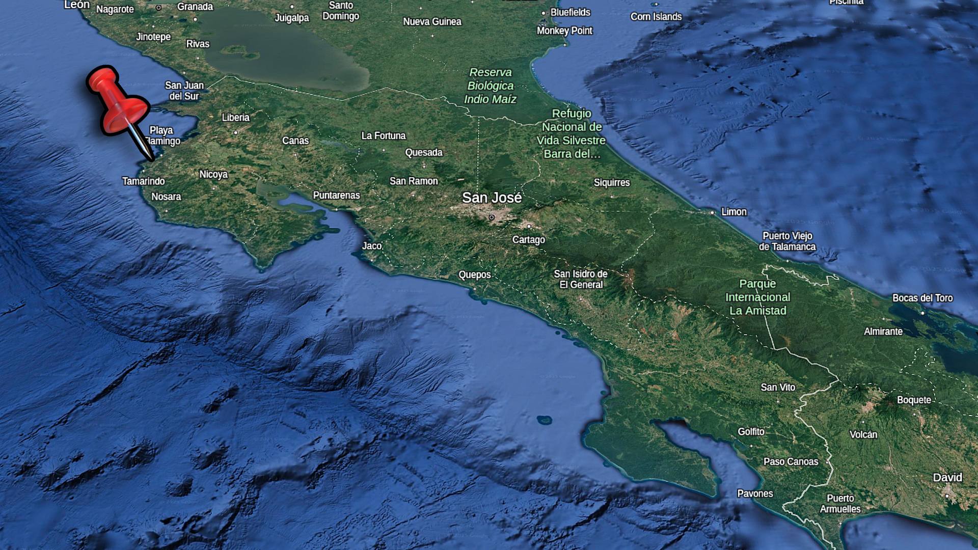
    Locations of Llanos del Cortes waterfall in Guanacaste Province, Costa Rica

    Getting There

    From Liberia International Airport

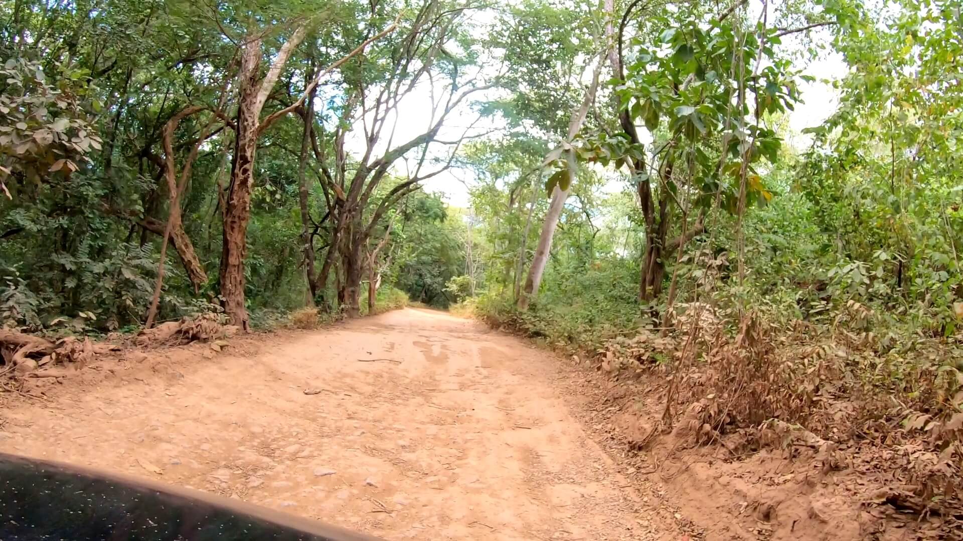
    The route will take you south on the Pan-American Highway, an excellent divided road with little traffic. You’ll head south for  about 20 minutes until you see signs for Bagaces. Look for the brown “Llanos del Cortes” sign – it can sneak up on you when driving at highway speeds.

    Watch for the entrance road on your right. Once you turn, a gravel road leads to the parking area. Any car can make this drive – just take the gravel section slowly. The whole trip from the airport takes about 30 minutes without traffic.

    Getting Supplies in Liberia

    Before heading to the waterfall, Liberia offers your last chance for full services. Several supermarkets near the highway sell snacks and drinks. You’ll also find plenty of restaurants and gas stations. Grab water and snacks here, as options are limited at the falls.

    The drive through Liberia town can get busy around rush hour. If you’re planning an afternoon visit, factor in extra time for city traffic, especially around the airport main intersection at the highway.

    Bagaces Town Nearby

    The small town of Bagaces sits just after the waterfall turnoff. You’ll find basic stores and sodas (local restaurants) here if needed. The town makes a good reference point – when you see signs for Bagaces, start watching for the waterfall entrance.

    While most visitors drive straight through, it’s worth knowing you can find basic supplies here if needed. You can also find some accommodations options in the area if you intend to stay the night.

    water shoes for exploring costa rica

    Pick up a pair of these awesome water shoes. I’ve been using them all over Costa Rica during my travels. They have vented soles so water drains right out the bottom! 

    Park Entrance and Facilities

    Entry Details

    The entrance booth sits at the start of the parking area. Current fees are $7 for foreign visitors and 2,000 colones for residents. Kids pay reduced rates. The park opens from 8 AM to 4 PM daily, with last entry at 3:30 PM. Staff give you wristbands when you pay.

    After paying, it’s a short drive to the main facilities area. The road remains well-maintained – any car can handle it. You’ll often see tour buses here, as it’s a popular stop for day trips from nearby beach towns.

    llanos del cortes entrance

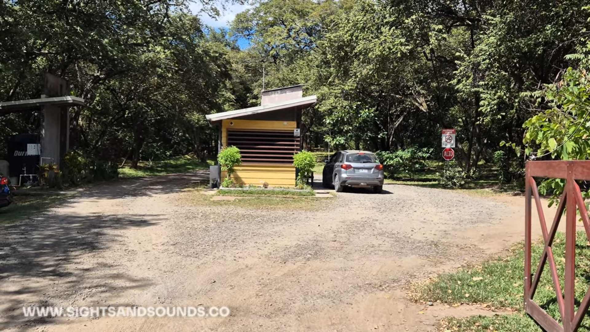
    The entrance where you’ll pay your fee and continue down the road to the parking area.

    Parking & Facilities

    The main lot offers plenty of spaces with some shade. Clean bathrooms, changing rooms, and showers make it easy to prepare for swimming. A covered sitting area provides views of the falls and space to store your things.

    Several local vendors set up near the path entrance, selling snacks, drinks, and local crafts. If you forgot anything or want souvenirs, bring cash for the vendors. They often have fresh coconuts and local snacks available.

    Trail to the Falls

    From the parking area, a well-built trail leads down to the waterfall. Concrete steps with handrails make the descent manageable for most visitors. The walk takes about 5-10 minutes, depending on your pace.

    The trail can get slippery when wet, so take your time. While not a difficult walk, those with mobility issues should note it’s a steady downhill that you’ll need to climb back up later.

    travel-backpack-costa-rica

    I use this sling backpack when I’m travelling in Costa Rica. It has a zipper lock to secure your stuff. I like the sling as I can flip the bag to the front for easy access.
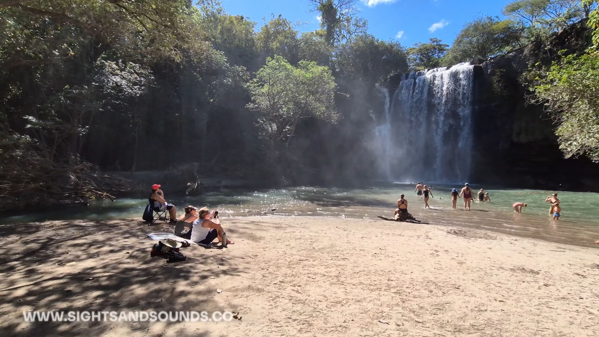
    The Waterfall

    Main Falls

    The wide cascade drops about 12 meters into a large pool, creating a constant mist that cools the air. A natural sandy beach area provides perfect spots for setting up towels and chairs. The falls face east, making afternoon a great time to swim in the shade of the falls.

    Unlike many waterfalls that are tucked into narrow canyons, these falls spread wide across the rock face. This creates multiple streams of water and different viewing angles. Several rocky outcrops near the base make good spots for photos or just watching the water flow.

    cortes waterfall costa rica

    The waterfall of Llanos del Cortes and small beach area where you can relax.

    Swimming Area

    The main pool offers different depths for all swimmers. Near the beach, shallow areas work well for kids and casual relaxing. Deeper sections near the falls attract stronger swimmers. The water stays refreshingly cool year-round, providing relief from Guanacaste’s heat.

    Most likely you’ll spend time between the beach area and swimming pool. The sandy bottom makes it easy to walk in, while large rocks along the sides provide spots to sit and enjoy the spray. Listen for the lifeguard’s whistle – they keep watch during operating hours and mark safe swimming zones.

    Hidden Pool Trail

    A less-used trail leads upstream to a secret pool above the main falls. This smaller pool is a spot away from the main area. The trail requires some basic scrambling over rocks, but the short walk rewards you with a peaceful swimming hole. Consider bringing some water shoes like the ones found in our Packing List.

    Few visitors know about this spot, so you’ll often have it to yourself. The pool here is smaller but deeper than the main area. Large rocks around the edges make perfect spots for jumping in, though always check depth first as water levels can change.

    Top of the Falls

    For those wanting more adventure, a trail leads to viewpoints above the waterfall. The climb needs careful attention – stick to marked paths and avoid wet rocks. From the top, you’ll see the whole valley and watch the water drop below.

    This trail isn’t maintained like the main path, so proper shoes and caution are needed. The view gives you a different perspective on the falls, and you can often spot wildlife in the surrounding trees. Time your visit for early morning if you want to explore up here – it gets hot quickly in Guanacaste sun.

    Llanos del Cortes offers the perfect mix of natural beauty and easy access. The falls provide a refreshing break when traveling between Liberia Airport and beach towns, or as a day trip from nearby areas. Most visitors spend 2-3 hours here, making it an easy addition to any Guanacaste itinerary.

    Remember to bring swimwear, towels, and water shoes if you have them. Early morning visits avoid both crowds and heat, though the falls stay refreshing all day. The combination of facilities and natural setting makes this one of the most family-friendly waterfalls in northern Costa Rica.

    Follow Us

    Be sure to Subscribe to the Youtube channel for more travel adventures from here in Costa Rica. We visit more waterfalls and rivers, as well as other attractions.

    LLANOS DEL CORTES FAQ

    Q: How much time should you plan here?

    A: 2-3 hours typical visit. Factor in swimming time and drying off. Morning visits best for photographs and fewer people.

    Q: What should you bring?

    A: Swimwear, towels, water shoes helpful, change of clothes, water, snacks, cash for entry and vendors. Camera good for photos.

    Q: Is it safe for kids?

    A: Yes, sandy beach area good for families. Lifeguard on duty. Shallow areas for kids. Watch them on steps down to falls.

    Q: What’s the best time to visit?

    A: Early morning best for photos and fewer people. Avoid midday heat. Last entry 3:30 PM. Check road conditions in rainy season.

    Q: How’s the access road?

    A: Well maintained gravel. Any car can make it. Drive slowly. Clear signs from highway. Parking at falls.

    Q: What facilities exist?

    A: Changing rooms, bathrooms, showers. Covered rest areas. Local vendors sell snacks and crafts. Lifeguard during operating hours.

    Q: How difficult is the trail?

    A: 5-10 minute walk down steps. Handrails available. Can be slippery when wet. Moderate climb back up. Some benches for resting.


  • Top Hiking Trails In Costa Rica

    Top Hiking Trails In Costa Rica

    Hiking in Costa Rica means watching the landscape change as you move through different elevations. Each altitude brings its own climate, creating pockets where specific plants and animals have made their homes. The southern Pacific region shows this off well, with trails running from beach level up into the high mountain passes.

    The microclimates here shape how you hike. Early starts help with coastal heat, while mountain trails need planning around afternoon clouds. Weather patterns change fast with elevation – you might need sunscreen and a rain jacket in the same backpack. Wildlife adapts to these changes too, with different birds and animals active at each level.

    These elevation shifts mean you’ll see something different on every hike. Beach trails have their morning monkey troops and macaw flocks. Mid-elevation paths wind through dense forest where oaks and wild avocados grow. The highest trails break through the treeline into open air where winds sweep across mountain peaks. Each trail tells its own story about how Costa Rica’s mountains meet the sea.

    trail shoes for costa rica

    I use these versatile trail runners on my hikes in Costa Rica. The aggressive grip tackles steep terrain while maintaining comfort for long days on mountain paths.

    El Miro: Jaco’s Hidden Viewpoint Trail

    jaco hike

    The El Miro trail starts at the south end of Jaco beach, climbing steeply through forest to a dramatic clifftop viewpoint. From here, the entire curve of Jaco Bay stretches north, while the coastline south towards Playa Hermosa disappears into the distance. The morning light shows surfers catching waves below, while late afternoon brings spectacular sunsets.

    Getting to the trailhead takes just minutes from central Jaco. Park near the south beach access, where a marked path leads into the trees. The climb takes 30-45 minutes, with some rope-assisted sections on the steeper parts. Early morning or late afternoon hikes avoid the midday heat.

    This short but rewarding hike offers a completely different perspective on Jaco. While most visitors stick to the beach, this elevated viewpoint reveals how the mountains meet the Pacific. Macaws often fly past at eye level, and the breeze at the top provides relief from the beach heat below.

    jaco hike location

    This hike is located at the south end of Jaco beach. You’ll cross the main highway and find the entrance across from Puddlefish.

    At a brisk pace the hike will take 20 – 30 minutes. You can take some stops to spot wildlife and enjoy the art, and spend about 1 hour on the trail.

    The trail is mostly moderate with a couple washed out areas that are rutted. Not recommended for those with mobility issues. Children can complete the hike under supervision.

    Early morning before the heat or 2-3 hours before sunset for best views. Sunrise offers clearest ocean views, while sunset provides dramatic lighting across Jaco bay.

    Water bottle, good walking shoes, camera for views. Phone for safety. Small backpack useful.

    Hike with others when possible. Tell someone your plans. Watch footing on steep sections. Bring water even for short hike. Return before dark if hiking for sunset.

    El Ascensión: Cloud Forest Peak Trail

    muerte

    The trail starts near the Pan-American Highway’s highest point, where clouds regularly sweep across the continental divide. This high-altitude hike offers rare access to Costa Rica’s páramo ecosystem, where stunted trees and unique vegetation adapt to life at 3,300 meters (11,000 feet).

    Hidden behind a small restaurant at the mountain pass, this trail climbs through cloud forest before emerging into open páramo landscape. The stark transition from dense forest to alpine-like conditions shows how elevation shapes Costa Rica’s diverse environments.

    The summit trail reveals both Caribbean and Pacific slopes on clear mornings, though clouds often roll in by mid-day. This ecosystem hosts unique highland species like the volcano junco and timberline wren, found nowhere else in Costa Rica.

    cerro de la muerte hike

    Located at KM 89 of the Pan-American Highway (Cerro de la Muerte). There’s a wide parking area at the roadside. Trailhead starts at the road with 3,300 meters of elevation.

    20 – 30 minutes to reach the summit at a steady pace. Plan for 1-2 hours total to enjoy views and return. Extra time needed for photography and bird watching.

    High altitude makes this moderate trail more challenging. Some steep/very vertical sections near top. Trail clearly marked but rocky in parts. Take time to adjust to elevation before starting.

    Early morning before clouds roll in (usually by 10 AM). Check weather as conditions change quickly. Clearest views December-April. Bring warm layers any time of year.

    Warm jacket and layers (temps can drop below 10°C), hiking shoes with good grip, water, snacks, camera. Rain gear recommended year-round. Hat and sunscreen despite cool temps.

    Watch for altitude symptoms. Start slow and stay hydrated. Tell someone your plans. Check weather before starting. Cell service available at trailhead. Return if weather turns bad.

    Los Gigantes: Valley View Trail

    gigantes

    High in the mountains above San Isidro del General, the Los Gigantes trail network winds through working coffee farms into pristine forest. The trails offer sweeping views across the Perez Zeledon valley, where on clear days you can see all the way to the Pacific Ocean.

    These paths started as coffee farm access routes but have evolved into maintained hiking trails. As you climb, the landscape shifts from sun-drenched coffee plants to cool forest shade. The elevation gain reveals how the valley’s patchwork of farms gives way to forest-covered peaks.

    Multiple viewpoints along the way showcase the region’s agricultural heritage. Morning fog often fills the valley below before burning off to reveal the expanse of San Isidro and the surrounding mountains. Local farmers still use parts of these trails, making this a unique mix of working land and natural space.

    gigantes screenshot

    Located in Perez Zeledon’s mountain region. Turn off the Inter-American Highway at San Isidro, follow signs toward Cerro Chirripo. Trail network starts near the community of Quebradas.

    Main loop takes 2-3 hours at steady pace. Multiple trail options ranging from 1-4 hours. Worth taking time at viewpoints and rest areas.

    Moderate with steady elevation gain. Well-maintained trails through farms and forest. Some steeper sections but regular rest spots available. Good for varied skill levels. You can drive to the top and walk across mostly level terrain to the giant trees.

    Early morning before heat and for best valley views. Clouds typically move in afternoon. Dry season (December-April) offers clearest visibility.

    Water, sun protection, light jacket for elevation, good walking shoes, camera for views, snacks. Cash for local stores if needed.

    Tell someone your plans. Stay on marked trails to respect farm boundaries. Watch weather as afternoon rains common. Carry enough water as sources limited.

    Subscribe For More

    These three hikes show different sides of Costa Rica’s southern Pacific region, each offering unique views and experiences. From beach town overlooks to high mountain passes, and agricultural valleys, the diversity of landscapes here creates endless hiking possibilities.

    Remember that conditions change throughout the year, so checking recent trail reports helps with planning. Each of these hikes works well as a half-day adventure, leaving time to explore the surrounding areas.

    Subscribe to the YouTube channel for more Costa Rica hiking videos, trail updates, and hidden spots across the southern Pacific region.

  • Playa Zapotillal

    Playa Zapotillal

    West of Playa Conchal, a rutted dirt road leads to one of Guanacaste’s less visited white sand beaches. Playa Zapotillal sits between rocky headlands, offering clear water swimming and hiking trails with incredible coastal views.

    The beach combines a wide sandy area perfect for relaxing with natural features to explore. At low tide, you can check out caves in the rock formations, while a short trail leads to viewpoints overlooking neighboring beaches and the blue Pacific waters below.

    Unlike busy Playa Conchal nearby, Zapotillal’s harder access keeps visitor numbers lower. The 4×4 road naturally limits traffic, though determined drivers in regular cars sometimes make the journey slowly. A parking attendant watches vehicles, and basic facilities exist for day visits.

    map of costa rica with playa zapotillal

    Map of Costa Rica, showing the location of Playa Zapotillal near Playa Flamingo.

    How To Get There

    From Matapalo Town

    Matapalo serves as your last stop for supplies before heading to the beach. This small town sits between Tamarindo and Playas del Coco, making it a good reference point. Several small stores and sodas offer chances to grab water and snacks.

    The drive from town starts on maintained gravel roads. During dry season (December-April), dust kicks up easily, so keep distance between vehicles. Green season might need more careful driving, but the main road stays passable.

    Key Junction Points

    After several minutes on the main gravel road, you’ll reach an important junction marked by Hotel Condor Lodge and Villas La Paz. These properties offer views over Playa Conchal and help mark your turn. If heading to Conchal, you’d continue right, but for Zapotillal, turn left.

    This intersection serves as the decision point – the easier road to Conchal or the adventurous route to Zapotillal. Several flags and hotel signs mark the spot, making it easier to find.

    Final Approach

    About 1 kilometer after the junction, look for a gap in a gate – this marks the turn toward Zapotillal. The road condition changes significantly here, with deep ruts and rough sections requiring careful driving.

    While some regular cars attempt this section, high clearance and 4×4 make the journey much easier. Take your time on this stretch, watching for oncoming vehicles as the road narrows in sections. The rough drive helps keep the beach quieter than nearby spots.

    road to zapotillal

    The road to this beach can be a little rough.

    water shoes for exploring costa rica

    Pick up a pair of these awesome water shoes. I’ve been using them all over Costa Rica during my travels. They have vented soles so water drains right out the bottom! 

    The Beach

    Swimming & Sand

    The white sand beach curves between rocky points, creating a protected swimming area. Unlike some nearby beaches, Zapotillal’s waters stay relatively calm near shore, making it good for families. The wide beach offers plenty of space for setting up, even during high tide.

    Several shady spots along the beach edge provide relief from the sun. The clear waters make it perfect for spotting marine life – sea turtles sometimes appear offshore, and the rocky points attract fish.

    Hidden Caves & Tide Pools

    At low tide, you can explore caves in the western rocky point. These natural formations create interesting photo opportunities and exploring spots. Always check tide charts before venturing to the caves, as high tide cuts off access.

    Small tide pools form among the rocks during low tide. These protected spots offer glimpses of small fish and marine life. The beach’s natural features give kids plenty to discover.

    Beach Activities

    Pack a cooler and plan to spend the day, as the journey here is worth taking time to enjoy. The beach’s position facing west makes it perfect for sunset viewing. During low tide, you can walk far along the beach, exploring different swimming spots.

    The small river mouth creates a peaceful spot to cool off, especially for kids. You’ll often see small fish in the clear water here. The beach’s natural curves create different areas to find your own space.

    playa zapotillal beachtrail shoes for costa rica

    I use these versatile trail runners on my hikes in Costa Rica. The aggressive grip tackles steep terrain while maintaining comfort for long days on mountain paths.

    The Viewpoint Hike

    Getting Started

    The hiking trail begins at the western end of the beach, marked by a natural path heading up the headland. A wire rope helps with the initial climb, making it manageable for most visitors. The first section takes about 10 minutes, leading to an impressive overlook of Zapotillal beach below.

    Watch your footing on the initial climb as the path can be dusty in dry season. Early morning or late afternoon provides better hiking conditions, avoiding the strongest sun. Bring water and wear good shoes, as flip-flops aren’t ideal for the terrain.

    Upper Trail Section

    After the first viewpoint, the trail continues along a wider path sometimes used by ATV tours. This section offers easier walking, with several natural platforms for taking in the views. You’ll find spots where you can see both north and south along the coastline.

    The path winds around the headland, revealing different angles of the coastline. Each turn brings new perspectives of the rocky shore below and neighboring beaches in the distance. On clear days, you can spot multiple beach coves stretching toward Playa Conchal.

    Summit Views

    The final lookout point rewards hikers with panoramic ocean views. From here, you can see the entire sweep of Zapotillal beach and several hidden coves to the south. The dramatic rocky coastline below shows why this area remains less developed than nearby beaches.

    This vantage point provides perfect photo opportunities, especially in morning light when visibility is best. The whole hike takes about 30 minutes round trip, not counting time spent enjoying the views. Some visitors bring snacks to enjoy at the top while watching for marine life in the clear waters below.

    playa nombre de jesus

    The views at the top of the mountains is incredible, you can see surrounding beaches.

    Nearby City: Liberia

    Getting There

    Liberia sits about 90 minutes from Playa Zapotillal. Daniel Oduber International Airport serves the region, making Liberia your likely arrival point. The city offers last-chance shopping and services before heading to beach areas.

    City Services

    Liberia provides all major amenities: Large supermarkets (Walmart, MaxiPali), Medical facilities including private hospitals, Banks with ATMs, Car rentals, and Hardware stores. Stock up here before heading to beach towns, as prices typically run lower than coastal areas.

    Shopping & Supplies Several shopping centers offer everything needed for beach trips:

    • Plaza Santa Rosa (major stores and restaurants)
    • Plaza Commercial Liberia (banks and shops)
    • Central market for fresh produce
    • Multiple gas stations along main highway

    Transportation Hub

    Liberia serves as a major transport connection:

    • International airport with regular flights
    • Bus terminal linking to beach towns
    • Major highways in all directions
    • Rental car offices near airport
    • Multiple taxi services

    Follow Us!

    Be sure to Subscribe to our Youtube Channel, and leave a comment with your thoughts about this location or request a video in other cool destinations around Costa Rica.

    Playa Zapotillal FAQ: Hidden Beach Guide

    Q: How do you get to Playa Zapotillal?
    A: Access through Matapalo town. Take gravel road to junction near Hotel Condor Lodge, then rougher road southwest. Look for gap in gate. 4×4 recommended for final section. Parking attendant at beach.

    Q: What makes this beach special?
    A: White sand beach with fewer visitors than nearby Conchal. Clear water swimming. Cave exploring at low tide. Hiking trail to viewpoints. Natural shade spots available.

    Q: Is 4×4 really needed?
    A: Highly recommended for final approach. Regular cars can make it slowly in dry season but risk bottoming out. Last section very rutted. Better access with higher clearance.

    Q: What facilities exist?
    A: Basic parking area with attendant. No restaurants or bathrooms. Bring supplies from Matapalo town. Some shade along beach. Bring everything needed for the day.

    Q: What activities are possible?
    A: Swimming in protected bay. Cave exploring at low tide. Hiking to viewpoints. Beach walking. Tide pool exploring. Sunset viewing. Marine life spotting.

    Q: When’s best time to visit?
    A: Early morning or late afternoon best light. Check tide charts for cave access. Less busy weekdays. Dry season (December-April) easiest driving.

    Q: What should you bring?
    A: Water and food for the day. Beach gear and sun protection. Good shoes if hiking. Cash for parking. Camera for views. Basic supplies as no services at beach.


  • El Miro: Hike To Jaco Beach View

    El Miro: Hike To Jaco Beach View

    El Miro is located in the tourist town of Jaco, Costa Rica. It’s only at the top of a very long trail that will take you up the side of a mountain. The views along the way, and all the way at the top, are amazing and well worth the journey.

    Finding The Trail

    You will locate the entrance to the trail at approximately the corner of Calle Madrigal/Costenera Sur. On your map you will find PuddleFish Brewery at the corner. There is on street parking on Calle Madrigal, as well as some limited parking on the west side of the main road.

    Costanera Sur is a very busy road, which is the main corridor along the Pacific Coast. Be very careful when crossing, especially with children, as motorists and trucks will be coming off a hill from the south. 

    You’ll first find a juice stand at the bottom, which has limited hours but amazing smoothies and fresh juices. If you decide to grab a drink before your hike, there are garbage cans along the trail for disposal.

    On The Way Up

    Once you start heading up the trail, you’ll first pass by building on the left. This building is called Villa Mariposa, it’s orange and hard to miss. Continue along a little farther and there are some winding trails with great views of the trees and hill to your sides. You’ll eventually reach a wide location on the path with an opening to the trees in the valley. This is where you’ll have an easy time seeing monkeys if there around at that day and time. 

    Another hundred meters or so up the hill, and you’ll reach a lookout point. This location has some seating areas to rest, and will afford you a really great view of Jaco and the beach below.

    Continuing on, there’s amazing inscribed paintings on the retaining wall. This part of the trail becomes a bit steeper, so be sure to have water and some snacks. Depending on the amount of rain, the trail around this part may be slightly muddy or even flowing with water.

    You’ll reach a fork on the path, where if you continue you’ll be heading towards Playa Hermosa. If you decide to continue on foot to Playa Hermosa, you can expect a very long walk. The pathway runs for quite some distance, and will deliver you to a road which is very high above Playa Hermosa. If you plan on this walk – come prepared.

    If you continue a little farther up the hill you’ll reach El Miro.

    At The Top

    The path to El Miro is very distinguishable, you’ll see a fork in the path from the Hermosa branch, with another route heading steeply up volcanic rock. Head up this short run and it will level off quickly into El Miro.

    El Miro is a three story abandoned building with amazing views, cool graffiti and lots of great architecture. The rumor is that a local family was building it as a house, when one of them passed away. Thus, the project was abandoned while only beginning to take form. 

    The entire walks up the hill at a brisk pace is about 15 minutes. With kids or dogs, expect at least 30 minutes. There’s a local horse tour that also heads up the hill as well, you can find these horses on the beach at the bottom of Calle Madrigal.

    Follow Us

    Be sure to comment on YouTube with your own experience, tips or questions. Subscribe To Our Channel to get more videos of locations and destinations!

    El Miro Jaco FAQ: Viewpoint Hike Guide

    Q: Where is El Miro located?
    A: South end of Jaco beach. Look for trail entrance across from Puddlefish restaurant. Parking available near beach access point.

    Q: How long is the hike?
    A: 20-30 minutes up at steady pace. Total round trip 1-2 hours including viewing time. Steeper sections slow progress.

    Q: What’s the difficulty level?
    A: Moderate to challenging. Steep sections with ropes for assistance. Natural trail surface. Some eroded areas. Not recommended for mobility issues. Children can complete with supervision.

    Q: What will you see?
    A: Panoramic views of Jaco Bay. South coast visibility toward Playa Hermosa. North views along beach. Mountains meeting ocean. Good for wildlife spotting.

    Q: What should you bring?
    A: Water bottle essential. Good walking shoes. Camera for views. Hat recommended for sun. Phone for safety. Small backpack useful.

    Q: When’s best time to go?
    A: Early morning before heat. Two hours before sunset for best photos. Sunrise offers clear views. Avoid midday heat. Return before dark if hiking for sunset.

    Q: What about safety?
    A: Hike with others recommended. Tell someone your plans. Watch footing on steep sections. Bring enough water. Keep valuables minimal. Return before dark.