Tag: Accommodation

Lodging options throughout Costa Rica. From luxury resorts to eco-lodges and hostels. Features unique stays and practical recommendations.

  • Best Places To Stay In Costa Rica (2026)

    Best Places To Stay In Costa Rica (2026)

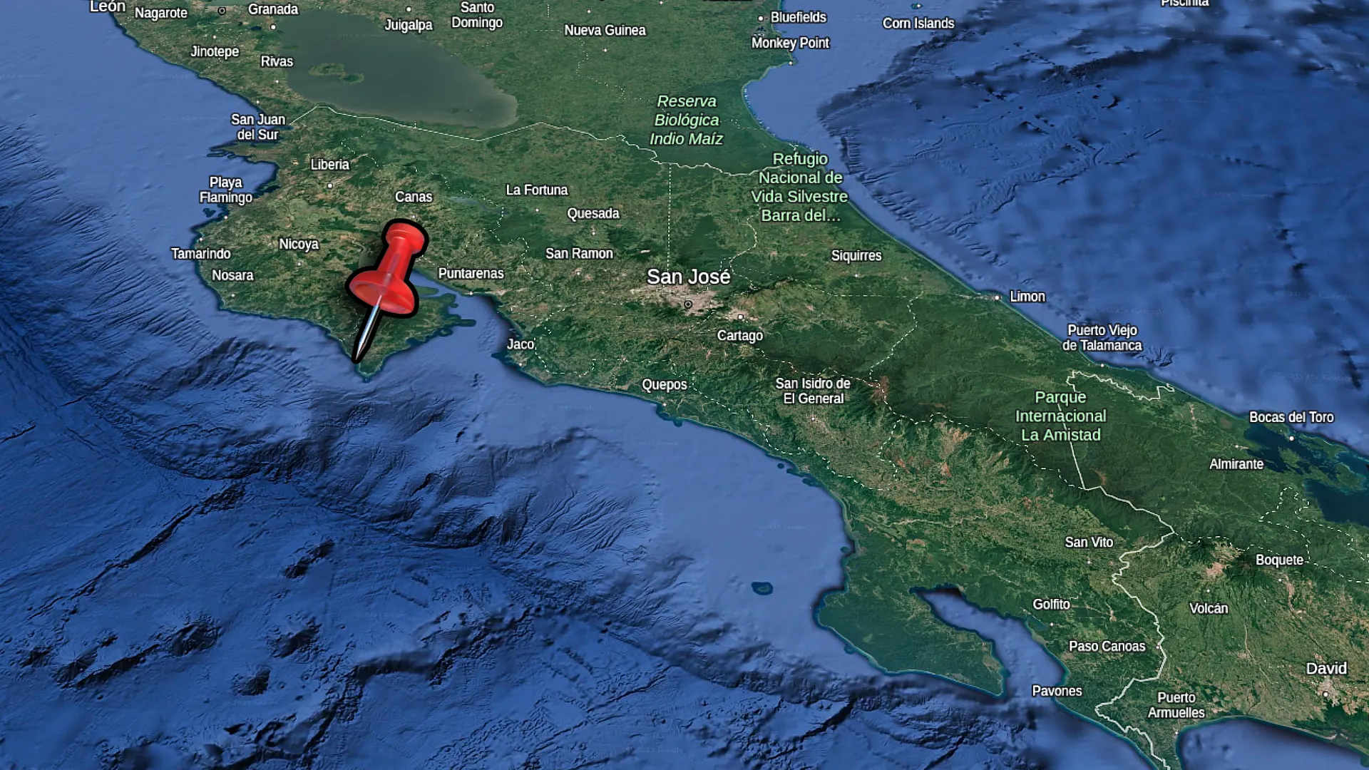
    Picking where to stay in Costa Rica can make or break your trip. The North Pacific coast feels completely different from the South. Beach towns have their own personalities. La Fortuna up in the mountains is nothing like the surf scene in Jaco. You need to match the location to what you actually want out of your vacation.

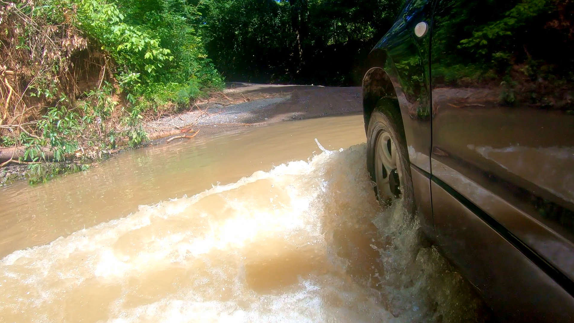
    I’ve driven all over Costa Rica filming these places for my YouTube channel. I stayed in condos in Playas del Coco. I walked the nightlife strip in Jaco. I dealt with the rough roads getting into Santa Teresa. I woke up early in La Fortuna hoping the clouds would clear off Arenal Volcano. These aren’t just places I researched online. I actually stayed there and figured out what works.

    This guide covers four different areas I know well. Each one serves a different type of traveler. I’ll break down the neighborhoods, tell you what it actually costs, and explain the logistics of getting there. By the end you’ll know exactly which area fits your trip.

    Table Of Contents

    Estimated Reading Time: 20 Minutes

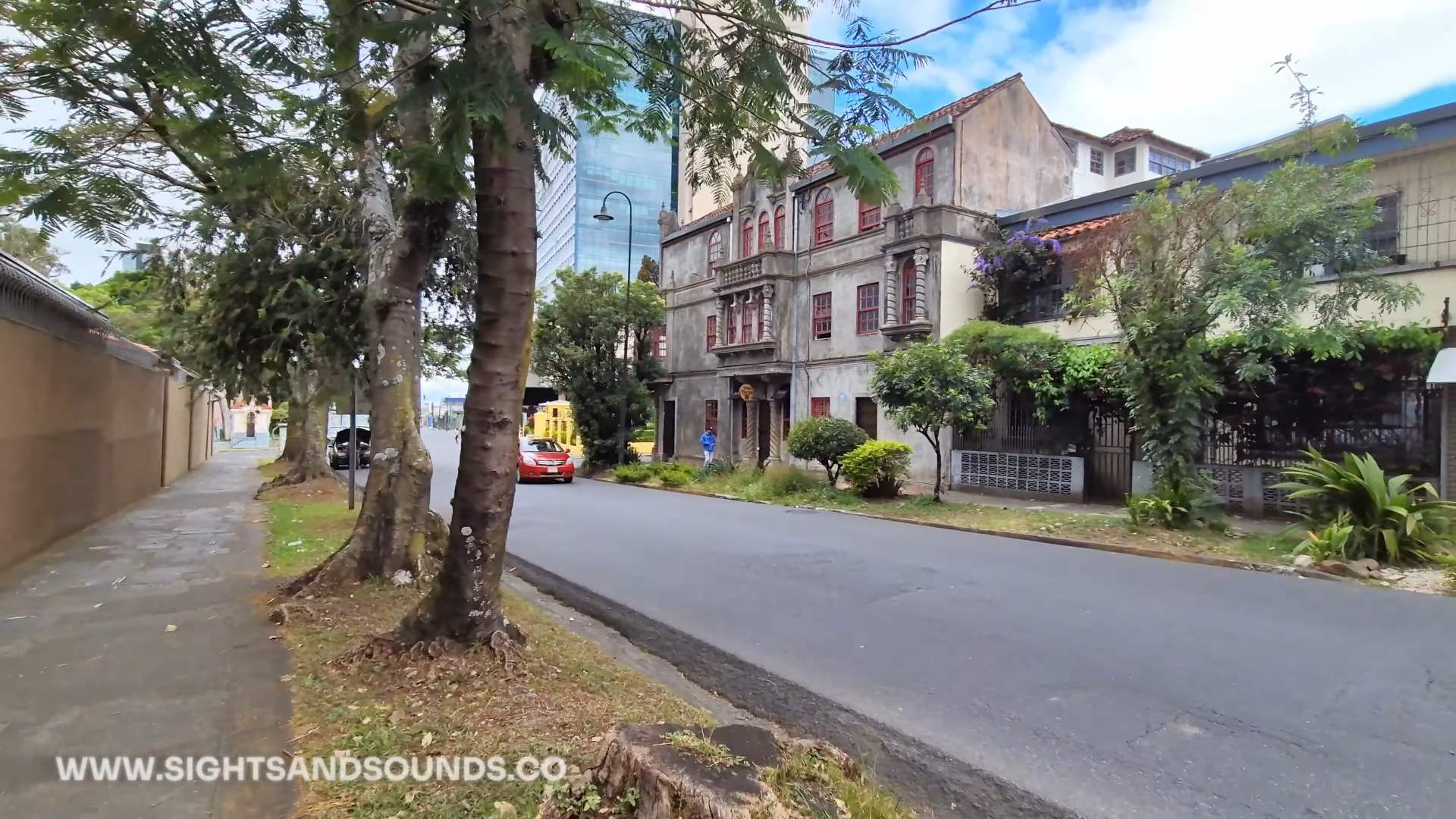
    Playas del Coco & Ocotal: Best for First-Timers

    Why This Area Works for First-Timers

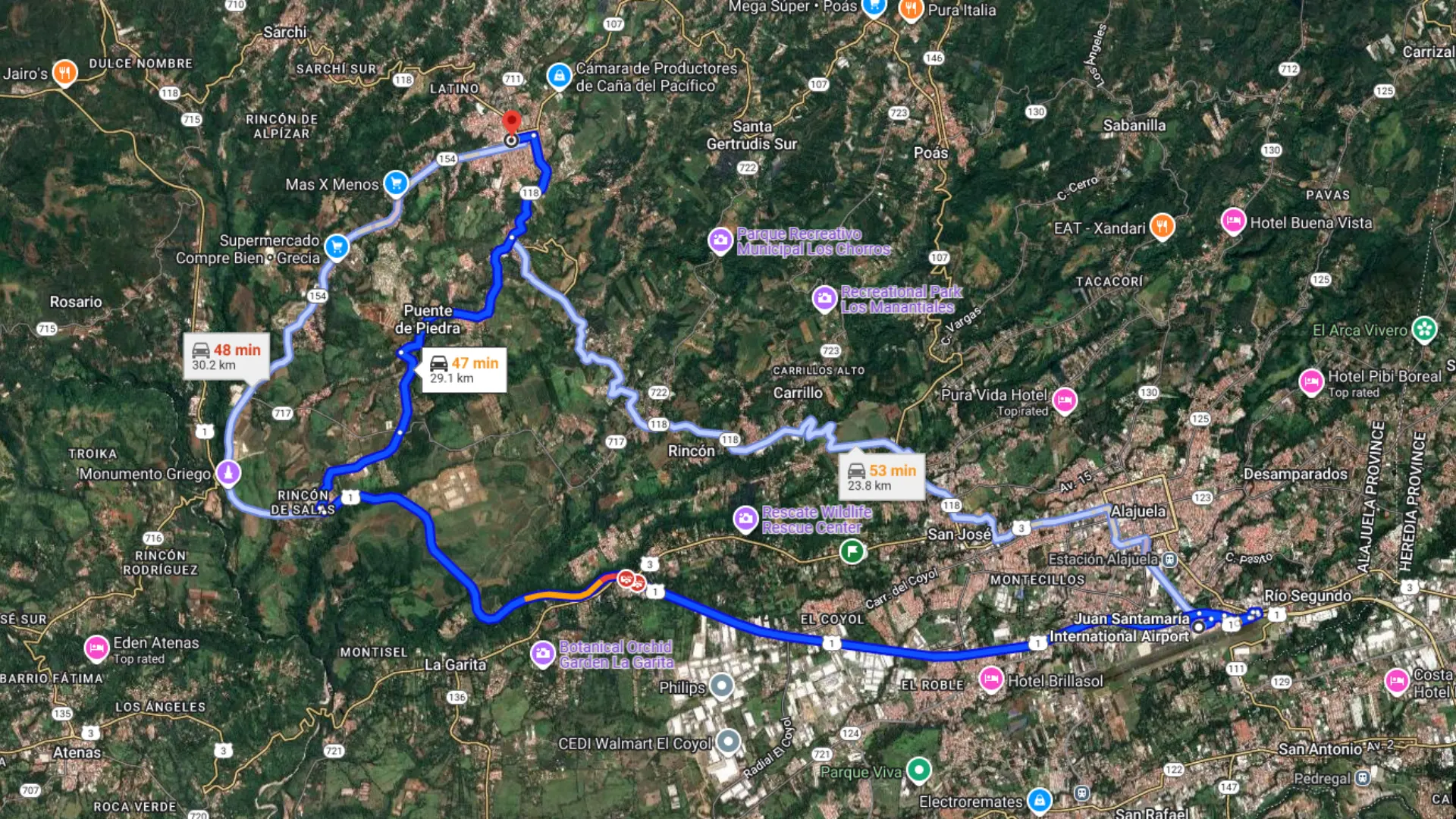
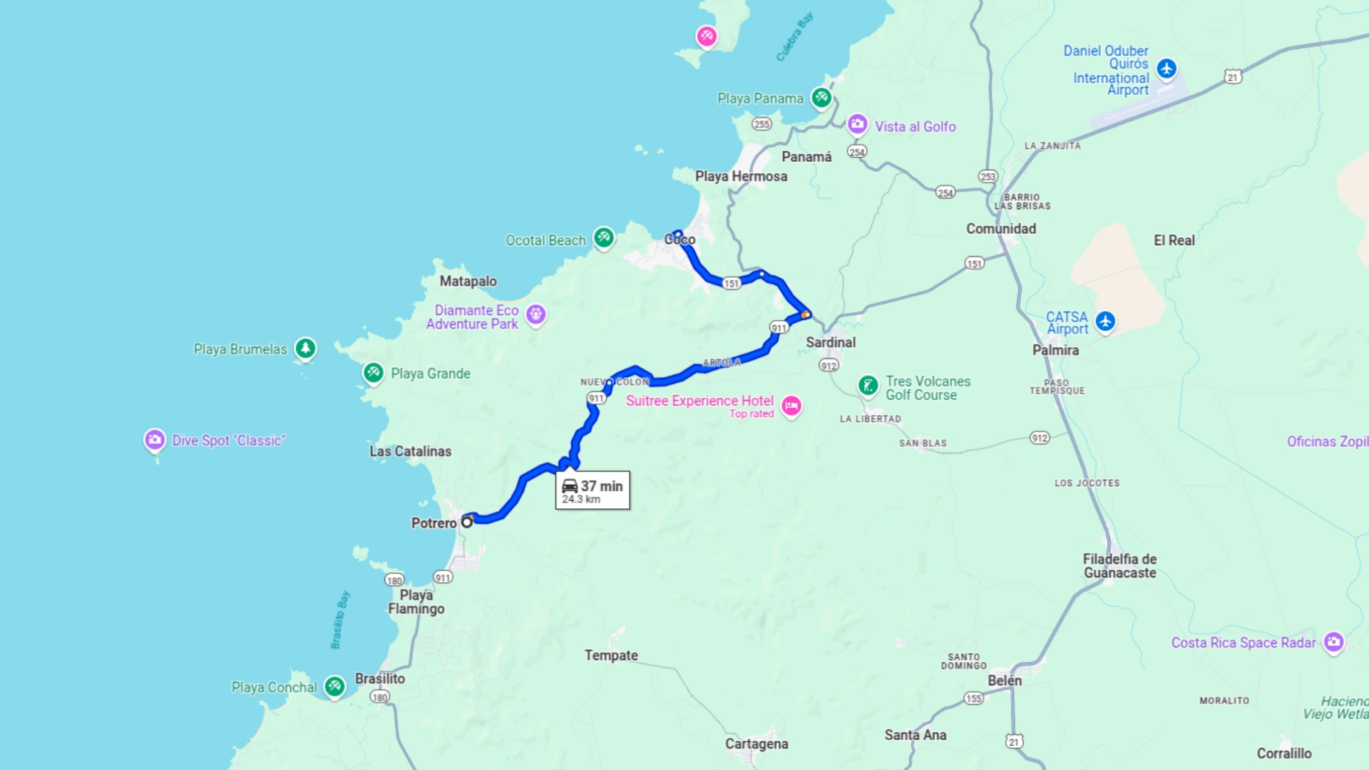
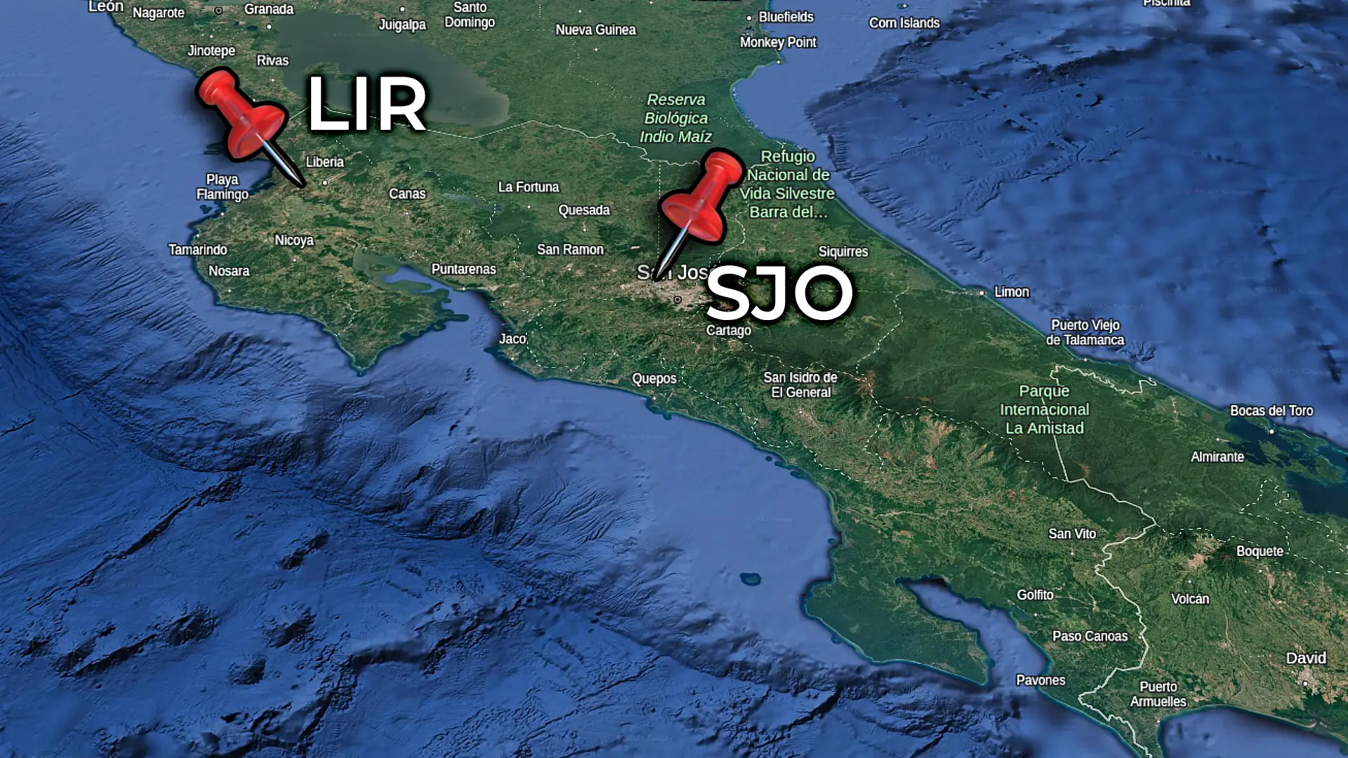
    Playas del Coco is just 30 minutes from Liberia International Airport on well paved roads. This is the closest real beach town to the airport. Not a resort complex. An actual Costa Rican town with supermarkets, banks and restaurants.

    The area gives you options. Playas del Coco has a variety of dining and nightlife options. Playa Ocotal is 10 minutes away with some of the best snorkeling and quieter beaches. You can stay in one spot and do both.

    If you’d like to read a comprensive guide to Playas del Coco, visit our blog post.

    Where to Stay: Neighborhood Breakdown

    Los Palmas (northern Coco) has cheaper condos close to the beach. Small commercial area with a supermarket, coffee shop, and restaurants. Quieter than downtown at night.

    Downtown Coco puts you in the middle of everything. Main beach strip, restaurants, park. Water isn’t as clear here but you can walk everywhere. Gets busy on weekends. Parking is tight.

    Pacifico is the gated development with higher prices. Auto Mercado is there as a higher end grocer. Pools and maintained grounds. They have a gym in the attached commercial plaza as well.

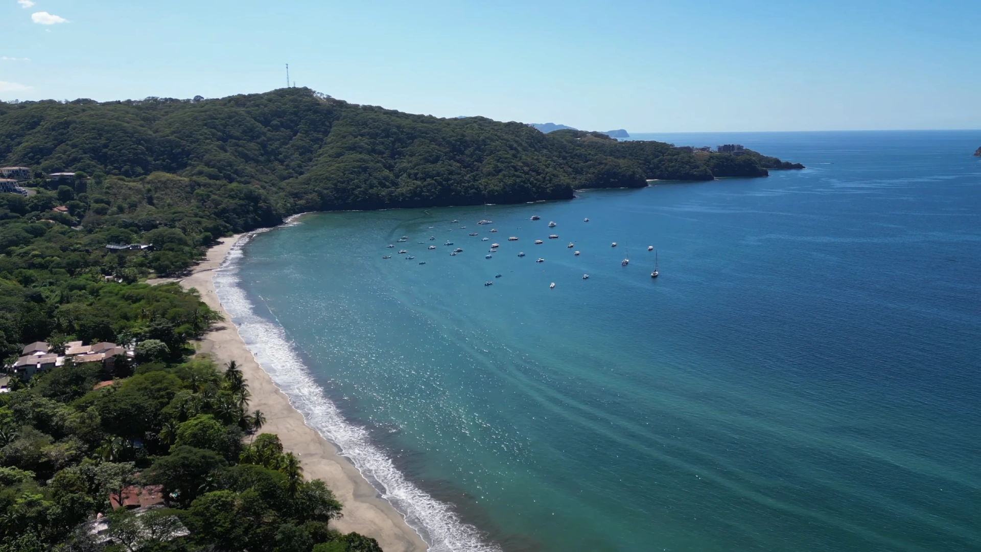
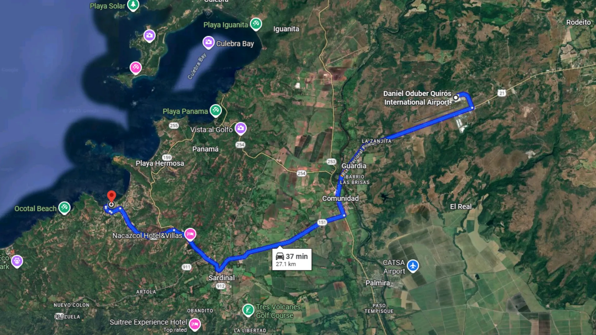
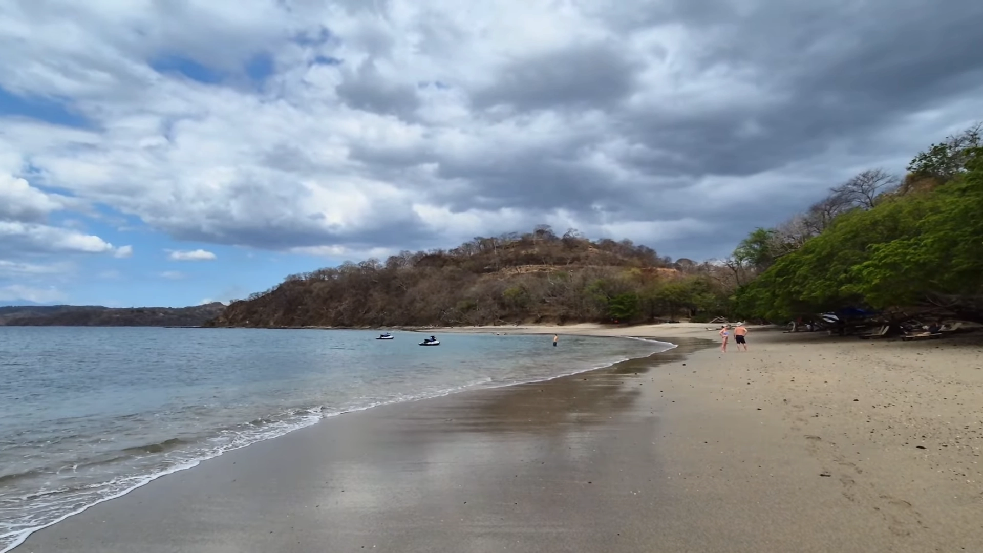
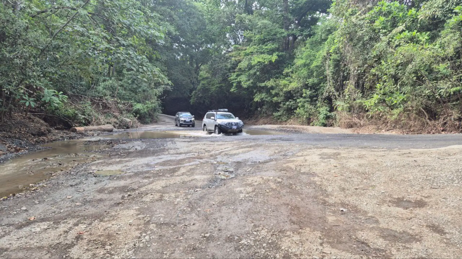
    Ocotal has black sand, crystal clear water, and excellent snorkeling on both ends. Rough road for the last couple kilometers. Dolce Vita and Serena Suites are the main condo options. Less crowded than Coco but a bit of a drive to get to. You can rent a golf car to go between Coco & Ocotal.

    Practical Details

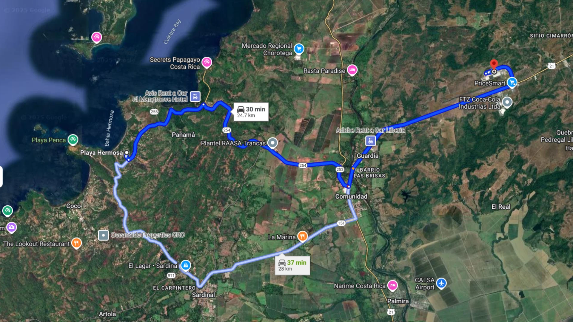
    The 30 minute drive from Liberia is straightforward until you hit the beach towns. Downtown Coco has paid parking and guys who watch your car for money. The road to Ocotal is mostly paved and a 5-10 minute drive from downtown Coco.

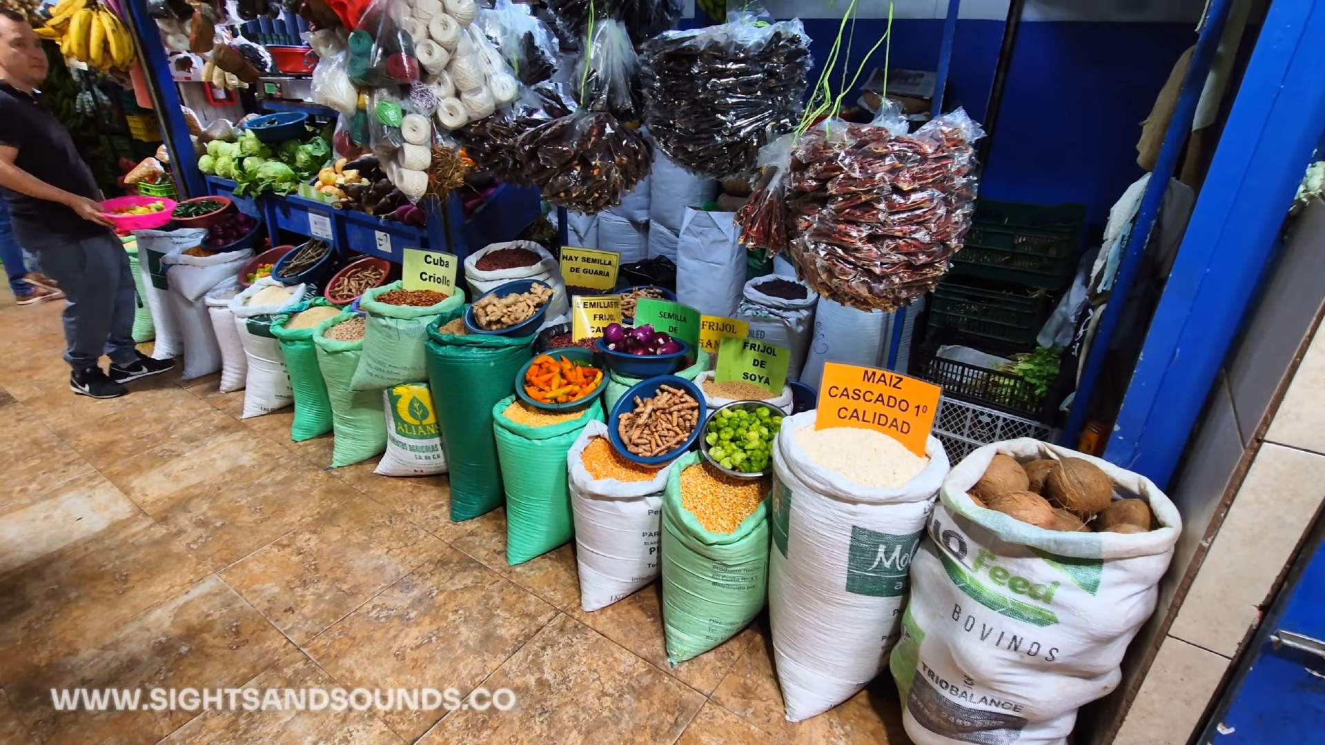
    For groceries I often go to Mega Super across from Pacifico. They have great selection and low prices. The Super Compro on the Ocotal road has cheaper prices as well. There’s a fish market on the road to Ocotal that sells fresh catches.

    Playa Hermosa is 10 minutes away. Tamarindo is an hour south. Both easy day trips if you want to compare beach scenes.

    Travel Tip: Bring a pair of water shoes when you’re exploring the beaches in Costa Rica. They let you keep your shoes on while you walk to the beach, in the water and around the tide pools.

    Jaco: Best for Nightlife & Surf

    Why Stay in Jaco

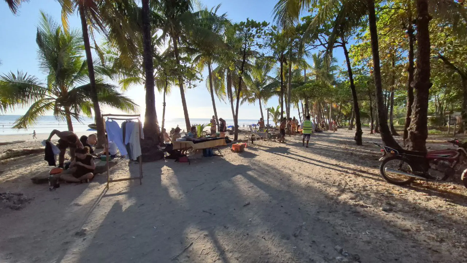
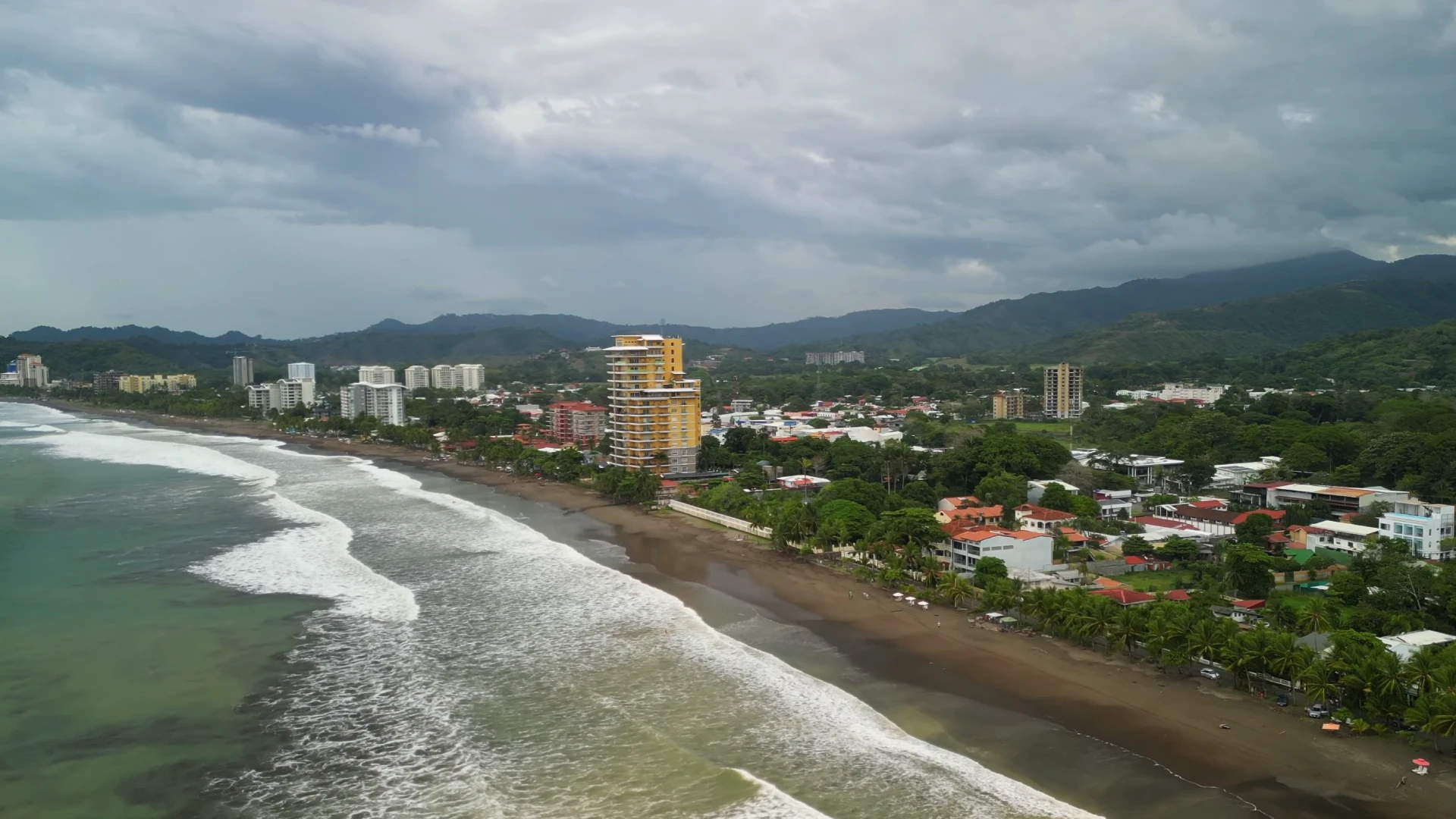
    Jaco has the most developed nightlife of any beach town in Costa Rica. More bars and restaurants per block than anywhere else I’ve walked. The town runs along one main strip parallel to the beach. Everything is walkable if you can handle the heat.

    The beach has year round surf. It’s close to San Jose at about 1.5 hours. If you’re flying into SJO instead of Liberia, this is your easiest Pacific beach option.

    Jaco is a great place for surfing and nightlife. If you’re traveling with kids, check out Best Places For Families blog post.

    The Jaco Experience

    I walked the nightlife strip on a Tuesday night around 10pm. Still pretty lively. Orange Pub and XTC are the well known drinking spots. There’s a casino downtown. Rolling Thunder Saloon had a band practicing when I walked by.

    The liquor store density is insane. You can’t walk more than a block without passing another one. Pizza Hut, KFC, Subway are all here if you need familiar food. Mega Super for groceries. There’s a Viniy convenience store at the main intersection downtown. It’s an easy stop for some basic groceries and things you need for the beach.

    The walk from one end of the strip to the other takes about 20 minutes at a casual pace. Beach access points run along the whole strip. Some of the beach access points have better parking options that are closer to the water.

    Jaco has a ladies of the evening scene. It’s just part of the town. You’ll get solicited walking around at night. The Cocal Casino is known for this. If that’s not your thing, just be aware it’s present.

    Where to Stay in Jaco

    I’ve stayed at the south end of Jaco as well. It’s quieter than downtown but still walkable to restaurants. The south end of the beach is also less crowded. Families with kids will appreciate the vibe and calmer waves at this end of the beach.

    Downtown puts you right in the action. Walking distance to everything. It can get loud at night from the bars. If you’re here for the nightlife scene, stay downtown. If you want to sleep, stay at one of the ends.

    What to Know

    It’s hot and humid in Jaco. I was sweating just walking around at night. Bring light clothing. The heat during the day would be much worse.

    Crowds pick up on weekends. Prices run higher than other beach towns because everything is more developed. You’re paying for the convenience and the scene.

    Security is fine if you’re aware. I walked around at night with camera gear and didn’t have issues. Just don’t be stupid about it. The police presence is visible downtown but there will still be unbecoming behavior.

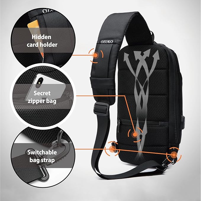
    Travel Tip: When I’m exploring bustling places like Jaco, I bring my lockable sling backpack. That way I know none of my valuables will wander away when I’m not looking!

    La Fortuna: Best for Adventure Base & Volcano Access

    Why Stay in La Fortuna

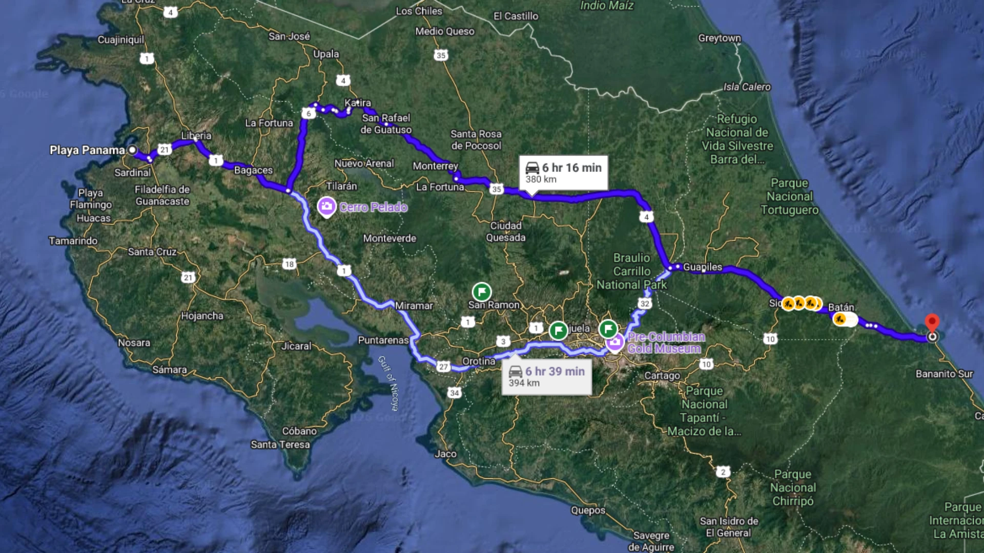
    La Fortuna is at the base of Arenal Volcano, about 3 hours from San Jose airport. This is the stopover point between the Pacific and Caribbean coasts. If you’re doing a coast-to-coast trip, you’ll probably spend a night here.

    The town exists because of the volcano and adventure tourism. Tour operators line every street. Hot springs are everywhere. The air feels fresh and cool compared to the beach. It’s a relief after the coastal humidity.

    Arenal Volcano views depend entirely on cloud cover. Most times I’ve been here, clouds hide the volcano. The volcano is best seen in the mornings before the clouds set in, so take a look when you first wake up.

    Landing at SJO Airport and heading to La Fortuna? Visit our blog post about that trip with some great stops along the way.

    Downtown La Fortuna

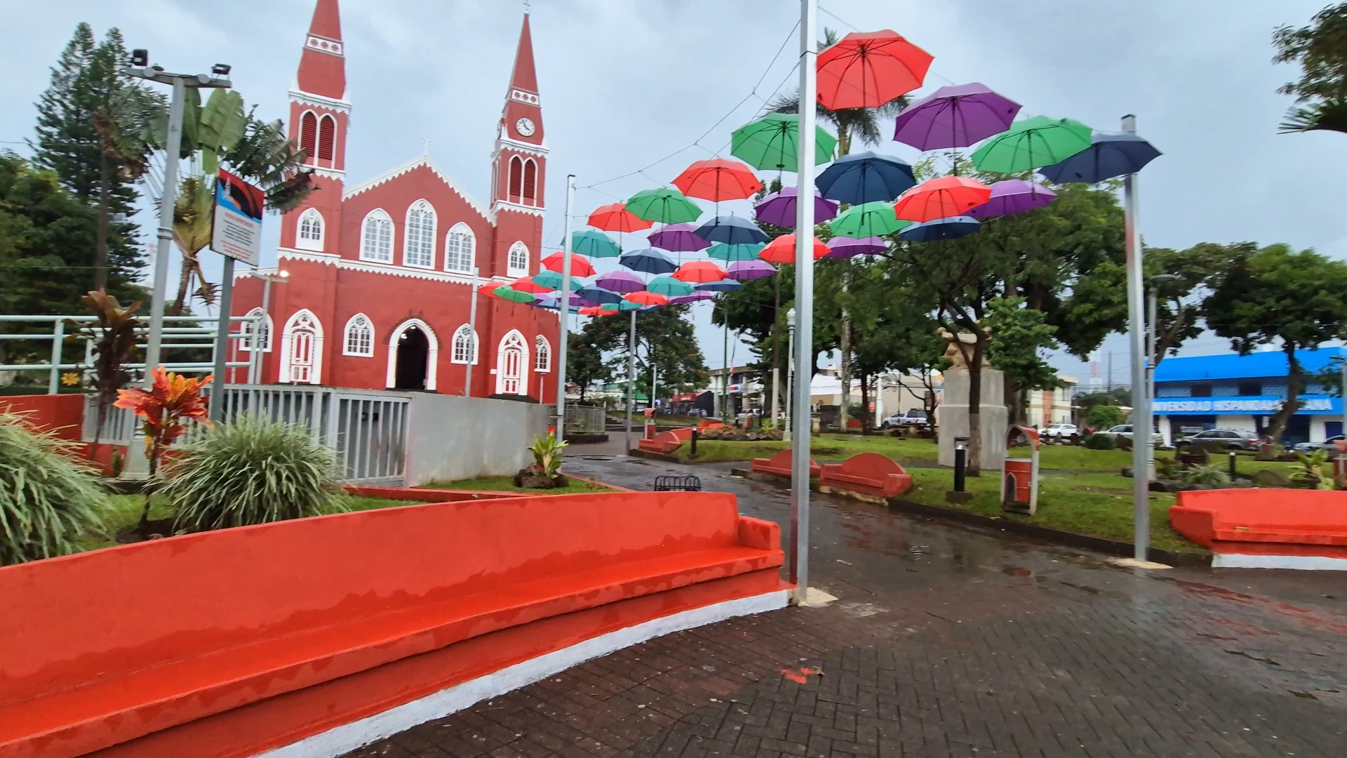
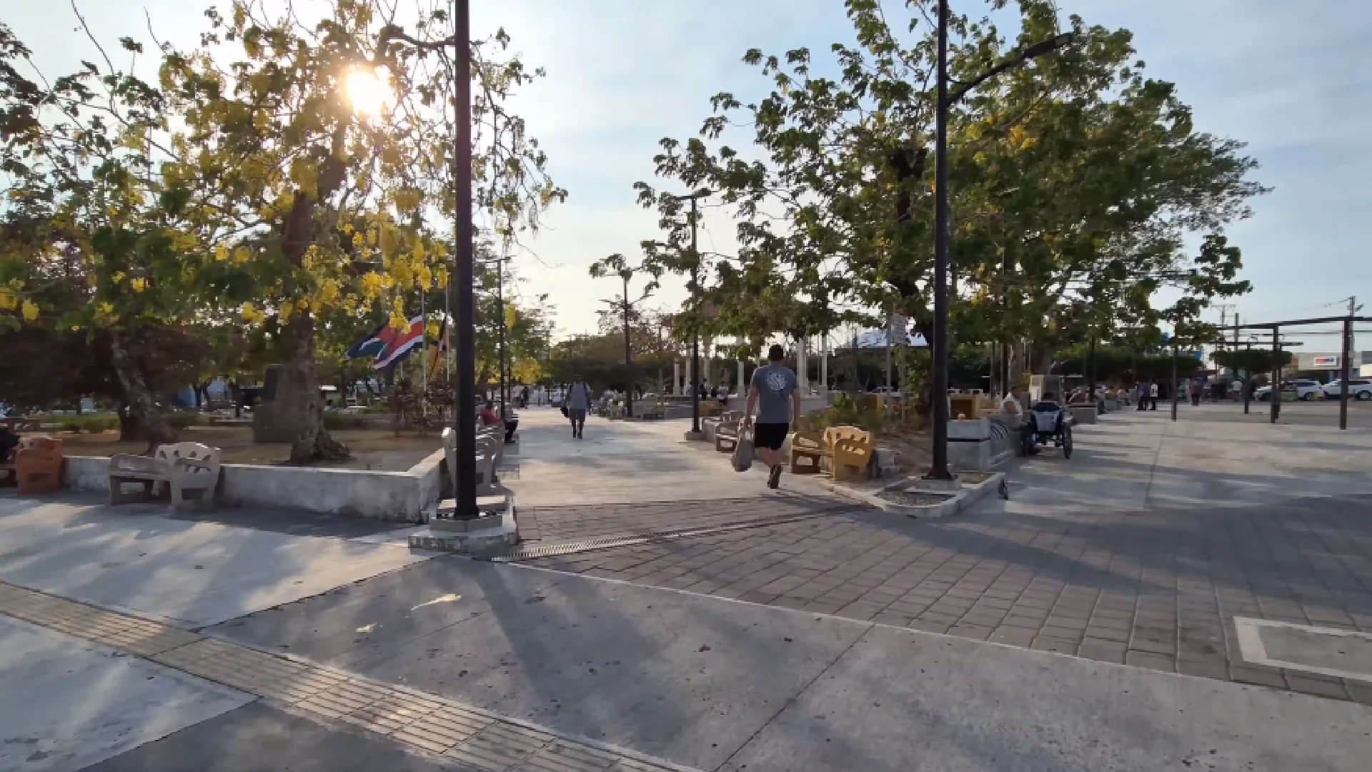
    The town is clean and well maintained. The central park has sitting areas, a big tree, and Christmas lights during December. Security guards patrol the park at night so families can enjoy it.

    Everything is walkable downtown. Restaurants, tour operators, the church, grocery stores. Shops stay open late because tourists come back from day tours and need to eat or book the next activity.

    There’s a few gyms right in the downtown square, which is great if you’re staying in a nearby hostel. You’ll also find a few large dollar style stores and grocery stores. The municipal bus station is a few streets over if you’re traveling by bus.

    Where to Stay

    When I visit La Fortuna I try to find hostels with private rooms. This gives the best bang for buck, as they usually have full kitchens. You’ll also find a lot of options on Airbnb on the outside of town. I found a nice 2 bedroom apartment about 3 minutes drive from downtown for a fair price.

    Downtown is my preference though, as it puts you walking distance to everything. Restaurants, tour booking, the park. You’ll hear some noise at night but it’s not crazy like Jaco.

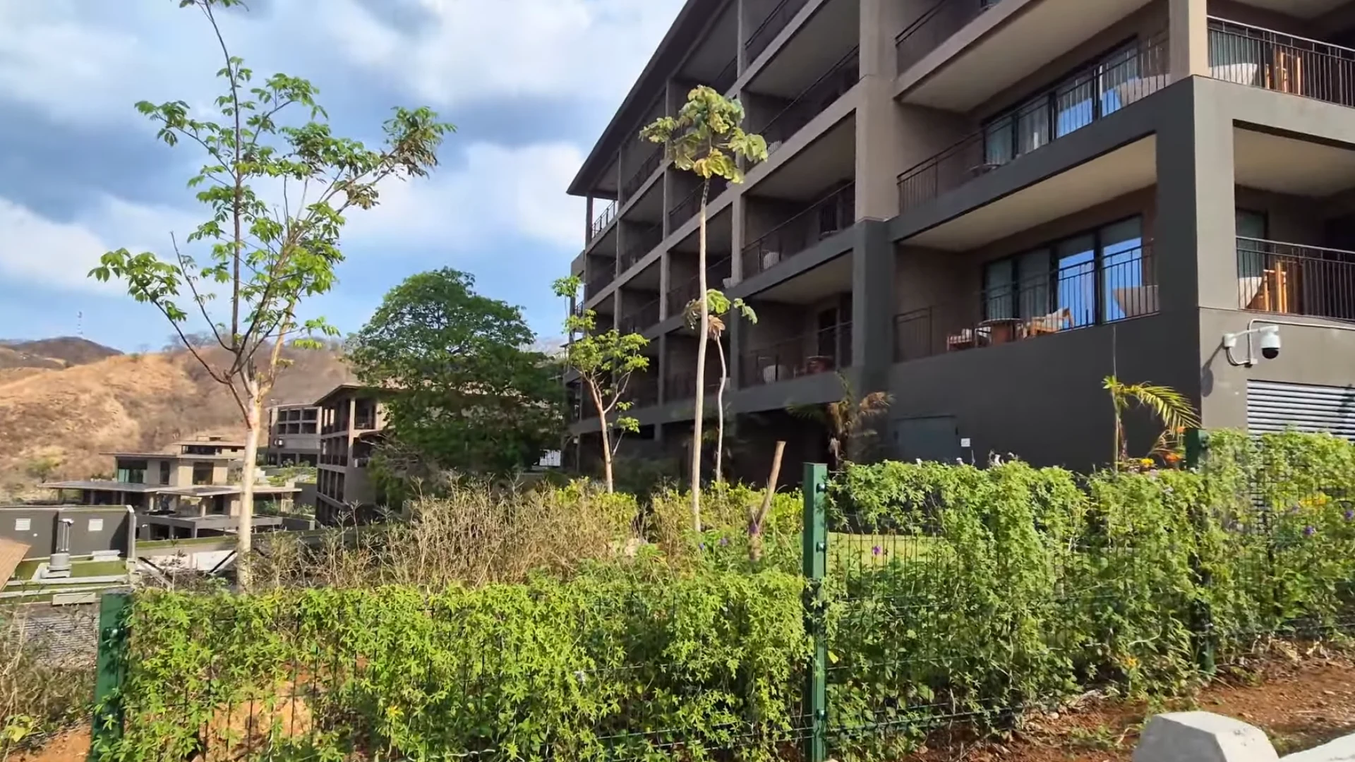
    The road heading toward the volcano has resort-style accommodations and hot springs. You’ll need to drive or take tours to get back to town. Trade-off is better views and direct hot spring access.

    What You Can Do

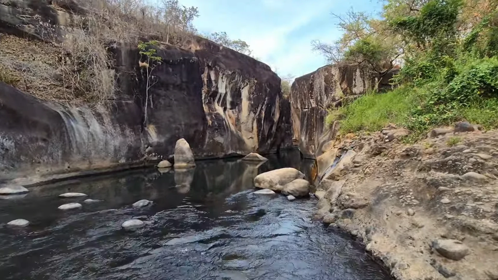
    Free hot springs are down the road toward the town of Nuevo Arenal. Check the Youtube video for a review and tour of that location. There’s a lot of paid hot springs as well. These are resort style with multiple pools and bars, and a higher price.

    Volcano hikes happen when weather permits. Hanging bridges, waterfall tours, all the standard adventure activities operate out of La Fortuna. You’ll have no trouble finding a tour operator to take you on these adventures.

    The town itself has a modest night scene. Restaurants, a few bars, nothing wild. Most people are exhausted from day tours anyway.

    Travel Tip: Don’t underestimate the amount of rain you can get in La Fortuna. It’s what keeps it so lush and green. Bring a high quality umbrella for your exploration.

    If these blog posts and videos help plan your Costa Rica vacation, please support our channel.

    Follow Us

    Keep up with our latest Costa Rica travel videos and guides by subscribing to our YouTube channel. We regularly post new content showing real conditions across different regions and seasons.

    Planning a trip to Costa Rica? Contact us — we help with itineraries, logistics, and finding the spots most tourists miss.

    Frequently Asked Questions

    Where should I stay in Costa Rica for the first time?

    Playas del Coco works best for first-timers. It’s 30 minutes from Liberia Airport on paved roads. You get a real Costa Rican town with supermarkets, restaurants, and nightlife instead of just a resort bubble. Ocotal is 10 minutes away for snorkeling. The infrastructure is solid and you can walk to most things downtown.

    What’s the best beach town near Liberia Airport?

    Playas del Coco is the closest real beach town at 30 minutes from the airport. The drive is straightforward on paved roads. You get actual town infrastructure with banks, grocery stores, and local restaurants. Downtown has nightlife and the beach. Los Palmas has cheaper condos. Ocotal is right next door for better snorkeling.

    Is La Fortuna worth staying overnight?

    Yes, especially if you’re doing a coast-to-coast trip. The town is 3 hours from San Jose and makes a good stopover. You need at least one night to do hot springs and volcano activities. The air is cooler than the beach, which is a relief. Downtown is walkable with good restaurants. Free hot springs are down the road toward the volcano.

    Is it safe to travel to Costa Rica right now?

    Costa Rica is generally safe for tourists. I’ve walked around Jaco at night with camera gear and had no issues. La Fortuna has security guards in the park at night. Downtown Coco has visible police presence. Standard safety rules apply. Don’t be stupid about it. Keep aware of your surroundings. Avoid sketchy areas that locals warn you about.

    What are the best beaches in Costa Rica?

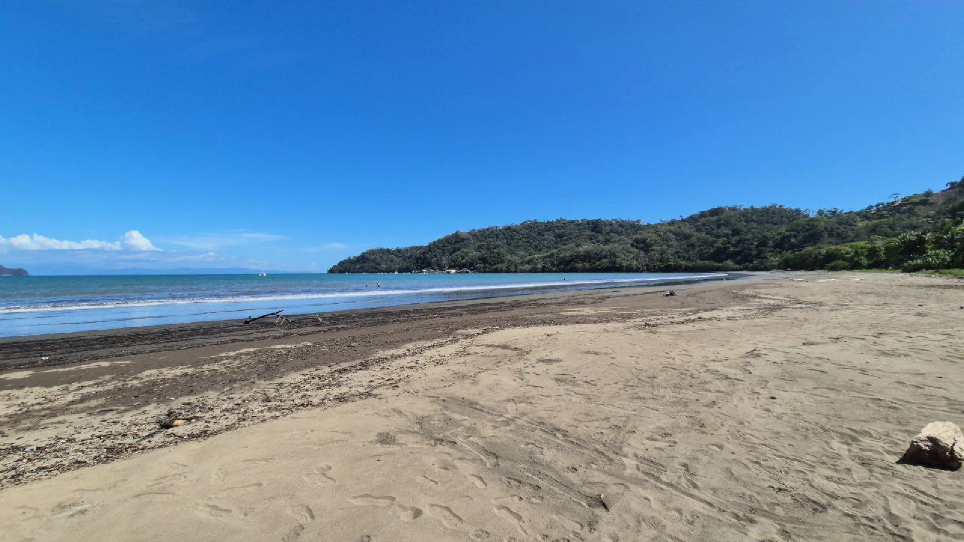
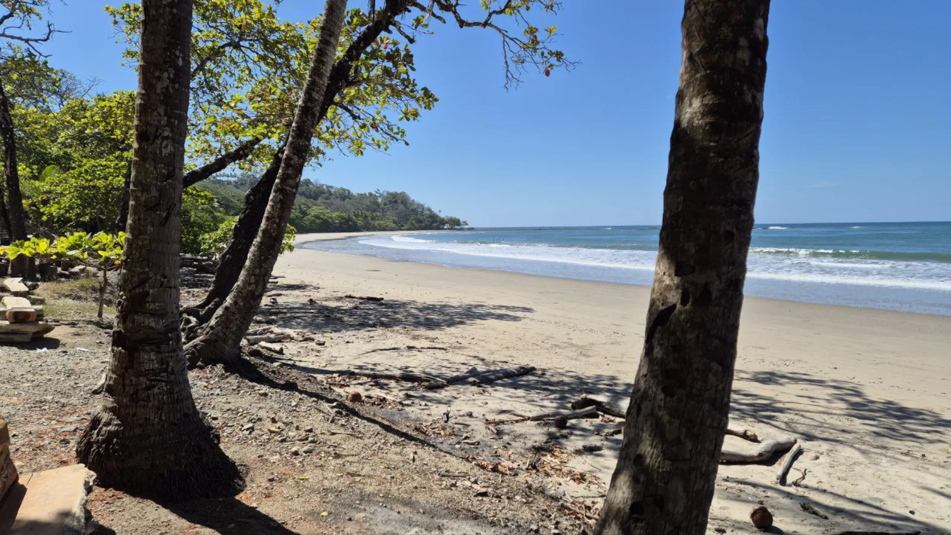
    Ocotal has crystal clear water and excellent snorkeling on both ends. Black sand beach, less crowded than most. Playas del Coco is good for convenience and walkability. Santa Teresa pulls the surf crowd with consistent waves. Jaco has year-round surf but the water isn’t as clear. Each beach serves different purposes. Ocotal for snorkeling, Coco for first-timers, Santa Teresa for surf culture, Jaco for nightlife.

    Do you need a passport to go to Costa Rica?

    Yes, you need a valid passport to enter Costa Rica. Your passport should be valid for at least six months beyond your planned departure date. US and Canadian citizens don’t need a visa for tourist visits up to 90 days. Immigration will ask how long you’re staying and where you’re going. Have a return ticket ready to show them.

    What’s the best time of year to visit Costa Rica?

    December through April is dry season on the Pacific coast. This is peak tourist season. Less rain, more crowds, higher prices. May through November is rainy season but it doesn’t rain all day. Mornings are usually clear. You get better prices and fewer tourists. The Caribbean side has different weather patterns with rain possible year-round.

    Should I stay in one place or move around Costa Rica?

    Depends on trip length. One week or less, pick one base and do day trips. Two weeks, split between beach and mountains works well. Playas del Coco for 4-5 days, then La Fortuna for 2-3 days, then another beach town. Moving around every 2 days gets exhausting. Give yourself at least 3 nights per location to settle in.

    Is Jaco safe for tourists?

    Jaco is safe if you’re aware. Police presence is visible downtown. I walked around at night with camera gear without issues. The ladies of the evening scene is present, especially around Cocal Casino. You’ll get solicited walking around. Just be smart about it. Don’t flash expensive stuff. The nightlife scene attracts some sketchy elements but most tourists have no problems.

  • Driving Guanacaste to Caribbean Coast: Complete Road Trip Guide

    Driving Guanacaste to Caribbean Coast: Complete Road Trip Guide

    In this post we’ll talk about the trip from Guanacaste’s Pacific beaches to the Caribbean coast. The drive takes about 7 hours on well-maintained highways. This route avoids San José traffic completely by using Highway 4 north of the capital. You’ll pass through mountain scenery, coffee towns, and flat agricultural plains before reaching Limón.

    I recommend spliting this drive up with an overnight stop. I chose to stop in La Fortuna, but there are many other small towns along the way. This creates two manageable 2-3 hour driving days instead of one long haul. La Fortuna has hotels, restaurants, and hot springs for breaking up the journey. You can leave Playa Panama or other Guanacaste beaches in the morning and arrive in La Fortuna by early afternoon.

    The entire route uses paved highways accessible with any rental car. Highway 4 runs north of San José with minimal traffic and scenic mountain views. Highway 32 is a divided two-lane highway connecting to the Caribbean coast. Watch for occasional potholes and ditches near towns, especially when entering Limón.

    Travel Tip: If you’re visiting Costa Rica for a road trip you’ll need a data connection for routes and road conditions. Check out Saily eSim, you won’t need a physical SIM card when you land.

    Table Of Contents

    Estimated Reading Time: 20 Minutes

    Route Overview and Timing

    This cross-country route connects the Pacific and Caribbean coasts while avoiding San José’s notorious traffic. The highways stay in excellent condition with minimal congestion outside major towns.

    Best Route to Avoid San José Traffic

    Highway 4 runs north of San José and eliminates the capital’s traffic completely. From Liberia or Guanacaste beaches, drive east to connect with Highway 4. The highway passes through Upala region with mountain scenery and small towns. You’ll never touch San José traffic or deal with city navigation.

    Puerto Viejo de Sarapiquí marks where Highway 4 meets Highway 32. This intersection connects the northern route with the main highway to Limón. Highway 32 is a divided two-lane highway in excellent condition. The road stays flat through agricultural areas until reaching the Caribbean coast.

    drive from liberia airport to limon in costa rica

    Here is the route we took from Playa Panama to Limon in Costa Rica. This route avoids the often high amounts of traffic in San Jose.

    Total Drive Time and Distances

    Playa Panama to La Fortuna takes 2-3 hours depending on stops. The drive covers about 150 km on Highway 4 with good pavement throughout. Bijagua de Upala is halfway and makes a good coffee stop near Río Celeste.

    La Fortuna to Limón takes 4-5 hours covering approximately 200 km. Puerto Viejo de Sarapiquí is 1 hour 15 minutes from La Fortuna. Guápiles is another hour past that with gas stations and supermarkets. The final hour from Guápiles reaches Limón on the coast. Total trip time is 6-8 hours of driving depending on stops and traffic in towns.

    Liberia to La Fortuna (First Leg)

    The first leg from Guanacaste beaches to La Fortuna takes 2-3 hours on Highway 4. This well-paved route passes through mountain scenery with minimal traffic. Plan to leave in the morning to arrive in La Fortuna with time to explore.

    Starting from Guanacaste Beaches

    Playa Panama is 15-20 minutes from Liberia International Airport in good traffic. Other popular Guanacaste beaches like Playa Hermosa, Playas del Coco, and Tamarindo range from 30-90 minutes from the airport. All connect to Highway 4 via well-maintained roads through Liberia.

    From any Guanacaste beach, drive to Liberia head south on Highway 1. You’ll then turn towards the east into the mountains. Traffic stays light once you leave the Liberia area. The scenic route provides mountain views and passes through small agricultural towns.

    Top Destination: La Fortuna is one of my favorite destinations in Costa Rica. Check out our blog post for more information.

    Highway 1 & 4 Conditions

    Highway 4 maintains excellent pavement throughout the entire route to La Fortuna. The two-lane highway has good sight lines and minimal curves. This highway has scenic views of the mountains around, and you might catch a view of the Arenal Volcano as you get close to La Fortuna.

    Expect occasional construction zones but nothing that significantly slows travel. The road climbs through mountains with scenic views of valleys and farmland. Small towns are every 20-30 minutes with sodas and gas stations. Any rental car handles this route easily without needing 4×4.

    Bijagua Stop and Río Celeste Access

    Bijagua de Upala is about 2 hours from Playa Panama and is about the halfway point to La Fortuna. This small town has a Mega Super grocery store, Super Económico, sodas, and coffee shops. Coffee costs around $1.50 at local cafes. The town makes a perfect stretch break.

    Río Celeste National Park entrance is 5 minutes north of Bijagua. The famous blue river and waterfall are Costa Rica’s most photogenic natural attraction. If you drive 5 minutes past the park entrance, you’ll find a free swimming spot in the blue river. A new restaurant plaza opened near this swimming area for post-hike refreshments.

    La Fortuna Overnight Stop

    I like stopping in La Fortuna for my cross Costa Rica trips. The town has everything you need within walking distance – hotels, restaurants, tour operators, and supermarkets. Arrive by early afternoon and you’ll have time to walk around before heading to the Caribbean the next morning.

    Where to Stay

    Airbnb units just outside downtown cost around $40 per night. These typically include secure parking, kitchenettes, and hot water. I booked mine the night I arrived and had no trouble finding availability. High season fills up faster so book ahead if traveling December through April.

    Hostels with private rooms work if you want to stay downtown. La Fortuna has several within 5 minutes of the central park. Maxi Palí supermarket is on the main road for stocking up on water and snacks before tomorrow’s drive. Gas stations are plentiful if you need to fuel up.

    Downtown at Night

    The central park gets decorated with Christmas lights during December. Security guards patrol the area so families walk around safely. I visited on a Tuesday night around 10 PM and restaurants were still busy with outdoor seating.

    Restaurants line the streets around the park – steakhouses, pizza places, sushi spots, and local sodas. A two-story gym operates above Kris Market if you need a workout. Everything stays walkable. The church dominates the central square with well kept grounds. You can see Arenal Volcano straight down the main street on clear days, though clouds often cover the peak.

    La Fortuna to Limón (Second Leg)

    The second day covers 4-5 hours from La Fortuna to the Caribbean coast. I left around 8 AM and reached Limón by early afternoon. Highway 4 continues east with smooth pavement before connecting to Highway 32. The landscape transitions from mountains to flat agricultural areas as you approach the coast.

    Highway 32 Conditions

    Highway 32 is a divided two-lane highway in both directions. The road quality here beats most Costa Rican highways – smooth surfaces with hardly any potholes to dodge. I passed maybe 10 cars the entire stretch. Construction zones appear occasionally but didn’t slow me down much.

    Puerto Viejo de Sarapiquí is 1 hour 15 minutes from La Fortuna where Highway 4 meets Highway 32. This bigger town has gas stations and fast food for quick stops. The landscape flattens completely after this junction. You’re entering agricultural lowlands with endless pineapple plantations on both sides.

    Guápiles Pit Stop

    Guápiles is about 2 hours from La Fortuna and was the perfect pit stop. I pulled into the Mega Super right off the highway some cold drinks. McDonald’s, KFC, and Taco Bell are near the highway overpass if you want familiar food. 

    The town extends beyond the highway but I just stuck to the commercial zone. Gas stations are plentiful here – fill up if you’re running low. From Guápiles, it’s about a 1 hour drive to Limón. The road stays flat and straight through argicultural areas. The air gets noticeably more humid as you descend toward the Caribbean coast.

    Arriving in Limón

    Limón is Costa Rica’s main Caribbean port city with a different vibe than Pacific beach towns. The town has a large central park, waterfront area, and cruise ship port. I drove about 10 minutes through town to reach the beach area where I set up for exploring.

    What to Expect

    Limón feels more like a working port city than a tourist destination. The central commercial area has shops, restaurants, and a municipal market selling produce and local goods. A large park near the waterfront gets decorated with Christmas lights in December.

    The town has older colonial style buildings mixed with modern commercial development. There’s a small regional airport just outside of town which allows for faster travel from the Capitol. Puerto Viejo beach town is about 1 hour south if you want more tourist infrastructure and beach vibes. Most travelers use Limón as a jumping off point rather than a final destination.

    Road Hazards to Watch

    Watch carefully for ditches and potholes when entering Limón. The roads deteriorate compared to Highway 32’s excellent condition. I hit a ditch on the side of the road and damaged my car’s undercarriage. These ditches often have asphalt covering them making them hard to spot.

    Park carefully and look for attended parking lots charging around $3 per hour. The beachfront road can be confusing – it looks one-way but operates as two-way traffic. Take it slow, watch for oncoming cars, and don’t rush through the beach area. The Caribbean coast rewards careful driving.

    If these blog posts and videos help plan your Costa Rica vacation, please support our channel.

    Follow Us

    Keep up with our latest Costa Rica travel videos and guides by subscribing to our YouTube channel. We regularly post new content showing real conditions across different regions and seasons.

    Planning a trip to Costa Rica? Contact us — we help with itineraries, logistics, and finding the spots most tourists miss.

    Frequently Asked Questions

    How long does it take to drive from Guanacaste to the Caribbean coast?

    The drive takes 6-8 hours total depending on stops. Most travelers split this into two days with an overnight stop in La Fortuna. Day one is 2-3 hours from Guanacaste beaches to La Fortuna. Day two is 4-5 hours from La Fortuna to Limón.

    Can you avoid San José traffic driving to the Caribbean?

    Yes, Highway 4 runs north of San José and completely avoids the capital’s traffic. From Liberia or Guanacaste beaches, take Highway 4 east through the mountains. This route connects to Highway 32 near Puerto Viejo de Sarapiquí without touching San José at all.

    Do you need 4×4 for this route?

    No, any rental car works for this route. Highway 4 and Highway 32 are fully paved and well-maintained. However, watch carefully for ditches and potholes when entering Limón. The roads deteriorate near town compared to the highways.

    Where should you stop for gas on this route?

    Gas stations appear in Bijagua de Upala, La Fortuna, Puerto Viejo de Sarapiquí, and Guápiles. Guápiles is the best stop with multiple stations right off Highway 32. Fill up in Guápiles if you’re low – it’s the last major town before Limón.

    Is La Fortuna worth stopping overnight?

    Yes, La Fortuna makes the perfect overnight stop. The town has hotels starting around $40 per night, restaurants, and hot springs. Splitting the drive into two days eliminates the exhaustion of 7 hours straight. You can explore downtown at night and leave refreshed the next morning.

    Can you visit Río Celeste on this route?

    Yes, Río Celeste is just 5 minutes north of Bijagua de Upala on Highway 4. The national park entrance has the famous blue waterfall. Drive 5 minutes past the park entrance to find a free swimming spot in the blue river. This adds minimal time to your drive.

    What are the road conditions on Highway 32?

    Highway 32 is a divided two-lane highway in excellent condition with smooth pavement and minimal potholes. The road quality beats most Costa Rican highways. Traffic stays very light except near major towns. Construction zones appear occasionally but don’t significantly slow travel.

    Is Limón a good final destination or should you continue to Puerto Viejo?

    Most travelers use Limón as a jumping-off point rather than final destination. Puerto Viejo beach town is 1 hour south with more tourist infrastructure and beach vibes. Limón works better as a lunch stop or quick exploration of the working port city before continuing south to beach towns.

  • Playa Hermosa Guanacaste: Complete Beach Guide for 2026

    Playa Hermosa Guanacaste: Complete Beach Guide for 2026

    Playa Hermosa ranks as one of the best beaches near Liberia Airport in Costa Rica. Located just 30-45 minutes from the airport, this protected bay delivers calm swimming conditions, clean sand, and clear water. The beach stretches wide with plenty of space even during high season.

    Families choose Playa Hermosa for safe swimming and easy accessibility. The protected bay creates gentle waves perfect for children and casual swimmers. Local crews maintain the beach regularly, keeping sand clean and facilities well-maintained. Multiple restaurants line the beachfront with direct sand access.

    This guide covers why Playa Hermosa stands out among Guanacaste beaches, where to stay, and what activities to expect. You’ll learn about nearby beaches worth exploring and practical details for planning your visit.

    Beach Tip: Bring a pair of quality water shoes when you vacation in Playa Hermosa. You’ll be able to walk to the beach from your hotel and explore the tide pools – without leaving your shoes on the beach when you swim. 

    Table Of Contents

    Estimated Reading Time: 15 Minutes

    Why Playa Hermosa Is My Favorite Costa Rica Beach

    Playa Hermosa combines three essential elements: excellent beach conditions, convenient location, and authentic Costa Rican atmosphere. After visiting dozens of beaches throughout the country, this bay consistently delivers the best overall experience for vacation travelers.

    Perfect Beach Conditions

    The protected bay creates calm water ideal for swimming and snorkeling. Waves break gently near shore without the strong currents found at exposed Pacific beaches. Water clarity improves as you move away from shore, revealing sandy bottom and marine life. The beach sand stays clean and well-maintained with local crews cleaning regularly and emptying garbage bins frequently.

    Rock formations at the north end is an excellent snorkeling spot. Fish congregate around these rocks along with occasional puffer fish cruising the sandy bottom. Tide pools form at low tide where kids can explore safely. The beach works for all activity levels from relaxing to active water sports.

    Close to Liberia Airport

    Liberia International Airport is only 30-45 minutes away on well-paved roads. This proximity makes Playa Hermosa one of the closest quality beaches to the airport. You can land, get your rental car, and reach the beach before lunch. The short drive eliminates the exhaustion of 3-4 hour transfers to southern beaches.

    Multiple beach towns surround Playa Hermosa within minutes. Playas del Coco is 5 minutes away with more restaurants and nightlife. The Papagayo Peninsula luxury resorts sit 10 minutes north. You can explore different beaches daily without long drives.

    liberia airport to playa hermosa costa rica

    The Liberia Airport is close to Playa Hermosa. On the way, you’ll pass many restaurants, rental car agencies & hotels.

    Family-Friendly Atmosphere

    The calm bay conditions make Playa Hermosa ideal for families with children. Kids can swim safely without parents worrying about strong currents. The gradual depth change lets children wade comfortably near shore. Multiple accommodation options cater to families at different budgets with beachfront hotels providing direct sand access.

    Jet ski rentals operate from the beach for older kids and adults. Boat tours depart for snorkeling trips and coastal exploration. The beach has enough activities to keep everyone entertained without feeling overcrowded or touristy. Leave me a comment if you’d like a great option for fishing tours out of Hermosa.

    Where to Stay in Playa Hermosa

    Playa Hermosa offers accommodations from budget beachfront hotels to hillside developments with ocean views. Most properties are within walking distance of the beach or provide easy access via short drives.

    Hermosa Heights Development

    Hermosa Heights is on the hillside overlooking Playa Hermosa with units ranging from studios to three-bedroom condos. The development has a pool with waterslides, jacuzzi, and full mini golf course. Units include kitchenettes, air conditioning, and washers. A small commercial area at the entrance has a mini market, wine bar, spa, and seafood shop.

    The hillside location provides ocean views from upper units. Security gate controls access with 24/7 staff. A basketball court doubles as a soccer field for morning workouts or family games. Walk to the beach takes 5-10 minutes down the hill. The development attracts families and groups wanting amenities beyond basic hotel rooms.

    Beachfront Hotels

    El Velero Hotel is directly on the beach with rooms steps from the sand. Roberto’s Hotel provides beachfront location with restaurant, WiFi, and pool access. These properties offer the most convenient beach access without needing to drive or walk far.

    Beachfront hotels typically cost more than hillside properties but eliminate transportation concerns. You can return to your room throughout the day for breaks. Most have on-site restaurants serving breakfast and dinner. Book early for high season as these limited beachfront spots fill quickly.

    Nearby Luxury Options

    The new Waldorf Astoria development opened on Playa Penca just minutes from Playa Hermosa. This luxury property is on the point between beaches with upscale accommodations and resort amenities. The development brought paved road access improving the entire area’s infrastructure.

    Playa Penca itself is an excellent beach with even calmer conditions than Hermosa. The adjacent beaches on Punta Cacique have fantastic snorkeling. Staying near the Waldorf area provides access to multiple pristine beaches while remaining close to Hermosa’s restaurants and services.

    Things to Do at Playa Hermosa

    Playa Hermosa balances relaxation with enough activities to keep everyone entertained. The calm bay conditions and nearby beaches provide options beyond simply lounging on sand.

    Beach Activities and Water Sports

    Swimming in the protected bay works for all skill levels. The calm water and gradual depth make it safe for children and casual swimmers. Adults can swim further out where water clarity improves and depths increase.

    Jet ski rentals operate from the beach during high season. Boat tours depart for snorkeling trips, fishing charters, and coastal exploration. The wide beach provides space for beach volleyball, soccer, or simply walking along the shoreline at sunset.

    Snorkeling Spots

    Rock formations at the north end of Playa Hermosa create the best snorkeling spots. Fish congregate around these rocks including colorful tropical species and occasional puffer fish. Bring your own gear or rent from beach vendors during busy periods.

    The north end of the beach also has a seperate but connected beach tucked away. You’ll have to do a quick jump into the water to access it. You can also snorkel your way around the tide pools, or kayak over to it.

    Nearby Beaches to Explore

    Playa Penca and Playa Calzón de Pobre are just minutes away around the point. Playa Calzón de Pobre translates to “Poor Man’s Underpants” making it possibly the best named beach in Costa Rica. Both beaches have even calmer conditions and excellent snorkeling with crystal clear water.

    Playa Panama is 10 minutes north with a pirate ship restaurant anchored in the bay. Playa Buena is between Hermosa and Panama with quieter atmosphere. Playas del Coco is 5 minutes away with more restaurants, nightlife, and tour operators. You can visit a different beach each day without long drives.

    Restaurants and Amenities

    Playa Hermosa has beachfront restaurants and essential services within the town area. Most dining stays casual with open-air seating and direct beach views.

    Beachfront Dining

    Aqua Sport restaurant operates right on the beach with tables in the sand. La Casita del Mariscos specializes in fresh seafood with ocean views. Roberto’s Hotel restaurant serves breakfast and dinner to hotel guests and walk-ins. These beachfront spots let you eat with your feet in the sand or watch the water from shaded tables.

    El Velero Hotel has a restaurant open to the public. Several small sodas and cafes line the main road serving traditional Costa Rican meals at local prices. Most restaurants welcome beach attire and provide casual family friendly atmospheres.

    Essential Services

    A small supermarket operates near the beach entrance for basic groceries and supplies. The Hermosa Heights commercial area has a mini market, wine bar, Pure Spa, and Panamá Seafood shop. A Banco Nacional ATM is available for cash withdrawals.

    Luperon supermarket is up the main road for larger grocery runs. The main road through Hermosa connects to Playas del Coco where you’ll find more supermarkets, pharmacies, and services. Liberia has major shopping and medical facilities 45 minutes away.

    More To Explore: Visit our list of top beaches in Costa Rica. A few beaches around Playa Hermosa are included in the list.

    If these blog posts and videos help plan your Costa Rica vacation, please support our channel.

    Follow Us

    Keep up with our latest Costa Rica travel videos and guides by subscribing to our YouTube channel. We regularly post new content showing real conditions across different regions and seasons.

    Planning a trip to Costa Rica? Contact us — we help with itineraries, logistics, and finding the spots most tourists miss.

    Frequently Asked Questions

    How far is Playa Hermosa from Liberia Airport?

    Playa Hermosa is 30-45 minutes from Liberia International Airport on well-paved roads. The entire route is easy to navigate making it one of the closest quality beaches to the airport. Any rental car handles the drive without needing 4×4.

    Is Playa Hermosa good for families with kids?

    Yes, Playa Hermosa is excellent for families. The protected bay creates calm water safe for children to swim. Tide pools at low tide let kids explore marine life. The gradual depth and gentle waves make it one of the safest beaches in Guanacaste for young swimmers.

    Can you snorkel at Playa Hermosa?

    Yes, snorkeling is good at both ends of Playa Hermosa around the rock formations. Fish congregate near these rocks including tropical species and puffer fish. For even better snorkeling, visit nearby Playa Penca and Playa Calzón de Pobre which have crystal clear water and excellent visibility.

    What other beaches are near Playa Hermosa?

    Playas del Coco is 5 minutes away with more restaurants and nightlife. Playa Penca and Playa Calzón de Pobre are minutes around the point with calmer water. Playa Panama and Playa Buena are 10 minutes north. You can easily visit multiple beaches in one day without long drives.

    Are there restaurants on Playa Hermosa beach?

    Yes, several beachfront restaurants operate directly on the sand including Aqua Sport and La Casita del Mariscos. Roberto’s Hotel and El Velero Hotel have restaurants open to the public. Most offer casual dining with ocean views and welcome beach attire.

    When is the best time to visit Playa Hermosa?

    December through April is dry season with consistent sunshine and minimal rain. This high season brings more crowds and higher prices. May through November is rainy season with afternoon showers but fewer tourists and better rates. The protected bay keeps water calm year-round.

    Do you need 4×4 to get to Playa Hermosa?

    No, you do not need 4×4 for Playa Hermosa. The entire route from Liberia Airport is paved and well-maintained. Any regular rental car handles the drive easily. Recent road improvements also paved access to nearby Playa Penca making the entire area accessible with standard vehicles.

    Is Playa Hermosa crowded?

    Playa Hermosa gets busier during high season and weekends but never reaches the crowd levels of Tamarindo or Manuel Antonio. The wide beach provides plenty of space even during busy periods. For the quietest experience, visit on weekdays during rainy season or explore nearby Playa Penca.

  • Perfect Grecia Itinerary: 2-Day Stop Between San José Airport and La Fortuna

    Perfect Grecia Itinerary: 2-Day Stop Between San José Airport and La Fortuna

    Grecia is located just 30 minutes north of San José’s international airport in Costa Rica’s green Central Valley mountains. This small town provides the perfect overnight stop if you’re heading to La Fortuna or want to avoid driving at night after your flight lands. The cool mountain climate and accessible location make it an easy first or last stop on your Costa Rica trip.

    Most travelers rush straight from the airport to beach towns or La Fortuna. They don’t realize what they’re missing in this area. Grecia gives you real Costa Rican mountain life without the tourist crowds. You’ll find farmers markets with local vendors, a genuine town square with an iconic metal church, and a stunning waterfall just minutes away.

    This two-day itinerary shows you how to experience Grecia properly. You’ll stay in unique glamping domes with mountain views. You’ll explore both daily and weekly markets. You’ll visit a beautiful waterfall and see the town center. Everything is close together and easy to reach without a 4×4 vehicle.

    Table Of Contents

    Estimated Reading Time: 15 Minutes

    Why Stop in Grecia?

    Grecia makes strategic sense for your Costa Rica travel plans. The town is on the route from San José airport to La Fortuna, one of the most popular tourist destinations in the country. Instead of rushing through a 3-4 hour drive after your international flight, you can stop here for the night and start fresh the next morning.

    The location eliminates the stress of night driving on unfamiliar Costa Rican roads. Landing in the afternoon gives you just 30 minutes to reach Grecia. This beats several hours to La Fortuna or the beaches. You’ll also experience a different side of Costa Rica that beach-focused tourists miss.

    If you’re heading to La Fortuna for your vacation, check out our blog post about how to get there.

    route from SJO airport to Grecia costa rica

    The route from SJO Airport to Grecia. Time can vary with traffic.

    Perfect Climate and Scenery

    The mountain elevation around Grecia creates comfortable temperatures year-round. You’ll find it cooler here than the coast or lowlands. This makes it pleasant for walking around town and hiking to waterfalls. The climate stays green with regular afternoon rain showers.

    Coffee fields cover the hillsides leading up toward Poás Volcano. The area stays lush and vibrant even during dry season. You can see the mountains from most vantage points in town. Views from accommodations like Tierra Nueva show why this region attracts people looking for mountain properties.

    What Makes It Worth Your Time

    Grecia provides local experiences without tour groups or resort complexes. The Friday farmers market brings together vendors from surrounding farms. They sell organic produce, honey, and prepared foods. The daily municipal market operates year-round with fresh ingredients and local products.

    The town centers around a metal church imported from Belgium in the 1890s. You can walk the entire downtown area in 20 minutes. Catarata El Paraíso waterfall is only 5 minutes away by car. The hike takes just 10 minutes to reach it. Two days here gives you enough time to see everything without feeling rushed.

    glamping accommodations in grecia, very green area

    Grecia and the surrounding mountains are green year round.

    Where to Stay – Tierra Nueva Glamping

    Tierra Nueva Glamping provides a unique mountain accommodation experience just 15 minutes from Grecia town center. The property has three geodesic domes scattered across the hillside, each with views of the surrounding coffee fields and mountains. You’ll stay in a comfortable tent structure with real beds, private bathrooms, and outdoor kitchenettes.

    The location works perfectly as your base for exploring the Grecia area. You can reach it in a regular car without needing 4×4 capabilities. The final stretch to the property is gravel, but well-maintained and easy to navigate. From here, you’re close to both town attractions and natural sites like Catarata El Paraíso.

    The Dome Accommodations

    Each dome at Tierra Nueva has its own character and location on the property. The structures combine camping’s connection to nature with hotel-level comfort. You’ll find a proper bed with linens, a full bathroom with a large tub, and a small kitchenette area outside your dome.

    The domes have fans for air circulation and large windows that showcase the mountain views. One dome is tucked under the trees near a river where you can hear the water at night. Another is higher up on the property with more open views. The third has its own secluded spot with a jacuzzi tub setup.

    Property Amenities and Features

    The property includes a swimming pool with curved edges designed for lounging. An old bus has been converted into a restaurant and bar with an upstairs lounge area. You can see the mountains and valley from the dining area, making it a great spot for morning coffee.

    The grounds are well-maintained with walking paths connecting the different domes. You’ll find fruit trees including limes and bananas that guests can pick. The river running through the lower part of the property adds to the peaceful atmosphere, especially at night when you can hear it from certain domes.

    Booking Information

    Pricing at Tierra Nueva varies throughout the year based on season and demand. Contact them directly through their website or social media to check current rates and availability. The property works well for couples or small groups, with each dome accommodating two people comfortably.

    Visit Tierra Nueva Glamping Website

    Day 1 – Exploring Grecia Town

    Your first day in Grecia focuses on the town itself. Both attractions are within walking distance of each other in the compact downtown area. You can cover everything in a few hours. This leaves time to relax at your accommodation or wander around on your own.

    The town follows the typical Costa Rican pattern. You’ll see a central park, church, and commercial area all clustered together. Everything is walkable. You’ll find local restaurants and cafes for meals throughout the day.

    Downtown Grecia and the Church

    The centerpiece of Grecia is its metal church. The red metal structure looks completely different from typical Costa Rican churches. It dominates the central square. You can walk inside to see the interior. The park surrounding it has benches and pathways where people hang out.

    The downtown area extends a few blocks in each direction from the church. You’ll find banks, restaurants, pharmacies, and local shops all mixed together. There’s a Pali supermarket nearby if you need supplies. The compact layout means you won’t get lost exploring.

    If you’re trying to decide if you should rent a car to explore Costa Rica, visit our blog post.

    Municipal Market

    The Mercado Municipal operates every day just a few blocks from the central church. Locals shop here for fresh produce, meat, and household goods. Vendors sell fruits, vegetables, plantain chips, and prepared foods at stalls throughout the market.

    The market has a covered structure with different sections. You’ll see produce in one area, meat in another. Prices run lower than supermarkets. The variety of tropical fruits and vegetables shows what grows in this mountain region. It’s worth a quick 20-minute walk-through to see daily Costa Rican life up close.

    Day 2 – Nature and Markets

    Day two takes you outside town to experience the natural side of Grecia. Start your morning at the waterfall before it gets crowded or rainy. If you’re visiting on a Friday, you can catch the weekly farmers market in the afternoon. This day balances outdoor adventure with local culture.

    The waterfall requires some advance planning since you need to contact the owner for access. The farmers market only happens on Fridays, so adjust your itinerary accordingly if you want to see it.

    Catarata El Paraíso Waterfall (Morning)

    Catarata El Paraíso is located about 5 minutes from Tierra Nueva by car. You need to contact the owner Jorge via WhatsApp at +506 8588-4337 to arrange entry. The cost is 3,000 colones (about $6) per person. He’ll meet you at the gate and open it up.

    The hike down takes about 10 minutes on a well-maintained trail. You’ll pass through a camping area with picnic spots and gazebos before reaching the jungle section. The waterfall runs heavy and creates a misty atmosphere at the bottom. There’s even a small water slide that feeds into a pool near the falls.

    The property is best visited in the morning before afternoon rains roll in. Bring water shoes for the trail and swimming if you plan to get in the water. The camping area makes it possible to bring a cooler and spend more time there.

    Friday Farmers Market

    The Friday farmers market is much larger than the daily municipal market. It’s held in a circular building with covered parking around the perimeter. Parking costs 500 colones (about $1), and you pay when you exit.

    Vendors come from surrounding farms to sell organic vegetables, fresh produce, honey, empanadas, and prepared foods. You’ll find everything from hydroponic lettuce to fresh juices to shopping carts full of tropical fruits. Several small restaurants operate inside the market serving local food.

    The market gets busy around mid-morning but stays active through early afternoon. It’s a great place to stock up on fresh ingredients if you have kitchen access at your accommodation. Even if you’re not buying, it’s worth walking through to see the variety.

    Practical Information

    Grecia works year-round, but October through April offers the best weather with less rain. The Friday farmers market is the main reason to time your visit for a specific day. Otherwise, you can visit any day and still see the municipal market and town attractions.

    You’ll need a rental car to get around comfortably. The drive from San José airport takes 30 minutes on paved roads. Parking in town uses an app and costs about $1/hour. The road to Tierra Nueva is mostly paved with a short gravel section that any car can handle.

    Bring an umbrella for afternoon rain showers. Water shoes work well for the waterfall hike and any stream crossings. Have cash in colones for market purchases and the waterfall entry fee. Most restaurants in town accept cards, but smaller vendors prefer cash.

    The elevation makes temperatures cooler than the coast. You might want a light jacket for evenings, especially at the glamping site. The area stays green year-round, so any season works for visiting.

    If these blog posts and videos help plan your Costa Rica vacation, please support our channel.

    Follow Us

    Keep up with our latest Costa Rica travel videos and guides by subscribing to our YouTube channel. We regularly post new content showing real conditions across different regions and seasons.

    Planning a trip to Costa Rica? Contact us — we help with itineraries, logistics, and finding the spots most tourists miss.

    Frequently Asked Questions

    How far is Grecia from San José airport?

    Grecia is about 30 minutes north of San José International Airport (SJO). The drive follows well-paved roads through small towns. It’s one of the closest mountain destinations to the airport, making it perfect for a first or last night in Costa Rica.

    Do I need a 4×4 to reach Tierra Nueva Glamping?

    No, you don’t need a 4×4 vehicle. The road to Tierra Nueva is mostly paved with a short gravel section at the end. Any regular rental car can make the drive. The property is accessible without high clearance vehicles.

    What day is the farmers market in Grecia?

    The large farmers market happens every Friday and runs from morning through early afternoon. The municipal market operates daily if you miss the Friday market. The Friday market is significantly larger with more vendors and variety.

    How do I visit Catarata El Paraíso waterfall?

    Contact the owner Jorge via WhatsApp at +506 8588-4337 before visiting. Entry costs 3,000 colones (about $6) per person. He’ll meet you at the gate to provide access. The hike down to the waterfall takes about 10 minutes on a maintained trail.

    Is Grecia worth visiting if I’m going to La Fortuna?

    Yes, Grecia makes an excellent stopover on the way to La Fortuna. It’s directly on the route and eliminates the need to drive 3-4 hours after landing at the airport. You’ll experience authentic mountain life and avoid night driving on unfamiliar roads.

    What’s the weather like in Grecia?

    Grecia has a cooler mountain climate than the coast or lowlands. Expect comfortable temperatures year-round with afternoon rain showers common. Bring a light jacket for evenings. The area stays green throughout the year, even during dry season.

  • “Complete Guide to Playas del Coco: Sunday Market, Beach & What to Do

    “Complete Guide to Playas del Coco: Sunday Market, Beach & What to Do

    Playas del Coco stands out as one of Costa Rica’s most accessible beach destinations. This beach town in Guanacaste Province combines local culture with tourist amenities just 30 minutes from Liberia International Airport. You’ll find everything from a weekly Sunday market to good beaches and nightlife.

    The town attracts both budget travelers and those seeking nicer accommodations. Los Palmas area has affordable condos with pools, while the main town has restaurants, bars, and shops within walking distance of the beach. The relaxed atmosphere makes it easy to spend days here without feeling rushed.

    What makes Playas del Coco special is its mix of local life and tourist infrastructure. The Sunday market brings together local vendors selling everything from organic vegetables to handmade jewelry. The beach varies from calm swimming areas to spots perfect for water sports. You can easily fill several days exploring the area.

    Table Of Contents

    Estimated Reading Time: 20 Minutes

    Getting to Playas del Coco

    Playas del Coco is located just 30 minutes from Liberia International Airport. This makes it one of the closest beach towns to an international airport in Costa Rica. The drive follows well-maintained roads through rural farmland and small towns. You’ll pass through several communities before reaching the coast.

    Most visitors fly into Liberia and either rent a car or arrange airport transfers. The route is straightforward with clear signage. Traffic can build up during peak season though. Having your own transportation gives you flexibility to explore nearby beaches like Ocotal or visit the Sunday market.

    From Liberia Airport (30 minutes)

    The drive from Liberia Airport takes you west toward the coast on mostly paved roads. You’ll follow Highway 21 through small towns like Comunidad and Sardinal before reaching the final stretch to Coco. The route is well-marked with signs pointing to “Playas del Coco.” There has been recent construction in Comunidad for easier flow of traffic.

    Rental cars are available at the airport from major companies like Budget, Hertz, and local providers. Airport shuttle services also run regularly to Coco. They cost around $35-50 per person. Private transfers cost more but provide door-to-door service to your accommodation.

    drive between liberia airport in costa rica and playas del coco

    Playas del Coco is a short drive from the LIR airport.

    Where to Stay and Park

    Budget travelers head toward Los Palmas area, about a 10-minute walk from downtown Coco. This area has numerous one and two-bedroom condos with shared pools. Most are within a few hundred meters of the beach. Prices range from $70+ per night depending on season and amenities.

    For upscale accommodations, the Pacifico development has luxury condos and full ocean view houses for rent. These properties come with private pools, modern kitchens, pickleball courts. Expect to pay $300+ per night for these premium rentals. Downtown Coco has hotels and hostels within walking distance of restaurants and bars. Parking is generally free throughout town. Spaces fill up quickly near the beach during weekends though.

    Playas del Coco Sunday Market Experience

    The Sunday market in Playas del Coco brings together local vendors selling everything from organic vegetables to handmade jewelry. The market happens every Sunday near Garden Bar with public parking available. You’ll find a mix of food vendors, artisans, and entrepreneurs selling their products to locals and tourists.

    The market runs from morning until early afternoon, but timing matters for the best experience. Peak activity happens around 10 AM when most vendors are set up and crowds are at their liveliest. By noon, some vendors start packing up and the energy winds down.

    Market Location and Timing

    The market takes place near Garden Bar with clearly marked public parking areas. You can reach it by walking from downtown Coco or taking the shortcut path through the residential area. The location puts you close to Los Palmas condos and other accommodations in the area.

    Arrive around 10 AM for the full market experience with all vendors present and active crowds. By noon, the market becomes quieter with fewer people and some vendors already closing up. The earlier timing also helps you avoid the midday heat while browsing the stalls.

    fresh produce vendor at market in playas del coco

    Fresh produce vendor Cielo Verde, from Escazu.

    Local Vendors and What to Buy

    Glenn sells flavored liquors with over 42 different varieties, including unique options like peanut butter whiskey and coconut spirits. He’s at the market every Sunday and also appears at the Saturday Tamarindo market and Wednesday nights at Playa Grande. You can sample before buying, with small bottles available for reasonable prices.

    Sebastian and his wife run Cielo Verde, an organic vegetable operation on half an acre with eight workers. They grow everything chemical-free including kale, arugula, bok choy, spinach, and herbs like rosemary and cilantro. You can pre-order through their phone number or buy directly at the market. They also deliver to San José for customers staying longer-term.

    Local artisans sell handmade jewelry using volcanic stones, coconut shells, and other natural materials. The young vendors often speak English and create bracelets, necklaces, and earrings with one-year guarantees. Prices are reasonable with deals like two bracelets for 10,000 colones($20).

    Food and Drinks at the Market

    Antonio makes kombucha in flavors like passion fruit, green tea with ginger, and turmeric blends. He also produces fruit wines from dragon fruit, passion fruit, and other tropical ingredients. Small bottles cost around $4, and you can sample different flavors before deciding.

    Ivan, a Colombian who’s lived in Costa Rica for 20 years, creates his own chocolate and nut confections. His specialties include cashew-based alternatives to Nutella, chocolate-covered macadamias, and spicy coconut treats. Everything is his own invention with different price points for various products.

    Venezuelan food vendors sell traditional dishes like arepas filled with chicken and avocado for around 3,000 colones. You’ll also find fresh fruit vendors with local produce, corn chips, strawberries, and other snacks perfect for the beach afterward.

    Beach and Activities

    Playas del Coco has two main beach areas with different characteristics. The central beach near downtown is calmer and has rock formations extending into the water. Los Palmas area, about a 10-minute walk south, has better swimming conditions and cleaner sand.

    The town has plenty of activity options beyond just beach lounging. Water sports, fitness facilities, and boat tours keep visitors busy. You can easily spend several days here without running out of things to do.

    Main Beach vs Los Palmas Area

    The main beach in central Coco is convenient but not ideal for swimming. The water is calmer here due to rock formations, making it good for families with small children. You’ll find more crowds and vendors near the central pier area.

    Los Palmas area has better water quality and swimming conditions. The beach is wider with fewer rocks in the water. Most of the condo developments are located here, putting you steps from better beach access. It’s also less crowded than the main beach. The Pacifico Beach Club is also located at this end of the beach.

    drone video of playas del coco in costa rica real estate service

    Drone photo of Playas del Coco showing the bay and the area of Las Palmas.

    Water Sports and Boat Tours

    Jet ski rentals are available right from the main beach. Fishing tours depart from the central pier area – Andy runs excellent fishing charters if you want a local contact. Catamaran tours also leave from here, taking you to more secluded beaches along the coast.

    There are plans for a marina development, though timing remains uncertain. The bay stays calm most days, making it ideal for various water activities. Book tours directly with operators on the beach or through your accommodation.

    The Gym and Fitness Options

    “The Gym” is right in downtown Coco and costs $10 per day. The facility has all basic equipment including dumbbells, cables, cardio machines, and a Smith machine. There’s also a functional training area with bumper plates and slam balls.

    Mario works as a personal trainer there and speaks English well. The gym uses a modern passcode entry system and stays open seven days a week. It’s a solid option if you want to maintain your workout routine while traveling.

    If these blog posts and videos help plan your Costa Rica vacation, please support our channel.

    Follow Us

    Keep up with our latest Costa Rica travel videos and guides by subscribing to our YouTube channel. We regularly post new content showing real conditions across different regions and seasons.

    Planning a trip to Costa Rica? Contact us — we help with itineraries, logistics, and finding the spots most tourists miss.

    Frequently Asked Questions

    What time does the Sunday market start and end?

    The Sunday market in Playas del Coco runs from morning until early afternoon. Peak activity happens around 10 AM when all vendors are set up and crowds are most active. By noon, some vendors start packing up and the market becomes quieter. Arrive by 10 AM for the best selection and energy.

    How far is Playas del Coco from Liberia Airport?

    Playas del Coco is about 30 minutes from Liberia International Airport by car. The drive follows Highway 21 through small towns like Comunidad and Sardinal. The route is well-marked with signs pointing to “Playas del Coco.”

    Which beach area is better for swimming?

    Los Palmas area, about a 10-minute walk south from downtown Coco, has better swimming conditions. The water is cleaner with fewer rocks, and the beach is wider. The main beach near downtown is calmer but not ideal for swimming due to rock formations.

    Can you drink the tap water in Playas del Coco?

    Costa Rica generally has safe tap water, but many visitors stick to bottled water to avoid any stomach issues. You can buy bottled water at local stores like Super Compro or get drinks at restaurants and the Sunday market.

    What should I bring to the Sunday market?

    Bring cash in Costa Rican colones for the best prices, though some vendors accept US dollars. Vendors sell everything from organic vegetables to handmade jewelry, kombucha, and local food. Come hungry and ready to sample different products.

    Is there parking available at the market?

    Yes, there’s public parking available near Garden Bar where the market takes place. Parking is free but can fill up during peak hours around 10 AM. You can also walk from most accommodations in the Los Palmas area or downtown Coco.

  • Budget Travel Near Liberia: Hidden Gems in Guanacaste

    Budget Travel Near Liberia: Hidden Gems in Guanacaste

    Costa Rica’s Guanacaste province has gained a reputation as home to many luxury resorts and high-end vacation spots, but budget travelers will find plenty to love around Liberia without emptying their wallets. With a little local knowledge, this hot region becomes an affordable destination. You’ll find pristine beaches, refreshing swimming holes, and authentic local experiences that won’t strain your travel budget.

    Within 30 minutes from Liberia International Airport, you’ll discover a network of free natural swimming spots, public beaches beside five-star resorts, and incredible viewpoints. The beauty of Guanacaste isn’t reserved only for those staying at expensive resorts – some of the best experiences here cost little to nothing, making it perfect for families and budget-conscious travelers.

    In this guide we’ll go over how to enjoy the Liberia with walking tours of the are. From the cool water at the Rio Colorado to the stunning beaches of the Papagayo Peninsula, you’ll learn how to experience the real Costa Rica without the premium price tag that many visitors unnecessarily pay.

    Table Of Contents

    Estimated Reading Time: 15 Minutes

    Getting to and Around Liberia

    Liberia has an ideal location for exploring Guanacaste’s attractions, putting you within an hour’s drive of the beaches, natural swimming spots, and scenic viewpoints. Despite being a major city, Liberia has affordable prices for food and accommodation compared to beach towns, making it a smart choice for budget travelers.

    While many people rush through Liberia on their way to other destinations, staying in town gives you strategic advantages. You’ll be positioned for easy day trips in multiple directions – beaches to the west, mountains and blue rivers to the east and north – all while paying significantly less for everyday expenses than you would in the tourist geared areas.

    liberia costa rica central park downtown near church tours

    The central park in Liberia, Costa Rica. A great place to relax in the shade and visit the church.

    From San Jose or Liberia Airport: Transportation Options

    Landing at Liberia International Airport puts you just 15 minutes from town, with several budget-friendly transportation options available. Public buses run regularly between the airport and downtown Liberia for under $2, though they follow a set schedule that might not align perfectly with your flight arrival. For groups of 2-4 travelers, splitting a taxi fare (about $25 total) often makes the most economic sense for this short journey.

    If you’re coming from San Jose, the public bus provides the most economical option at around $10-15 per person for the 4-5 hour journey. Buses are comfortable, coach style, and run throughout the day from the terminals in San Jose. Once in Liberia, the compact downtown area is easily walkable, eliminating transportation costs while exploring the city itself.

    For day trips from Liberia, consider renting a car only for specific days rather than your entire stay. Many local agencies have better rates than international companies, with basic vehicles starting at $35-45 daily during low season. Alternatively, public buses connect Liberia to major beaches and towns, with one-way fares typically under $5 per person.

    Budget-Friendly Accommodation in Liberia

    Hotel Primavera is my favorite one of Liberia’s best budget finds, with clean private rooms from just $30 per night. Located beside the central park and church, this simple hotel has secure parking, basic amenities, and a convenient location that puts you within walking distance of affordable restaurants and the main bus terminal.

    For slightly more comfort without breaking the bank, several family run guesthouses around Liberia have rooms in the $40-50 range, often including breakfast and more personalized service than larger hotels. These smaller establishments frequently provide insider tips on local eateries and hidden attractions that typically only residents know about.

    Liberia’s accommodation prices reflect seasonal patterns, with rates dropping significantly during the green season (May-November). Visiting during this period can save you 30-40% on room rates compared to high season, with the added bonus of fewer crowds and lusher landscapes. Even during brief afternoon rain showers typical of this season, you’ll still have plenty of sunny morning hours for exploration and activities.

    water shoes for exploring costa rica

    Pick up a pair of these awesome water shoes. I’ve been using them all over Costa Rica during my travels. They have vented soles so water drains right out the bottom! 

    Free and Low-Cost Water Activities

    Guanacaste’s dry tropical climate makes cooling off in natural water spots one of the most refreshing and budget friendly activities in the region. Within a short drive from Liberia, you’ll find several pristine swimming holes to escape the heat without spending money on beach club fees or resort passes.

    These natural swimming areas become particularly popular with local families on weekends, creating a genuine Costa Rican social experience while saving money. Bringing your own snacks and drinks makes these outings completely free apart from transportation costs, providing a perfect alternative to pricier coastal activities.

    saily esim costa rica bannersaily-banners-affordable-esim-1200×628

    Rio Colorado: A Free Natural Swimming Spot

    Just 10 minutes north of Liberia along well-maintained roads, Rio Colorado has one of the area’s most impressive natural swimming experiences at Poza del Cañon. This dramatic river canyon features crystal clear water flowing between towering rock walls, with depths perfect for swimming in several spots while shallow areas accommodate younger children.

    To reach Poza del Cañon, drive north from Liberia toward Rincón de la Vieja and watch for signs for the same. The most accessible entrance requires a short walk down from the roadside parking area near a bridge, with a clear path leading to the swimming area below. Unlike many natural attractions in Costa Rica, access remains completely free, though no facilities exist beyond basic parking.

    The canyon’s geography creates several distinct swimming areas along the river, including spots where people younger than I will cliff jump from heights of approximately 30 feet. While watching others jump can be entertaining, stick to the main swimming area if you’re not familiar with water depths or currents. About 2 km further along the same river, Poza La Pipa has another excellent swimming spot with slightly different scenery and typically fewer visitors.

    poza swimming in costa rica near liberia free budget friendly family activity vacation tourism

    This swimming hole is a really incredible location. A deep chasm cut by the river opens up into a scenic swimming area.

    Best Times to Visit Free Swimming Areas

    Morning visits (before 11 AM) to Rio Colorado and similar swimming spots give you the most pleasant experience, with cooler temperatures for the hike down and far fewer people sharing the space. During dry season (December-April), water levels remain lower, creating more accessible swimming areas with gentler currents ideal for families and less confident swimmers.

    Weekdays bring a completely different experience compared to weekends at these natural swimming holes. While Saturdays and Sundays see many local families gathering for picnics and swimming, weekday visitors might have the entire canyon to themselves, especially during morning hours. This solitude creates a tranquil experience as you swim in crystal clear waters surrounded only by nature.

    Visiting during green season (May-November) requires more caution, as afternoon rains in the mountains can cause rapid water level changes downstream. Always check with locals about current conditions during rainy season, and never swim if the water appears brown or carries significant debris. The upside to rainy season visits includes more dramatic water flow and lusher surroundings, with the best compromise being morning visits when rain is less likely.

    The Papagayo Peninsula Beach Trio

    The Papagayo Peninsula boasts some of Guanacaste’s most beautiful beaches, all within 30 minutes of Liberia International Airport. What makes these three beaches particularly attractive for budget travelers is their remarkable combination of calm, clear waters and public accessibility, despite being surrounded by high end resorts and hotels.

    While luxury hotels charge hundreds of dollars per night for access to these pristine coastlines, Costa Rica’s beach protection laws ensure everyone can enjoy the same stunning shorelines without paying resort prices. Each beach has its own character, but all share the protected waters of Papagayo Bay, creating ideal swimming conditions with minimal waves compared to other Pacific beaches.

    Playa Hermosa: Accessible Beauty with Amenities

    Playa Hermosa is my favorite beach in Papagayo for its perfect balance of natural beauty and practical amenities. It’s 25 minutes from Liberia Airport and 10 minutes from Playas del Coco, this curved bay combines the relaxed atmosphere of a beach town with enough restaurants, small markets, and accommodation options to make extended stays comfortable without a rental car.

    The beach itself has a wide stretch of dark sand with plenty of natural shade from trees lining the shore, eliminating the need for paid umbrellas or loungers. Water clarity at Hermosa ranks among the best in the region, with excellent snorkeling around the rocky points at either end of the bay. Budget travelers will appreciate the multiple public access points and free parking areas, along with reasonably priced sodas (local restaurants) serving meals for $6-10.

    Its proximity to Playas del Coco gives Hermosa vacationers access to larger supermarkets, banking services, and nightlife options without staying in the busier town. Local buses connect these neighboring beaches throughout the day for under $1 each way, making it easy to shop or dine in Coco while enjoying the more tranquil setting of Hermosa for swimming and relaxation.

    playa buena beach top costa rica best vacation travel clear water swimming occidental papagayo st regis resort all inclusive

    Playa Buena in Guanacaste. This beach has super calm waves, clear water and great views. It’s located at the Occidental Papagayo Resort and new St. Regis development.

    Playa Panama and Playa Buena: Resort Beaches Without Resort Prices

    Playa Panama and the smaller Playa Buena stretch along the inner curve of Papagayo Bay, home to El Mangroove Hotel, Occidental Papagayo resort, and new developments including the under-construction St. Regis residences. Despite this concentration of luxury properties, both beaches remain completely public with multiple access points that budget travelers can use.

    Playa Buena has exceptionally calm, clear water ideal for families with young children. The beach sits below the adults-only Occidental Papagayo resort but maintains a public access road that’s now fully paved. While the beach lacks food vendors or facilities, its sheltered position creates perfect swimming conditions rarely found elsewhere on the Pacific coast. For budget travelers, the panoramic views across the bay toward the marina and mountains provide the same million-dollar vistas that resort guests pay premium prices to enjoy.

    Playa Panama stretches for nearly a kilometer with multiple entry points, though water clarity sometimes varies depending on currents and season. The section near El Mangroove resort has the most consistent swimming conditions, while the eastern end near the new Bahia Papagayo development provides more seclusion. A handful of local restaurants near the public parking areas serve fresh seafood at prices far below what you’d pay at the nearby resorts, making it possible to enjoy a beach day with amenities without excessive costs.

    Luxury Views at Budget Prices

    The newest addition to Guanacaste’s luxury landscape is the Waldorf Astoria Costa Rica Punta Cacique, perched on a scenic peninsula between Playas del Coco and Playa Hermosa. While this ultra premium resort represents the height of exclusivity with rooms currently priced at over $1,000 per night since its 2025 opening, budget travelers can still enjoy many of the same natural features without the hefty price tag.

    The unique geography of this region places some of the most beautiful beaches and viewpoints within reach of all visitors, regardless of whether they’re staying at premium accommodations or traveling on a modest budget. With smart planning, you can experience many of the same natural wonders that draw wealthy travelers to this stretch of coastline.

    Playa Penca & the Waldorf Astoria: Enjoying Public Beaches

    The Waldorf Astoria Costa Rica Punta Cacique occupies one of the most scenic stretches of coastline in Guanacaste, with direct access to both Playa Penca and neighboring beaches. Following the resort’s 2025 opening, the access road was completely paved and new stairs were constructed leading down to Playa Penca, actually improving public access compared to the rugged path that existed previously.

    When arriving at the Waldorf Astoria entrance, simply inform security you’re heading to the public beach access. You’ll be directed to designated public parking areas, from which a well maintained staircase leads down to Playa Penca. The beach itself remains exactly as pristine as what resort guests enjoy – white sand, exceptionally clear turquoise water, and excellent snorkeling along the rocky outcroppings. While the resort’s beach amenities are for guests only, anyone can swim in the same waters and enjoy the same views.

    Playa Penca consistently ranks among the clearest swimming beaches in Guanacaste, with visibility often exceeding 20 feet even during high season. The sheltered position protects it from strong currents, making it ideal for families with children. Early mornings typically have the most tranquil experience, and weekday visits generally mean fewer visitors than the weekends.

    residences at the waldorf astoria cacique costa rica high end luxury resort hotel best beach

    Waldorf Astoria at Punta Cacicuq – View of the residences at this luxury hotel. Just down the path you’ll arrive at Playa Penca, one of the top rated beaches in all of Costa Rica.

    Viewpoints and Free Activities Near Luxury Developments

    Beyond beach access, several public viewpoints around the Waldorf Astoria Costa Rica and other Papagayo developments provide Instagram worthy vistas without admission fees. The paved road leading to Punta Cacique has multiple turnouts where you can safely stop for panoramic views across the bay toward Playas del Coco and the Four Seasons Peninsula.

    One of the best free viewpoints is located just before reaching the Waldorf security gate, with sweeping views of both Playa Hermosa and the Papagayo Gulf. This spot has become popular for sunset photography, offering the same multimillion-dollar views that resort guests enjoy from their balconies. The newly paved roads also make this area more accessible for budget travelers relying on public transportation, basic rental vehicles, or even a bicycle.

    While the Waldorf Astoria Costa Rica markets itself as an exclusive resort experience, savvy travelers can create their own memorable day by bringing a small cooler with drinks and snacks to enjoy at public beaches adjacent to the property. Morning snorkeling at Playa Penca, followed by a picnic lunch and an afternoon watching surfers at neighboring beaches, provides many of the same experiences resort guests have – minus the infinity pools but also minus the $1,000+ nightly rate.

    If these blog posts and videos help plan your Costa Rica vacation, please support our channel.

    Follow Us

    Keep up with our latest Costa Rica travel videos and guides by subscribing to our YouTube channel. We regularly post new content showing real conditions across different regions and seasons.

    Leave a comment with your Costa Rica travel questions – we’re happy to help plan your perfect time to visit.

    Frequently Asked Questions

    Is there a Waldorf Astoria in Costa Rica?

    Yes, the Waldorf Astoria Costa Rica Punta Cacique opened in 2025 on the Papagayo Peninsula in Guanacaste. This luxury resort is located between Playas del Coco and Playa Hermosa, with rooms currently priced at over $1,000 per night. While it’s a high-end property, the beaches it fronts remain public according to Costa Rican law, allowing budget travelers to enjoy the same natural beauty.

    Where is Punta Cacique, Costa Rica located?

    Punta Cacique is located on the Papagayo Peninsula in Guanacaste Province, about 30 minutes from Liberia International Airport. It’s between Playas del Coco and Playa Hermosa, overlooking Papagayo Bay. This area is home to the new Waldorf Astoria Costa Rica and provides access to several beautiful beaches including Playa Penca, known for its clear waters and excellent snorkeling.

    Is Papagayo, Costa Rica worth visiting on a budget?

    Absolutely! While Papagayo is known for luxury resorts, budget travelers can enjoy the same stunning beaches, clear waters, and beautiful viewpoints without spending a fortune. Costa Rica’s public beach access laws ensure everyone can enjoy beaches like Playa Hermosa, Playa Panama, and Playa Penca. By staying in nearby Liberia or Playas del Coco and driving to different beaches each day, you can experience this premium destination at a fraction of resort prices.

    Can you swim in Papagayo, Costa Rica?

    Yes, the Papagayo Peninsula has some of the best swimming beaches in Costa Rica. The sheltered bay creates calm, clear waters that are perfect for swimming and snorkeling. Playa Hermosa, Playa Panama, Playa Buena, and Playa Penca all have excellent swimming conditions with gentle waves compared to other Pacific beaches. The best swimming spots are typically found in the protected coves, where water visibility often exceeds 20 feet during dry season.

    Where is Playa Panama located in Costa Rica?

    Playa Panama is located in Papagayo Bay in Guanacaste Province, approximately 20 minutes from Liberia International Airport and 10 minutes from Playas del Coco. This nearly one-kilometer stretch of beach is situated between Playa Hermosa to the south and Playa Buena to the north. El Mangroove Hotel and the new Bahia Papagayo development are located here, but multiple public access points make this beach accessible for all visitors.

    Where is Bahia Papagayo located?

    Bahia Papagayo (Papagayo Bay) is located on the northern Pacific coast of Costa Rica in Guanacaste Province. This large bay extends from the Papagayo Peninsula (home to the Four Seasons) in the west to Playas del Coco in the east. The bay contains multiple beaches including Playa Panama, Playa Buena, and Playa Hermosa. Bahia Papagayo is approximately 25-30 minutes from Liberia International Airport, making it one of the most accessible coastal areas for international travelers.

  • Monkey Trail Costa Rica: Short Route From Coco To Potrero

    Monkey Trail Costa Rica: Short Route From Coco To Potrero

    The Monkey Trail, also known as Route 911, stretches between Playas del Coco and Potrero along Costa Rica’s Pacific Coast. This rugged shortcut offers a direct connection for travelers heading between Liberia Airport and popular destinations like RIU Guanacaste, Las Catalinas, and the beaches of Potrero. While the conventional route follows the paved highway around the mountains, the Monkey Trail cuts through them, potentially saving 30-40 minutes of driving time.

    What makes the Monkey Trail distinctive is its river crossing, particularly during green season when water levels rise. The main crossing near Nuevo Colón becomes a decision point for many drivers, who must judge whether their vehicle can handle the current conditions. During dry season (December through April), almost any vehicle can navigate the crossing, but rainy season transforms this simple stream into a challenging obstacle that may require 4×4 capability.

    The route offers more than just a shortcut – it provides a glimpse into rural Costa Rica away from tourist centers. Small towns like Nuevo Colón and Artola are landmarks along the journey, with local stores where you can stop for refreshments or directions. For guests staying at or planning to visit Las Catalinas, understanding this alternative route can add flexibility to your transportation options and potentially save valuable vacation time. This route also connects to the primary roads connecting to the Riu Guanacaste and Palace.

    Travel Tip: You don’t need to buy a SIM card when you land in Costa Rica to get data connection. With an eSIM, you’ll be able to configure your data connection before you depart for your vacation. I use the Saily eSIM in Costa Rica.


    Table Of Contents

    Estimated Reading Time: 20 Minutes

    About Route 911 and the Monkey Trail

    Route 911 runs through the mountainous interior of Guanacaste, passing through the towns of Artola and Nuevo Colón before continuing south. While the entire road is designated as Route 911, only the southern portion from Nuevo Colón to Potrero is known as the “Monkey Trail.” This distinction is important for travelers, as the northern section of Route 911 is generally better maintained than the more challenging Monkey Trail section.

    The Monkey Trail earned its nickname from the wildlife often spotted along this rugged stretch, particularly howler monkeys in the trees overhead. This 8-kilometer section connects Nuevo Colón with Potrero and the southern beaches, creating a shortcut that bypasses the longer coastal route. The trail is mostly paved, with sections that range from well-graded gravel to challenging rocky patches and notable river crossings.

    river crossing costa rica

    Location and Connections

    Route 911 begins near Sardinal and connects to the main road leading to Playas del Coco. From Liberia International Airport, you’ll drive approximately 25 minutes toward Sardinal before finding the turnoff for Route 911. There’s a prominent corner store right at the corner, where you can grab some essentials for the trip. The road passes through Artola before reaching Nuevo Colón, where the Monkey Trail portion begins. This rugged section then continues south until emerging near Potrero, providing access to beaches like Flamingo, Las Catalinas, and Playa Danta.

    The small town of Nuevo Colón serves as the primary landmark and transition point where the regular Route 911 becomes the Monkey Trail. This town marks where the road becomes more challenging and sits near the main river crossing. For travelers staying at RIU Guanacaste, a separate access road branches off from Route 911. You’ll basically stay straight on the paved road in Nuevo Colón, rather than turning left towards the river crossing.

    If the river is too deep you can try The Congo Trail, a paid alternative route that bypasses the main river crossing on the Monkey Trail, offers an emergency option during extremely high water conditions. Most navigation apps recognize Route 911, though they often don’t account for seasonal conditions or distinguish between the northern section and the more challenging Monkey Trail portion.

    Why Take This Route

    The primary reason travelers choose the Monkey Trail portion of Route 911 is to save time when traveling between Playas del Coco and the southern beaches near Potrero or Las Catalinas. The conventional route would require following the coastal highway all the way around, adding an extra 30-40 minutes of driving. During peak tourist season when coastal traffic increases, the time savings can be even greater.

    Route 911 also provides essential access to several popular destinations. The northern section connects to RIU Guanacaste and Diamante Adventure Park, while the southern Monkey Trail section creates a direct link to Las Catalinas and Potrero. This interior route allows visitors to easily explore a wider range of beaches and activities without lengthy detours around the peninsula.

    For adventure seekers, traversing the Monkey Trail portion of Route 911 offers a more rugged Costa Rican experience than the main highways. You’ll see local life unfolding in small towns, pass cattle ranches and family farms, and potentially spot wildlife including monkeys, coatimundis, and tropical birds. In the video of this destination linked below, I saw a cowboy riding casually through Nuevo Colón – pretty cool!. The elevated sections will provide stunning viewpoints over the Pacific coastline, making the journey itself part of your adventure in Costa Rica.

    Driving the Monkey Trail

    Navigating the Monkey Trail requires different approaches depending on when you visit. The road conditions change dramatically between seasons, and river crossings that barely wet your tires in March might require serious consideration in September. I’ve driven this route dozens of times in different vehicles, and the experience is never quite the same twice.

    Most of the northern section of Route 911 stays in decent condition year-round, with some mostly paved sections with some patchy asphalt stretches. Once you reach Nuevo Colón and turn onto the Monkey Trail proper, things get more interesting. The route becomes narrower, bumpier, and includes two river crossings that serve as the main decision points for many drivers.

    map route 911

    Map of Guanacaste area, showing the route between Playas del Coco & Potrero. The Liberia Airport is shown for reference.

    River Crossings & Conditions

    The main river crossing sits just past Nuevo Colón at the start of the Monkey Trail. During dry season, this crossing typically has just a few inches of water flowing over a solid rock bottom. Most days, you’ll see all types of vehicles crossing without difficulty – from motorcycles and sedans to buses and delivery trucks. The river bed has been reinforced and leveled at the crossing point, making it more manageable than it appears.

    During my visits, I’ve noticed drivers often take clever routes through the crossing. They’ll stick to the shallowest parts or follow tire tracks from previous vehicles. If you’re unsure, simply pull over and watch a few vehicles cross first – you’ll quickly learn the best path.

    The second crossing is smaller and rarely poses problems except after heavy storms. Both crossings have bypass routes that locals use when water levels rise too high. If the water looks deeper than about 12 inches, and you’re not in a high-clearance 4×4, consider taking the alternative Congo Trail route or the longer coastal highway.

    Dry vs Rainy Season

    Dry season (December through April) transforms the Monkey Trail into a dusty but relatively easy drive. The river crossings typically shrink to minor water features, and even small cars can manage the journey with careful driving. The main complaint during this period is the dust – vehicles ahead of you will kick up clouds that can reduce visibility, so keep your distance and consider closing your windows.

    Rainy season changes everything. From May through November, particularly in September and October, afternoon downpours can temporarily raise river levels by several feet. The road develops washouts and ruts that require more careful navigation. After heavy rain, the crossing points can become impassable for several hours before receding to manageable levels.

    I’ve seen the main river crossing at waist height during particularly wet periods. What’s interesting is how quickly conditions can change – a river that’s too deep to cross in the evening might be perfectly manageable by the following morning. If you’re staying nearby and the crossing looks too challenging, simply wait a few hours and check again.

    cars crossing monkey trail costa rica

    Two vehicles crossing the primary river area of the Monkey Trail. It’s dry season, so there’s not much water.

    Vehicle Requirements

    During dry season, almost any vehicle can handle the Monkey Trail. There’s no rental car in the fleet that won’t be able to manage the small crossing. The key is careful driving – take it slow over rocky patches and approach river crossings with caution.

    Rainy season raises the bar significantly. During this season I strongly recommend a vehicle with higher clearance and ideally 4×4 capability. SUVs and pickup trucks handle the conditions much better than standard cars. If you’ve rented a small vehicle and find yourself needing to use the Monkey Trail during rainy season, consider taking the longer coastal route instead.

    Motorcycle riders face special considerations. The trail is popular with dirt bikes and dual-sports, but street bikes need to be careful with the rocky sections and water crossings. As shown in the video, I’ve crossed on a street bike by carefully picking my line through the river, but sometimes it’s safer to turn off the engine and walk the bike through to prevent water damage to your exhaust system.

    Destinations Along Route 911

    Route 911 and the Monkey Trail serve as key connectors to some of Guanacaste’s most popular beach destinations. Rather than isolated points, this route links several distinct coastal areas, each with its own character. Understanding how these spots connect can help you maximize your time exploring the region, whether you’re on a day trip or moving between hotels.

    The area surrounding Route 911 has seen significant development in recent years, with new resorts, residential communities, and attractions appearing along its length. There’s a new development called Zapotal, which has a golf course and very high end development. Despite this growth, the road itself has maintained much of its rural character, creating an interesting contrast between luxury destinations and an authentic country landscape.

    RIU Guanacaste Access

    RIU Guanacaste resort is at the beach of Playa Matapalo, a beautiful but often overlooked beach on the Papagayo peninsula. To reach the resort from Liberia Airport, most transportation services will take Route 911 through Sardinal and Artola before turning onto the resort access road near Nuevo Colón.

    The turnoff to RIU is well-marked and located before you reach the main river crossing of the Monkey Trail. This means that resort guests rarely encounter the more challenging sections of road, as the resort access remains on the better maintained portion of Route 911. The resort road itself is paved and winds through dry tropical forest before reaching the property gates.

    For guests staying at RIU who want to explore nearby beaches like Playas del Coco (about 15 minutes north) or Las Catalinas (about 25 minutes south), Route 911 provides convenient access to both. This central location makes RIU Guanacaste a good base for exploring multiple beaches while enjoying the all-inclusive resort.

    Las Catalinas & Potrero

    The southern end of the Monkey Trail emerges into Potrero, a small beach town with a growing expat community. From here, it’s just a short drive to Las Catalinas, an upscale planned community known for its Mediterranean inspired architecture, car free downtown, and excellent mountain biking trails. Taking the Monkey Trail from Playas del Coco to Las Catalinas cuts driving time nearly in half compared to the coastal route.

    Las Catalinas sits on a hillside overlooking Playa Danta and Playa Dantita, two of the area’s most incredible beaches. These beaches have excellent swimming conditions and tend to be less crowded than more accessible beaches in the region. The controlled development around these beaches has preserved much of their natural beauty, making them worth the journey via the Monkey Trail.

    Potrero itself offers a more laid-back beach experience with several small hotels, restaurants, and a long stretch of gray sand beach with calm waters. The area has fewer tourists than Playas del Coco but still provides essential services for travelers. I’ve found some great local restaurants in Potrero where the seafood is fresh and prices are reasonable compared to more developed beach towns.

    Travel Tip: Bring a good set of water shoes to explore the beaches at Potrero or Las Catalinas. You can walk through town and the water!

    Connection to Playas del Coco

    Playas del Coco, one of Guanacaste’s most developed beach towns, is near the northern end of Route 911. This busy town has the widest range of amenities in the area, including supermarkets, banks, medical services, and a variety of restaurants and nightlife options. For travelers exploring the more remote beaches to the south, Coco serves as the main supply point and service center.

    The drive from Coco to Potrero via the Monkey Trail takes about 35-40 minutes in dry season, compared to 60-75 minutes if you follow the coastal highway. This makes it practical to base yourself in either location while making day trips to explore the other. Many visitors to RIU Guanacaste also make evening trips to Coco for dinner or entertainment, using Route 911 as their access road.

    For divers and snorkelers, Playas del Coco is a great departure point for trips to the best underwater sites in the region. Using the Monkey Trail connection, visitors staying in southern areas like Las Catalinas or Potrero can easily reach morning boat departures without having to change accommodations. Similarly, visitors based in Coco can easily explore the beaches to the south without a lengthy drive around the peninsula.

    Check our blog post about Playas del Coco for more info about this popular town.

    Follow Us

    Keep up with our latest Costa Rica travel videos and guides by subscribing to our YouTube channel. We regularly post new content showing real conditions across different regions and seasons.

    Planning a trip to Costa Rica? Contact us — we help with itineraries, logistics, and finding the spots most tourists miss.

    If these blog posts and videos help plan your Costa Rica vacation, please support our channel.

    Frequently Asked Questions

    Is the Monkey Trail safe to drive?

    The Monkey Trail is generally safe to drive, though road conditions vary by season. During dry season (December-April), most vehicles can handle it without issue. In rainy season, it becomes more challenging and potentially hazardous after heavy rainfall. The biggest safety concerns are the river crossings when water levels are high and occasional blind corners where you might encounter oncoming traffic.

    How long does it take to drive the Monkey Trail?

    The complete drive from Playas del Coco to Potrero via the Monkey Trail typically takes 35-40 minutes in dry season with good conditions. During rainy season or after storms, allow 45-60 minutes as you’ll need to navigate more carefully. The specific Route 911 section from Sardinal to Nuevo Colón takes about 15 minutes, while the Monkey Trail portion from Nuevo Colón to Potrero takes approximately 20-25 minutes.

    Will I see monkeys on the Monkey Trail?

    While the trail is named for the monkeys that inhabit the surrounding forest, sightings aren’t guaranteed. Your best chance of spotting howler monkeys is in the early morning or late afternoon when they’re most active. Listen for their distinctive calls, which can sound like roaring and often reveal their location in the trees along the route. Coatimundis, tropical birds, and occasionally sloths can also be seen along the trail.

    Can I take a rental car on the Monkey Trail?

    Most rental cars can handle the Monkey Trail during dry season without problems. However, many rental agreements in Costa Rica have restrictions about driving on unpaved roads or through water. Check your rental agreement carefully, as damage occurring on unpaved roads might not be covered by insurance. If renting during rainy season, consider requesting an SUV or 4×4 vehicle if you plan to use this route.

    What should I do if the river is too high to cross?

    If you arrive at the river crossing and the water appears too deep (generally over 12 inches for standard cars), don’t attempt to cross. You have several options: take the paid Congo Trail bypass route, backtrack and use the longer coastal highway, or simply wait a few hours for the water level to recede. After heavy rain, water levels typically drop significantly within 4-6 hours as long as the rain has stopped.

    Is there cellular service along the Monkey Trail?

    Cellular coverage along Route 911 and the Monkey Trail is spotty but improving. The northern section near Sardinal and Artola typically has good coverage, while the Monkey Trail section through the hills has several dead zones. Don’t count on having consistent signal for navigation – download offline maps before your journey if you’re relying on your phone for directions.

  • Santa Teresa Area Guide: Beaches, Hostels & Getting Around

    Santa Teresa Area Guide: Beaches, Hostels & Getting Around

    Santa Teresa and Playa Carmen stretch along the southern tip of Costa Rica’s Nicoya Peninsula. A single road connects these beach communities, running about 7 kilometers from the crossroads at Playa Carmen to the northern edge of Santa Teresa. All along this road the jungle meets the sandy beaches of the Pacific coastline.

    The Playa Carmen area is essentially at the center point between Santa Teresa to the north and Mal País to the south. This spot is as a tourism hub with its central location and shops, restaurants, and hostels. You’ll find larger grocery stores in this area so you can get your essentials for your stay.

    Travel Tip: You don’t need to buy a SIM card when you land in Costa Rica to get data connection. With an eSIM, you’ll be able to configure your data connection before you depart for your vacation. I use the Saily eSIM in Costa Rica.

    Table Of Contents

    Estimated Reading Time: 15 Minutes

    Getting Here and Area Layout

    Santa Teresa is at the southern tip of Costa Rica’s Nicoya Peninsula, about 150 kilometers west of the San José International Airport. Getting here means first driving to the port city of Puntarenas, catching a ferry across the gulf, then winding through the peninsula on a mix of paved and uneven roads. The extra travel time keeps visitor numbers lower than more accessible beach towns.

    The Santa Teresa area spreads along a single coastal road that connects several beach communities. Starting at the Playa Carmen intersection, this main dirt road runs north for about 7 kilometers through Santa Teresa before reaching Playa Hermosa. To the south, it connects to the fishing village of Mal País. The entire strip has stayed relatively undeveloped with thick jungle running right up to the beach.location of santa teresa on map of costa rica

    Map of Costa Rica showing the location of Santa Teresa. This town is within Puntarenas Province, and the Province is Guanacaste is to the north.

    The Ferry Route from San José

    The drive from San José International Airport to the Puntarenas ferry takes about 2 hours. You’ll head west on Highway 1 through the mountains until you reach the long peninsula that is the town of Puntarenas. The ferry terminal is at the far end of Puntarenas, you’ll see the vehicle loading area with large infrastructure for the ferries.

    Ferries run several times daily between Puntarenas and Paquera. The first boat leaves Puntarenas at about 5:30 AM and the last one at 8:30 PM. The crossing takes about 70 minutes. You’ll want to arrive at least an hour early to buy tickets and get your car in line. During busy seasons and holidays, showing up an hour early is crucial.

    *Note: There is another ferry which goes from Puntarenas to Naranjo. This location is farther north along the Nicoya Peninsula, which will result in a longer drive to Santa Teresa. Be sure to get on the Paquera ferry.

    Once you reach Paquera, the drive to Santa Teresa takes about 1.5 hours. The road starts out paved as you head toward Cobano, then turns to uneven pavement/gravel portions for the final stretch to the beach. Most rental cars can handle this route fine in dry season, but 4×4 vehicles make the journey more comfortable.

    The Peninsula Drive

    From Paquera, you’ll follow the signs toward Cobano on a paved two-lane road. The route winds through hills and farmland for about 45 minutes. Cobano is the last major town before the beach, with several grocery stores and gas stations where you can stock up on supplies.

    If you’d like to stop at a beach along the way to Cobano, check out Playa Tambor. This quiet beach is great for swimming and has a few restaurants at the beach. It’s also directly off the main road towards Santa Teresa. Here’s a video profile of Playa Tambor.playa tambor on the way to santa teresa

    Playa Tambor is a sheltered cove beach between the ferry landing and Santa Teresa.

    After Cobano, the road is unevenly paved/gravel for the final 25-minute drive to Playa Carmen. This stretch can get bumpy and dusty in dry season or muddy during rains. You’ll pass through the small town of Delicias before the final descent toward the coast. When you arrive at Playa Carmen you’ll see a built up area with grocery stores and shops, along with the ocean one block away.

    Most GPS apps work fine for navigation but cell service can get spotty on the final stretch. The route is well marked with signs pointing to Santa Teresa and Mal País at major turns. If you’re arriving after dark, take it slow – the dirt roads have lots of dips and occasional potholes that are hard to spot at night.

    Santa Teresa Area

    The main road through Santa Teresa runs parallel to the beach, connecting several distinct areas. Starting at Playa Carmen, it heads north for about 7 kilometers to Playa Hermosa. This single dirt road gets busy with ATVs, motorcycles, and cars kicking up dust during dry season.

    Playa Carmen marks the start of the strip, with a busy intersection near Super Ronny and the soccer field. As you head north, you’ll pass surf shops, cafes, and hotels tucked into the jungle on both sides of the road. The road stays close to the beach the whole way, with paths leading to different beach access points.

    Side roads branch off toward the beach and up into the hills, where many hotels sit on the hillside overlooking the ocean. The main road gets rougher and steeper as you head north, with some sections requiring 4×4 during rainy season. The area has kept its natural feel, with monkeys and iguanas often visible in trees along the road.

    beach layout of santa teresa and playa carmen

    Map showing the layout of the Santa Teresa area. Playa Carmen(bottom) is more built up with commercial areas.

    Beaches and Areas

    The beaches along Santa Teresa stretch for several kilometers, each with its own character. Playa Carmen sits at the center, marked by consistent waves and a busy beach scene. As you move north toward Santa Teresa beach, the sand gets whiter and the crowd spreads out. Further north, Playa Hermosa lives up to its name with clear waters and a quieter vibe.

    Small roads lead to hidden beaches on either end of the strip. To the south, Playa Mal País offers rocky tide pools and fishing boats. To the north, beaches like Manzanillo and Majagua take more effort to reach but reward you with nearly empty stretches of sand. The entire coastline faces west, bringing surfers and sunset watchers to the beach every evening.

    Playa Carmen Beach

    Playa Carmen forms the heart of the area where the main road meets the beach. The wide sand beach has good waves for both beginners and experienced surfers. Several surf schools set up here in the mornings, and you’ll see their students practicing in the whitewash while more experienced surfers head out to the break.

    This beach gets busy during mid-day. Surf shops near the beach rent boards and offer lessons. The Super Ronny grocery store sits just back from the sand, making it easy to grab drinks and snacks. Local vendors often set up stands selling fresh coconuts and fruits.

    The beach has plenty of shade from almond trees along the sand. The southern end near Mal País has good tide pools for swimming when the surf is big. Most people gather here for sunset, with groups spreading out on the beach or grabbing drinks at the beachfront restaurants.

    Santa Teresa Beach

    Santa Teresa’s main beach runs north from Playa Carmen for about 3 kilometers. The sand here is whiter than Playa Carmen, and the beach gets wider as you head north. Rocky points break up the beach into smaller sections, each with different waves and swimming conditions.

    Several paths lead from the main road to the beach. Signs mark public access points, though some go through hotel properties. The water here breaks harder than at Playa Carmen, drawing more experienced surfers. During low tide, the beach gets wide enough for football games and running.

    This stretch has less shade than Playa Carmen but also fewer people. The northern end near Playa Hermosa has some good snorkeling spots around the rocks during calm days. Watch out for strong currents, especially around the rocky points – lifeguards mark dangerous areas with red flags.

    Nearby Beaches

    North of Santa Teresa, smaller beaches like Manzanillo and Majagua offer a different experience. These beaches take more effort to reach, with rough dirt roads leading through the hills. Manzanillo sits about 15 minutes north by car, while Majagua is another 10 minutes past that. The roads need 4×4 in wet season.

    Playa Manzanillo has clear water and good snorkeling around its rocky points. The beach forms a protected bay with gentler waves than Santa Teresa. A small fishing village sits at the south end of the beach, with boats heading out early each morning. The beach has good shade and usually just a handful of people.

    Playa Majagua stays almost empty most days. The long beach has white sand and breaks up into small coves at high tide. Getting here means a bumpy drive and a short walk through the forest, but the privacy makes it worth it. There are no facilities at this beach, so bring what you need for the day.

    playa manzanillo near santa teresa

    Playa Manzanillo is a perfect sandy beach just north of the area of Santa Teresa.

    Where to Stay

    Santa Teresa offers lodging options spread along the entire strip, from Mal País through Playa Carmen and up to Playa Hermosa. Most places sit either right on the beach or up in the hills with ocean views. The Playa Carmen area has the highest concentration of hostels and mid-range hotels, making it a good base for first-time visitors.

    Prices vary widely across the area. Hostels start around $15 for dorm beds, while mid-range hotels run $50-100 per night. High-end villas in the hills can cost several hundred dollars nightly. Dry season (December-April) sees prices increase by 30-50%, and many places require minimum stays of 3-5 nights during this period.

    Playa Carmen Hostels

    Playa Carmen has most of the area’s budget options, with over a dozen hostels within walking distance of the beach. These range from simple dorm setups to more social hostels with pools and bars. Most hostels cluster along the main road or on the side streets just off the beach.

    El Gato Rojas sits near the Playa Carmen intersection, just a two-minute walk from the beach. The hostel has both shared dorms and private rooms built around a central courtyard with hammocks. The shared kitchen and common areas make it easy to meet other travelers, while the location puts you close to grocery stores and restaurants. I stayed at this hostel and paid about $80 USD for an airconditioned private room.

    Other popular hostels include Selina with its coworking space, Lost Boyz with its party atmosphere, and Somos with its yoga deck. Most hostels offer surfboard rentals or discounted lessons through partner schools. During high season, booking at least a week ahead is necessary, especially for private rooms.

    Santa Teresa Accommodations

    The main Santa Teresa strip offers more mid-range and upscale options. Small hotels with 5-10 rooms make up most of the accommodations here. Many have pools and gardens, with rooms built into the hillside for ocean views. The beach access points are less obvious here, so check the walking distance before booking.

    Many places fall into the “rustic luxury” category – think outdoor showers and natural materials but with quality beds and good WiFi. Air conditioning becomes important in this area, as the hills can block the sea breeze. Most hotels include breakfast, often featuring local fruits and Costa Rican coffee.

    For longer stays, rental homes and apartments become good options. These often come with kitchens and more space, starting around $700 weekly. Rental agencies in town can help with these bookings, or you can find them through booking sites. Many repeat visitors start in hostels then move to longer-term rentals as they get to know the area.

    Some photos of the beach area at Playa Carmen, where local vendors will set up stalls and tables with goods.

    Follow Us

    Keep up with our latest Costa Rica travel videos and guides by subscribing to our YouTube channel. We regularly post new content showing real conditions across different regions and seasons.

    Leave a comment with your Costa Rica travel questions – we’re happy to help plan your perfect time to visit.

    BONUS VIDEO: Check out our Ambient Costa Rica channel on Youtube where we upload walking and driving tours. This video will show the uncut drive on a moto between Playa Carmen and Santa Teresa.

    Frequently Asked Questions

    Here are answers to common questions about visiting Santa Teresa and Playa Carmen. These will help you plan your trip to this part of the Nicoya Peninsula.

    Do you need a 4×4 vehicle to get to Santa Teresa?

    A 4×4 is highly recommended for Santa Teresa, especially during green season (May-November). The final 25 kilometers from Cobano to the beach are unpaved with occasional steep sections. In dry season, standard cars can make it but will have a rougher ride. The main road through Santa Teresa is also unpaved with potholes and water crossings after rain.

    What is the difference between Playa Carmen and Santa Teresa?

    Playa Carmen is the central area where the main road meets the beach, with more businesses, hostels, and a busier atmosphere. Santa Teresa refers to both the entire strip and specifically the area north of Playa Carmen, which becomes progressively quieter as you head north. Playa Carmen has more budget accommodations while Santa Teresa has more upscale options.

    How long is the ferry from Puntarenas to Paquera?

    The ferry crossing takes approximately 70 minutes each way. Ferries run roughly every 2 hours during daylight, with the first departure from Puntarenas at 5:30 AM and the last at 8:30 PM. During high season (December-April), arrive at least 60 minutes early to secure a spot, especially if traveling with a vehicle.

    Is Santa Teresa good for beginner surfers?

    Playa Carmen has the best conditions for beginner surfers, with gentler waves and several surf schools. The main Santa Teresa beach has more powerful breaks better suited for intermediate surfers. Morning sessions (6-9 AM) typically have cleaner conditions for learning. Surf lessons cost $40-60 for a two-hour group session including board rental.

    How many days should you spend in Santa Teresa?

    Most visitors stay 4-7 days in Santa Teresa. The area deserves at least 3 full days due to the effort required to reach it. The laid-back atmosphere and variety of beaches make it easy to extend your stay. Many travelers plan 3 days but end up staying longer. If you’re coming primarily to surf, 5-7 days gives you time to experience different breaks and conditions.

    What is the best time of year to visit Santa Teresa?

    December through April offers the most reliable weather with sunny days and minimal rain. January and February have the best combination of good weather and manageable crowds. May through November brings afternoon showers but fewer tourists and greener landscapes. September and October see the heaviest rainfall, with some businesses closing temporarily.

  • Airports in Costa Rica: Your Complete Travel Guide

    Airports in Costa Rica: Your Complete Travel Guide

    Costa Rica has two main international airports that put you close to different parts of the country. You’ll find Juan Santamaría International Airport (SJO) in Alajuela near the capital city, while Daniel Oduber Quirós International Airport (LIR) in Liberia gets you straight to the beaches of Guanacaste. Which airport you pick will affect your travel time and shape your route through Costa Rica.

    From SJO in the Central Valley near San José, you can quickly reach Manuel Antonio, Jacó, and the southern Pacific coast. If you’re heading to beach towns like Tamarindo or Playas del Coco, flying into LIR cuts your drive time from 5 hours to just 1 hour. Most European flights land at SJO, while LIR sees more traffic from the US and Canada, especially during high season.

    You can also hop on SANSA Airlines from either airport to reach smaller spots around Costa Rica. Their planes fly to places like Nosara, Quepos, and La Fortuna – turning long car rides into quick flights. These local flights make it easier to see more of Costa Rica, letting you spend less time on the road and more time exploring.

    airports in costa rica

    Map of Costa Rica showing the relative locations of the international airports.

    Table Of Contents

    Estimated Reading Time: 20 Minutes

    SJO – Juan Santamaria International Airport

    Juan Santamaria International Airport (SJO) brings you right into center of Costa Rica. It’s only about a 20 minute drive to central San Jose. This airport handles about 5 million passengers each year and has direct flights from cities in North America and Europe. You’ll find food shops, money exchange, rental cars, and tour operators right in the terminal.

    The airport is right between the beach towns of the Central Pacific and the Caribbean coast. It’s a great option for trips to either coast. Most flights land in the morning or early afternoon, so you’ll have time to depart for your destination before it gets dark.

    Why Fly Into SJO

    Flying into SJO puts you closer to many of Costa Rica’s popular spots. You can reach the surf town of Jaco in about 2 hours. A bit farther, you can reach Manuel Antonio in 3 hours. The Caribbean coast towns of Puerto Viejo and Cahuita are 4 hours east, all on well maintained highways.

    The roads from SJO spread out in all directions, so you’ll also be able to drive south to the region of Perez Zeledon or north to La Fortuna. If you’re planning to visit multiple areas during your trip, starting at SJO lets you make a loop through the country without backtracking.

    Accommodation Options Nearby

    The areas around SJO have hotels for every budget, from $30 rooms to luxury resorts. Escazu is a town 15 minutes from the airport, and has high-end options like the Marriott and InterContinental, plus great restaurants and the boutique shopping center – Multiplaza.

    Right next to the airport, you’ll find cheaper places to stay in La Garita and Alajuela. These spots work well for late arrivals or early departures. Many include breakfast and have restaurants within walking distance. One option that I enjoy staying at is a 5 minute drive from the airport, featured in this video:

    Flights from Europe

    SJO gets daily flights from major European cities like London, Paris, Madrid, and Frankfurt. These flights usually land in the afternoon, making connections to other parts of Costa Rica easy to plan. The airport has special immigration lines for international arrivals, speeding up the entry process during peak times.

    The European routes to SJO run year-round, unlike some seasonal flights to LIR. This consistent schedule makes SJO more reliable for planning trips, especially during shoulder season. Most European carriers partner with local airlines, letting you book your whole trip, including domestic flights, on one ticket.

    travel-backpack-costa-rica

    I use this sling backpack when I’m travelling in Costa Rica. It has a zipper lock to secure your stuff. I like the sling as I can flip the bag to the front for easy access.

    LIR – Daniel Oduber Quiros International Airport

    Daniel Oduber Quiros International Airport (LIR) in Liberia connects you directly to Guanacaste’s beach destinations. This modern airport expanded in 2012 to handle more international flights. It has comfortable facilities with air conditioning, duty-free shopping and several food options.

    The terminal design is simple enough and usually pretty quick. It’s a straight walk from your plane through immigration to baggage claim and customs. Many hotels in Guanacaste arrange shuttle service directly from LIR. All the major rental car companies have desks in the terminal and offices nearby the airport.

    Why Fly Into LIR

    Flying into LIR puts you within an hour from popular beach towns like Tamarindo, Playa Flamingo, and Playas del Coco. The roads from Liberia are well maintained and clearly marked. This makes it easy to navigate to your destinations at the beach. You can also reach the cloud forests in Monteverde in about 3 hours.

    La Fortuna and Arenal Volcano are also about 3 hours from LIR on well maintained and rarely busy highways. While SJO is slightly closer to these attractions, LIR works well if you’re combining Arenal with beach time in Guanacaste.

    Accommodation Options

    You can find several hotels within 5 minutes of LIR, perfect for late arrivals or early departures. The Hilton Garden Inn is right beside the terminal, while budget options in Liberia town are just 15 minutes away.

    Many of these airport hotels offer free shuttles and have restaurants on site. The city of Liberia is close by, giving you access to restaurants, supermarkets, and medical facilities if needed. Here’s a video tour featuring my favorite budget spot in Liberia:

    Seasonal Flights

    Liberia sees a big jump in flights during high season (December to April) when airlines add routes from Canada and the US. Airlines like United, American, and Air Canada increase their service during this time. Some others like Air Tranat only fly to Liberia during these peak months.

    During low season, you’ll find fewer direct flight options but often at better prices. Major US hubs like Miami, Houston, and Atlanta maintain year-round service to Liberia. The airport stays quieter than San Jose, meaning you can usually expect a shorter line at immigration.

    liberia costa rica

    A cool statue located along the main street going into Liberia.

    Regional Flights

    SANSA is a regional airline flies small planes to smaller cities in Costa Rica, from both international airports. They use smaller Cessnas that fly lower than big jets, so you get amazing views of the landscape below. Most flights cost between $100-200 depending on where you’re going and what time of year you book.

    As their planes are smaller, you can’t bring as much as you can on a jet. Each person gets one small carry-on and one checked bag. They’ll weigh you and your bags right at check-in. If you show up with too much stuff, you’ll either pay extra or need to leave things behind.

    Finding the SANSA terminal is easy. At San Jose airport, it’s right beside the main terminal. In Liberia, it’s a short distance outside the terminal to their separate building. Make sure you get there an hour early. Most flights take off in the morning because the weather’s usually better then.

    Nosara

     You can catch a SANSA flight from Liberia to Nosara for about $130. It’s a quick 30 minute flight that will save you from 4 hour drive. The last driving stretch into Nosara is quite bumpy. The Nosara airstrip is right in town, just a few minutes from the beach.

    Nosara is a chill surf town with dirt roads and plenty of yoga studios. The beaches here stay quiet because there’s no big development right on the water. That is, except for sunset when all the surfers in town descend on the beach. You’ll find most restaurants and shops in the Guiones area. Here’s a walking tour that shows you around:

    Tamarindo

    Flights to Tamarindo from San Jose are about $160. The flight takes about 45 minutes, compared to a 4-5 hour drive. The local airport is small and is only about 5 minutes drive from downtown Tamarindo.

    Tamarindo is one of the busier beach towns in Guanacaste. It has a main strip along the beach with shops, restaurants, and bars. The waves here work for both beginner and experienced surfers. Check out this walking tour of the town:

    Quepos (Manuel Antonio)

    San Jose to Quepos costs around $100 and takes about 30 minutes. The Quepos airport is right outside town. If you’re heading to Manuel Antonio, you can grab a taxi which will take 15 minutes.

    Quepos is the closest town to Manuel Antonio National Park. The town has a marina, plenty of restaurants, and a busy main street. Most tourists stay up on the hill between Quepos and Manuel Antonio beach. Here’s a tour of the area:

    La Fortuna

    Flying from Liberia to La Fortuna costs about $190 and takes 40 minutes. You land at a small airport about 10 minutes from downtown La Fortuna.

    La Fortuna sits at the base of Arenal Volcano. It’s the main hub for activities like hot springs, waterfall hikes, and volcano tours. The town has plenty of hotels and restaurants right in the center. Here’s a walking tour around La Fortuna:

    water shoes for exploring costa rica

    Pick up a pair of these awesome water shoes. I’ve been using them all over Costa Rica during my travels. They have vented soles so water drains right out the bottom! 

    Follow Us

    Keep up with our latest Costa Rica travel videos and guides by subscribing to our YouTube channel. We regularly post new content showing real conditions across different regions and seasons. Leave a comment with your Costa Rica travel questions – we’re happy to help plan your perfect time to visit.

    FAQ About Costa Rica Airports & Flights

    Q: Which Costa Rica airport is better – SJO or LIR?

    A: It depends where you’re going. SJO is better for Manuel Antonio, the Caribbean coast, and southern Costa Rica. LIR is better for Guanacaste beaches like Tamarindo and Playas del Coco. For La Fortuna/Arenal, both airports work since it’s about 3 hours from either one.

    Q: How long should I allow for immigration at the airports?

    A: SJO typically takes 30-45 minutes during peak times. LIR is usually quicker, around 15-20 minutes. Both airports can be much faster in low season or if you arrive when no other flights are landing.

    Q: Do I need to arrange airport transportation in advance?

    A: Yes, especially if you’re arriving at night. Both airports have official taxi stands, but shuttle services and private transfers often cost the same or less. Most car rental companies have desks at both airports but might close early.

    Q: Is it worth taking regional flights within Costa Rica?

    A: If you’re short on time or want to avoid long drives on mountain roads, yes. SANSA flights save hours of travel time. But they’re more expensive than driving and have strict baggage limits. For example, a 4-hour drive to Tamarindo becomes a 45-minute flight.

    Q: What’s the best time of year to find cheap flights to Costa Rica?

    A: Low season (May to November) usually has better deals, especially to LIR. European carriers fly to SJO year-round with consistent pricing. More North American airlines add routes to LIR in high season (December to April), but prices go up.

    Q: Can I fly between different regions of Costa Rica?

    A: Yes, SANSA connects major tourist spots like Tamarindo, Quepos, and La Fortuna. Flights run mostly in the morning and cost between $100-200. You can’t fly between SJO and LIR though – that’s a 4-5 hour drive.

    Q: Do I need to book regional flights in advance?

    A: Yes, especially in high season. SANSA uses small planes with only 13 seats, and popular routes often sell out. You’ll also get better prices booking early. If you’re flexible, sometimes you can find last-minute deals in low season.

  • Colonial Costa Rica: Three City Walking Guide

    Colonial Costa Rica: Three City Walking Guide

    Costa Rica’s original colonial centers offer a glimpse into the country’s past through preserved architecture, historic plazas, and traditional markets. Three cities in the Central Valley – Cartago, San Jose, and Heredia – each tell different stories about the nation’s development from colonial times through modern growth.

    The original capital Cartago maintains its religious heritage centered around the Basilica. San Jose shows how the coffee boom transformed a small town into a bustling capital with grand theaters and public spaces. Heredia preserves its university town character with colonial buildings around a traditional central park.

    These walking routes connect historic sites while passing through active city centers where daily life continues among colonial architecture. Each city offers distinct perspectives on Costa Rican culture, from Cartago’s pilgrimage traditions to San Jose’s theater district to Heredia’s student life mixed with coffee history.

    Travel Tip: You don’t need to buy a SIM card when you land in Costa Rica to get data connection. With an eSIM, you’ll be able to configure your data connection before you depart for your vacation. I use the Saily eSIM in Costa Rica.

    Cartago

    Cartago’s historic center preserves Costa Rica’s original colonial capital, where narrow streets lead to landmark buildings and traditional markets. The walking route starts at the iconic Basilica of Our Lady of the Angels, a masterpiece of religious architecture that draws pilgrims from across the country.

    The city’s grid layout makes exploration easy, with most historic sites within a few blocks of the central plaza. Notable stops include the ruins of Santiago Apostol Parish, destroyed in the 1910 earthquake but preserved as a public park, the Municipal Museum’s colonial exhibits, and the central market where local life continues much as it has for generations.

    Where to Stay in Cartago


    The Historic Center

    Several small hotels operate near the Basilica, giving easy walking access to main attractions. This area offers the full historic atmosphere with morning church bells and market sounds. Most accommodations here provide basic but clean rooms in restored buildings, ideal for pilgrims and history enthusiasts.

    The Western Zone

    Modern hotels line the main highway entering Cartago, about 10-15 minutes walking from downtown. These offer standard amenities like parking, wifi, and restaurants on site. The area provides quick access to both historic sites and shopping centers, with regular buses passing to downtown.

    The Orosi Road Area

    Just outside town on the road to Orosi Valley, several boutique hotels and B&Bs offer mountain views and cooler temperatures. While requiring transport to reach downtown, these properties provide peaceful settings and easy access to both city sites and valley attractions.

    cartago market

    Things to Do in Cartago


    The Municipal Museum (Free Entry)

    Located in colonial-era building near central park, this free museum displays city history through artifacts and photographs. The exhibits show Cartago’s evolution from colonial capital through earthquake rebuilding. Local art exhibitions rotate through regularly.

    Santiago Apostol Ruins

    The preserved ruins of the original parish church create a peaceful park in city center. Stone walls and arches remain from the 1910 earthquake, now surrounding gardens and walkways. Good spot for photos and understanding local history.

    Central Market

    Traditional market building houses local food vendors and small restaurants. Morning hours bring produce sellers and coffee shops to life. Try traditional meals at food stalls or shop for local products.

    Downtown San Jose

    San Jose’s historic center spans roughly 20 blocks, where colonial architecture meets modern city life around the pedestrian boulevards of Central Avenue. The walking area connects major landmarks like the National Theater, Central Market, and various museums, each telling different parts of Costa Rica’s development from small coffee town to capital city.

    The heart of downtown centers on Plaza Culture, where the underground Gold Museum and the iconic National Theater anchor the historic district. From here, pedestrian zones branch out to historic neighborhoods, busy markets, and plazas where locals gather throughout the day. The grid system makes navigation simple, with most attractions within a few blocks of Central Avenue.

    Where to Stay in San Jose

    Downtown Historic District

    Located around National Theater and Plaza Culture, this area puts you walking distance to main museums and historic sites. Hotels range from restored historic buildings to modern business hotels. Best for cultural activities and market visits. Active during day, quieter at night.

    Barrio Amon/Otoya

    Historic neighborhoods filled with restored mansions from coffee baron era. Boutique hotels and B&Bs operate in converted Victorian homes. Tree-lined streets good for walking. Close to downtown but quieter atmosphere. Popular with architecture enthusiasts.

    In the video, I show a budget but very nice hotel option in this neighborhood.

    Paseo Colon Area

    Modern hotel zone along wide avenue west of downtown. Major chain hotels offer full amenities. Easy access to both historic center and western suburbs. Good transport connections. Business district atmosphere with restaurants and services nearby.

    downtown san jose

    Things to Do in Downtown San Jose

    Jade Museum Experience

    Located in modern six-story building near Plaza Democracia, this museum houses Central America’s largest collection of pre-Columbian jade. Each floor tells different stories about ancient life, from spiritual practices to daily tools. Interactive displays and dramatic lighting bring artifacts to life, while top floor offers city views.

    Historic Buildings Walking Route

    Start at National Theater’s ornate façade, then explore surrounding historic structures. Notable stops include Gran Hotel Costa Rica, Post Office Building, and Metropolitan Cathedral. Many buildings showcase different architectural periods, from colonial era through coffee boom years. Yellow plaques on buildings detail historical significance.

    Barrio California Night Scene

    East of downtown, this neighborhood transforms evenings into San Jose’s main social district. Local bars, live music venues, and restaurants fill restored buildings. Area stays active until late, especially Thursday through Saturday. Mix of traditional bars and modern craft beer spots. Good area for meeting locals and experiencing urban culture.

    Heredia

    Heredia’s historic center clusters around Central Park, where the colonial-era church towers above one of Costa Rica’s best-preserved traditional plazas. Known as the “City of Flowers,” Heredia maintains its university town character while preserving architecture from its coffee-growing golden age.

    The walkable downtown grid connects historic sites with modern student life, as the National University’s influence spreads through surrounding streets. Coffee processing plants converted to cultural spaces, colonial buildings housing cafes, and traditional markets still serving local produce create a mix of old and new Costa Rica. The central area’s layout makes it easy to explore by foot, with most points of interest within a few blocks of the main square.

    Where to Stay in Heredia

    Central Historic District

    Surrounding Central Park and the historic church, small hotels operate in restored buildings. Perfect for exploring colonial architecture and market areas by foot. University atmosphere keeps area lively during day. Most accommodations offer basic but comfortable rooms with traditional character.

    University Zone

    Near National University, modern hotels cater to visiting academics and families. Walking distance to both campus and historic center. Student-friendly cafes and restaurants nearby. More residential feeling than downtown, but still convenient to attractions.

    Western Heredia

    Newer hotels along the highway to San Joaquin offer modern amenities and mountain views. Quick bus or taxi ride to center. Close to shopping malls and business district. Good base for exploring both city and surrounding coffee towns.

    heredia market

    Things to Do in Heredia

    Central Market Experience

    Located one block from main square, Heredia’s traditional market buzzes with local life. Morning hours bring produce vendors, small food courts serving traditional breakfast, and coffee sellers. The covered market maintains original architecture while housing modern shops. Best visited early when locals do their shopping.

    Historic Church and Central Park

    The colonial-era Inmaculada Concepcion Church dominates the plaza with its unique architecture and earthquake-resistant design. The surrounding park serves as the city’s social center, where students and locals gather throughout the day. Traditional architecture frames all four sides of plaza.

    University Cultural Center

    The National University campus includes several museums and cultural spaces open to public. Former buildings from coffee processing era now house art galleries and performance spaces. Regular events and exhibitions showcase student and local talent.

    Ambient Walking Tour

    Check out our Ambient Costa Rica channel for a walking tour of downtown Heredia. These videos are great for virtual treadmill walks, or to just get the sense of the town.

    These three historic cities in Costa Rica’s Central Valley each offer unique perspectives on the country’s colonial and cultural heritage. Cartago maintains its religious significance centered around the basilica, while San Jose’s museums and theaters showcase the nation’s artistic growth, and Heredia preserves its scholarly character around the university.

    All three cities are easily walkable, with well-preserved historic districts that tell different parts of Costa Rica’s story. Whether exploring religious architecture in Cartago, cultural institutions in San Jose, or coffee history in Heredia, each city provides distinct walking experiences through Costa Rica’s past and present.

    Follow Us!

    Be sure to Subscribe to our Youtube Channel, and leave a comment with your thoughts about this location or request a video in other cool destinations around Costa Rica.

    GAM (Greater Metropolitan Area) San Jose FAQ: Urban Guide

    Q: What is the GAM?
    A: Greater Metropolitan Area includes San Jose, Alajuela, Heredia, and Cartago cities. Spans central valley region. Main population center of Costa Rica. Major business and cultural hub.

    Q: How’s transportation in GAM?
    A: Public buses connect all cities. Train service weekday rush hours. Major highways link areas. Taxis operate throughout. Ride shares available. Walking good in city centers.

    Q: What facilities exist?
    A: Complete urban services: Major hospitals, Shopping malls, Universities, International airport, Government offices, Banking centers, Cultural venues.

    Q: What makes GAM unique?
    A: Mountain valley setting. Coffee regions surround cities. Mix of colonial and modern. Cultural center of country. International business hub. Educational center.

    Q: How’s weather different?
    A: Cooler than coast (15-25°C). Morning sun common. Afternoon clouds typical. Less rain than other regions. Year-round spring climate. Mountain breezes.

    Q: What activities exist?
    A: Cultural events, Shopping districts, Historic tours, Coffee tours, Museum visits, Theater shows, Sports events, University activities.

    Q: When to visit?
    A: Year-round moderate climate. Dry season (December-April) most reliable. Cultural events throughout year. Rush hours busy weekdays. Weekend markets active.